2:55 central - Tornado watch issued for NW KS and nearby aras in CO and NE. I am in Scott City at the time; the southern extent of the watch is one county north of there.
3:22 central - DDC NWS forecast discussion mentions a stout cap detected by a special sounding, with storms unlikey except around Scott City, where I still am, and farther north All storms and warnings up to this time have been well north of there, so I decide to head north.
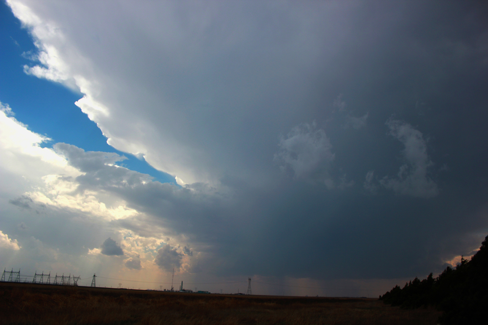
Around 3:45 central - 15 mi. N of Scott City, I notice that a new isolated storm has formed to my SW. Took a few minutes after I saw it visually, but it appeared on radar SW of Scott City. So, I turned around and went back south to Scott City, then west to Modoc. Before turning west, I stopped along 83 and took this picture:
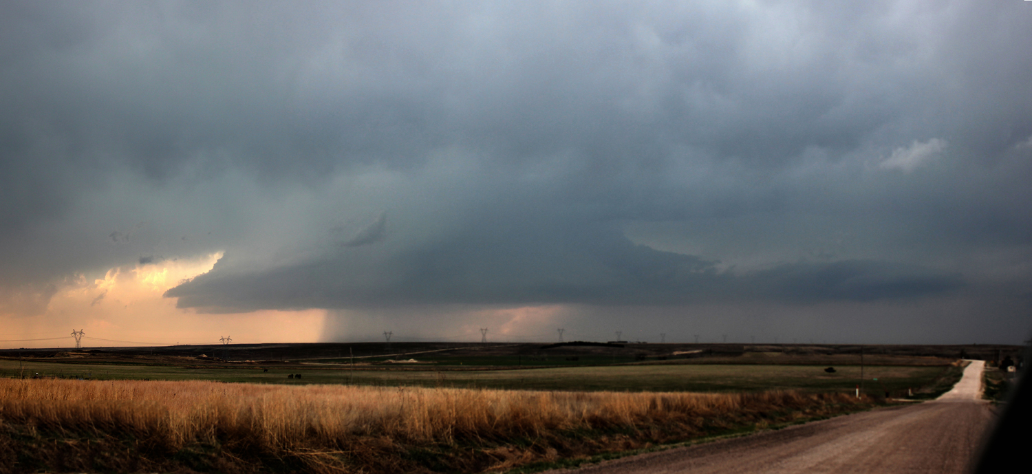
At this point, the storm was a single, isolated storm. That was the last time that would be the case in this general area, as following this storms were soon going up all over and the storms were becoming messy and multicellular, even along the dryline. Upon reaching Modoc, I then spend maybe an hour or so working my way north on back roads from Modoc, as what changed from one storm to three storms continue to intensify near, north of, and SSW of Leoti. Eventually, a SVR warning is issued covering all three storms. They all looked supercellular, but were drawing energy from earch other. Here is a picture of the middle and southern cells, which were very close together:
As I noted, all 3 storms were SVR-warned, and I believe the middle one did produce some severe hail. But the strongest of the 3 was the lead, or northern, one, which was the original one of the 3 to go up. It had pretty nice structure:
Eventually I head east to 83 to either go north to catch this northernmost storm, which looked the best of the three storms, with its large, hard updarft base for a while. This was the original storm that I saw when it was SW of Leoti around 3:45. One of these storms, probably the northernmost or middle one, produced 2.5-inch hail 5 miles NW of Leoti ar 4:40. But by the time I got to 83, I decided to go south as storms were popping down the dryline, rather than trying to catch up to the storm to the north. All 3 storms moved over Leoti, and one of them dropped 1-inch hail there and as I Iaid, larger farther north.
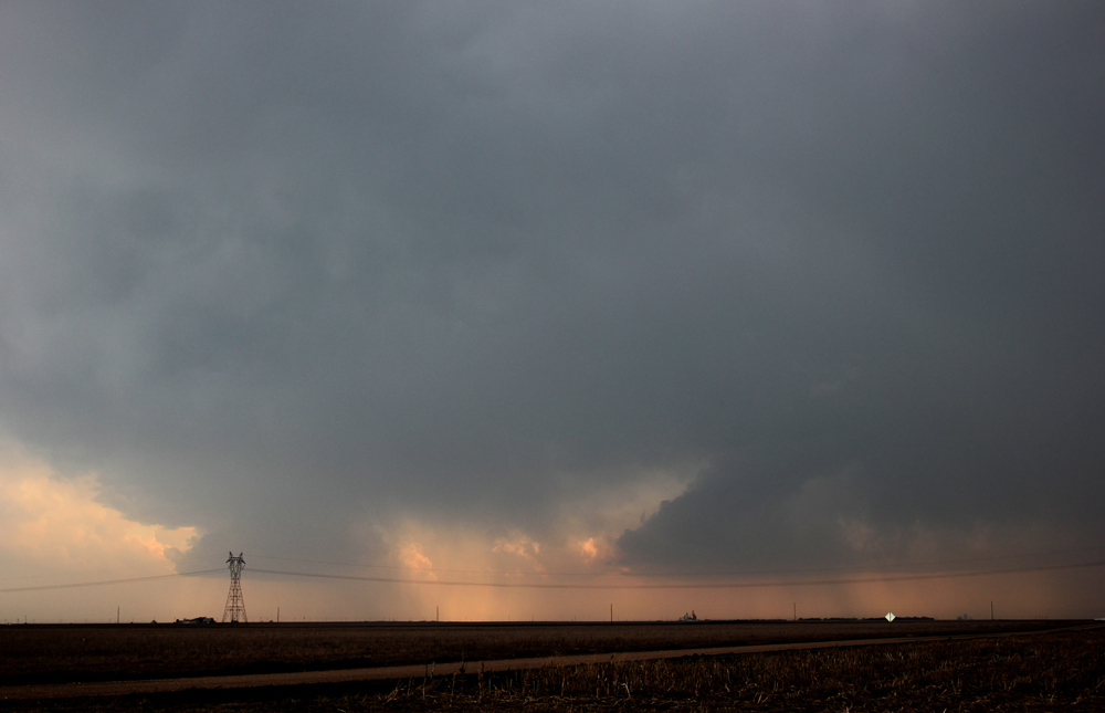
Around 6 p.m. or so, circling back south and west to intercept a new tail-end storm coming up from around the Syracuse, KS area, I get to Leoti - lots of water everywhere and some things blown around. On the way to there from route 83, I encounter intense, dusty inflow winds, blowing from the southeast into the cluster of storms north and NW of Leoti. For a brief time, visibility is near zero in blowing dust from the inflow. I toy with going after the still-intense but messy clusdter of storms north and NW of Leoti, but decide instead to go after the Syacuse storm, now SVR warned for 2-inch hail with a "tornado possible" tag on the warning. As I do this, I notice a new storm going up to the east near Scott City. I think about going after it, and in hindsight, I should have. But with the warning on the storm to the SW, I go after it. But it looks unimpressive after a while, so I turn back north, then east. Then of course it gets a new warning with report of more 2-inch hail. I stop east of Leoti to take pictures, clearly it is LP and high-based, so tornado unlikely. Nonetheless, it produces 2-inch hail around 6:30 10 miles N of Syracuse, around the time I get this picture looking to my southwest:

So with the Syracuse storm clearly LP and appearing visually to weaken, I continue after the storm to my east near Scott City. I thought it had the best chance to produce a tornado, because it was SE of all the other storms, in unimpeded warm, humid inflow.
After a long time stairstepping east and north trying to catch up with the storm, eventually near Gove I am somewhat in position on the cell that went up near Scott City. With this one again, I drive through intense dust storms caused by inflow. South of Gove, I also notice what I thought was an inflow band that extended for miles to the SE of the storm - low clouds surging to the northwest into the storm. At first, I am not even sure whether these were clouds or more blowing dust. As I get closer, I can see that it is low clouds. In hindsight, these clouds were associated not directly with the storm, but with the NW-SE frontal boundary that had been hanging around KS from the northwest corner across much of the state to the east-southeast. Early in the day, this boundary was a warm front, then then it stalled out and became a stationary front. This is the same front that in the morning, when it was a warm front, I had considered targeting but did not due to concerns about messy storm modes. Now, after stalling out and becoming a stationary front, this front was backing to the southwest as a cold front. In the course of the chase, I had kind of lost track of the position of this front - hard to keep up with everything when chasing solo - with the result that the front is now farther south and west than I had realized As I near and eventually cross this front, the temp plunges from the mid 70s or around 80 to the upper 50s. (Before the first storm went up near Leoti, it had been as high as 90.) If any storn I saw was going to produce a tornado, this was the one, as first it was in unimpeded inflow then it moved over the front. And when it did that, it did come close. By then, a new cell had popped up just to its south and after a short time merged into the original one to its north. Just before this occurred, the aforementioned band of low clouds along the front was drawn into the updraft of the new cell, right over the front, creating what looked like the longest beavertail/inflow band ever. It extended from the updraft miles to the ESE, and I managed to get a picture of it as it was drawn in to the updraft.:

This is probably my favorite moment of the chase, as I had never seen anything quite like this before. I have seen some impressive beavertails, and I have seen low clouds surging along with a cold front, once even from the top of a mountain in South Dakota. But never a hybrid of the two together!
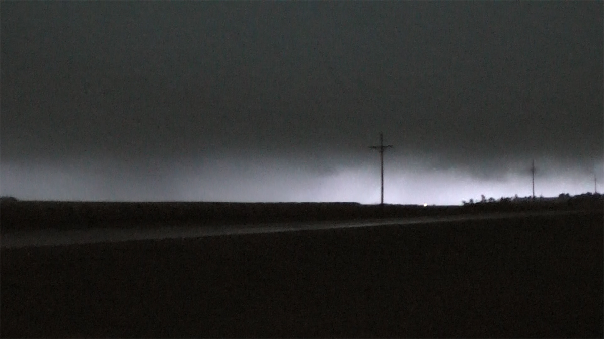
The storm really ramped up just north of Gove, producing golfball to 2-inch hail in Grainfield and a tight couplet for a while. But by the time it got to Grainfield, it was north of the front over the cold air at the surface, so less likely to produce a tornado. Later, after dark and after I left it, it even got a TOR warning well NNE of Grainfield, but I saw no reports of any tornadoes. By the time the storm was dropping hail on Grainfield, it was hard to see anything with this storm between it getting dark (now around 8:30 central) and the very low clouds that were everywhere on the cold side of the front. This kind of captures what it looked like:
Once I reached Grainfield, there were still chasers and others hanging out at the gas station there. Some were jammed in under the canopy over the gas pumps, even though by then the 2-inch hail that had fallen there had moved on to the north. With darkness setting in, I called it a chase and headed west to Oakley, the closest place where I could likely find a room for the night. Unlike some other chasers who were on this storm, I did not head east to catch the next day's storms in eastern Nebraska and western Iowa, only to return to Kansas or Oklahoma the following day. At 74, I am just too old for that much driving in a short time. In hindsight, maybe I should have, given the numerous photogenic tornadoes that occurred on the 26th in eastern Nebraska and western Iowa. But I really think that would have been too much driving. Even without doing that, I ended my trip a few days later with over 2,000 miles. Instead of chasing, I had a leisurely day drifting southeat to Dodge City to set up for my chase on the 27th, including a visit to a Kansas gem I did not even know existed, the Monument Rocks.
Travel distance previous day:298 mi.
Chase distance this day: around 380 mi.
Return to 2024 Severe Weather Observation Page