8:10 a.m. - I leave Pagosa Springs. My target area is around Calhan or Simla, on the Palmer Divide between Colorado Springs and Limon.
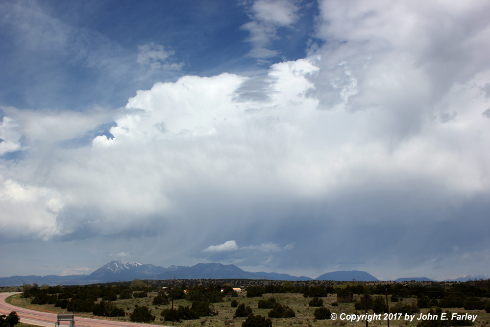
10:30 a.m. - Storms initiate over the Sangre de Cristo Mountains northwest of Walsenburg. At this time, they are more more rain and snow showers than real storms. By around 11:30, I was in the Walsenburg area, and stopped to get a picture of this initial convection over the Sangre de Cristo Mountains northwest of town:
At this time these storms were not much - no lightning on the lightning tracker, and did not even look like a lot of precipitation reaching the ground, though clearly some snow and rain showers in the mountains. I never considered giving up my Palmer Divide target for these storms, nor should I have. Or should I? - see update below. However, over the next few hours these storms did gradually intensify, eventually resulting in golfball-sized hail and a tornado warning in the mountains northwest of Walsenburg near Gardner, around 2:20 p.m.
UPDATE, July 10: It turned out these storms in the mountains DID actually produce a tornado. It happened above 11,000 feet in an area that had lots of snow on the ground, with all the roads closed at the time. But when the snow melted and the roads opened in late June for the summer, Forest Service personnel discovered a tornado track and notified the National Weather Service in Pueblo. They in turn conducted a damage survey and determined that an EF-1 tornado occurred, with wind around 100 mph. You can read about the tornado, and see radar images and pictures of damage to the trees here. The tornado occured at an elevation of 11,300 feet above sea level.
1:00 p.m. - After a quick lunch stop in Pueblo, I notice that a storm has initiated north of Simla, a little earler than I expected. I can see it on both radar and visually, and from what I can see visually, the storm looks surface-based. But it is still nearly 2 hours away! This was a little earlier than I had expected the show to begin, so I had to play a bit of catch-up.
2:30 p.m. - I have worked my way north to near route 96, well west of Limon. Storms are in an E-W line (but with 3 distinct storms) NW of Limon and SE of Denver (with a separate massive hailer moving into DEN from the SW). The 3 storms in the E-W line are to my north. The easternmost one, well to my ENE, has displayed intermittent wall clouds for the past half hour or so. The westernmost one, much closer to me to my NNW, also now shows a wall cloud. When I get to 96, I choose the western storm because it is closer and an easier intercept, as they are still moving away from me to my N. Slight jog west, then north. BAD CHOICE. This probably cost me the chance to get any decent view of the funnel cloud that later occurred on the eastern storm.
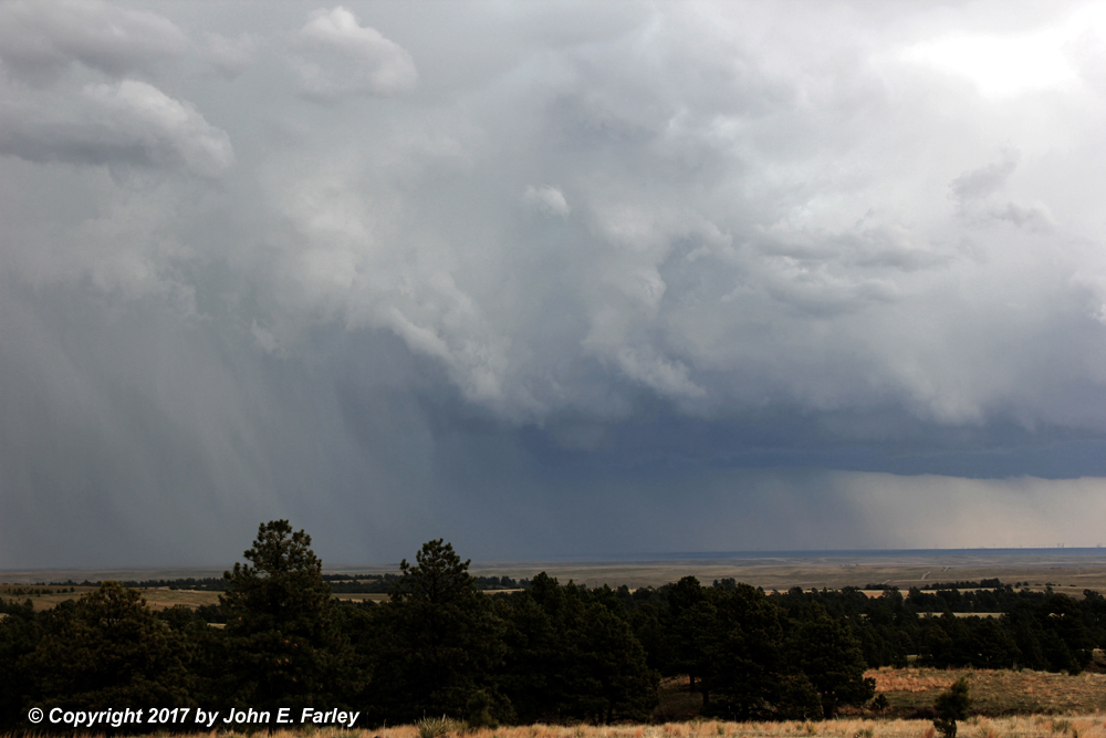
2:45 p.m. - I am heading north on a lousy road, trying to get closer to the western storm of the three. After briefly displaying a wall cloud around the time I decided to go after it, the wall cloud is gone, but the storm still looks pretty intense:
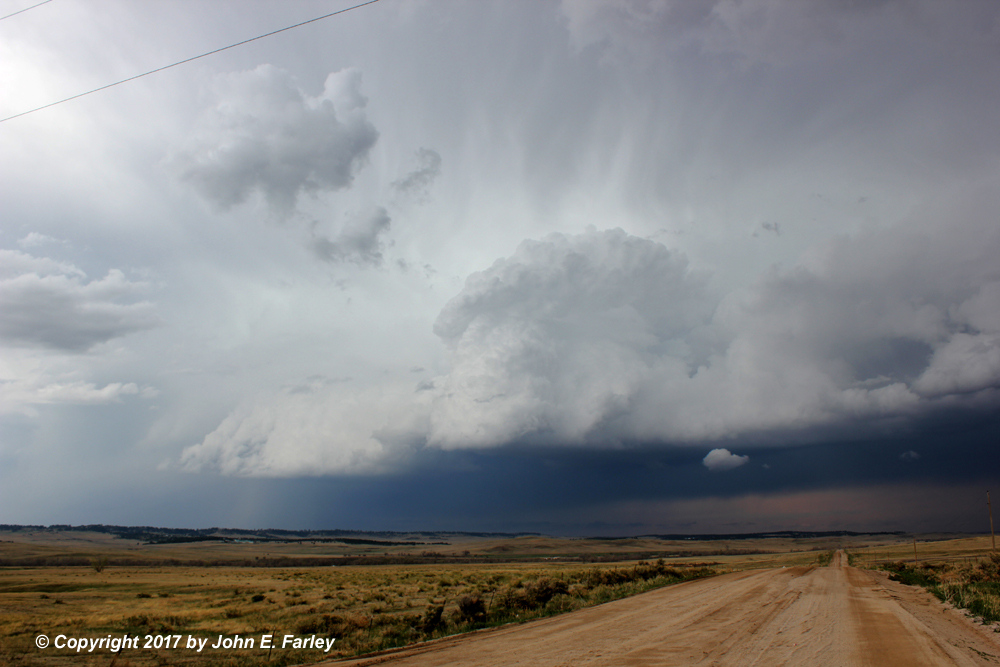
About 15 minutes after I took this picture, this western storm produced 1.5-inch hail near Buckley Air Force Base which is located at the edge of Aurora. From this location, I can still also see the eastern storm, which would go TOR-warned in another five minutes or so. Here is how it looked around this time frame, i.e. 5 minutes before the tornado warning:
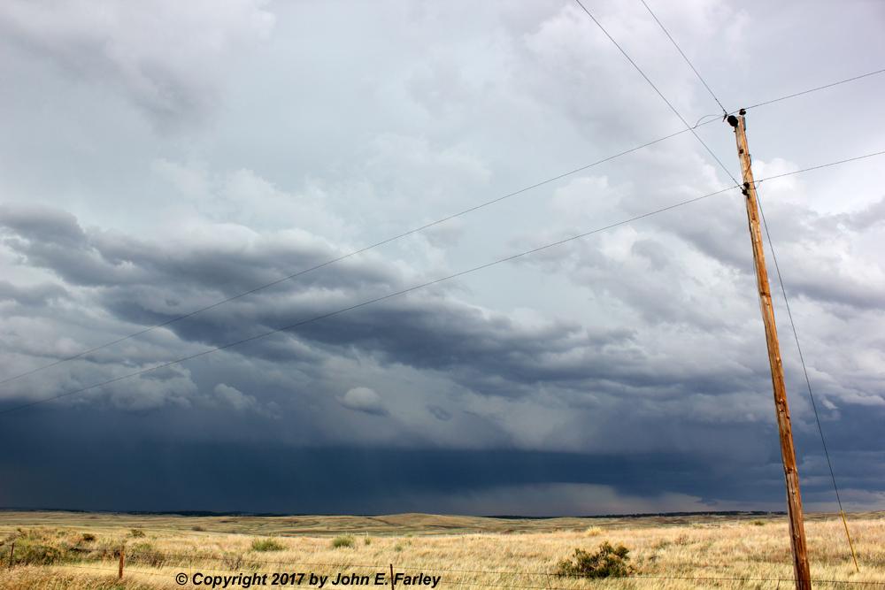
You can see a lowered area under the updraft, but it is through some precipitation so it is hard to tell whether it is a new wall cloud or precipitation-related. Soon after this, my view of the base became increasingly limited due to precipitation, but this had me wondering whether I should have gone after this storm. Yes, I should have. This is the last picture I have of this storm until a half hour later, well into the tornado warning. Increasingly bad roads (you can see that in the picture of the western storm) and lack of places to stop precluded stopping for pictures, and I couldn't see a lot most of the time anyway.
2:50 p.m. - The eastern storm, of which I now have a limited view, goes TOR-warned. I did see a lowering that could have been the funnel reported a few minutes later, but more likely was some scud. Honestly I couldn't tell from that distance (now probably 15 miles or more) and through rain. A number of chasers who took a different route than I did got good views of the funnel (the good view was from the SE) and one or two thought there was a brief touchdown. (UPDATE: Although I do not know whether or not the NWS ever officially confirmed a tornado, I have seen a couple pictures/videos that do show at least a brief dust swirl on the ground below the funnnel. So at least a brief, weak tornado did occur.) I work my way back east toward the storm on terrible roads, which eventually became undrivable due to the rain that had fallen from the storms. Here are a couple of pictures I did manage to get of this storm once I found a place to stop and was back in an area with a somewhat decent view of the eastern storm:
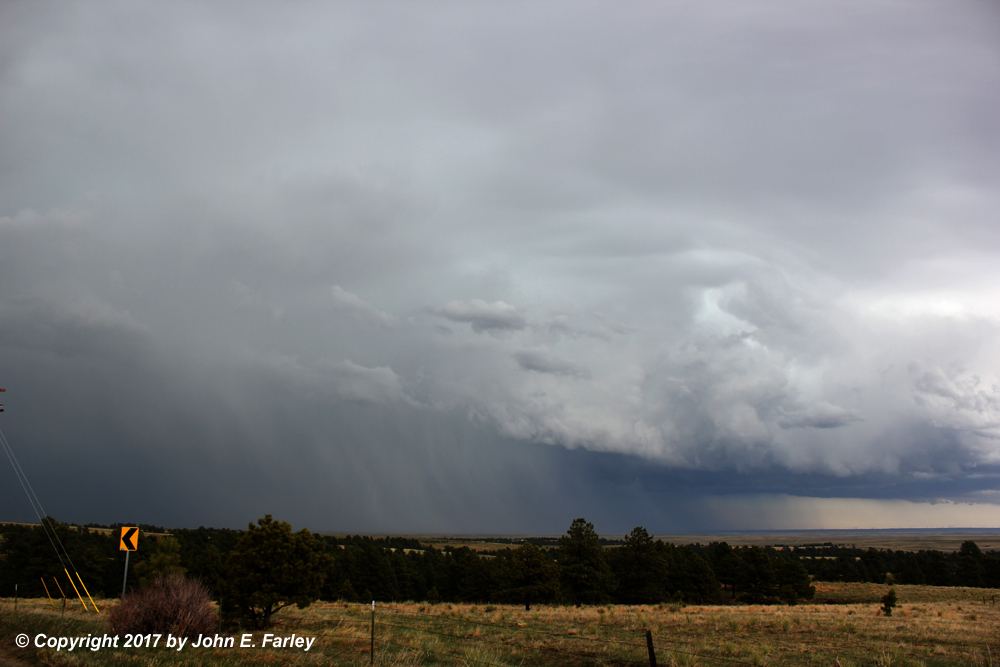
In this picture, taken around 3:15, you can see definite hail shafts and some storm structure, but not a good view of the meso. At this time the storm was still TOR warned, but this was likely after the rather short-lived funnel reported by others had dissipated.
This picture was taken around 3:20 - about the time the TOR warning expired, and also about the time the storm dropped 2-inch hail near Deer Trail and covered I-70 in hail. Again in this picture the hail shafts are quite visible, and you can now see what appears to be the meso as well, near the center of the picture. When these two pictures were taken, I was near Bijou, about 10 miles from the storm.
By the time I got a little past where these pictures were taken, the roads had become totally undrivable. They were bad enough even dry, very soft steep edges that already had nearly gotten me in the ditch once. But now wet, they were pretty much undrivable at any speed. I am sure that without AWD I would have been either stuck or in the ditch, and even with AWD I was fishtailing even at 10 or 15 miles an hour. And the storm was moving away from me a lot faster than I could drive on these roads, so I knew it was time to let it go and try to catch something else coming up from the south. So around 3:30 I reversed course and headed back south and west. There were SVR warned storms approaching Colorado Springs and also farther SE near Kim, so I figured I could work my way between those storms, which were moving north, and see what I could see. East of Colorado Springs I stopped to photograph some lightning, but that storm seemed to be weakening, so I returned to I-25 by the same route I had used earlier, passing east of Colorado Springs and rejoining 25 at Fountain to head south.
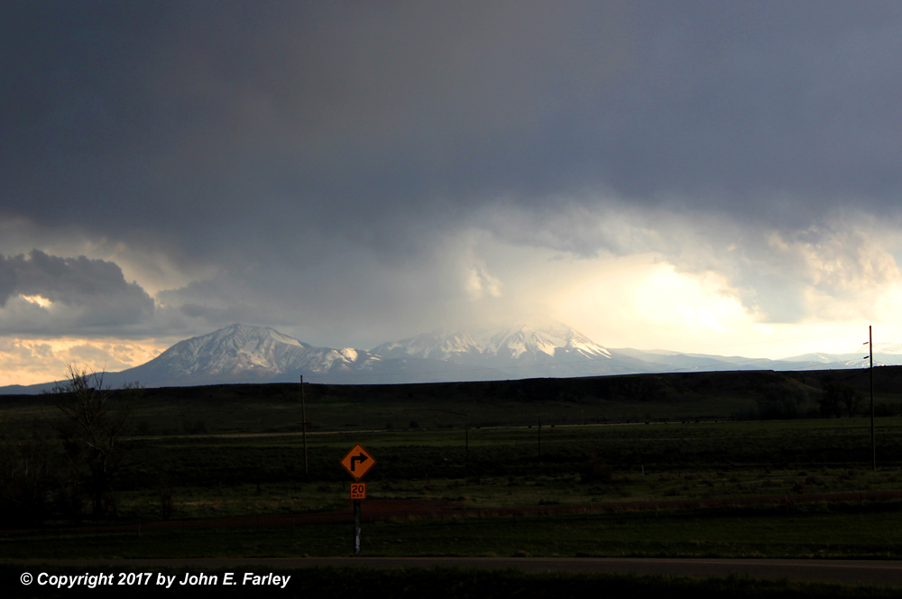
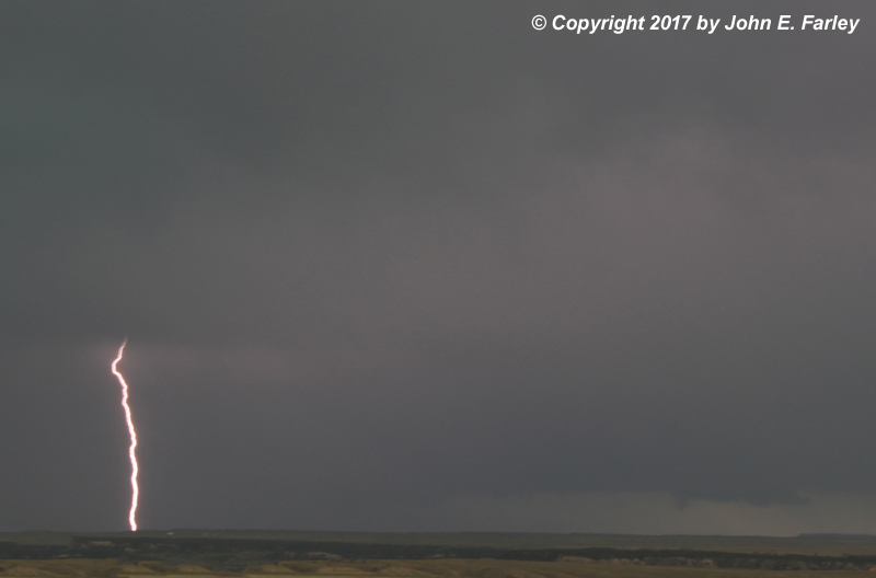
6:35 p.m. - In northern Huerfano County I stopped at an exit in a high spot staying there to watch a strong storm to my east and a new storm beginning to develop to the southwest over the Spanish Peaks, and watched the storms for 15 or 20 minutes. This picture of the storm to my east (taken around 6:48 p.m.) shows a lightning bolt and what looks like it could be a wall cloud on the right (south) side of the storm. As had been the case all day, this was the inflow side of this northward-moving storm. This storm produced a number of reports of dime to quarter-sized hail around Olney Springs, Manzanola, and Cokedale between 6:45 and 7:05 p.m. The storm forming over the Spanish Peaks was much weaker, and may have been producing snow in the higher elevations, but it was pretty in the lowering sun angle of evening:
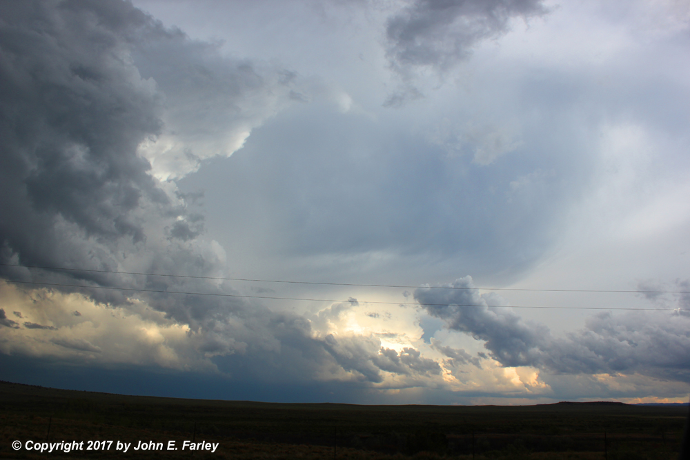
7:10 p.m. - Figuring I would spend the night in Walsenburg, I drove a little east of there when I got to the CO Route 10 exit, getting a pretty view of storms to the southeast and their somewhat backsheared anvils:
The storm near the center of the picture produced golfball hail west of Kim along Route 160 a few minutes after I took this picture. I then decided to call it a night, getting a room and heading for dinner. As I got out of the car at the restaurant amid rumbles of thunder, a little pea-sized hail began to fall as the storm that had formed over the Spanish Peaks moved down into Walsenburg. Although I was frustrated by my poor road choice that cost me any decent view of the funnel, this was not a bad first chase of the season - I did, after all, manage to see the only tornado-warned storm in my target area. A good view of the funnel/brief tornado would have made it better, though!
Chase distance for day: 530 miles.
Local Storm Report Summary from Denver/Boulder NWS Office