
After several days of household projects, I was itching to get out on a good storm chase, and today finally offered a good opportunity. There had been good instability over the MO/IL area for several days, leading to occasional severe pulse storms, but with weak upper wind, the storms could not keep going on any sustained basis. But today would be different - much stronger upper winds would approach, as western MO would be in the right exit region of a jet streak associated with an approaching trough, with surface low pressure moving slowly across Kansas from south-central Nebraska toward western MO. Extending southeast then south from the low, in eastern Kansas and eastern OK would be a dryline/Pacific cold front, and storms were expected in the warm sector ahead of this feature. Directional shear would be somewhat lacking, leading to a limited tornado threat, but with considerable speed shear, continued instability with CAPE in the 2000-3000 range over western MO, and the front/dryline as a trigger, supercells would be likely. Initially, I decided to head west on I-70, as the RUC model was indicating storms would fire between Columbia and Kansas City. All else being equal, I would prefer chasing along or north of I-70, as the chase terrain in that area is not quite as bad as it is farther south (though it isn't great anywhere in MO). I headed out around 11 a.m., giving myself time to be in position when storms fired, probably around 4 p.m. After a data check around 12:30, I decided to adjust my target southward, despite the more hilly, wooded terrain most anywhere south of I-70. The RUC was no longer breaking out any precip as far north as I-70, and SPC's 1630z discussion, consistent with that, mentioned storms firing in AR or OK and spreading northward into SW MO, with initiation more doubtful farther north. US 54 offers a good southwestward option off I-70 through Jefferson City and the Lake of the Ozarks area, so making a southward adjustment would not be difficult. I figured I would go over to the U.S. 65 area and then decide between going farther south or farther west. Since the very first storm I saw on radar was east of Tulsa near the corner of OK, MO, and AR, I figured continuing south was the better option, and I was in the general area of Buffalo, MO when storms began to fire.
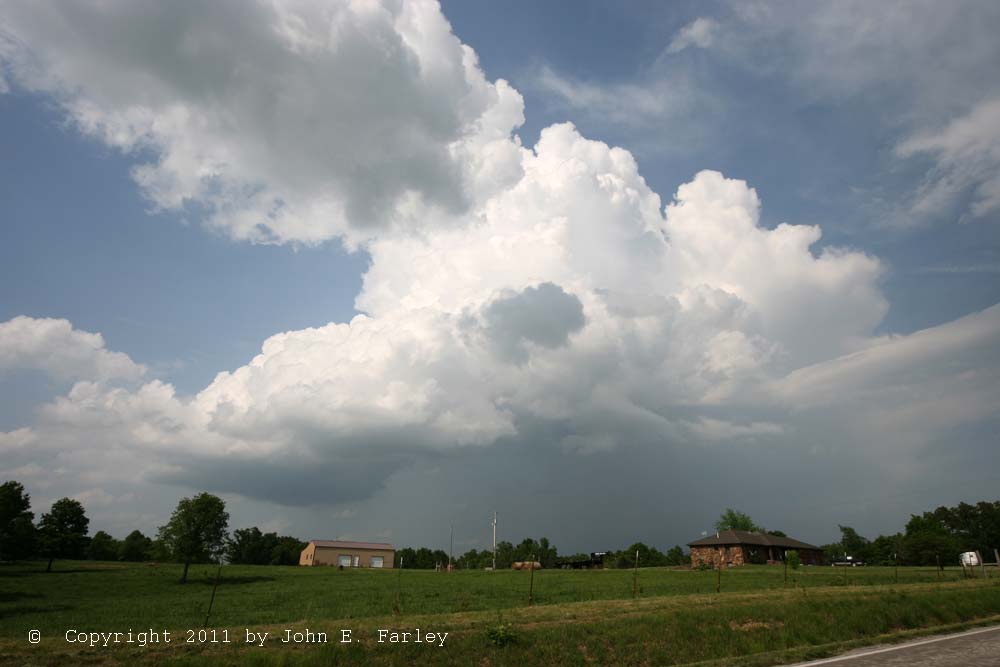
Around 4 p.m., the first storm initiated in front of me, near Fair Grove. Other updraft towers were visible at various locations to my south, east, and west. Storms had initiated earlier in OK, but this was the first real storm in MO, though there had been some attempts over the course of the previous half hour or so. I followed this storm E and NE of Fair Grove, and got pics of it and another one that was developing to my SW, both of them appearing quite sheared and LP-ish, around 4:30 p.m, near Conklin:
First storm, looking northeast from near Conklin
New storm, looking southwest from same location
Soon, the storm to my NE weakened, but the one to my SW had a nice RFB, so I decided to stay with it for a while, even though I noticed on radar a larger and stronger storm to my NW approaching Stockton Lake that went SVR-warned a little after 4:30.
I went north on 38 toward Elkland to stay with storm that had been to my southwest but was now to my west. I saw smoke west of Elkland under the updraft base that I briefly thought was a dust plume being kicked up by outflow wind, or possibly gustnadoes - but going slightly west of Elkland I saw that it was smoke, so I continued north on 38 to just west of Charity to keep up with the storm, now to my northwest. Meanwhile, the SVR-warned storm near Stockton Lake was looking better and better on radar - larger and stronger than any of the others, 65 dbz or higher reflectivity. At this time, a number of storms had popped up over southwest MO, and all of the storms were pretty isolated, and visually and on radar, many of them appeared to have supercell characteristics. When I got to where 38 turns west, just to the west of Charity, I made the decison to break off my storm I had been following, and go to the more impressive Stockton storm via U.S. 65 north to Buffalo then west on 32 through Bolivar.
After I left the mostly northward moving storm near Charity, it went severe warned and eventually produced several reports of large hail. It was likely either this storm or another one that formed on its outflow that was responsible for 4.25 inch hail in Sunrise Beach on the north shore of Lake of the Ozarks. But my attention was now turned to the spectacular supercell to my west near Stockton Lake.
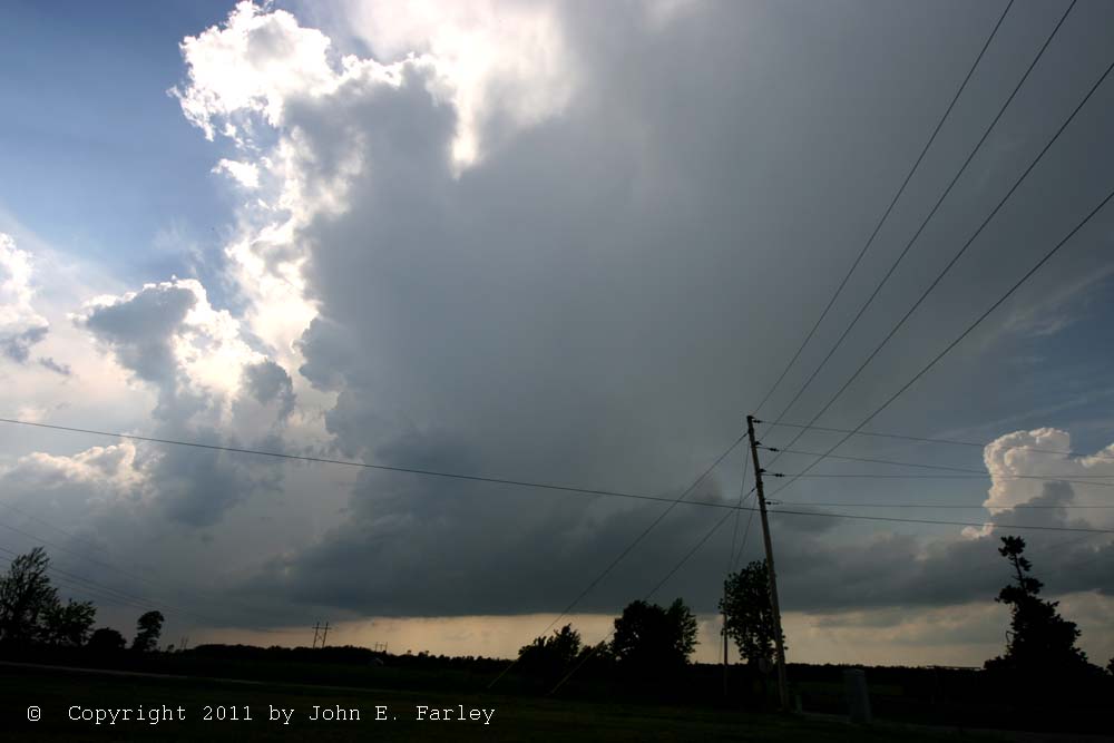
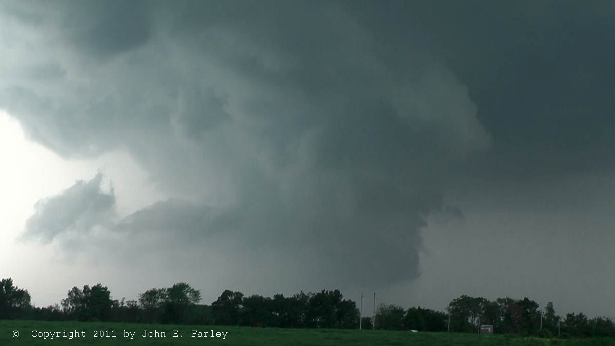
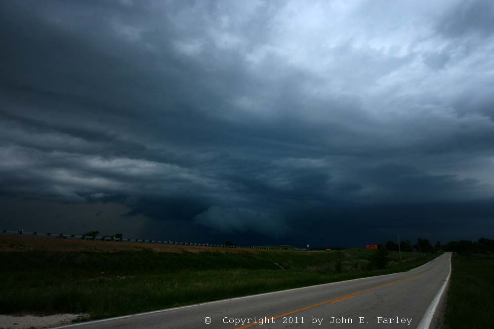
This Stockton Lake storm that I was now going after became TOR-warned at 5:10 based on radar indication of a possible tornado, with the warning remaining in effect until 6:15. The storm had a very pronounced hook echo on radar beginning about 5 p.m., and this continued to be the case most of the time until about 6:15, when the character of the supercell storm would begin to change. By 5:20, the storm was producing 2-inch hail just southwest of Stockton Lake. Around 5:35, approaching Bolivar, I got my first glimpse of a large wall cloud, well in the distance to my WSW. The storm was an isolated classic supercell. As I was passing through downtown Bolivar around 5:40, I could see the storm's huge, hard updraft tower directly ahead, so I pulled out the video camera and got some video. Here is a capture:

Once I got through town and was just west of Bolivar around 5:45 I could see and and managed to get video of of what I am nearly certain was a distant but nicely backlit funnel cloud. It lasted 1-2 minutes from when I first spotted it through the trees, but it may have been there earlier. I wasn't sure whether I had gotten it on video until I looked at my video once I got home from the chase, as I was driving at the time I saw the funnel, but I did manage to get it. Here's a capture:

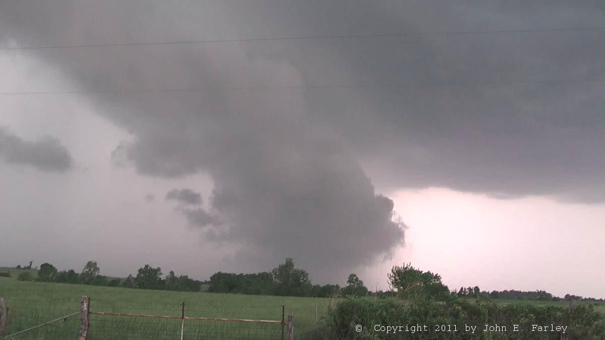
Another video capture can be seen here. Probably it was over or coming off Stockton Lake near Masters. Although my view of it was distant, I do like the fact that, at that distance with such an isolated supercell, I could get the structure of the storm above the funnel in the picture. By time I could find a safe place to stop, get out, and run to a clear view, the funnel was gone and the wall cloud was starting to occlude/wrap in rain. A zoomed video capture of the wall cloud at this time can be seen here. The storm structure was very impressive at this time - I vertically stitched together two video captures to show the knuckled and backshearing updraft tower above the wall cloud:

By 5:55, a new meso had formed NE or ENE of occluding one, which disappeared in rain, but the new one was less tight and more outflowish than the old one. As the RFD was surging toward me and the storm moving off to the ENE, I retreated east around 6 p.m. to get through town and re-position.
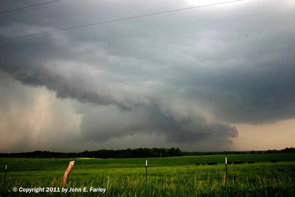
By about 5 minutes later, I'm just northeast of Bolivar and the wall cloud has tightened again:

A more zoomed video capture of the wall cloud, taken just after the photo above, can be seen here. Around this time, the storm is producing golfball hail a few miles to my northwest.
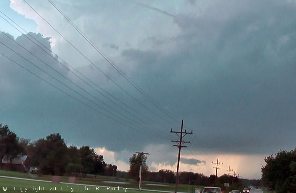
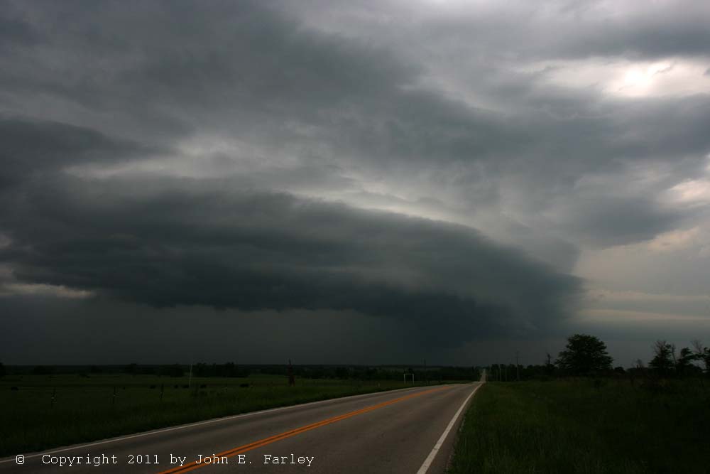
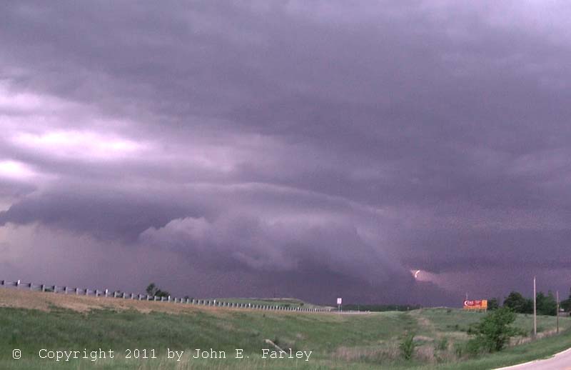
I followed the storm, north then east through Huron and Goodson. A new TOR warning was issued at 6:15 valid until 7 p.m. The storm remained intense and tightened up quite a bit at times, but the storm had become HP in character by around 6:20 p.m. Around 6:25, I observed a very low, ground-hugging wall cloud near Polk (backlit by lightning in the linked video capture). Radar indicated a possible tornado near Polk at 6:30, now with a more easterly movement than earlier, which is consistent with my observations. Hook-echo precipitation got within a mile or so of my location, surging in from my west, so I continued east toward route 73, taking this picture somewhere near Goodson around 6:35 p.m.:

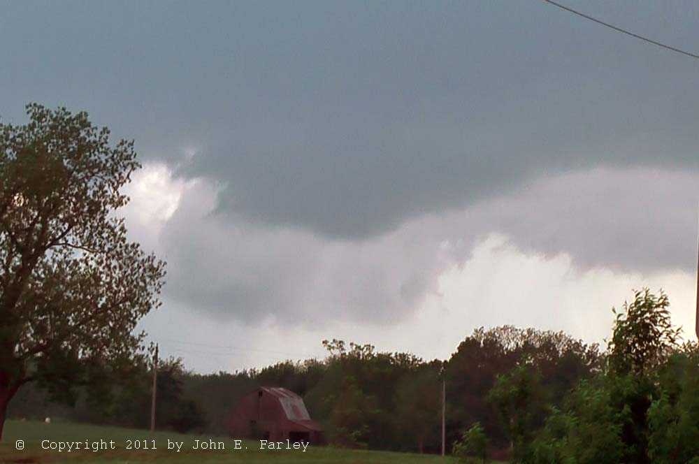
At the time the picture above was taken, the storm was producing golfball hail near Pittsburg, just south of Pomme de Terre Lake. The storm continued to cycle, and my ability to see its features varied with my position relative to it and the amount of wrapping rain. When I got to route 73 I took it north to Pumpkin Center. As I was approaching Pumpkin Center from the south the storm, now very HP in character, had developed a nice stacked-plate appearance. By the time I reached Pumpkin Center, the storm was again very close, so I went east again from there toward Lebanon - I could not continue north toward Mack's Creek and Camdenton without getting cored (which with the warnings mentioning baseball hail I was not about to risk!), and this is the last east option until then in a hilly, wooded area with a poor road network. I went east to Lebanon then north toward Camdenton for one final intercept before dark. The storm appeared, per radar, to have an HP meso on its east side, with periods of very high reflectivity (over 70 dbz) just west of that at times while I was between Pumpkin Center and Lebanon. Indeed, the storm did produce 2-inch hail about midway between Preston and Mack's Creek and golfball hail in Mack's Creek. Glad I didn't go that way! Gradually, the storm also backbuilt, with a second meso appearing to form near the southwest end of the storm. Many more storms were now to the NE, W, and SW of this storm, and evolution to a more linear storm character appeared to be under way. Nonetheless, this storm still appeared to have HP supercell character. I was back on the storm a few miles southeast of Camdenton on route 5 by around 7:45 p.m. Once again, it had a lowered area with rain again wrapping around to the west and south of of the lowering. I got video of the storm and lightning and some stills until it was too dark:
Wide-angle photo of storm as it approached Camdenton around 7:45 p.m.
Video capture of storm with lightning, taken from same location
I left the storm around 8 p.m. as it moved over Camdenton and Lake of the Ozarks, and I headed south to Lebanon for the night, as it was getting dark.
The storms continued to rapidly evolve into a linear structure. In what was now a squall line, the storms with wind-driven rain hit Lebanon around 9:10 with reports of 60 mph wind 1 mile south. I get video of wind, rain, and lightning at hotel. Heavy rain and wind continued for about 20-30 minutes, with lighter rain continuing through around 1 a.m.
A video of the first part of the chase is embedded below. This video shows the storm as seen from Bolivar, the funnel as I was driving west from Bolivar, and some video taken from west of Bolivar of the occluding wall cloud and the developing new one as the storm cycled. Watch full-screen and in HD if you can:
A video from the portion of the chase from Bolivar to near Camdenton, showing several ground-hugging wall clouds as the storm continued to produce golfball and larger hail, is linked below. Near the end of this video there is also a short segment showing the squall line that developed later as it produced strong wind and heavy rain in Lebanon around 9:10 p.m. Here is the video:
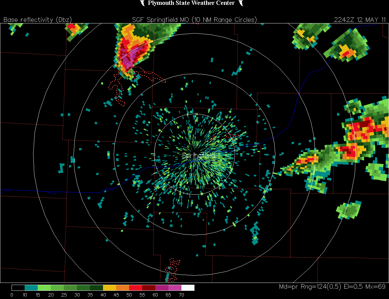
A radar image from a couple minutes before I saw the funnel cloud can be seen here. Note the hook echo about over Stockton Lake (the storm northwest of the radar site).
Total chase distance: 612 miles.
Return to 2011 Severe Storms page
.