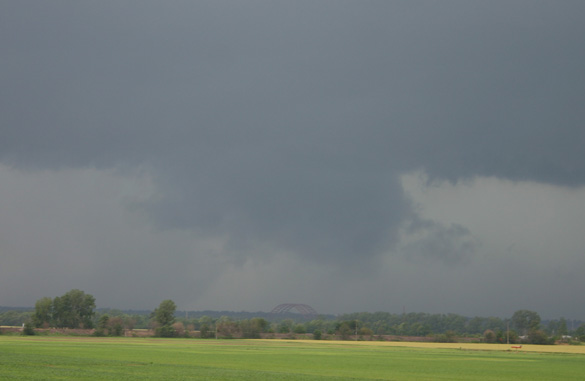
Wall cloud and possible funnel cloud with the first storm:
Note the bridge below the wall cloud. This is the Jefferson Barracks Bridge, the main crossing of the Mississippi on the south side of the St. Louis metro area. This picture was taken looking northwest from the west edge of Columbia, IL. A couple Missouri spotters near the wall cloud reported funnel clouds around this time, and trees were blown down on a house and a garage (though I am not sure whether the latter occurred with this storm or others later). This meso reportedly produced brief touchdowns later in the Collinsville and St. Jacob, IL areas. It is very fortunate that it did not do more, as it moved for a long distance over densely-populated areas in the southern and eastern suburbs of St. Louis. Around the time these photos were taken, I phoned in a report of a persistent wall cloud near the Jefferson Barracks bridge.
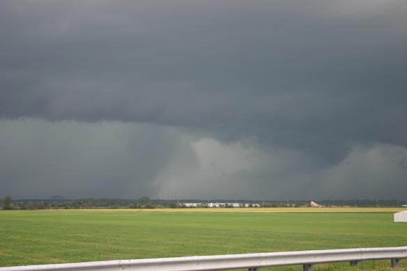
Here is a picture taken a couple minutes after the one above - notice the intense wet rear flank downdraft (RFD) cutting in behind the bridge and to the left of the wall cloud. This is very typical of HP supercells, and is usually an area of very heavy rain, strong wind, and sometimes (though not for the most part with this storm) large hail. At this time, the wall cloud was probably about over the Mississippi River between the south part of St. Louis city and Cahokia, IL, or may have already crossed.
I tried to chase the first storm a little but could not keep up for long. At some point, I did notice through the trees that the wall cloud was very low, and this may have been about the time of the tornado reported in Collinsville. Didn't see anything I could confirm in that brief glimpse, though. I was able to follow the storm, sort of, to the southeast edge of Belleville near Eckerts Orchard, but with the storm going northeast and my road options (at best) only going due east, it was getting farther and farther away, and at times the wrapping rain totally hid the meso. So, I broke off and headed back south on route 159 to catch the next storm in the line, also TOR warned and now with a reported tornado in progress across the river in Jefferson Co., MO. I was able to make a close, though brief, due the the storm's high speed, intercept of this storm around 4 p.m. from a couple miles east of Waterloo, IL:
Wall cloud from the second storm over Waterloo, IL:
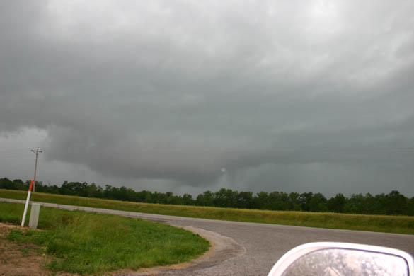
This picture was taken looking northwest from a couple miles east of Waterloo. Note what may be a funnel just to the right of the wall cloud - I couldn't tell, but in the enhanced version of this photo, it looks like it may have been:
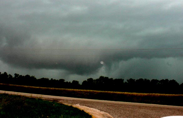
I wouldn't be surprised if it was, as there were a couple reports a few minutes earlier of a tornado with this storm 4 or 5 miles to the southwest of its location when this photo was taken. This wall cloud wrapped up in rain and disappeared very quickly after this picture, and I had to bail to keep ahead of the wet RFD. I tried to move south to stay ahead of the storm and see if any new cells were down the line, but saw nothing but outflow after this, and gave up the chase around 4:30, returning home in occasional torrential rain, with numerous close CG strikes along route 15 in Belleville
A listing of the local storm reports for these storms from the National Weather Service can be found here. These storms definitely lived up to their name as HP (high precipitation) supercells - note the report of 3.25 inches of rain in an hour in Edwardsville. And more fell in other storms intermittently until around 7:00 p.m.