
The setup: After the previous day's chase, I spent the morning and mid-day hanging out and looking at data, forecasts, and models from Lamar, CO, where I had spent the night. The setup would be similar to the previous day, but more active, with higher dewpoints especially in the far east-central and southeast part of CO. Once again, wind shear would be favorable for supercells, with southerly low-level winds and westerly to WNW upper level winds. CAPE would likely exceed 2000 j/kg at least in the far southeast part of the state. There would be more storms than the previous day, potentially moving in different directions due to left and right splits. Storms would initiate near the mountains again, and likely be supercellular in their early stages. While better dewpoints and instability would be in the far east and southeast part of CO closer to the KS state line, some of the convection-allowing models (CAMs) suggested the possibility that, by the time storms reached that area, they would have grown upscale into a large linear complex, harder to observe than discrete storms and perhaps offering a lesser chance of tornadoes. On the otherhand, with the best moisture and instability in that area, the chance of tornadoes might be better there IF the storms stayed discrete rather than forming a line or bow echo. What to do? The models also showed a potential gap along the U.S. 50 corridor, as storms formed to the north along the Palmer Divide and to the south along the Raton Mesa. Since the storms would likely move to the ESE or SE, storms forming on the Palmer Divide would be easier to chase from where I was than ones going up and over the Raton Mesa through roadless, mountainous areas into northern NM. So despite the near-certainty of severe storms, there was a lot of uncertainty on exactly where to chase. I decided to hang out in Lamar until after lunch and then, with a few storms starting to form over the mountains to my west, I decided to re-position westward to the La Junta area around 1:15.
The Chase: Supercell 1
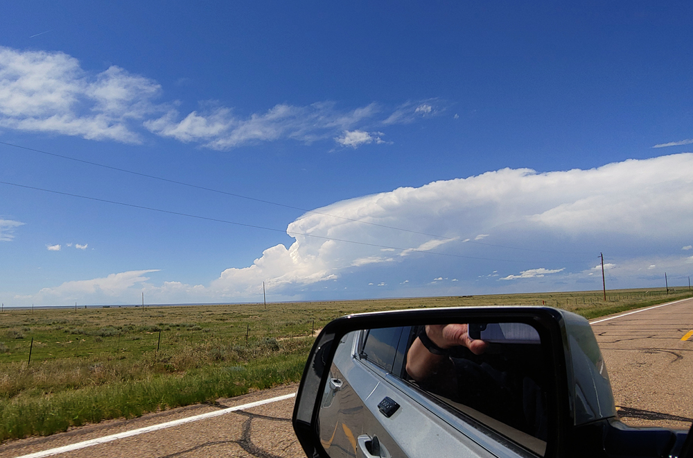
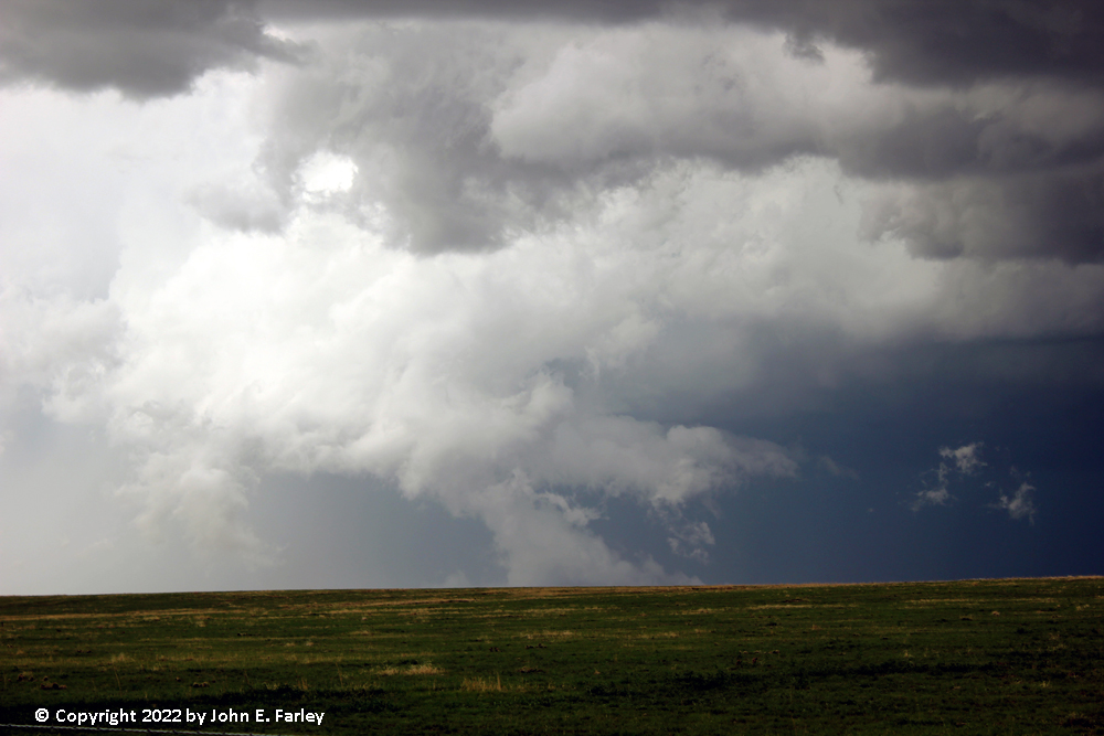
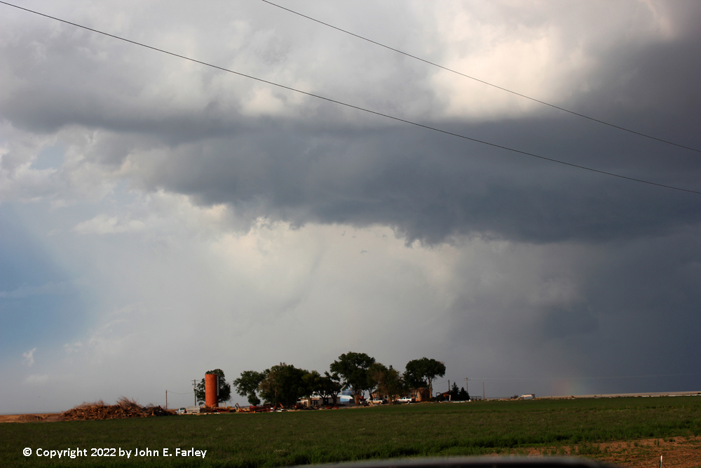
As I headed west on 50, I could see two areas of storms, visually and on radar. One was a cluster of storms near Trinidad, forming on and near the Raton Mesa. The other was a better-looking and more discrete storm on the northeast fringe of the Colorado Springs area, near Black Forest. At 1:22, this storm got the first SVR warning of the day. In the southern cluster, the strongest storm, near I-25 on the CO/NM state line, soon also became SVR warned. But this one would be harder to chase because it would move right over the Raton Mesa, and once it got past there, I would be playing catch-up. The Colorado Springs storm, on the other hand, would move right toward me, and was also more discrete. By the time I was into the La Junta area, my decision was made. I would go after the Colorado Springs storm, up CO route 71, then adjusting as needed. By 2:30, I was on 71 headed north in pursuit of the storm, now looking good to my NW. Around twelve miles north of Ordway, figuring I needed to work west to get closer to the storm and stay out of its path, I turned west on county road AA. My DeLorme atlas showed it going through about 12 miles to road 8, but instead it dead-ended at a ranch a few miles past road 17. So, I doubled back east and headed north on road 17 to near road E, which is around 10 miles north of road AA. Along the way, and particularly there, I got some great views of the supercell as it moved in my general direction, producing hail reports ranging from 1 to 2 inches in diameter. Wall clouds would come and go under the storm's main updraft, and occasional lowerings formed under them, sometimes extending halfway from the wall cloud to the ground.
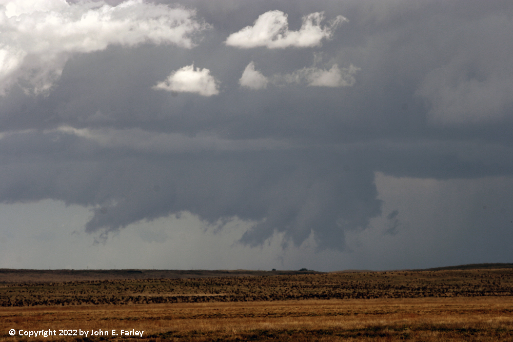
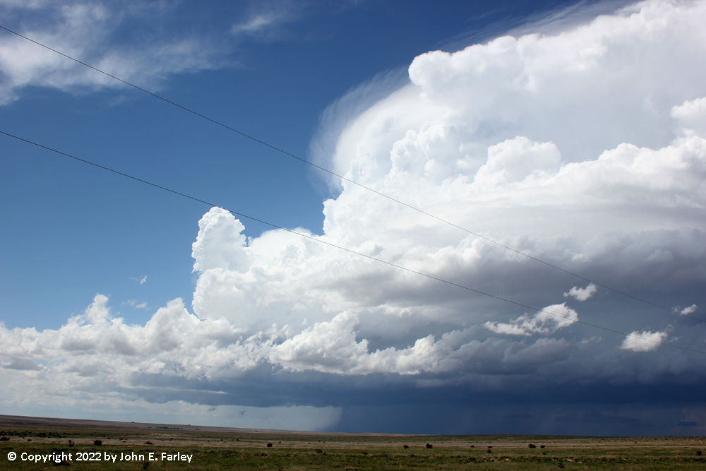
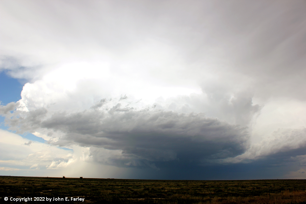
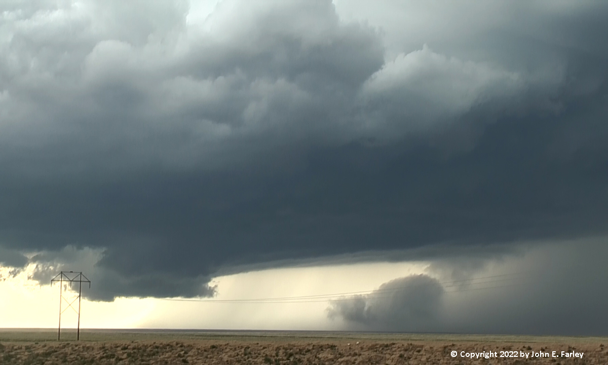
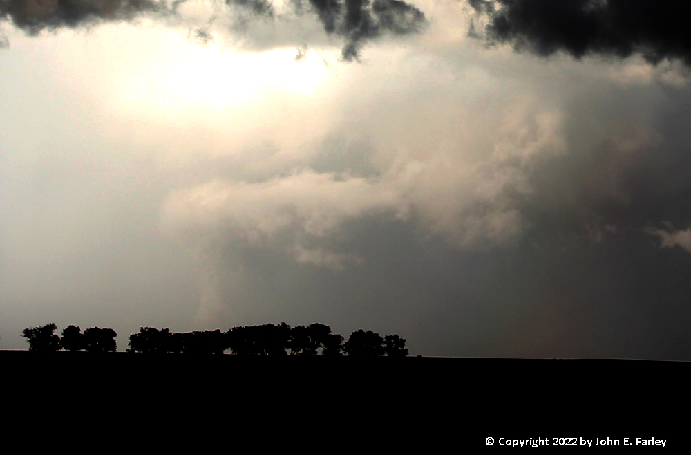
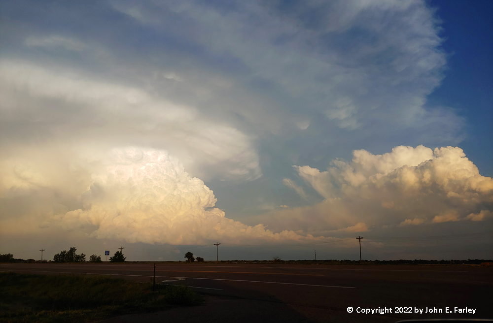
Knowing I was in the path of the storm, I eventually doubled back east on road E to route 71. By the time I was on route 71, I was treated to this:
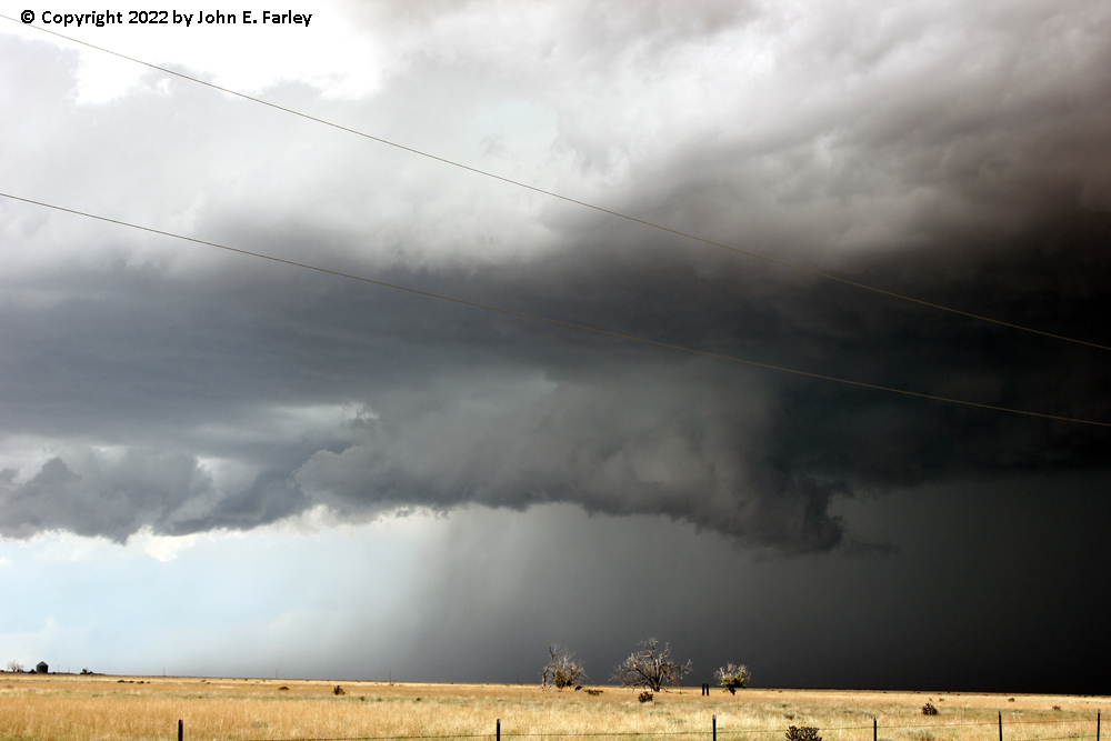
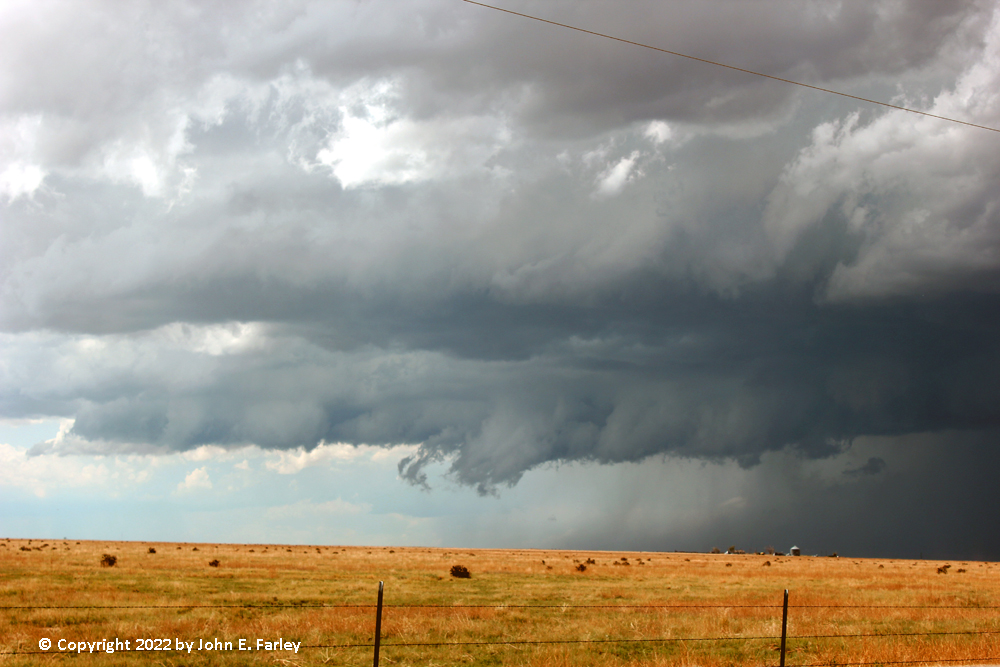
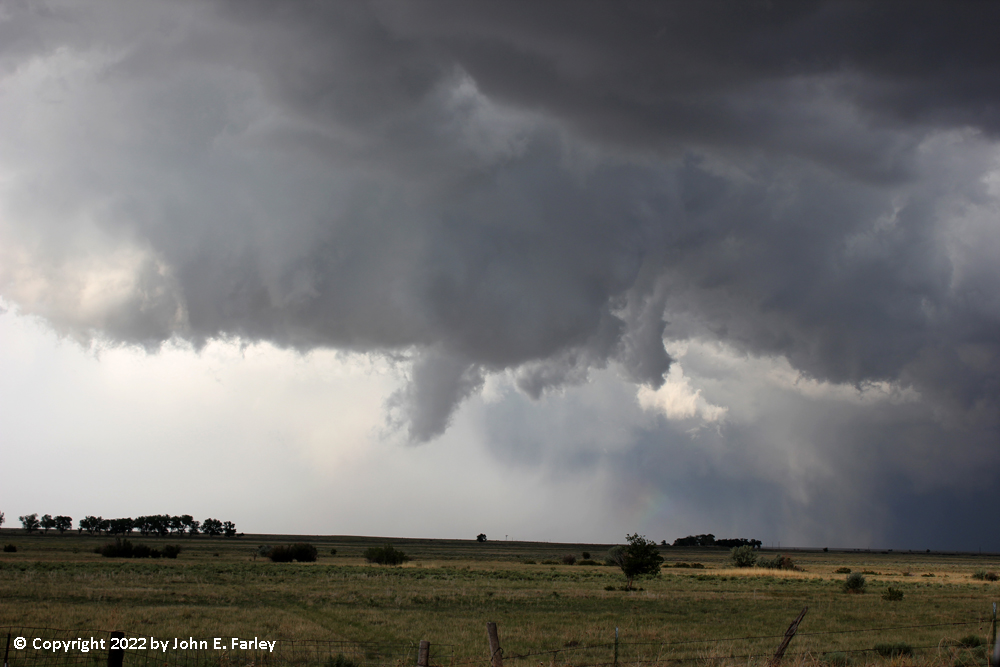
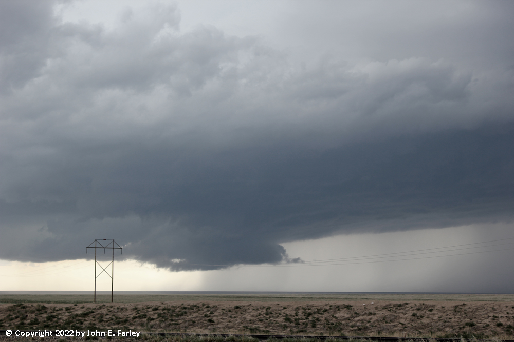
A short time later, the wall cloud was rotating and the RFD appeared to be intensifying. This was around 3:50. I got video of the rotating wall cloud, then after a short dash south on 71 to keep ahead of it, I got pictures and video of a big cloud of dust to my northwest heading toward me just before 4:00 p.m. At first I thought it could be a gustnado, but the video seems to indicate that the dust was all blowing pretty much the same direction.
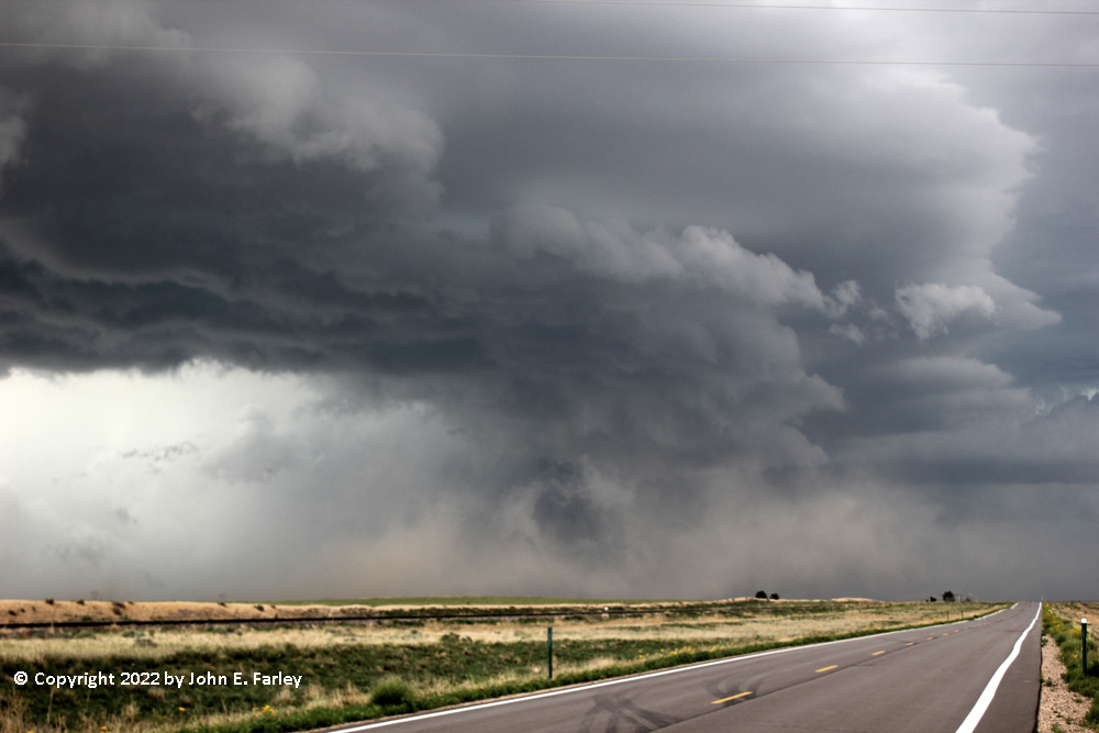
From there I continued south on 71 with a couple stops for pictures, until after the storm had crossed 71 behind me, I headed east on roads T and U to keep up, then south on road 27 to state highway 96 east of Sugar City, close to where I had seen golfball hail on the ground the previous day. All the while, the wall cloud persisted and the RFD intermittently lofted dust high in the air. This went on from around 4 until after 5:00 p.m., with the storm at times displaying spectacular structure, and even once briefly, what appeared to be a funnel cloud.

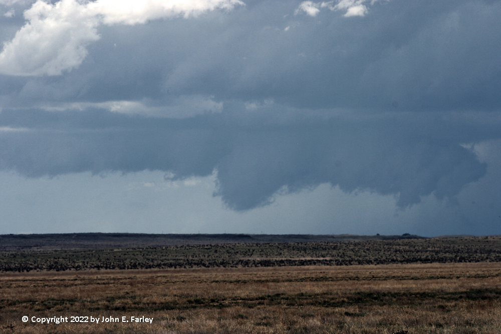
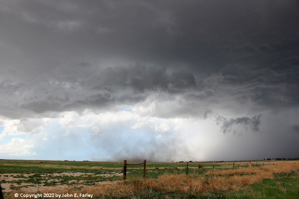
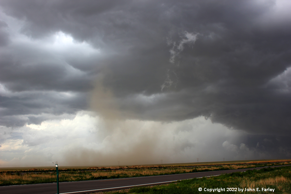
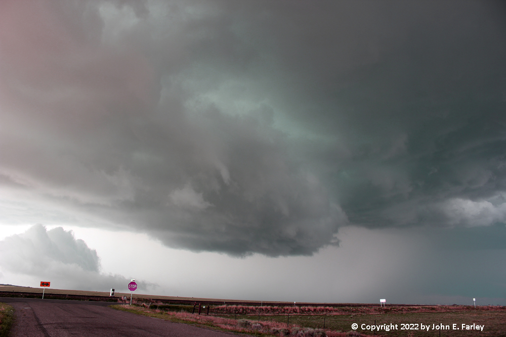
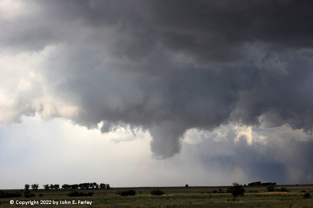
The storm's rear flank downdraft winds lofted a LOT of dust at times:
I headed ENE on route 96 until the dust lofted by the RFD sharply reduced visibility a half mile or so ahead of me, encounteing strong wind then and more dust. Meanwhile, I could see that another supercell had developed behind the first one (again near Black Forest, around 3:30 p.m.) and was following the same path as the first one. Knowing that the first storm was getting away from me and moving southeast ahead of me into an area with a limited road network, I decided to shift my attention to the second supercell, doubling back west and then a little north, and keeping going even when the storm I had just left got a tornado warning. I got a few pictures of the new storm now approaching (see below), but when a TOR warning update for the first storm stated that it was now moving only 5 mph, I decided to double back and see if I could catch up with the first storm somewhere south or east of Arlington. But a short distance up route 96 toward Arlington, it became evident that 1) I was not going to catch up with the first storm and 2) I would most likely end up in the hail core of the second storm. So this time I dropped the first storm for good and doubled back to get in position for the second one. This would have been a while after 5:30. For the record, the first storm remained TOR warned for the better part of several more hours, and eventually much later, produced a tornado 8 miles south of Lamar a little before 7:00 p.m. and another near the KS state line ENE of Two Buttes, CO around 8:18 p.m.
Here is a compilation of video from this storm, including the rotating wall cloud mentioned above:
Supercell 2
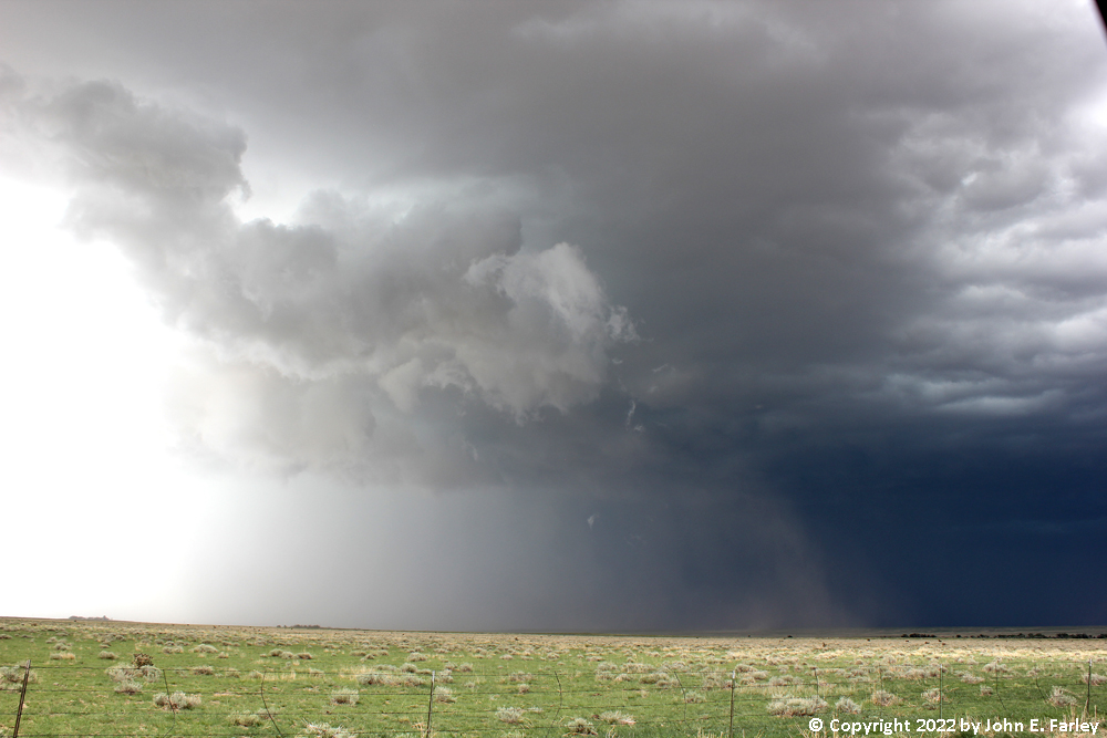
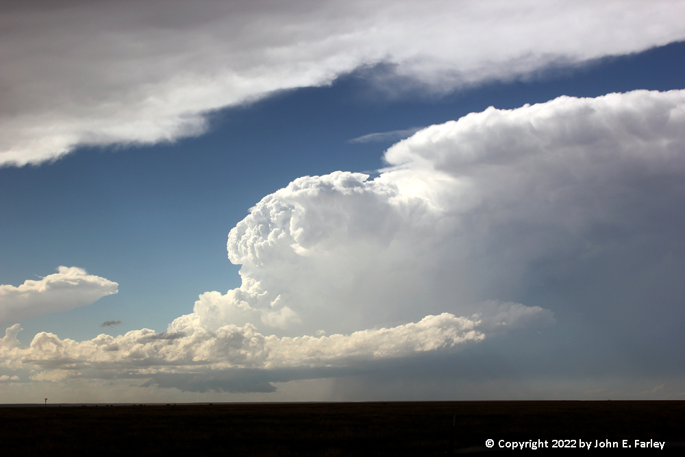
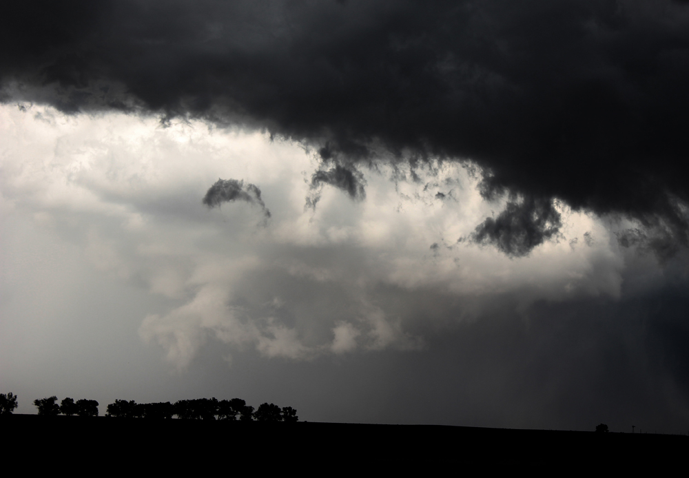
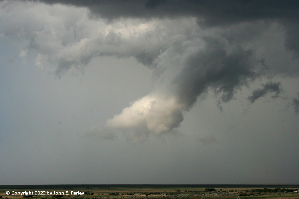
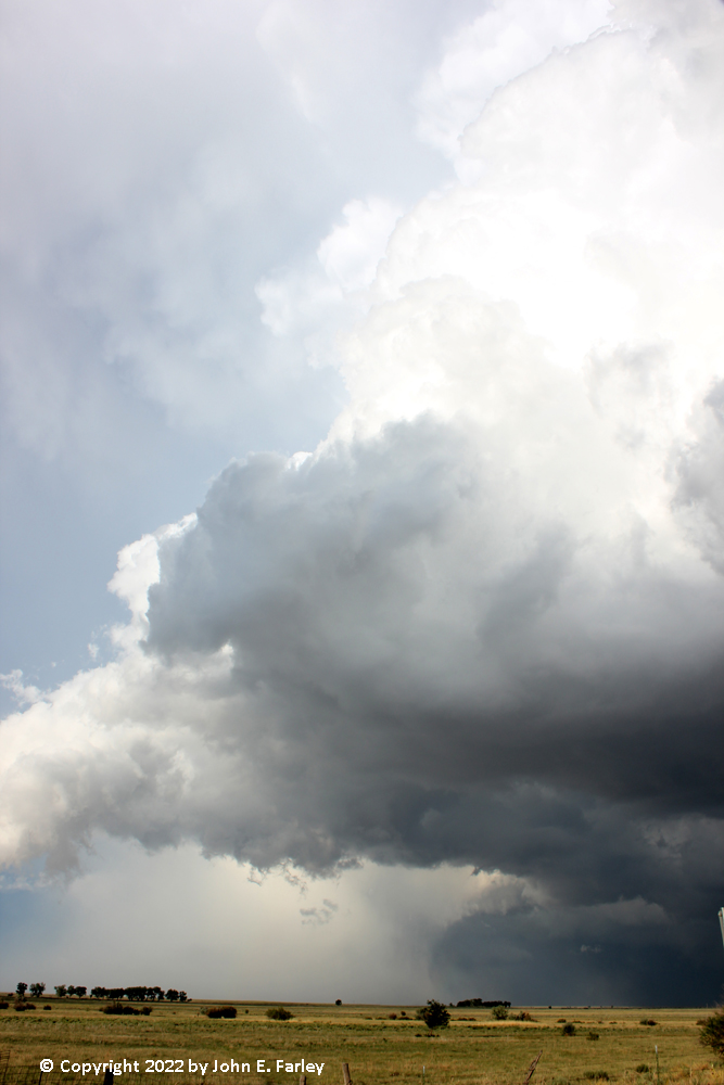
As I said, the second storm went SVR-warned around 3:30, again near Black Forest in the northeast part of the Colorado Springs metro area. From there, it moved southeast on a very similar track to the first storm. I had noticed it while chasing the first storm, but until that storm began to get out of my reach around 5:00 p.m., I did not pay much attention to the second storm, though I did turn around to get pictures of it once or twice. Here is one from around 4:25 looking to my NW - note that this second storm has supercellular structure very similar to that of the first storm.
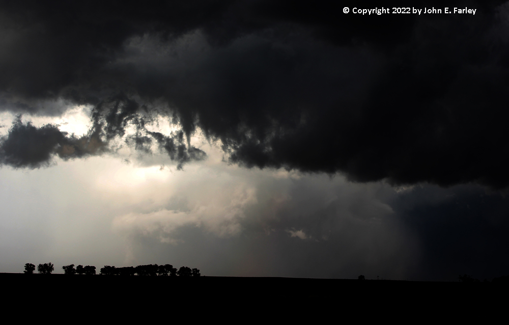
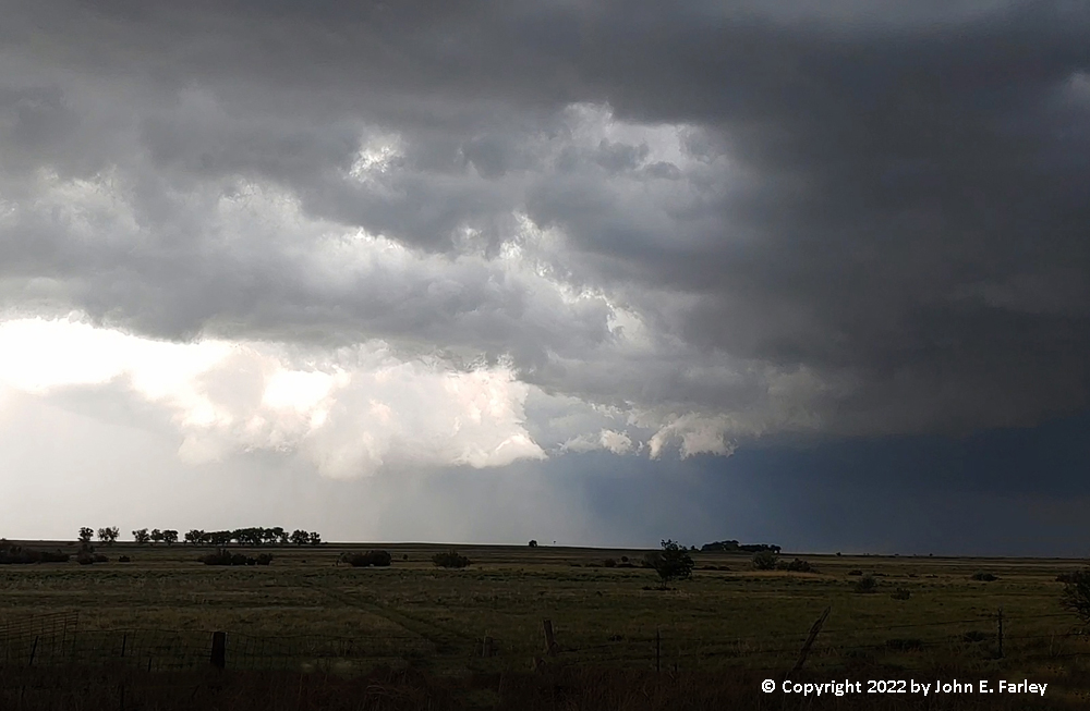
The storm would have been somewhere near Truckton at this time. But it would be a couple more hours until I finally turned my full attention toward this storm, somewhere after 5:30. By 6:00 p.m., the storm was getting close to me, with a distinct wall cloud and, at times, some cloud formations very near the ground - likely condensation in outflow from the sudden cooling caused by rain and hail:
I briefly tried to get ahead of it going east on 96, but it soon became evident that would put me in the hail core, so I doubled back and headed south toward La Junta on county road 31 (also locally known as something like Dock 99 road, as it goes very close to Cherlaw Lake). Apparently around this time, the storm made a fairly hard right turn. As I made the turn to the south on road 31, the wall clloud was just to my northeast, and I was about to be taken over by the gust front:
By the time I was under way again, I was just behind the RFD gust front, and clouds of dust were going up several places nearby. Somewhere around 6:15, a gustnado spun up a mile or so ahead of me, just west of the road I was on. At first I thought it was just another plume of RFD-driven dust, but then I saw that it was spinning. It lasted less than a minute, and unfortunately I was not fast enough with the video camera to get video of it. With the mesocyclone getting a little more to the east, I decided to go east, but ended up stair-stepping east and south several times on the local roads, as none of them kept going too far to the east. At one of these turns, I think around 3 miles ENE of Cherlaw, I notice that the wall cloud, now sunlit as the sun shined into the RFD notch, was strongly rotating. By now my video camera battery was pretty much dead, so I got some video with my cell phone. I captured a still from the video; the video of the rotating wall cloud is included in the video from this storm, linked later in this report.
I also took some stills with my DSLR camera. I knew a tornado was possible given the strong visible rotation and also the presence of a tight couplet on Radarscope in the same location. At 6:41, the emergency alert on my phone went off again, as it had several times earlier, this time for a confirmed tornado northwest of Las Animas and northeast of La Junta - right where I was looking. Looking at these pictures taken with my DSLR camera just before time of the reported tornado, although the meso was quite rain-wrapped, with some enhancment you can see what appears to be a funnel cloud mostly to the ground:

This is behind the trees under the north side of the wall cloud, which in the video appeared to be the part rotating most intensely. Then, 3 minutes later, within a minute of the reported time of the tornado, you can see what appears to be a funnel fully condensed to the ground, in about the same location, though harder to see because it was becoming more rain-wrapped:
Can't tell quite for sure if it is fully condensed to the ground due to the trees, but certainly it was close and I believe this to be the tornado. Also, in a radar loop I saw later, the intense velocity couplet did not move between scans, which is consistent with the lowering being in almost exactly the same place in pictures taken 3 minutes apart. So I think this is the tornado. Very rain-wrapped, but I'll take it, as it is my first one in 2022.
After this, the whole wall cloud became completely rain-wrapped from my viewpoint, and nothing was really visible except the rain wrapping around the meso. However, the storm was now attempting to cycle, and a new meso formed much closer to my location, and easily visible - and quickly it formed a lowering. The tornado warning issued around 6:40 for the confirmed tornado also mentioned a new tornado might be forming closer to Las Animas, but the location does not exactly match up with this new lowering, so not sure if that is what they were talking about or not.
The lowering under the new wall cloud did not appear to be rotating, although there did seem to be a little rotation in the wall cloud itself. In any case, the attempt at cycling largely failed, as the new wall cloud fizzled after a few minutes and the older one, albeit occluded, continued to be the dominant one, at least from my viewpoint. A wider picture, taken about 5 minutes after the reported time of the tornado, showing the storm structure and the now-completely rain-wrapped meso that had produced the tornado, can be seen here.
After another 5 minutes or so, the rain-wrapping cleared a little, revealing a lowering that may have been what was left from the tornado. However, by now, around 6:45, the tornado was over, although the storm would remain tornado-warned for more than another hour.
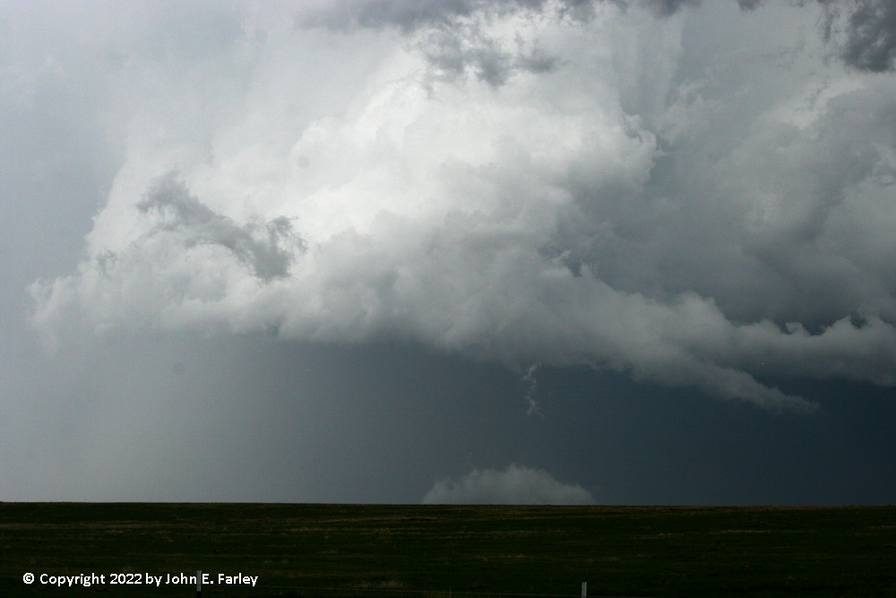
I continued to pursue the storm, stairstepping south and east on the back roads until I reached route 194 which I took east to pick up route 50 at the north edge of Las Animas and continue east to Fort Lyon, where I got one more look at the storm, still TOR-warned and still producing some partially rain-wrapped lowerings:
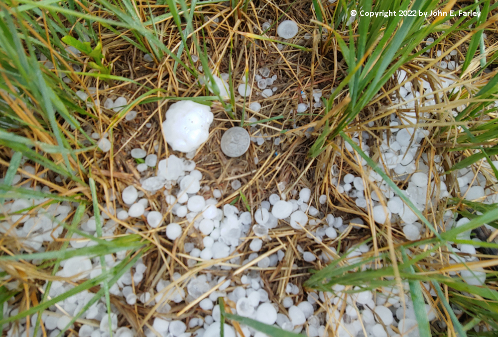
Now, though, the storm had crossed John Martin Reservoir and was moving away from me to the SE. I knew at that point that the chase was over. I returned to route 50 and went east to look for hail on the ground, and five or six miles east of Fort Lyon I found a golfball-sized stone on the ground among a number of smaller ones. Although this is the biggest hail I saw, there was, earlier, a report of baseball-sized hail near the time and place of the tornado.
Having booked a room in La Junta, I then headed there to get a bite to eat and check into the room. But not before stopping once more along the way to get a picture of the beautiful storm as it moved away from me, illluminated by the setting sun:
Here is a compilation of video from this storm, including the rotating wall cloud that occurred just before the tornado (I do not have video of the actual tornado, because by then I had switched to still photography.):
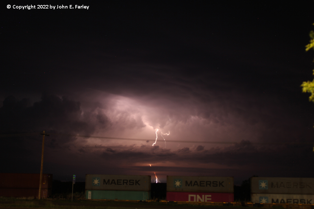
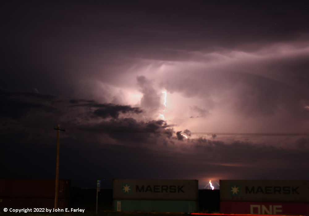
Night-time Lightning
Once I had eaten and got settled in my room, I went outside to look north, because late in the evening, a cluster of severe thunderstorms, some supercellular, had once again formed in the same general area as the earlier storms, though perhaps slightly farther north, and was tracking southeast into areas impacted by earlier storms. When I got outside, I could see that the lightning in the storms, though quite distant from La Junta, was frequent and spectacular. So, I got the tripod and set up the camera for some lightning shots. Here are a couple of my favorites, showing bolts from the upper part of the storms to the ground:
Chase distance for the day: 315 miles.
Total trip chase distance: 936 miles.
Return to 2022 Severe Weather Observation page