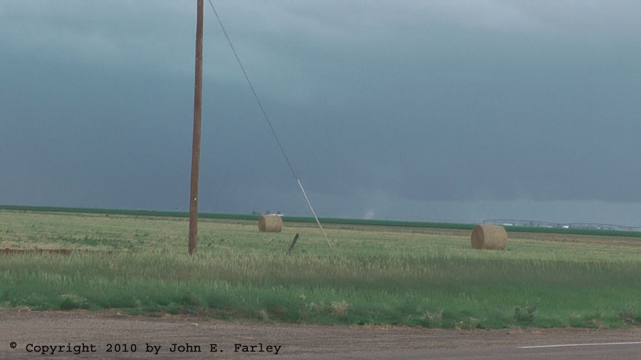
A more zoomed version of that picture and pictures of two of the others can be seen here. I tried to get video of these, but they were very brief (most of them lasted a minute or less) and a mile or two away, so in my rush to zoom in on them I failed to keep them in focus and/or they ended before I could get decent video. But I did manage to salvage a few decent stills. The gustnadoes occurred between 5:05 and 5:15 p.m., and at one point there were three of them at the same time.
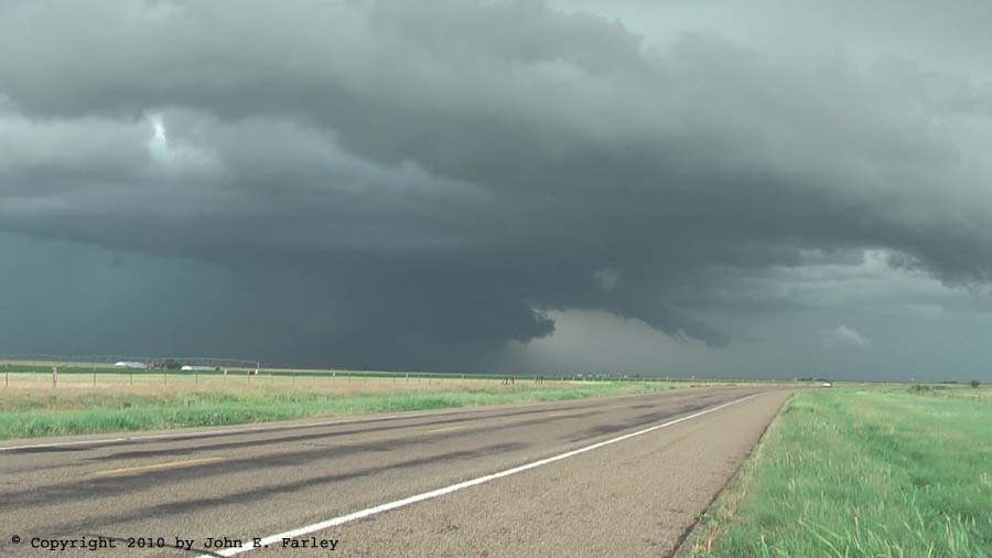
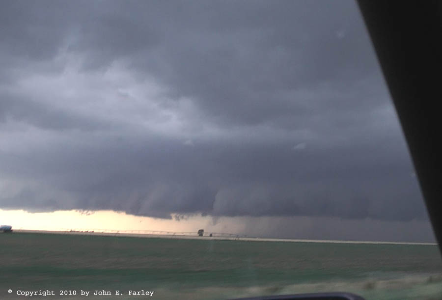
I stayed in this general area for quite a while, just drifting north, as the storm did not seem to move a great deal and what movement there was was mostly to the north. By the time I had caught up to it, the storm was very HP, and it stayed that way throughout the time I was on it, producing lowerings like this:
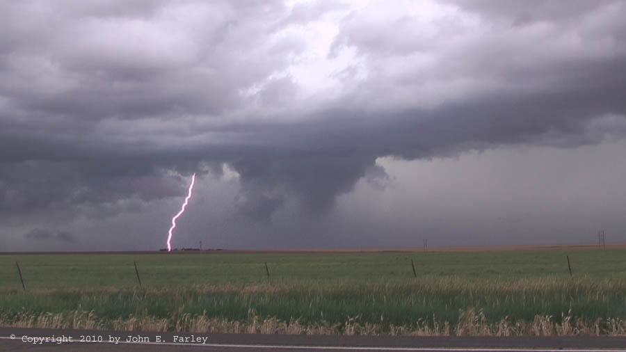
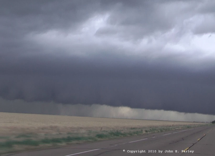
The storm did cycle a few times, though, forming new wall clouds, often starting as scud under the updraft which rose, grew, and quickly merged with the cloud base above. The third time this happened, the wet RFD that formed south of the new wall cloud surged quickly to the east, forcing me some distance eastward on route 281, to a location well ESE of Spearman. The storm remained SVR-warned and, in addition to the gustnadoes, produced a couple reports of 1-inch hail and one wind report during the time I was on it. But it never regained the intensity it had earlier exhibited, at the time of the brief tornado and giant hail that I missed. Eventually, as the storm seemed to be getting more linear and outflowish, I let it go.

This picture was taken along route 152 between Stinnett and Dumas, looking west toward Dumas. Although you don't see other chasers in this picture, the crowds were just toward the storm from here, and soon I was in the crowds as I nudged west and the storm approached. There appeared to be potential areas of rotation near the northern end of the feature pictured above and also near the left end of the precipitation area under the center of the broad lowered area, which is also about where radar was showing rotation. I am not sure whether this feature was a small funnel or a scud finger, but it was somewhat persistent: the picture linked here was taken about 2 and a half minutes after the panorama one above, and the feature is present in both pictures. Also around this time, you could see evidence, as in this picture, of the intense precipitation, accompanied by violent wind, to the west toward Dumas. At the northern end of the lowered area, where the inflow tail came in, you could readily see the upward surge into the base of the storm. Finally, of note during this time period was the very strong inflow. When I first approached the storm, there was a strong, cool wind from the NE that seemed to be some combination of outflow from the early supercell now well to the northeast and inflow to the new one. As I got closer to the storm, the wind veered to due east and was quite strong, but still cool. I imagine that farther south, the storm was drawing warmer inflow, but I am guessing that the ingestion of this storm-cooled air might be one reason this storm did not produce a tornado.
As I closed on the storm and it moved closer to me, it was clear that there was a broad area of rotation in the cloud base to my southwest. I have video showing rotation from about 7:39-7:52. For the most part this was rather broad-scale cloud-base rotation, though it did occasionally tighten up a bit. Here is part of that video:
You can also see in the video that there were a lot of chasers who converged on this storm, and the traffic got a bit heavy for a while. Although I am sure it did not rival a couple days in Oklahoma this year, this was by far the most chasers I have seen on any day this season and probably as many as I have ever seen. Certainly a lot for a day that did not even have a FCST thread on ST until after noon on the day of, LOL!
As you can see in the video, the precipitation really fills in just to the west and south of the area of rotation, and this was part of a process whereby this supercell, like the early one, transitioned to HP (high-precipitation) mode. By the time I and the rest of the case caravan were pushed east by the storm into Stinnett, this process was complete. In this picture, you can see that the supercell had made the transition to HP. Also of interest in this picture is what I thought was dust rising between the two white buildings near the center of the photo - I thought this most likely was a dust plume kicked up by the strong inflow, or possibly a gustnado. Turns out it was neither. Steve Miller reports that it was smoke from a fire. For me, this was pretty much the end of the show for this storm. A number of chasers did head north/NNE on route 207 to try to stay ahead of the storm, but figuring this was a sure way to get cored, I did not.
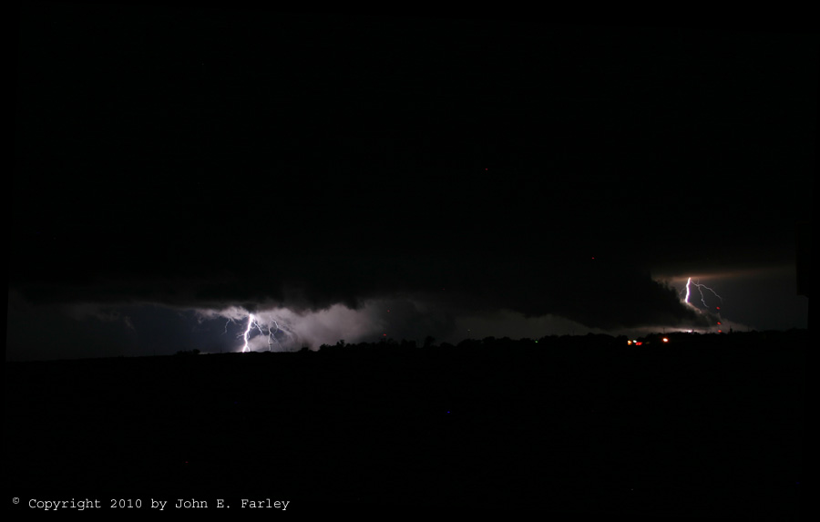
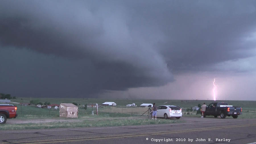
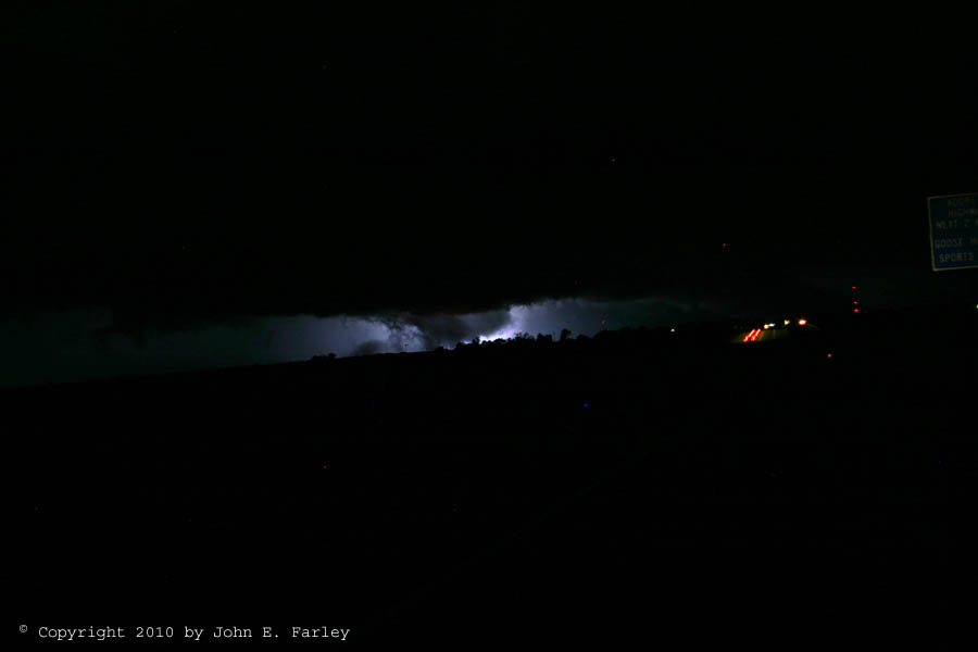
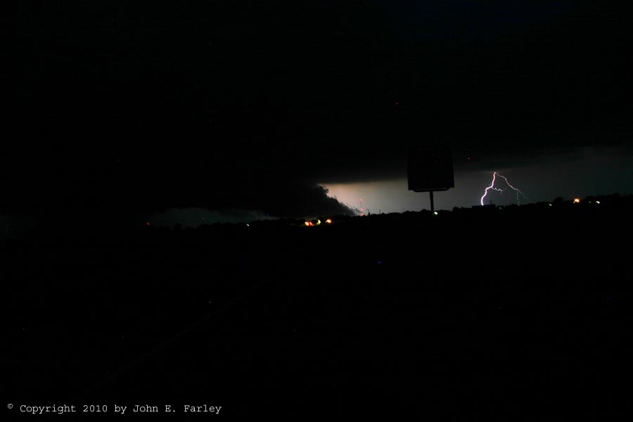
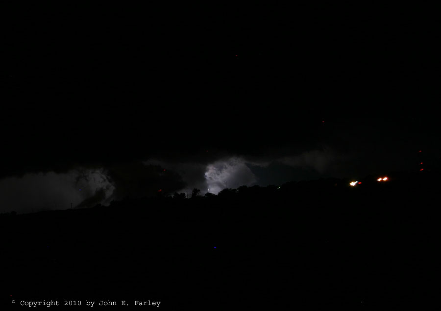
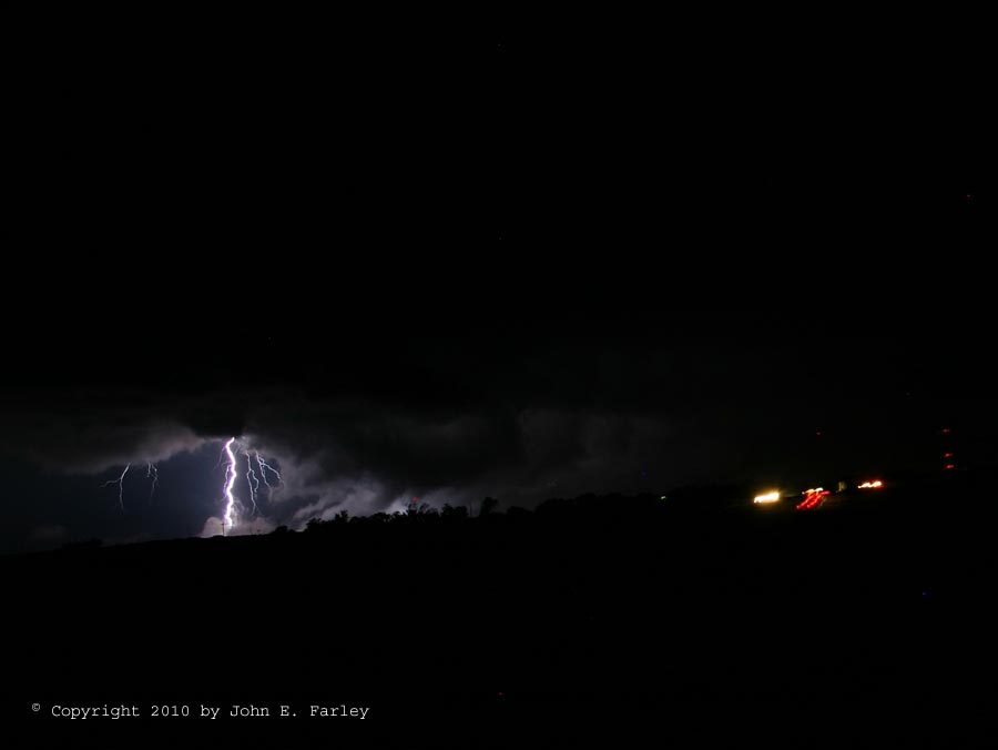
Around 9:30, the structure in the storm became better-developed, with a ground-hugging wall cloud and inflow tail just the other side of Stinnett. Occasionally the lightning backlit and/or illuminated these features quite nicely as in this picture, perhaps my favorite for this entire chase:
I began to wonder if there could have been a tornado in there, but none were reported in that area, and I saw no power flashes. There were some flashes of lightning when the wall cloud looked rather disorganized and scuddy and disorganized and others where it looked pretty good - it is really difficult to tell at night. But since there were no reports of any tornadoes, I assume there were none. The storm did verify as severe, however, producing quarter-sized hail in Morse. Another feature of these storms was extremely heavy rain, in part because all three of these supercells as well as some other intense storms moved over the same area, roughly around Sunray, Morse, and Grover, with doppler radar indicating storm totals of 11 inches or more throughout this area. Perhaps a little exaggerated due to the effects of hail, but there still was a tremendous amount of rain, and quite a bit of flash flooding, across this area. Around 9:40, I called it a chase day, and headed to Amarillo to get a room for the night.
Total chase distance for day: 549 miles.