
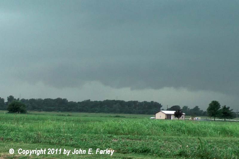
I stopped at the parking lot of the cineplex on Center Grove in Edwardsville, where the view is good, and got this picture (actually a panorama made from two photos) of the approaching storm:
The leading edge of the arcus cloud with this storm - the dark cloud along the horizon - extended about 10 miles ahead of the precipitation. When I took this picture in Edwardsville, the leading edge of the precipitation was still near the Mississippi River, with the storm still mainly over Missouri - but the leading edge of the arcus cloud was over me a minute or two later, by the time I left this spot.
From there, I moved to near the intersection of I-270 and IL route 157 for an intercept, and got video of the frequent CG lightning as the storm approached. Here are a couple captures:


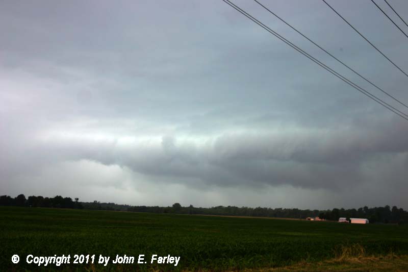
Around this time, the storm went severe-warned for St. Clair County, just to my south. As it did, I could see one area where there was a distinct shelf cloud and a couple lowered areas under it, right near the northern extent of the warned area - looked a little like an embedded HP supercell may have been trying to form. A video capture of this feature can be found here
As the precipitation was about to overrun me, I decided to move east to route 4 and intercept again. I intercepted the storm again along route 4 about 6 miles or so north of Lebanon. I thought about trying to get south to I-64 to stay ahead of it as it evolved into a distinct bow echo and began to turn to the southeast - but I knew I could not get to 64 before the storm would reach my access point to the freeway, and did not really want to be chased halfway across IL by an accellerating bow echo anyway, so I let it overrun me. It had a shelf-cloud feature similar to the one in the picture linked above, as additional SVR warnings were issued, this time including my location. As the storm blew over me it produced what I would estimate to be 40-50 mph winds, which I phoned in to the NWS - strong but not severe - and very heavy rain. Little if any hail, though. And, again, lots of CG lighting:

Once the storm was subsiding and I started back, I noticed water running 2-3" deep across two side roads along route 4, and pooled deeper, so I called that minor flooding in, too. The storm produced numerous reports of wind damage across southeastern St. Louis County, MO and various places in St. Clair and Clinton Counties, IL, as well as minor flooding and mostly small hail in various places in these counties and Madison and Bond Counties, IL also. It was SVR-warned all the way across IL, and SPC issued a severe thunderstorm watch for southern IL and parts of KY and IN around the time I completed the chase. So not bad at all for a local chase of only 50 miles, as the MCS intensified nicely into a bow echo system with lots of CG lighting right where I could intercept it. I am not sure of the exact times, but I believe my two intercepts of the storm were around noon and 12:30 p.m. Later in the afternoon I tried again as the storm parameters became very good (CAPE 4000, EHI 6-10) just southwest of STL, with both the RUC and HRRR models predicting intense, discrete storms between 5 and 8 p.m. just west or SW of STL. However, the atmosphere was just too worked over from the mid-day bow echo for storms to initiate before dark, as I knew might be the case, so this second 150 mi chase yielded nothing.