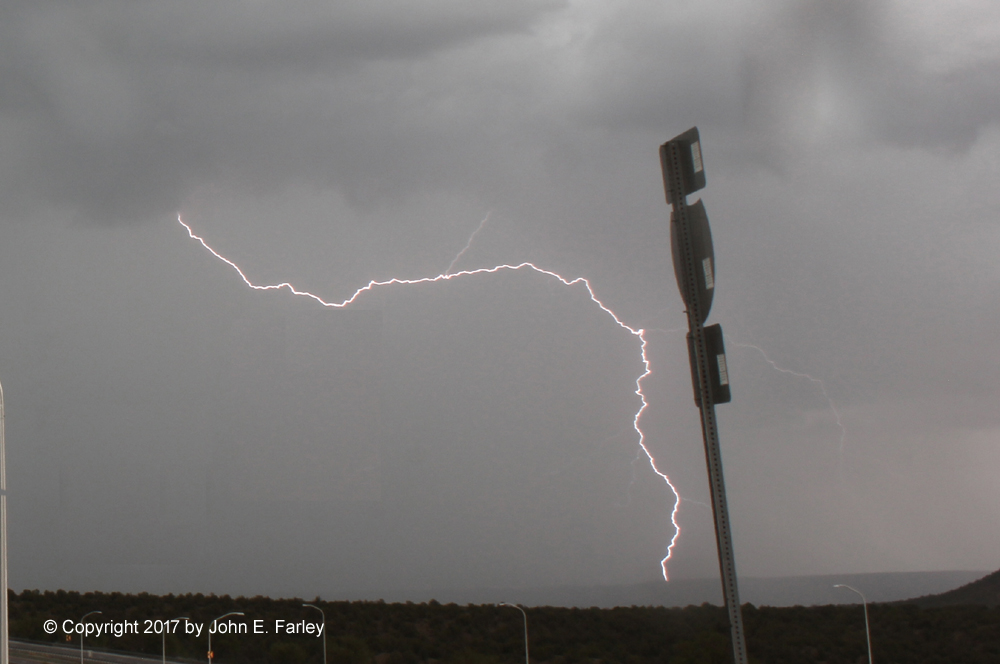
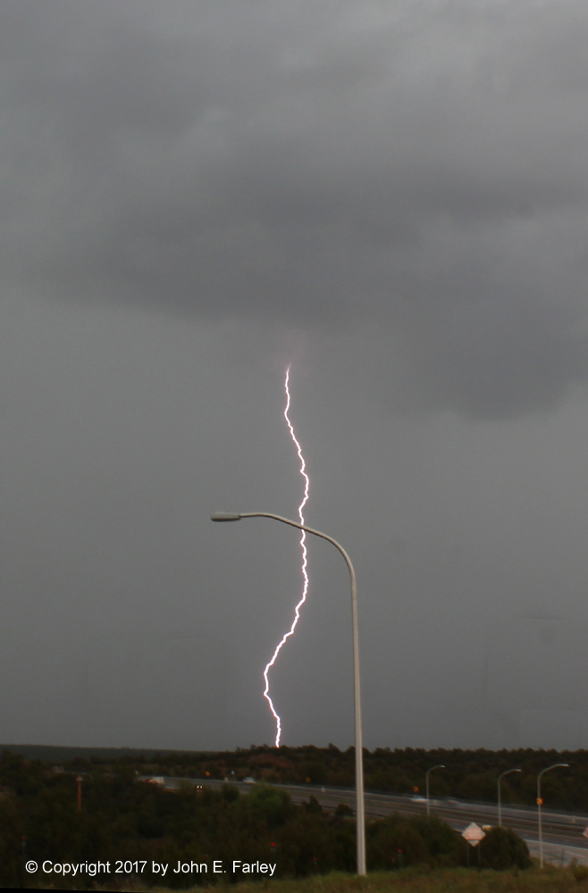
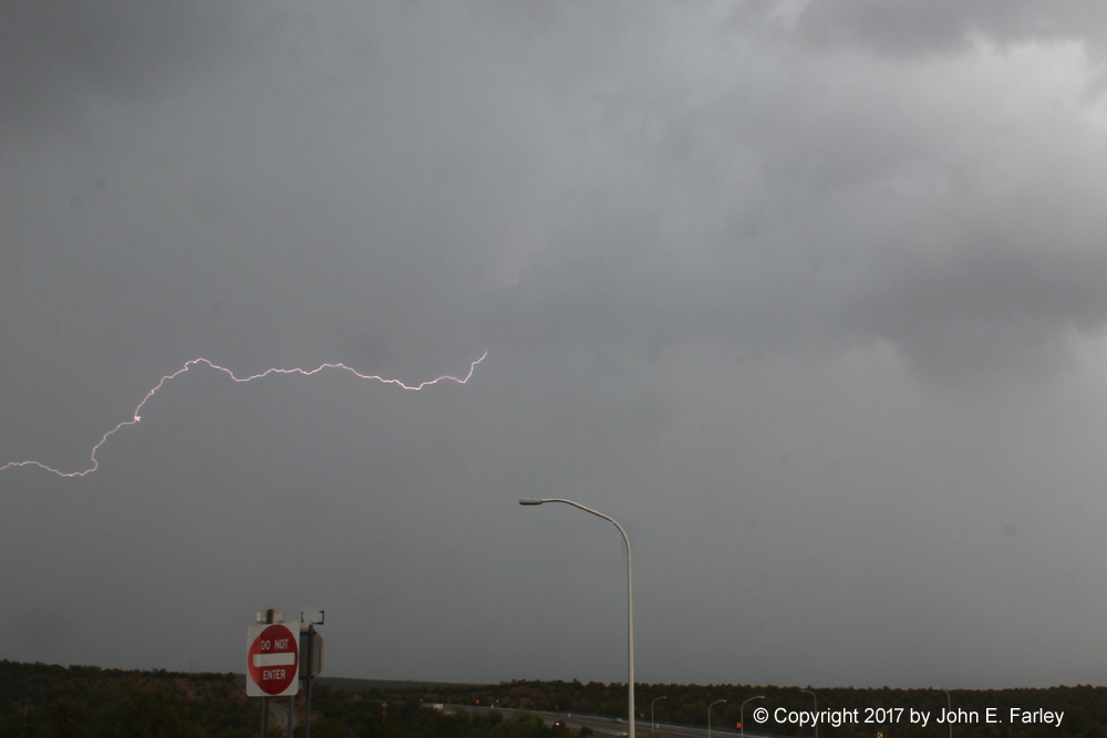
July 13 brought the first really good surge of moisture associated with the North American Monsoon into the Santa Fe area. Although there had been isolated storms in the area for several days, this was the first day that really ended up having widespread storms all over north-central New Mexico. At first indecision was my enemy on this monsoon chase, leading me to do quite a bit of perhaps unnecessary driving around before finally getting on a storm with good lightning about 45 miles east of Santa Fe along I-25. These three pictures were taken looking east from that location between about 3:50 and 4:00 p.m.:
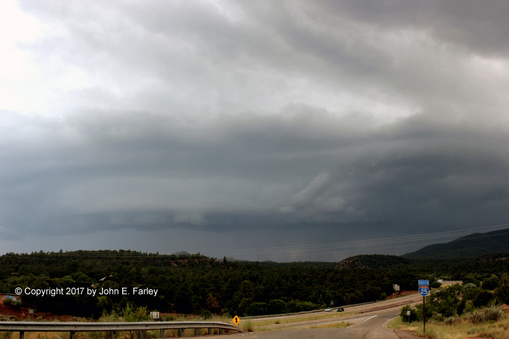
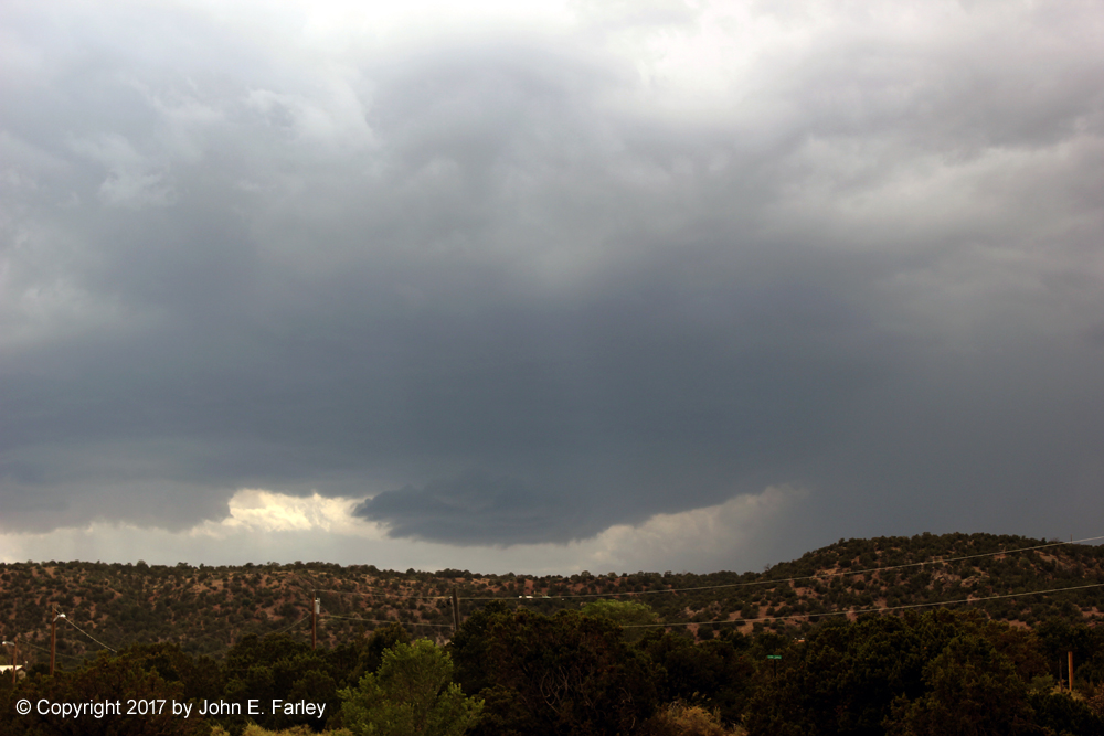
After around 4:00 the lightning subsided, and I noticed on radar that a strong line of storms was approaching Santa Fe. So I returned back to the west and was able to get some decent storm structure pictures on those storms. The first picture was taken from the Glorietta exit, looking to the SW - decent shelf cloud by central NM standards:
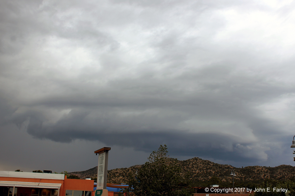
After that I moved to the Eldorado/Clines Corner exit and got a couple closer pics of the storms, as a flood advisory was issued for parts of the Santa Fe area:
Only downside to this chase was that at the last stop, as it began to lightning again, I noticed the release cable for my camera lighting trigger was gone - apparently I lost it somewhere along the way, probably at one of the previous stops. So no more daytime lightning photos (unless they are video captures) for a little while. But this time I got smart, and ordered two cables, so if I ever lose another one I will have a spare.
Total chase distance: Around 140 miles.
Return to 2017 Severe Weather Observation Page