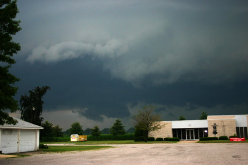
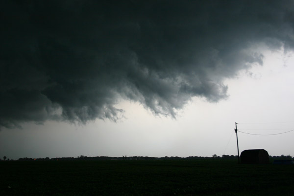
The biggest cluster of storms was in NE MO around Hannibal, but a storm initiated in central Macoupin Co. only a half hour's drive from my house and initially looked decent, so out I went. It died quickly, however, so I knew I needed to blast west across Macoupin Co. toward Jerseyville to intercept the main show. Initially the southernmost storm in the cluster was a strong, slow-moving single cell, with some supercell characteristics, over Lincoln and Pike Counties, MO, drifting slowly into Calhoun Co., IL. This storm seemd to be right on the outflow boundary, and stayed isolated for quite a while. But as I got toward Jerseyville, the storm abruptly changed speed and character. It quickly evolved from a single cell into a bow echo, with the northern part now screaming across Jersey Co. at 50 mph, double its earlier speed. (To the southwest, down the line, the motion was still much slower, but that did not matter where I was.) I could see I was going to get overrun by the time I was 5 or 6 miles or so east of Jerseyville, so I backtracked east to IL 111/267 to blast south and try to get around what I thought was still a single cell. But by the time I got to Brighton, it was obvious that would not work, as the storm was already nearly on me. I could see the gust front just to my west, with one lowering that looked like a wall cloud but may have just been scud. I briefly stopped for this pic before I blasted east:
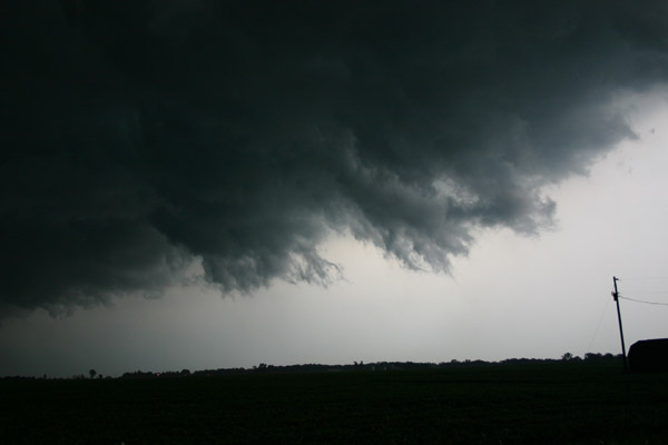
As I blasted east on a back road from Brighton toward Bunker Hill, I was right on the gust front and the shelf cloud was directly above me, with darkness and heavy precipitation behind me. The wind was fairly strong and I was nervous about the trees along the road possibly blowing down, but luckily the most intense winds were behind me in the rain. I stopped briefly to photograph the shelf cloud and the scud fingers along its leading edge, looking northeast roughly toward Shipman:
When I got to Bunker Hill, I had gained nothing on the storm, so I stopped away from any trees or wires and pulled under the roof of a bank drive-through and let the storm overrun me. I videotaped intense rain and wind I would estimate at around 50 mph, perhaps a little stronger. Here is a short Youtube video video from this location:
There were numerous reports of wind damage in the Brighton and Shipman areas, with a measured gust of 71 mph at Shipman. A spotter west of Bunker Hill also estimated 70 mph wind, but it did not seem that strong to me where I stopped. Once the worst of the storm passed over, I headed south on IL 159 toward Edwardsville. There were several tree limbs down along the road between Bunker Hill and Midway. Just north of Edwardsville, I noticed an abrupt increase in CG lightning to my southeast over the east side of Edwardsville, where I live. I stopped again to videotape the lightning for a while. Here is a Youtube clip from this video:
When I got home, my wife confirmed that the barrage of CG had been in our part of town. There didn't seem to be much damage in Edwardsville, though, except for one branch I saw down in the north part of town.
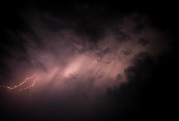
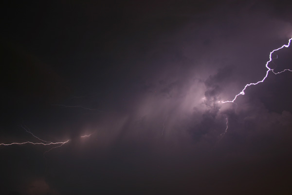
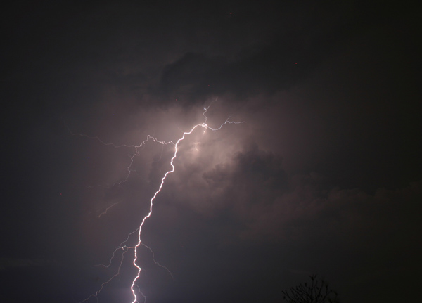
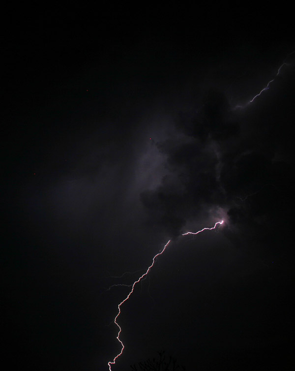
Later, after dark, I went out again to nearby Glik Park and photographed the lightning, which was mostly anvil crawlers, but some CG, too.
This was my first chase with my Sprint aircard. As people told me, I need to get an antenna - the connection was sporadic, and it also seemed like Weathertap was not always updating properly even when I had a good connection. It was good for confirming I needed to go west in the early part of the chase, but did not pick up the abrupt change in storm character and motion in time to do me any good.
UPDATE, 8/8/08 - The National Weather Service in St. Louis has now issued a public information statement on their damage survey in the area I chased (link below). The survey showed a wide area of straight-line wind damage from Jersey County across Macoupin County into parts of Montgomery and Bond Counties, with localized areas of greater damage caused by mircobursts. One of these, with winds estimated at 65-75 mph, hit Jerseyville, with damage east to just north of Brighton (in other words, it was a few miles west of me when I reversed direction east of Jerseyville, and would be just to the right of my view in the photo from Brighton, above), and others occurred south of Shipman (where the 71 mph gust was measured) and south of Bunker Hill, in the area where I saw the branches down. (Apparently there was also a tree down on a house in this area, but I did not see that.) Another intense microburst hit farther east in the Mt. Olive area.
There was also an online article in the Alton Telegraph describing damage in and around Bunker Hill. (I have no idea how long this link will work.) Three dugouts at the Bunker Hill HS ball diamonds had their roofs blown off, a large tree was blown down on a house on South Franklin Street (not far from where I videotaped the rain and wind), and another large tree landed on a propane tank, causing a leak. Later that night, a car fire resulted from arcing by a power line downed on the car, so all in all there was quite a bit of damage right in Bunker Hill. Both the NWS and Macoupin County Emergency Services agreed that all the damage was from straight-line winds, with no evidence of tornadoes.
Listing of local storm reports from the St. Louis National Weather Service
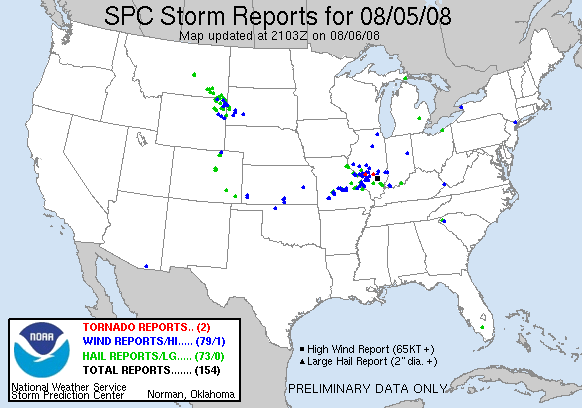
National map of severe storm reports
Public Information Statement from the St. Louis National Weather Service on the damage survey
Additional information and map showing storm path and microburst areas, fron STL NWS