In fact I did not personally experience or observe any severe weather, and I would have had to go all the way to near Amarillo to have seen the one brief tornado the group of storms I was chasing eventually produced, and going that far was not in the books for me. That said, this still turned out to be a decent chase day for me because, although the storms for the most part were not severe, they were quite photogenic at times, and I ended up with a lot of pictures I am quite happy with. At different times I chased four different storms, and will describe each and present the pictures of each below.
Storm 1
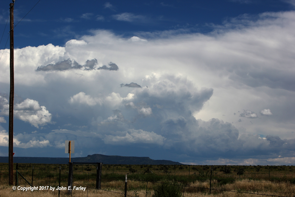
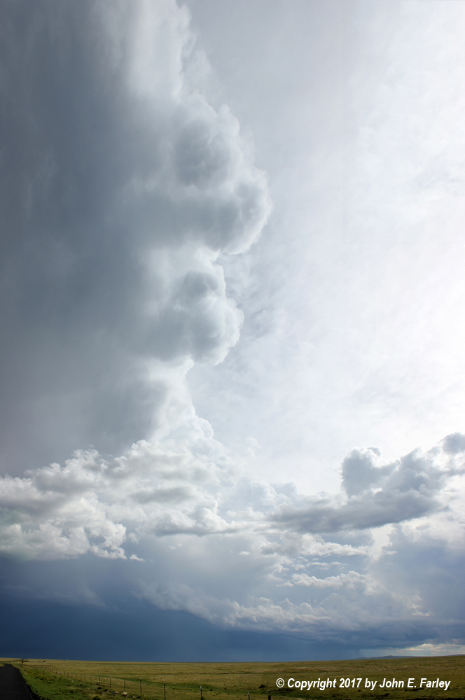
This picture was taken around 2:20 p.m., when this storm was near the CO/NM state line southeast of Kim, CO and northwest of Clayton, NM. At this time the storm was quite a distance away, perhaps 30-40 miles. This was the southwesternmost of a cluster of storms that went up beginning before 1 p.m. near the eastern end of the Raton Mesa - earlier and a bit farther east than I had expected, though certainly in the area where I expected the strongest storms would eventually occur. The storm on the opposite (northeast) end of this cluster of storms was a left split, likely anticyclonic, and moved off to the northeast while all of the other storms drifted, initially very slowly, to the south or SE. Both the storm in the picture above and the left split at the opposite end of the line got SVR warnings after this picture was taken, and several more as the afternoon went on.
Since this storm was the closest to my location (this picture was taken from the intersection of routes 160 and 389, 10 miles or so north of Branson, CO, looking to the ESE) and was moving very slowly, actually nearly stationary for around an hour, I decided it was the one to go after. So I dropped south through Branson, CO just into NM, where the map showed route 456 going east right toward the storm. However, this road, which I had never been on before (and do not plan to again!) turned out to be a disaster. Basically it follows a canyon eastward within the Raton Mesa, just south of the state line. So no sky visibility. But it gets worse. After 8 or 10 miles, the pavement ended, and the road got progressively worse. The top of the storm looked good, and later when I got back to where I could get data I saw that it got more SVR warnings, but you could see nothing below occasionally the top, and I could gain no ground on it on the worsening road. So I finally decided to give up, head back west, and find another storm.
Storm 2
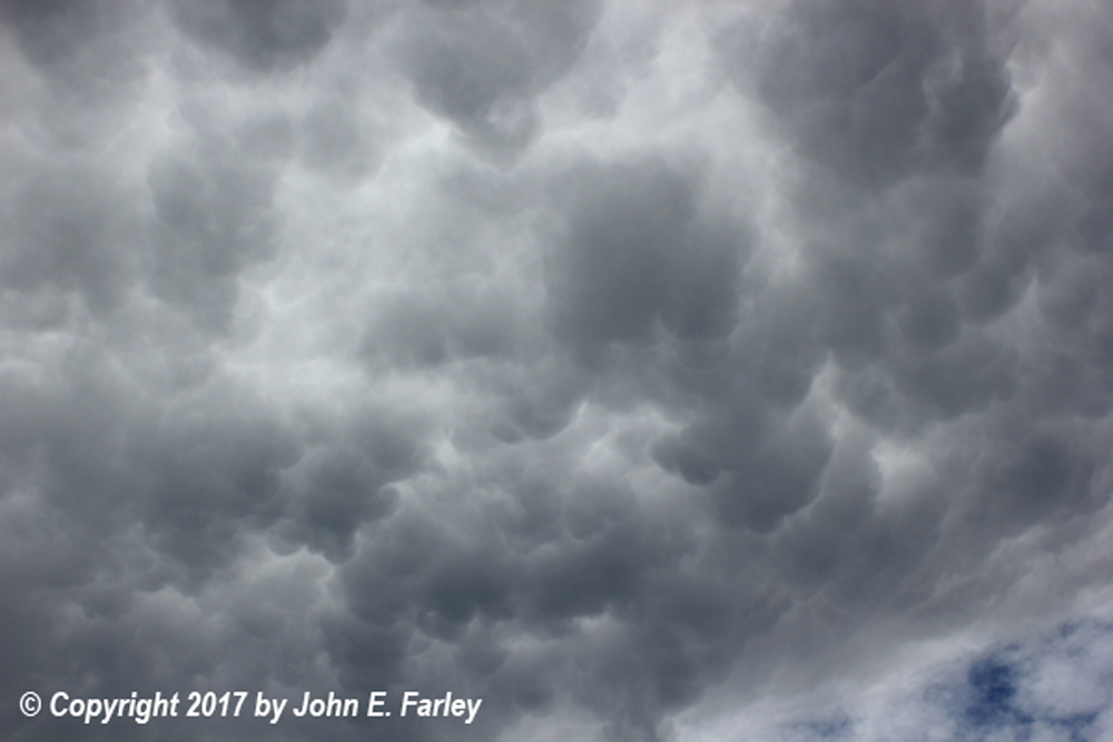
This storm hung out for hours over the western part of the Raton Mesa, perhaps 10-20 miles east of Raton. By the time I made it back to NM route 551 (the continuation of CO 389 after it crosses into NM) I could see it was taking on some nice LP supercell characteristics, so I returned back north almost to the CO state line, found a clear spot, and watched the storm for a while. There was, for a while, some decent motion in the base of the updraft - probably rotation but too far to tell for sure. With the storm having been going, pretty much in the same place, for 2-3 or more hours, its anvil stretched eastward all the way across the sky, and at times had some pretty decent mammatus underneath. Despite its evident LP supercell character, the storm never had a SVR warning and never appeared to be overly intense, though I would imagine it produced some hail somewhere up in roadless areas on the mesa east of Raton. Here are zoomed and wider-angle shots of the storm, taken looking basically west from route 551, as well as a view of the mammatus it produced:
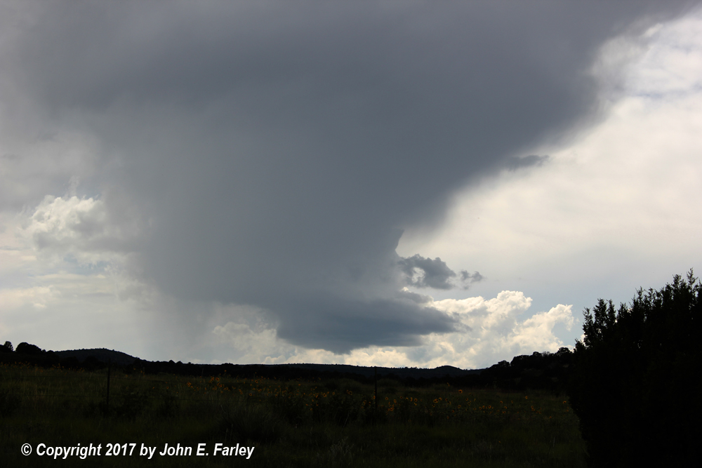
These pictures were taken between 3:45 and 4:00 p.m.
Storm 3
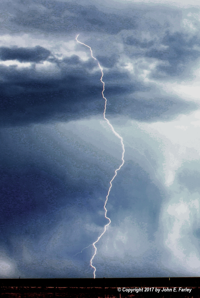
After I watched Storm 2 for maybe a half hour, it seemed to be weakening, so I decided to work my way south to Capulin to see if I could gain position on the main line of storms, which extended basically from the initial cluster of storms in a broken line SW to a SVR-warned storm around Wagon Mound, well to my SW. By the time I got to Capulin a SVR warning had been issued for two storms, one to the SSW of Greenville, NM and the other to the ENE of that, west or SW of Clayton. This SVR warning was issued at 4:19 p.m., valid until 5:15. I thought I could get to the closer storm, SSW of Greenville, so I blasted east then SE on U.S. 64 to Greenville then south on NM route 453 until I was within 10 miles or so of the storm. There I got several pictures that photomerged nicely into a wide angle shot of the storm, along with one of some in-cloud lightning it produced:
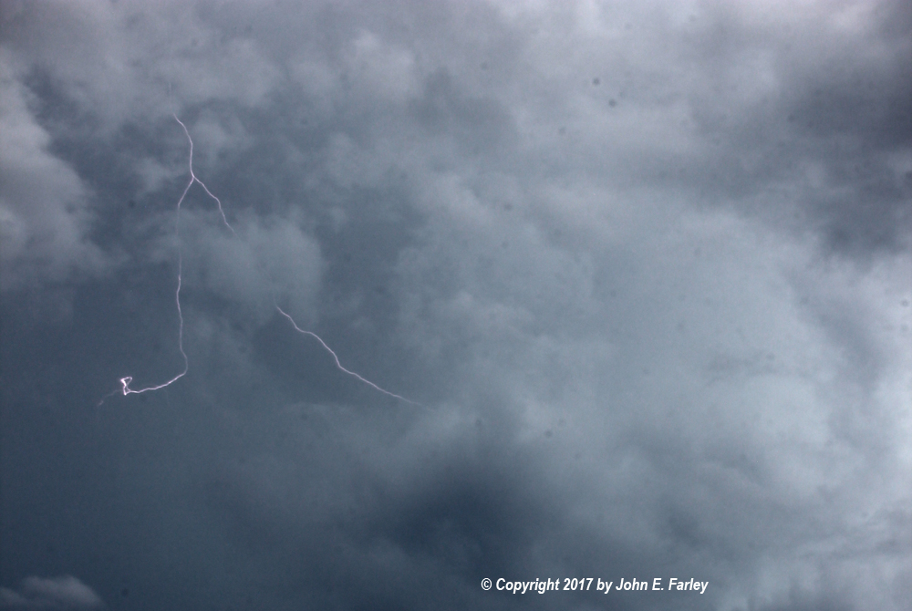
The first of these pictures was taken around 5:10, while the SVR warning was still in effect, and the second about 15 minutes later, shortly after it expired.
Storm 4
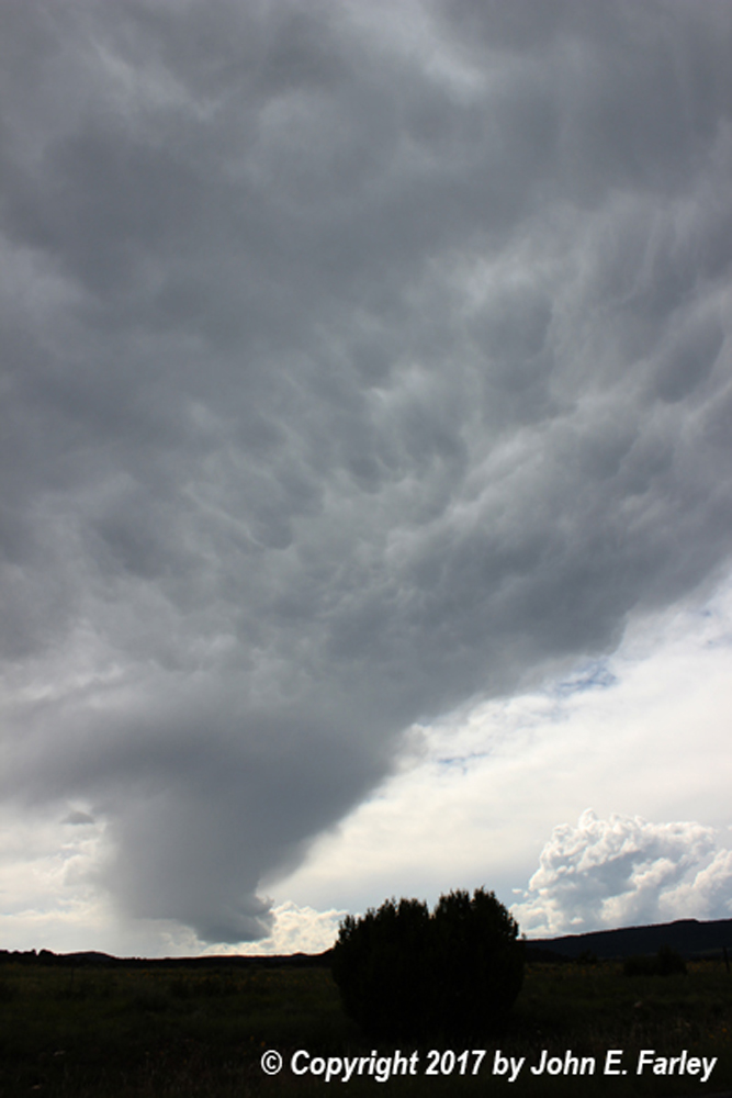
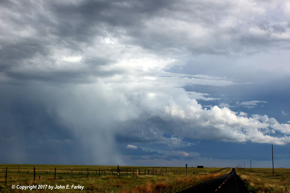
As Storm 3 moved away to the SE, the line continued to backbuild. The next cell down the line to its southwest was not severe at this time, but it merged with another storm just to its west and later intensified. Just before this merger occurred, this interesting feature formed between the two cells around 5:30 p.m.:
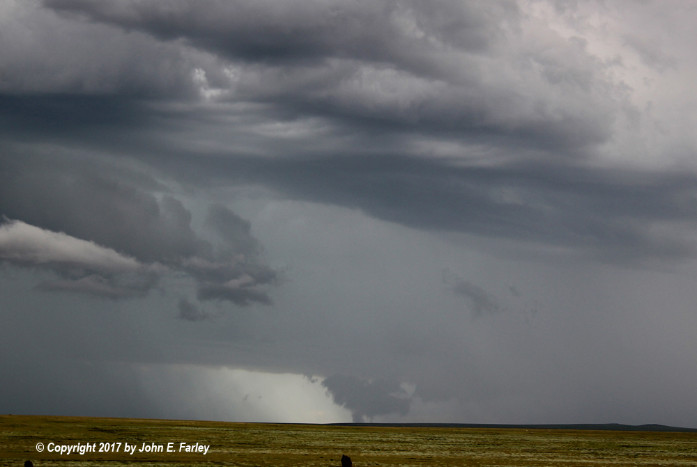
It looked like it extended to or very close to the ground, but note that the large scuddy cloud mass was not attached to the base of the parent cloud above it. Also, there was no indication of any rotation on radar in this area. So, just an interesting cloud feature. As the two storms merged just to the southeast of Gladstone, a SVR warning for what was now my Storm 4 was issued at 5:41 p.m., valid until 6:30. I continued south on NM 453 toward the storm, which continued to drift SE but seemed to be weakening a little by a little before 6. As I cut west on U.S. 56 and 412, the storm regained strength, and I turned south on NM 120 and went about 4 or 5 miles. There I watched as the storm produced a nice rainbow and a fair amount of lightning in the precipitation core, which was by now (around 6 p.m.) to my southeast, indicated by radar just after 6 p.m. as 13 miles north of Boyeros, which looked about right. I managed to get a nice rainbow shot and a couple shots of lightning and a rainbow both in the same picture:
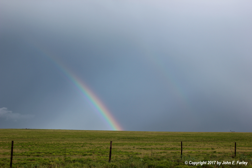
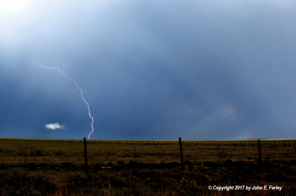
This (above) is one of the ones with both lightning and the rainbow. The rainbow is not bright, but it is definitely visible on the right-hand side of the picture. If I had stopped a little sooner I might have done better, as I saw a bolt of lightning that appeared to go right through the rainbow, just before I stopped and got the first of the pictures above. Eventually as the storm continued southeast, I got an image of a bolt right in front of brightly sunlit rainshafts. Since I had not adjusted my camera settings for the brightening conditions and was using the lightning trigger which requires a relatively long (1/10 second) exposure, the picture was badly overexposed. Couldn't really fix it so it looked natural, but I ended up with this which I think has kind of an artistic, painting-like look to it:
The final picture I got was of the now-shrinking precipitation core around 6:15 p.m.:
About the time this picture was taken, the SVR warning was cancelled, and I knew the chase was pretty much over. Time to head to Raton and find a room before everything filled up.
Chase distance for the day: 480
Total chase trip: 709