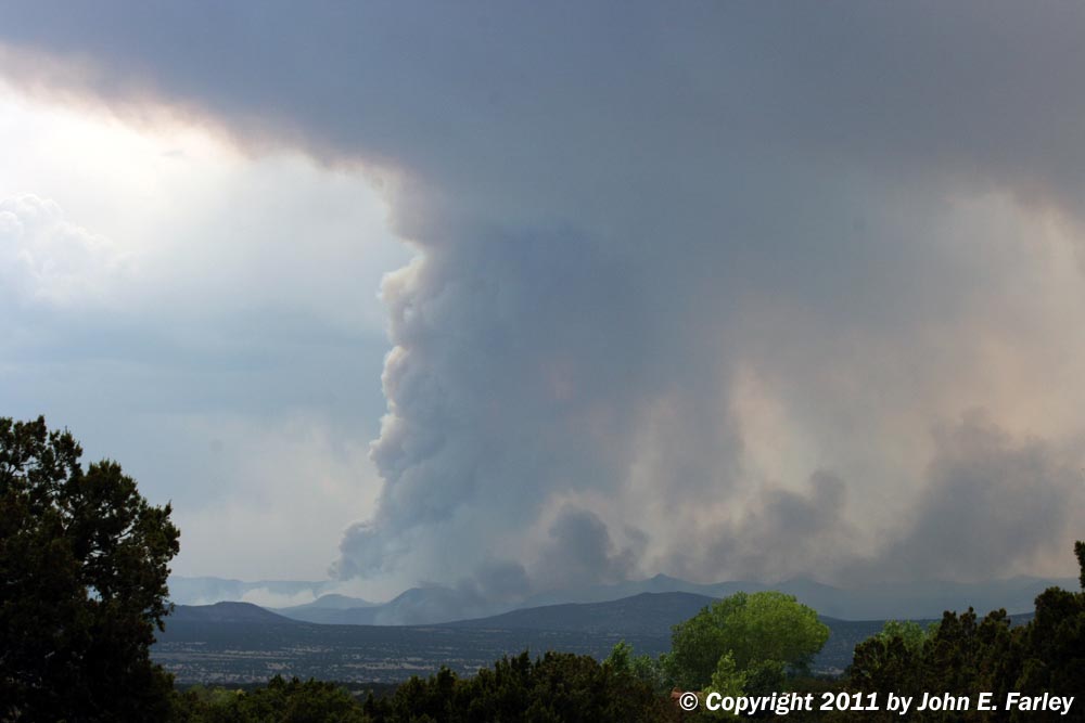
This picture shows how intense the fire was at times. The intense smoke plume was near the southern end of the fire, which as of the morning of 6/29 has grown to a size of nearly 70,000 acres, or about 108 square miles.
This picture shows how intense the fire was at times. The intense smoke plume was near the southern end of the fire, which as of the morning of 6/29 has grown to a size of nearly 70,000 acres, or about 108 square miles.
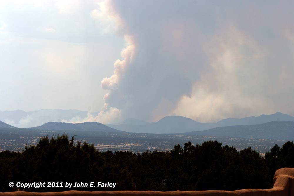
Note the possible smoke funnel forming on the right side of the smoke column.
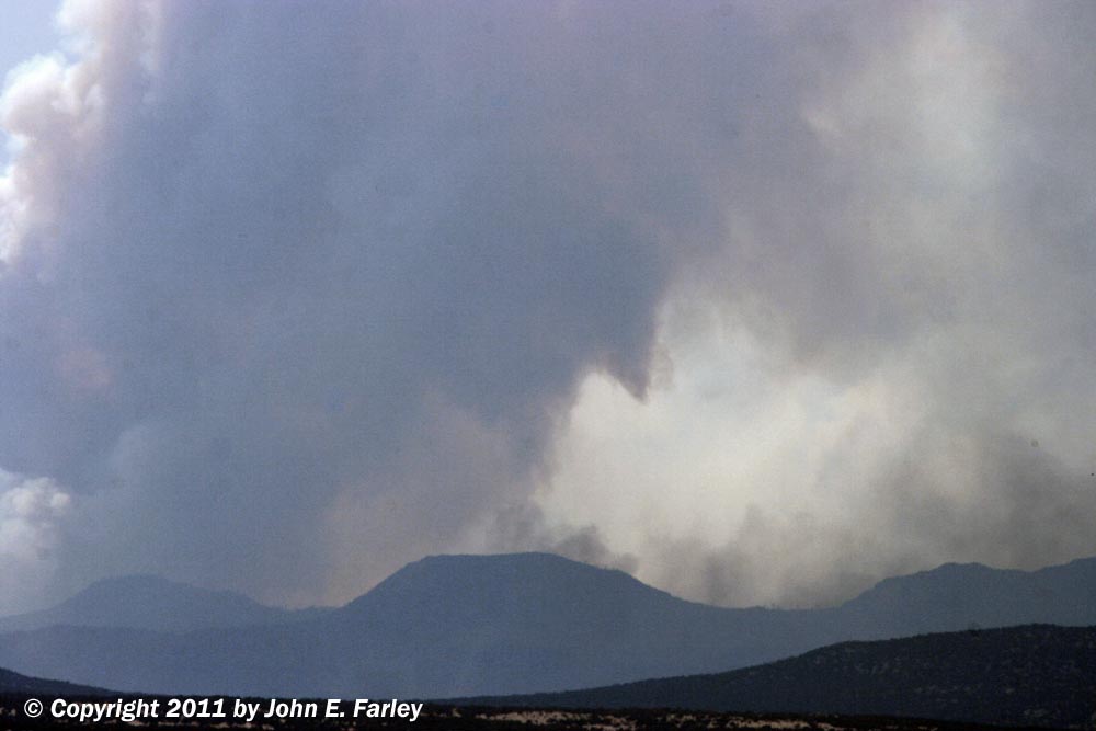
Zoomed picture of the feature that I think was a smoke funnel. From 15-20 miles away, it was hard to be sure, though.
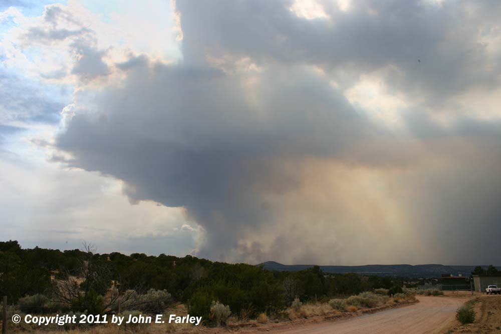
A pyrocumulus cloud (a cloud generated by the updraft created by the fire) formed above the most intense smoke plume, as shown in this picture. The environment was favorable for convection, and (mostly dry, unfortunately) thunderstorms were scattered around the area, but clouds consistently formed over the most intense smoke plume. These clouds were carried southeast, toward Santa Fe, by the mid-level wind, even as the smoke near the ground was blown toward the north (to the right in the picture).
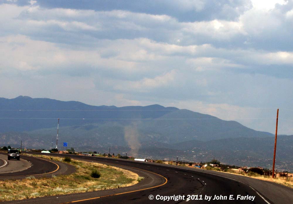
While I was driving between two locations to view the fire, this dust devil spun up a half mile or so from my location.

After dark, I returned to the same area I had been in during the day to get some night-time pictures of the fire.
As of 6/29/11, the fire continues to threaten Los Alamos, the Los Alamos National Laboratory, and the Pajarito Ski Area (my favorite place to ski in NM). The city of Los Alamos has been evacuated and the Lab is closed. The fire crews, including two Type 1 teams that are reserved for the worst fires, are doing a great job of protecting the town, the lab, and the ski area, and no structures in any of these areas have been burned as of now. In the first hours of the fire, before firefighting resources could be marshalled on a large scale, the fire grew explosively, and burned around 30 structures in the Cochiti Mesa area northwest of Cochiti Lake, including a dozen or so homes, mainly vacation homes and cabins.
UPDATE, JULY 1 - As of today, the fire is the largest on record in New Mexico, covering nearly 104,000 acres, or about 162 square miles. Firefighters are starting to gain on the fire due to weaker winds and the northern part of the fire burning into areas that were previously burned, including one large area burned last year. Los Alamos remains evacuated and the National Laboratory remains closed, but both appear to be safe at this time and there has been no damage to either. They remain closed/evacuated indefinitely due to smoke and the risk that the fire situation could change.
An aspect of the fire that has received less attention, however, is damage to the extensive cultural, natural, and recreational resources around Los Alamos. As of this morning, July 1, the following is known, as best as I can determine:
1. About half of the land in Bandolier National Monument has burned. None of the buildings there have been damaged, however, and the newly renovated visitor center is safe. No doubt the fire did reach some of the archeological sites there, but these have endured many fires over the years so many of them may have come through fairly well.
2. At Pajarito Ski Area, some of the wooded areas at the top of the ski area and between the runs burned, and there were also spot fires on some of the ski runs. There are reports that the cable snapped on one of the ski area's five chairlifts, causing the chairs to fall to the ground. The lodge and all of the other buildings at the ski area are safe. Firefighters are continuing burnout operations to protect the ski area.
3. Sizable portions of the Valles Caldera National Preserve have burned, and the currently active northern part of the fire is in or near the Preserve. At this time I believe that most of the fire has been east and northeast of the Valle Grande.
4. The fire has affected portions of the Santa Clara Pueblo, although the fire remains about seven miles from the Pueblo's main village. About 6,000 acres have burned on Pueblo land, including some sacred sites, as well as plants used for medicinal purposes and the Pueblo's watershed area.
5. The fire caused major damage at Dixon's Apple Orchard. Only about 10 percent of the apple trees burned, but nearly all of the buildings were damaged or destroyed, and the orchard will need assistance in order to be able to have a harvest this year.
6. Tent Rocks National Monument has not been directly affected by the fire, but remains closed due to smoke and the risk that the fire could spread into that area.
Most National Forest, BLM, and state recreational areas throughout the mountains of northern New Mexico remain closed, including not just the areas in the immediate fire area, but also others in areas that have not had fires but are at extreme risk of wildfires with any recreational usage of these areas. These closures include the Pecos Canyon, the Sandia Crest Scenic Byway, Hyde State Park and the Santa Fe ski area road above it, and many other areas. However, it is important to note that Albuquerque, Santa Fe, Taos, and other urban areas visited by tourists are safe and open for business. Due to the southerly winds, smoke has been minimal in the Albuquerque and Santa Fe areas, although there has been somewhat more today due a wind shift with the passage of a weak cold front last night. But the wind is already starting to shift back to a southerly direction, and the smoke will again soon blow away from Albuquerque and Santa Fe.
This page last updated July 1, 2011.
Return to 2011 Severe Weather Observation page