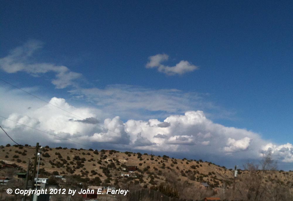
The storm basically came in three waves of convection. The first, during the day on February 2, affected mainly the mountain areas, with valley and desert areas remaining sunny through most of the day. Here is a picture of the convection over the Jemez Mountains, looking northwest from Madrid, NM around 1 p.m.:
Here is how it looked over the Sangre de Cristo Mountains, looking northeast from south of Santa Fe, around 4 p.m.:
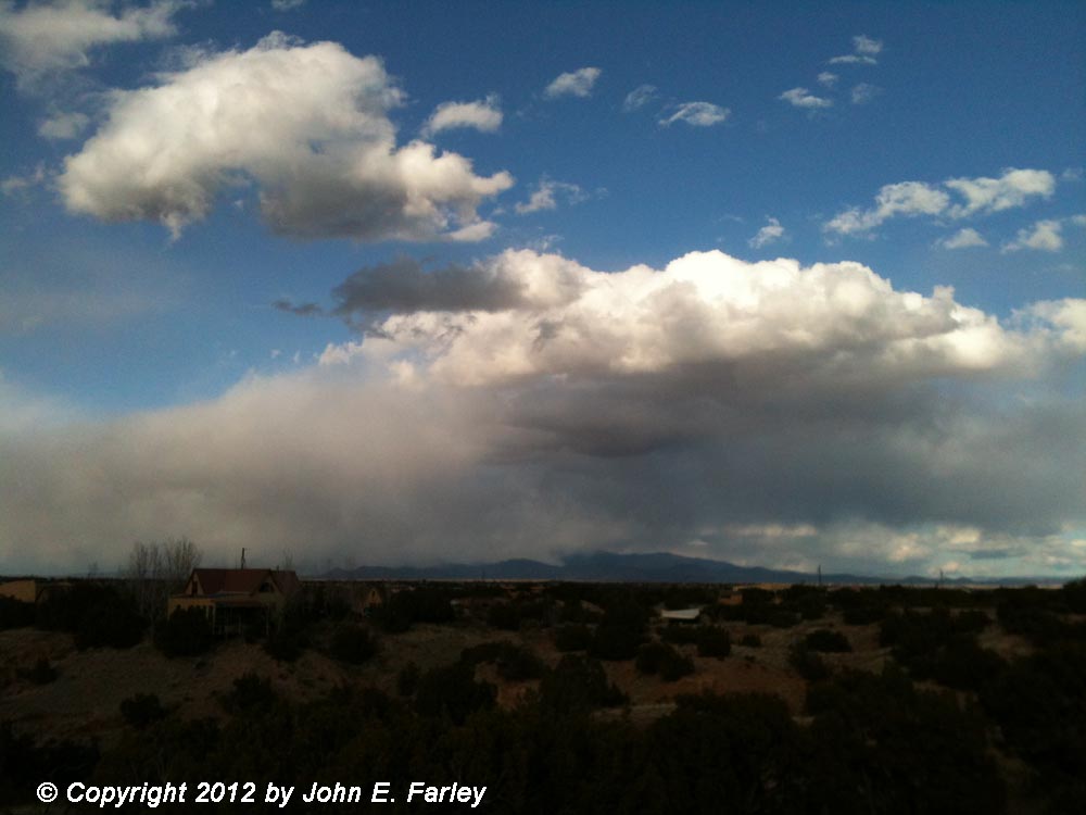
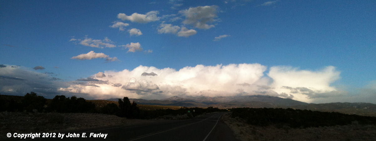
In this picture, note the snow sweeping down a mountainside near the center of the picture. Both of these pictures illustrate the convective nature of the snow, with the first picture quite similar to the appearance of distant thunderstorms in the spring or summer. These pictures, and the ones used to construct the opening panorama, were among the first pictures taken with my new iPhone, which I recently acquired. They are definitely several steps up from what my old cell phone could do. (I did not have a regular camera with me, because I was not mainly out to take pictures; just took these between errands.) In regard to the opening panorama picture - I like this one because it shows how high the cumulonimbus clouds towered over the mountains. This was taken from just north of Santa Fe, looking mainly east toward the Sangre de Cristo Mountains.
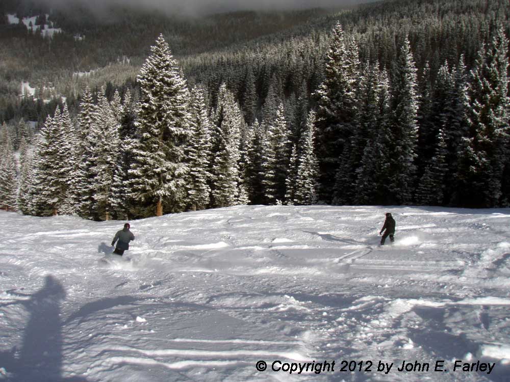
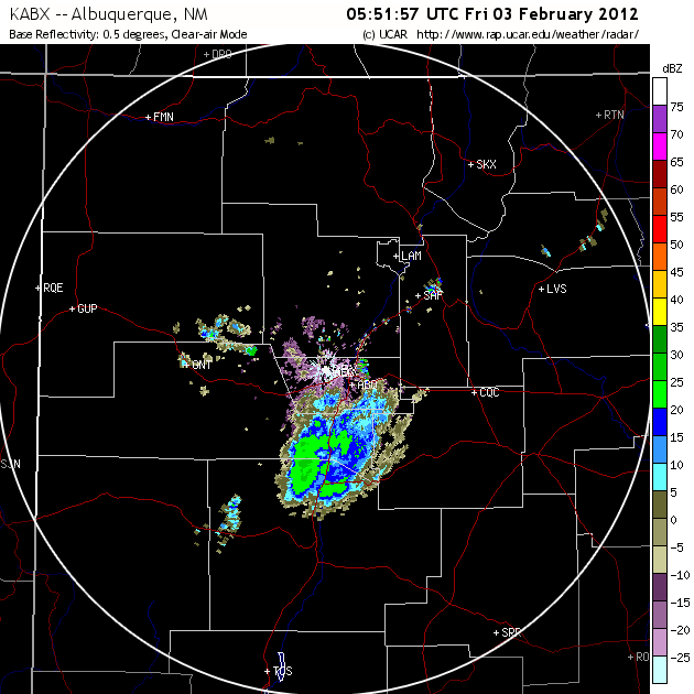
The second wave of snow came during the overnight hours of February 2-3. Around 9 p.m. an area of convection began south of Albuquerque, and expanded rapidly in coverage and intensity over the next few hours. A radar image from 06Z (11 p.m. MST) can be seen here. As this area expanded and moved northeast, it produced precipitation over the valley and high desert areas as well as the mountains. In Albuquerque it was a mix of rain and snow, with accumulating snow only in the higher parts of town near the Sandia Mountains. But in Santa Fe, it was all snow, with about 4 and a half inches of light, powdery snow near downtown and more in the higher parts of town northeast of there. This wave of precipitation also dumped around six inches of light fluffy powder at Ski Santa Fe, offering to skiers and snowboarders a much-desired "champagne powder" day:
As you can see, it was bright and sunny when this picture was taken around mid-morning. But by late morning, the convective towers began to build again, and around noon, the third wave of snow began. This one, like the first one, affected mainly the mountain areas. But it was heavier, and lasted through the afternoon and well into the evening. The first picture below was taken at the top of Ski Santa Fe (12,075 feet above sea level) during a heavy burst of snow; the second picture below was taken from Santa Fe around 2:20 p.m.

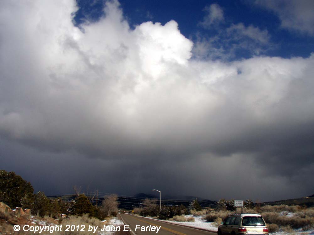
Again, this picture clearly shows the convective nature of this snowstorm. By the time this wave of snow finally moved out sometime in the late night or early morning hours, Ski Santa Fe had received a storm total of 15 inches. However, this third wave of snow produced only light showery snow in Santa Fe, mostly swept down the side of the mountains, and did not add to the storm total in the city proper, except perhaps in locations very close to the mountains.
Return to 2011-12 Winter Weather page