
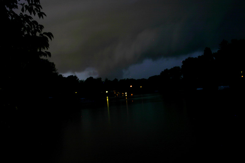
Note the evident striations - I think this was the mesocyclone, or area of rotation in the supercell. This picture was taken looking just a tad west of due north. As the southeastward moving updraft base came closer, I could see that there were also some decent lowered areas under the updraft base:

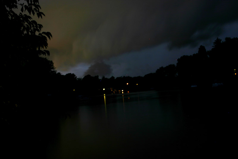
As it got even closer, I saw one that looked pretty interesting at first, but quickly detached from the base:
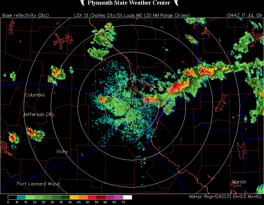
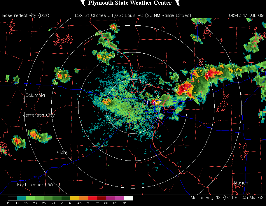
I think these lowered areas were probably associated with the formation of a rear-flank-downdraft (RFD) gust front, as these areas were west of the feature in the first picture above - and this would also be suggested by this radar image which would be from about the time I got the last of the pictures - by then, the mesocyclone would have been about crossing I-55, as indicated by the notch in the radar image very near I-55. And by this time, the storm was beginning to weaken, as all of the first batch of severe reports from the storm and also the heaviest accumulated precipitation on radar were west of I-55.
The storm did, however, re-strengthen later after it moved southeast across Carlyle Lake, attaining 73 dbz on radar with a 3-inch hail marker (though no hail of this size has been confirmed). This was as it moved through the Salem and Iuka area around 10:30 p.m., where the wind damage, tornado, and flooding reports came from. After this, the storm morphed into a larger thunderstorm complex known as a meso-convective system (MCS) and continued across southeast Illinois, southern Indiana, and Kentucky.
A few meteorological comments: This supercell storm occurred in an area that did not even have a slight risk from SPC during the afternoon and evening. In fact, on the evening update of the severe weather outlook (issued half an hour before the severe weather began), the nearest slight risk was well to the southwest in Arkansas. Additionally, the storm developed behind a weak cold front that passed through the area the previous day. However, the development of this storm is a good example of the fact that you cannot simply predict severe weather by looking at these severe weather outlooks or looking at a weather map. What happened was that a weak disturbance developed along a second, stronger cold front that was approaching the area from the northwest, and in response to this, a weak warm front formed extending southeast from the disturbance through the northeast part of the St. Louis metropolitan area and southeastward across Illinois to around where IL, KY, and IN come together. Although the storms in the area in general may have been triggered in part by the approaching cold front, this storm in particular moved toward the east-southeast along the warm front. This provided an additional source of uplift that kept this storm going when the others didn't, and the subtle wind shift line along the warm front provided a very localized environment favorable to storm rotation. The result - a severe and perhaps tornadic supercell in an environment that otherwise was not particularly favorable for severe weather. Now, I would love to say that I figured this out ahead of time, but actually as I said above I was too swamped with other things to even pay much attention to the weather. In this case, the storm - and the favorable environment that produced it - simply came to me. This weather setup is discussed in this mesoscale discussion from SPC - but this was in fact issued after most of the severe weather occurred - so I guess SPC was almost as surprised by this storm as I was, although the did a good job of keeping track of the situation and alerting people to the potential of further severe weather once the situation unfolded.
UPDATE, July 18 - A National Weather Service damage survey in the Iuka area found that the damage caused there was the result of two separate downbursts. The stronger of the two, which passed through the town, downed trees up to 4 feet in diameter and was estimated to have had winds up to 80 mph, with a damage path 3/4 of a mile wide. As I suspected was the case, evidence was also found of hail damage in eastern Marion County. As was the case earlier in Madison County, the hail was nickel to quarter size, but in Marion County there was enough of it to cover the ground and cause significant crop damage. The Public Information Statement with the results of the damage survey can be found here.
Local Storm Reports from the National Weather Service St. Louis office