While the hail was small where I took this video, there was some larger hail in other parts of town. At 11:10 am, .88" hail (nickel sized) was reported in the Agua Fria neighborhood, a few miles WSW of where I took this video.
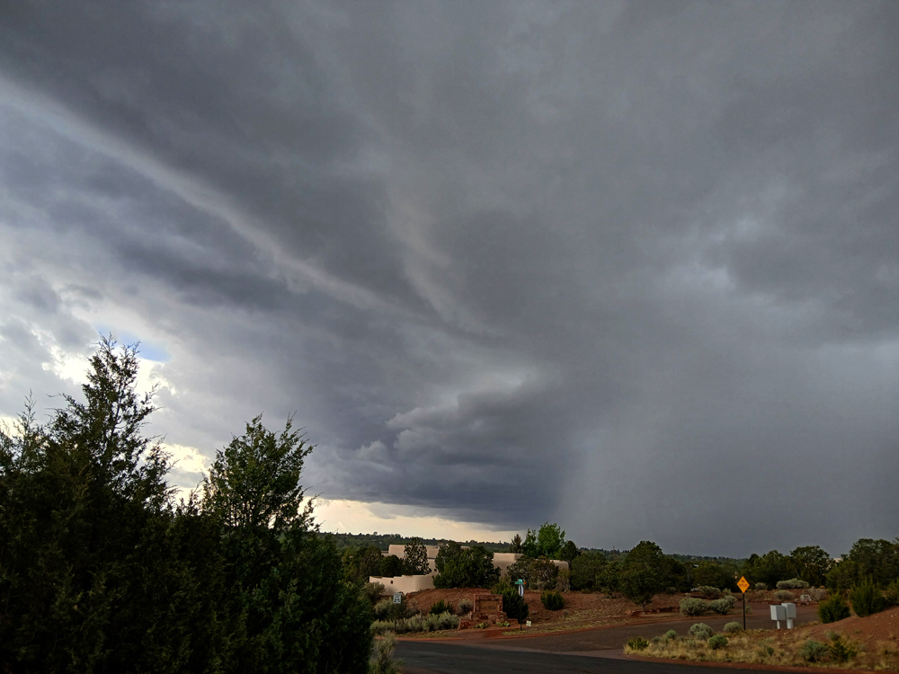
That storm was a harbinger of what was yet to come. By between 3:30 and 3:45 p.m., another storm was moving into the area. This one would prove to be quite a bit more consequential. I could see on radar and visually that as the storm was moving in, it ws rapidly intensifying, and beginning to produce more lightning. I decided to head up to the foothills to find a place with a good view, and then perhaps get up into the mountains ahead of the storm, and maybe get some more thundersnow. Here is a picture taken around 3:50, looking across the city at the storm as it moved in:
The updraft base and the main precipitation core show up nicely in this picture, and note the relatively light volor of the precipitation core, indicating hail and/or winter precipitation. In fact, both were present. Even when I took this picture, well ahead of the storm, a light mix of rain and wet snow had begun to fall. After taking this I headed up to the Ten Thousand Waves spa's parking lot, figuring it would be in the path of the storm and at that higher altitude, thundersnow would be likely. But it turned out that, at least at that point in time, the storm's motion had too much of a northerly component to get there in the short term. In general, I was hoping the storm would move into the mountains where the main P-type would be snow, but on the whole it moved through the foothills just west of the mountains and never really got into the mountains. I moved back a bit to the west, in residential areas in the foothills, to get back fully in the path of the storm. And soon I did. A wintry mix of rain, wet snow, and graupel (snow pellets) fell, with considerable thunder and lightning and some close lightning strikes. At times it was mixed with what seemed to be small hail, although you might argue it was sleet or partially-melted graupel. But there certainly was hail in town and in nearby areas to my west and south, with reports of up to half-inch hail. The latter occurred southeast of town around the time a special weather statement was issued for the area based on radar indication of hail about that size a few miles south of town. Unfortunately, I messed up my video during the heaviest part of the storm, but still was able to capture the general idea of what was going on, as can be seen in this video:
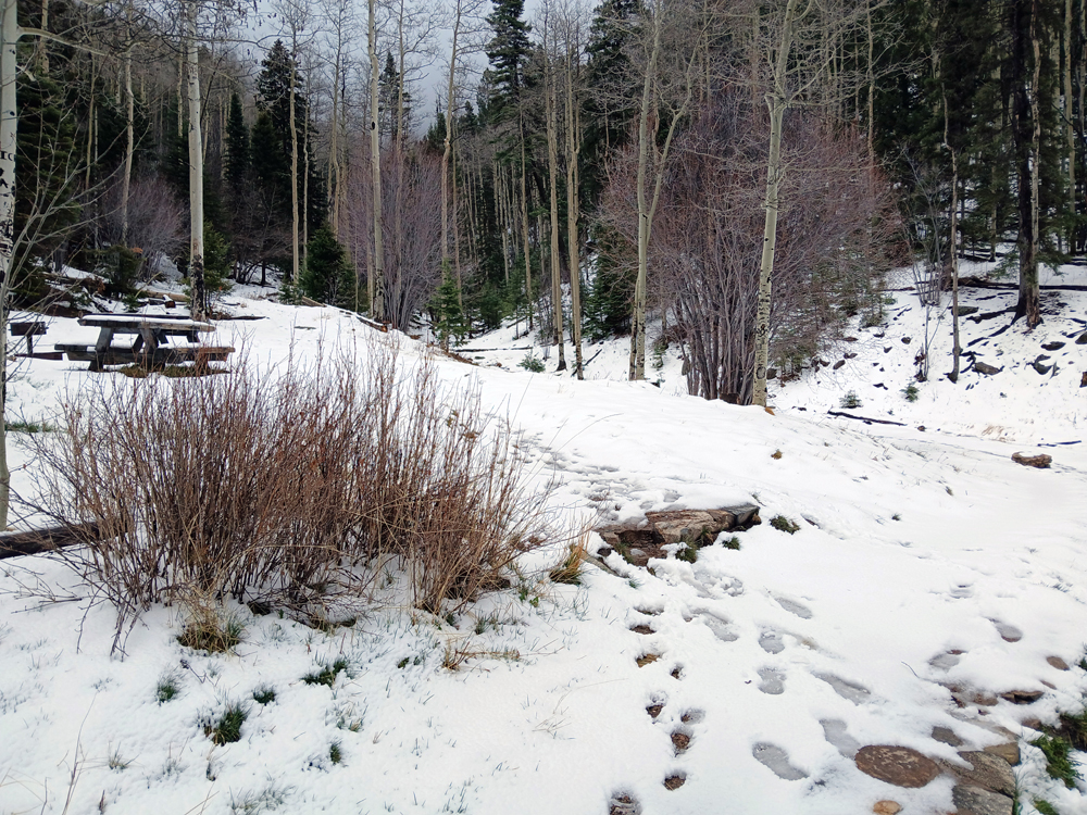
The storms kept backbuilding, with new cells going up on the southern edge of the storm. It was largely a training pattern (storms moving repeatedly over the same areas, like cars on a train), resulting in heavy precipitation, repeated bouts of wintry mixed precipitation and hail, and an extended period of frequent CG lightning in and near the city. I thought the backbuilding was bringing the tail-end storms just enough eastward that I might be able to still catch some thundersnow, so I headed up into the mountains again. The heavy weather did make it as far up as Ten Thousand Waves and a couple miles beyond, but not yet up into the high mountains with this cluster of storms. I went up as far as the Big Tesuque campground, elevation 9,675 feet, but got neither snow nor thunder, as the storm stayed to my west and weakened as it moved north away from the city. But I did get a picture of the snow accumulation there from the previous night's storms:
It became increasing clear that the storms were not going to reach that location any time soon, and it was getting toward dinner, so I decided to call it a chase and head back down into Santa Fe. Well below the state park and a couple miles before getting back to Ten Thousand Waves, I entered the main path the storm (which was now well to the north) had taken. It had laid down a heavy accumulation of hail, graupel, and snow, and the road was covered with slush and slippery. In placess, there was a half inch of accumulation of this mixed frozen precipitation on the ground, and this continued for five miles or so, extending past the area where I had gotten the video above. So if I had stayed there, it certainly would have gotten more intense. There was still some accumulated snow and graupel in town, and what I found on the ground when I got back was similar to the mix of hail, snow, and graupel that accumulated in the storm I had videoed and photographed the night before, basically hailstones sitting in a slushy accumulation of snow and graupel. More importantly, though, when I came to the stop light at the corner of Bishop's Lodge Road and Paseo de Peralta, it was not working. This suggested the power might be out, and when I got back it was. Likely the result of a lightning strike, power was out in much of the northern part of Santa Fe and extending north to Teseque Village and the Teseque Pueblo. Around 8,000 customers out in all. The power went out at 4:33 p.m., at the height of the storm, and stayed out until 10 p.m. Then it briefly came on but went back out within a few minutes, finally coming back for good around 10:50 p.m. So it was out for more than 6 hours overall. We went out to dinner in a part of town that still had power, since we had no power, and as we were eating dinner another strong storm formed and impacted roughly the western half of Santa Fe, again dropping more hail and probably some more wintery mixed precipitation. There were a couple reports of half-inch hail in the western part of the city between 7:15 and 7:30. Later in the evening, this final group of storms spread out into a wider area of steady precipitation, with occasional lightning and rumbles of thunder into the late evening. This broad bnnd encompassed both the city and the mountains, and produced steady accumulating snow through much of the night in the mountains. In town, the precipitation started as rain but gradually mixed over to snow, although it did not accumulate in town. And the next morning, there was more rain and snow in town and steady accumulating snow in the mountains. By 9:25 a.m., snow had accumulated to 14 inches at a snowtel near Ski Santa Fe, and more snow fell through much of the day. Snow is not unusual in the mountains of northern New Mexico in May, but that much is. And farther north in the mountains near Taos, accumulations reached 20-24 inches. There was even a report the morning of May 7 of a storm total of 34 inches of wet snow in Upper Luna Canyon in Mora County.
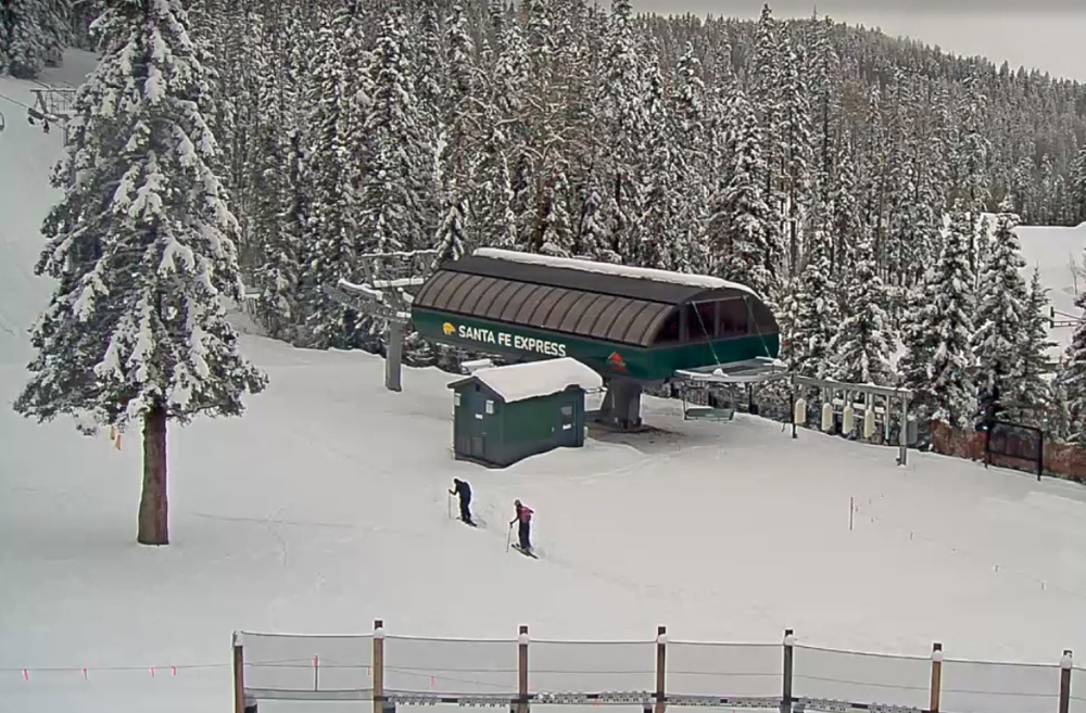
Around 5 p.m. on May 6, I took a look at the Ski Santa Fe webcam to see the snow accumulation. There was a lot, and lo and behold I managed to catch two skiers starting up to "earn their turns" - hiking up to ski the fresh snow, the only way to do it since the lifts had by now been closed for a month. Here is a grab from the webcam:
As well as the copious accumulation of snow in the mountains, precipitation totals down lower over the 3 days were impressive, too. In the immediate Santa Fe area, 3-day precipitation totals averaged a bit over 3 inches (rain plus melted frozen precipitation) as of early morning on May 6, with a couple spots close to 4 inches. The average 3-day rainfall was about three times what is typical for the entire month of May, so this was a pretty exceptional event! And some parts of the Santa Fe area got another half inch or so of rain by the morning of May 7. Nearly all of New Mexico was in some level of drought at the time of this storm system, and near Santa Fe, it was extreme drought. This one storm system won't totally break the drought, but it has put some dent in it, at least
Return to 2024-25 Winter Weather Observation Page
Return to 2025 Severe Weather Observation Page