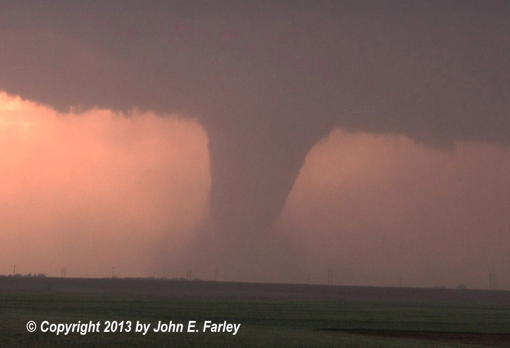
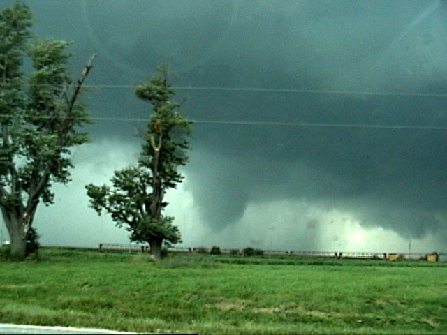
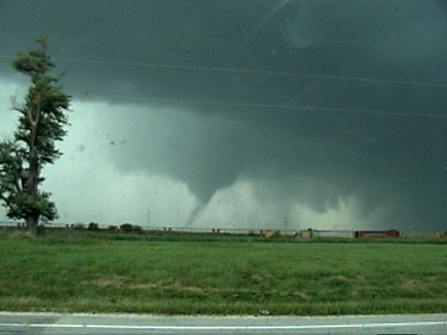
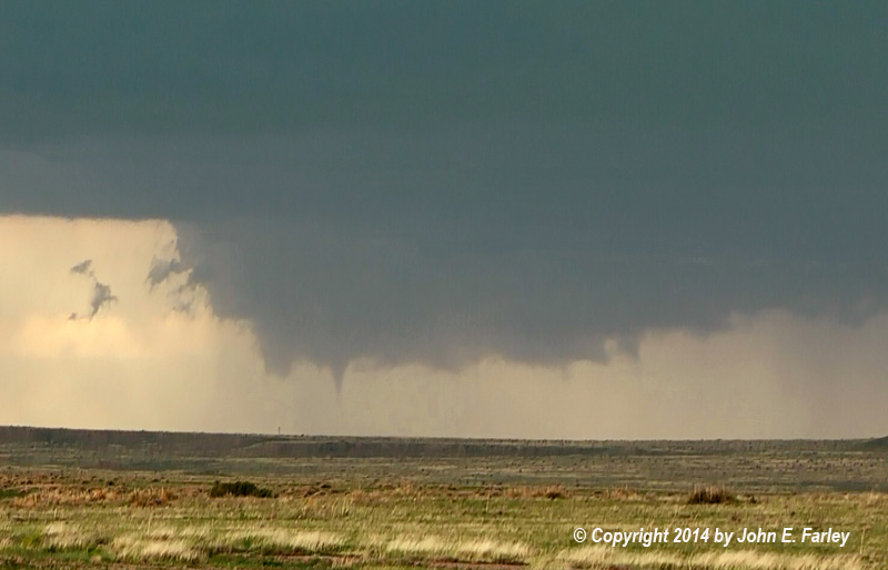
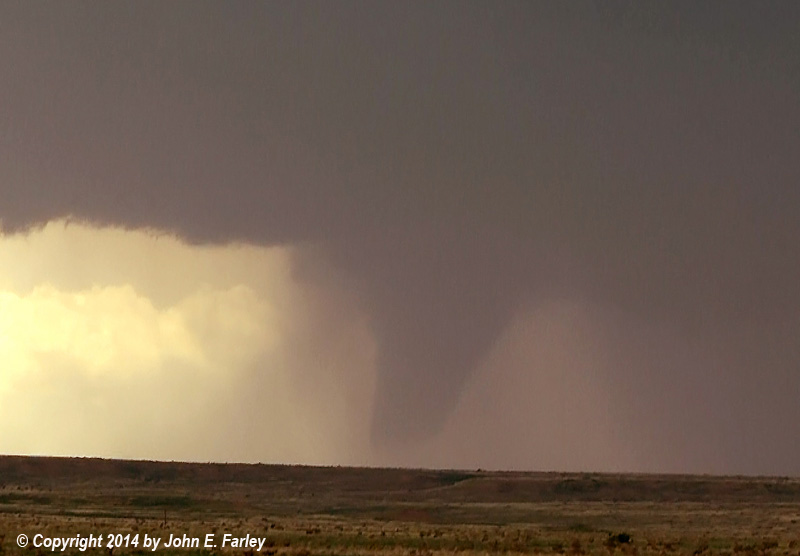
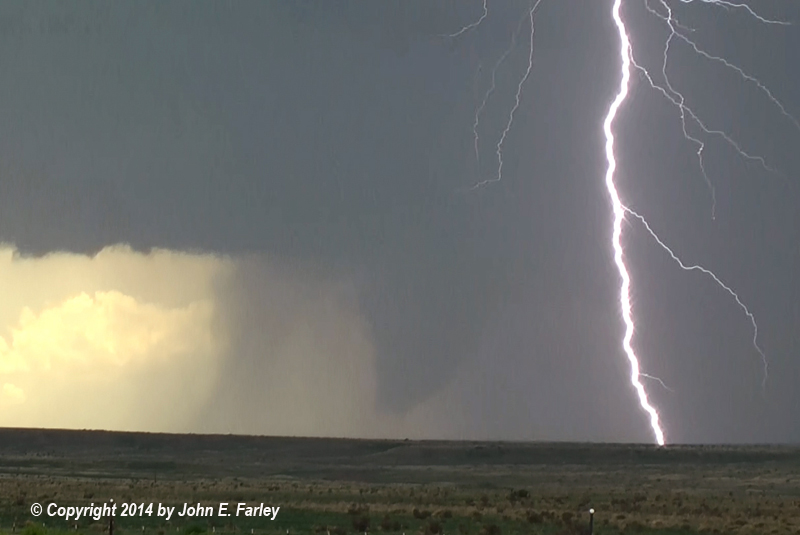
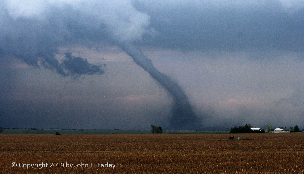
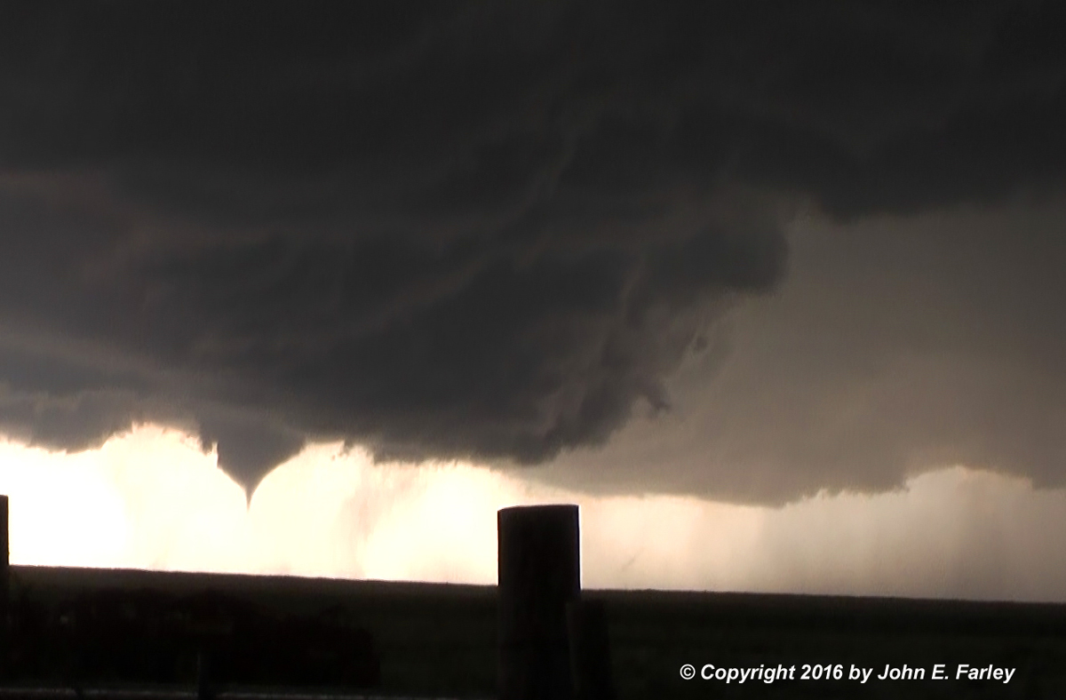
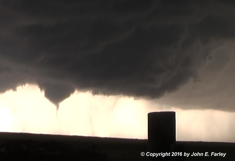
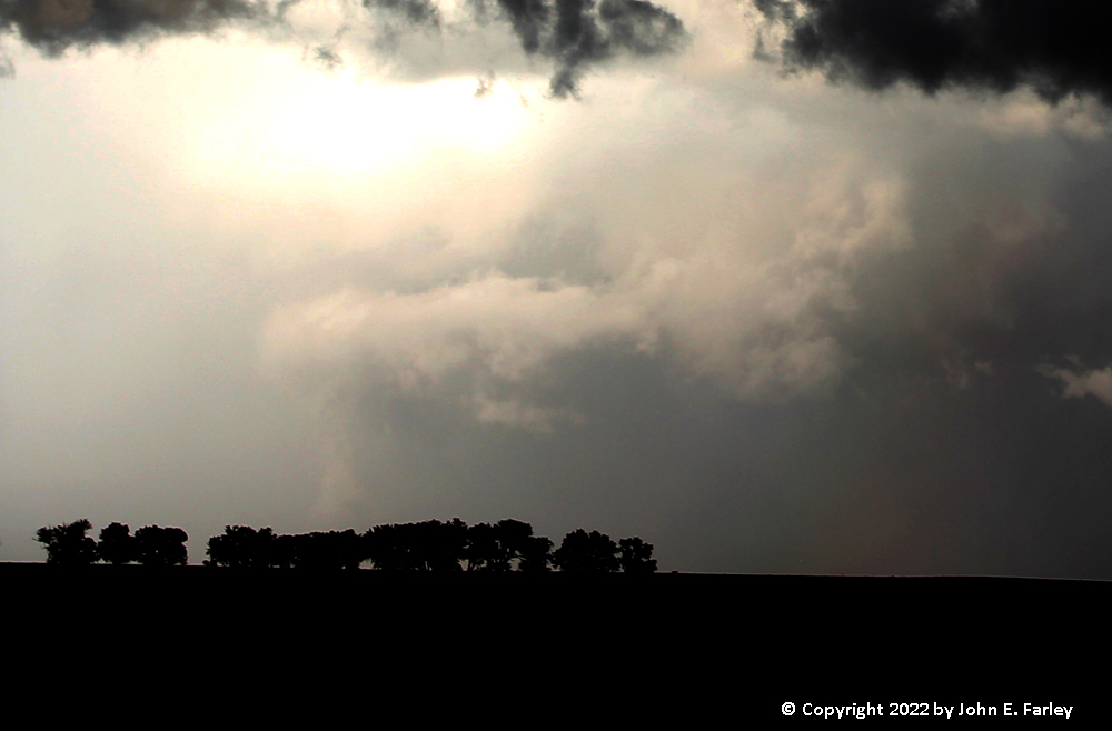
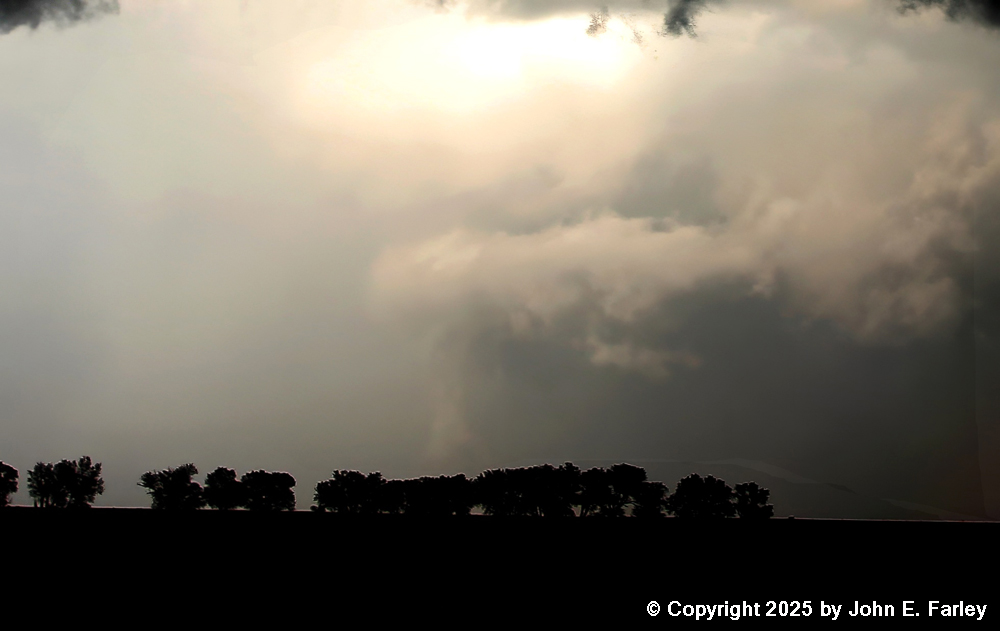
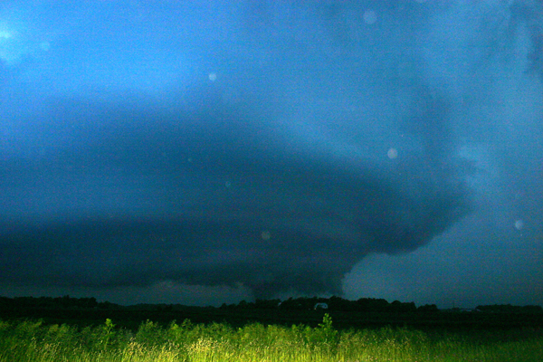
I watched this spectacular EF-4 tornado through its entire lifecycle of about a half hour. Winds in this tornado were measured at 165-185 by the Doppler on Wheels, and the tornado was 5/8 of a mile wide. You can see video of this tornado here.
Tornado 1 - 12-mile path, up to 300 yards wide, Rated EF-3:

Video of this tornado can be seen here
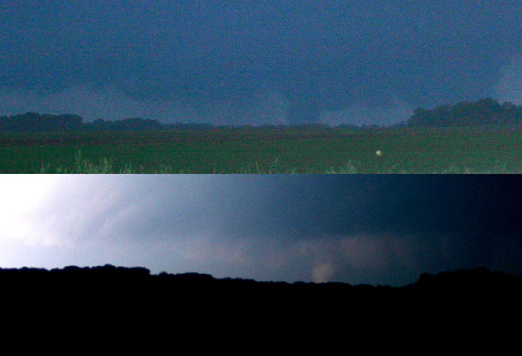
. Tornado 4 - 17.4 mile path, one mile wide, Rated EF-2:


Video of this tornado can be seen here
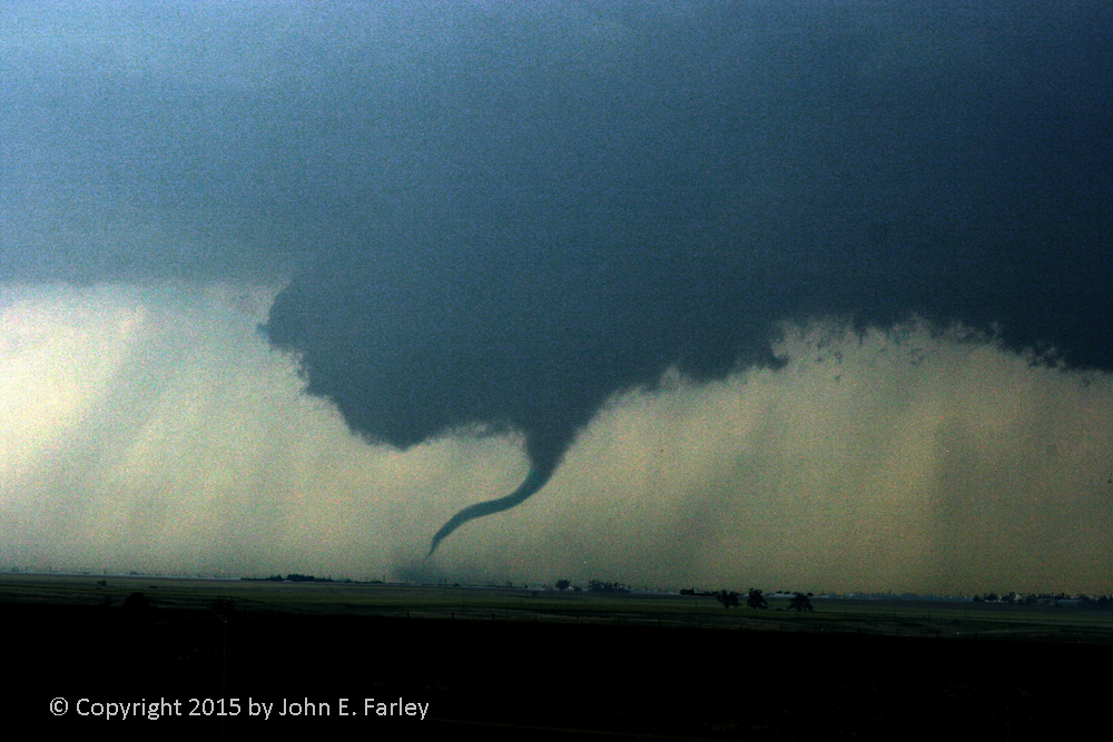
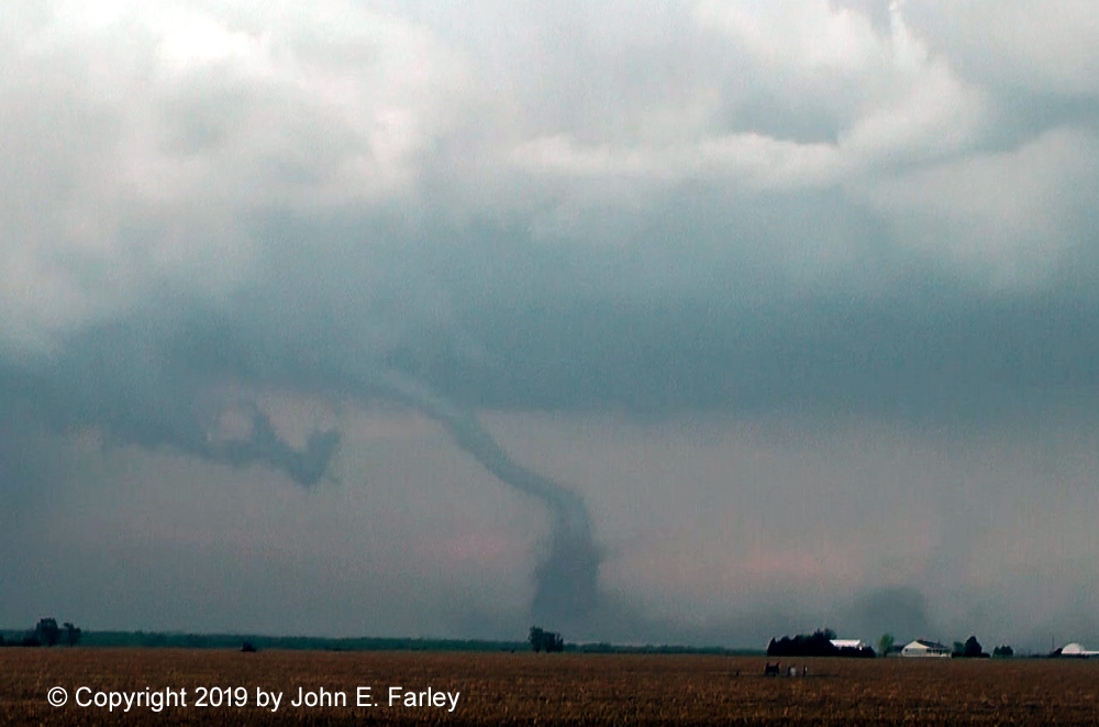
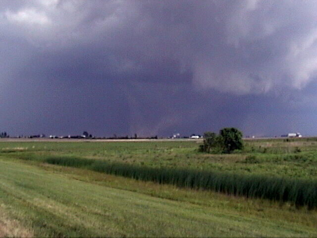
. Tornado 5 - 10.2 mile path, up to 100 yards wide, Rated EF-3:
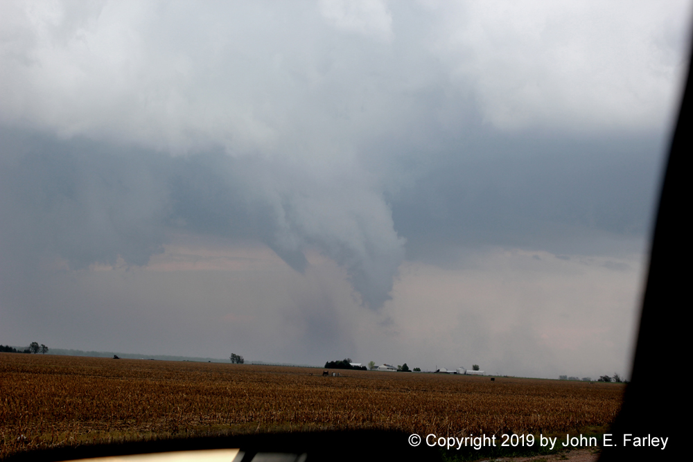
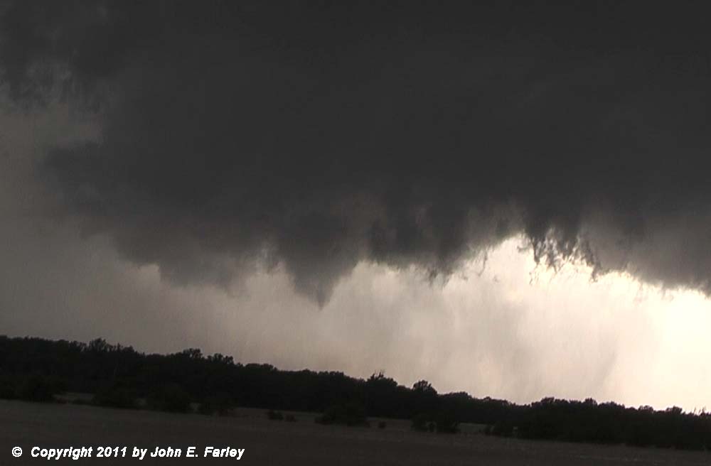
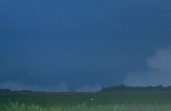
In this picture, the roping-out Tornado 4 is at the left and the new Tornado 5 is at the right.


Video of this tornado can be seen here

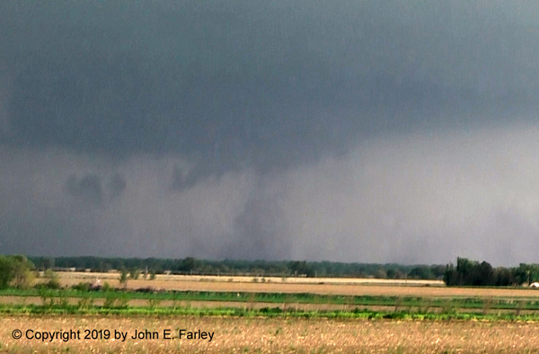
I watched this tornado from just north of Roodhouse, IL, beginning around 2:15 p.m., looking to the west-northwest. This tornado continued to the northeast, causing significant damage in Manchester, IL. You can see video of the tornado here.
The first of these three tornadoes was on the ground for about 35 minutes and was rated high-end EF-1. I was over 40 miles away when I saw it, and gradually worked my way toward it. In the last picture, it is roping out and a new meso is forming to the left. This new meso would produce the second and third tornadoes. The second one was brief, lasting only a minute or so, but about five minutes after that, the third tornado, also rated high-end EF-1, formed and was on the ground for about 14 minutes. I was within 20 miles or so of this tornado.

This tornado had a track 2.3 miles long and .4 mile wide at its widest point. It destroyed or severely damaged several ranch buildings and blew down dozens, perhaps hundreds, of trees. Rated high-end EF-1, it was only the second tornado on record ever in Rio Arriba County, NM. It was my first New Mexico tornado, my first tornado above 7,000 feet above sea level, and my first tornado west of the Continental Divide (by a couple miles.) Video of the tornado can be seen here.


Tornado 2 - EF-2 tornado near McCook:
Tornado 3 - distant tornado near Cozad:
These were my first-ever Nebraska tornadoes.
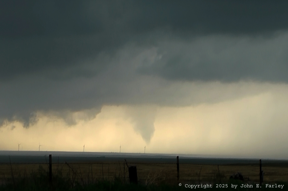
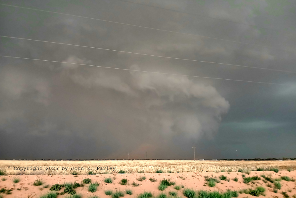
 June 5, 2025 Tornadofest - Portales, NM to Lubbock, TX
I see one tornado with a supoercell near Rogers, NM, southeast of Portales, then at least five more on another supercell that formed to the south of the one where I saw the first tornado, near Lingo, NM, and tracked southeast through Lubbock, TX.
Tornado 1 - Unrated, but confirmed by an NWS employee, in open country near Rogers, NM southeast of Portales
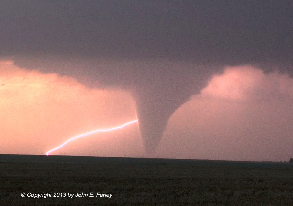
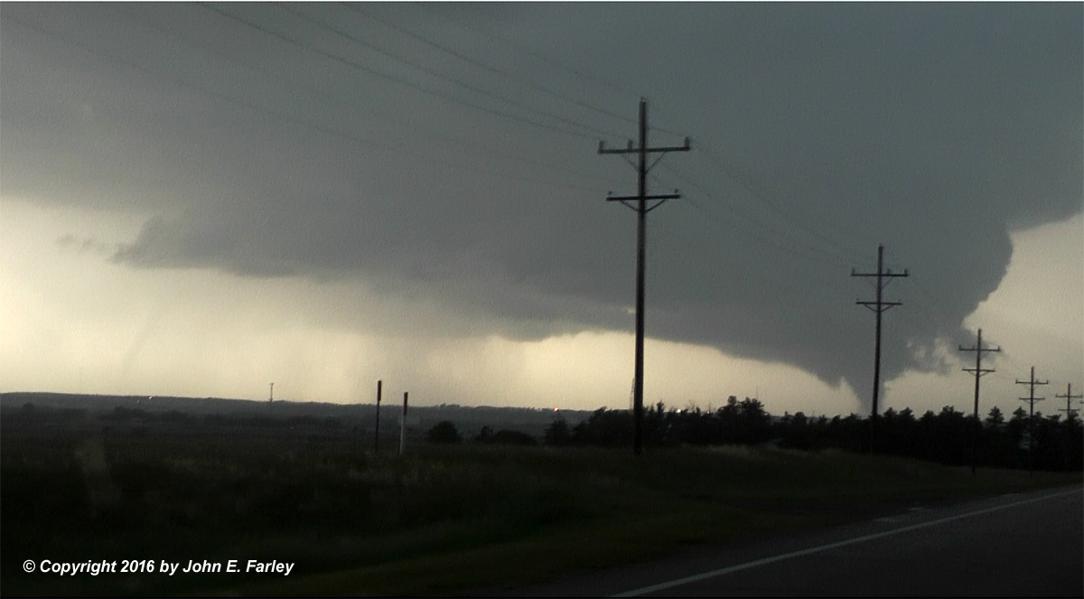
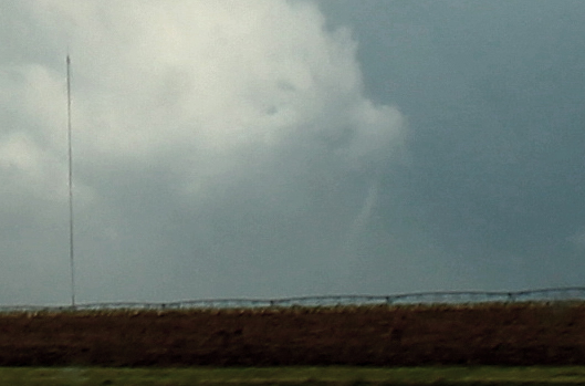
Tornado2 - EF-2, north of Levelland, TX, More than a mile wide with path length of more than 9 miles. Peak estimated wind was 125 mph
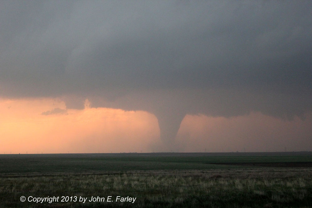
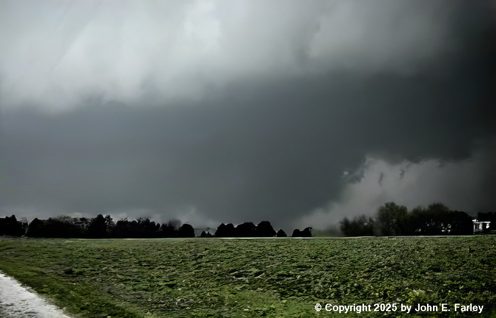
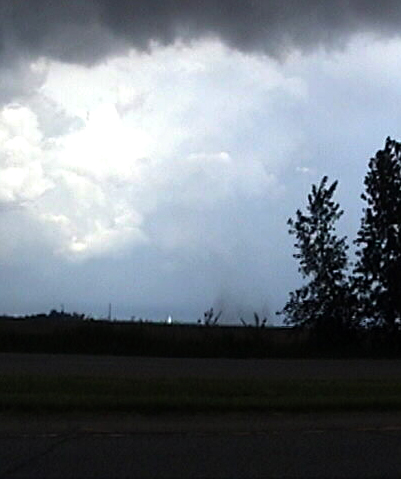
Tornado 3 - Northeast of Smyer, TX and northwest of Reece Center, TX This tornado was rated EF-1 with peak wind estimated at 110 mph. Path length was 3.72 miles and with was about a half mile. It is possible that there is more than one tornado in this picture.
Tornadoes 4 and 5 - An EF-2 tornado just northwest of Reese Center, TX and a satellite tornado to its east (right of it in the pictures). The EF-2 tornado was more than a half mile wide with a path length of about 3 1/3 miles, with peak estimated wind of 130 mph.
Tornado 6 - The final tornado in this sequence, over Reese Center, TX. Rated EF-1, just under a half mile wide, with a 2.65-mile path length.
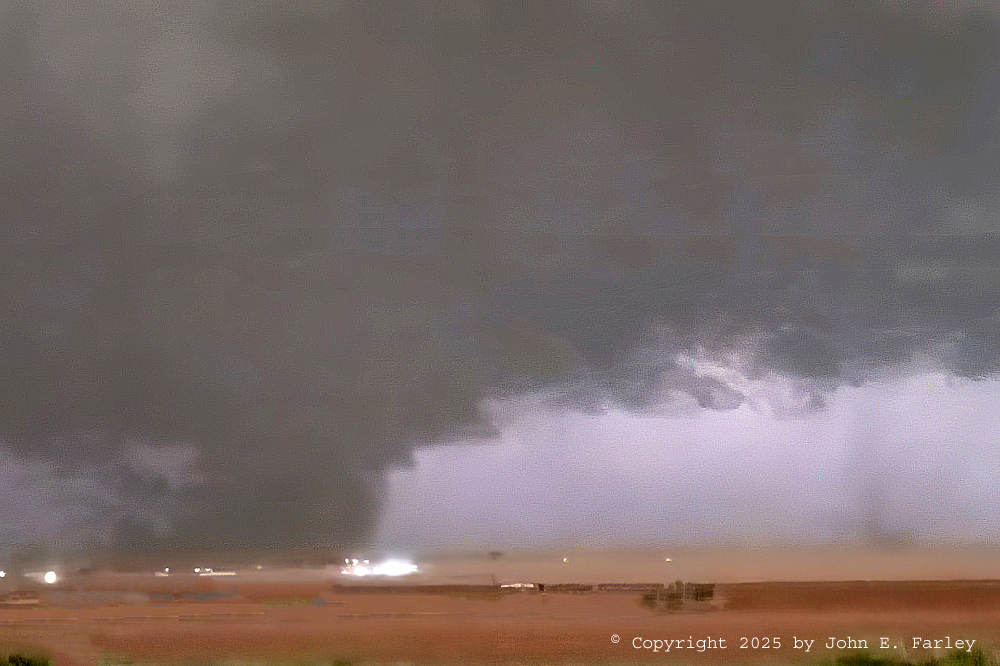
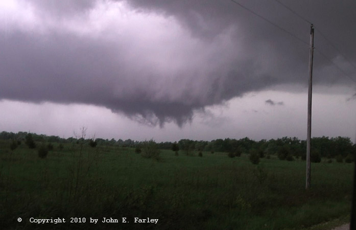
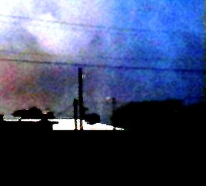
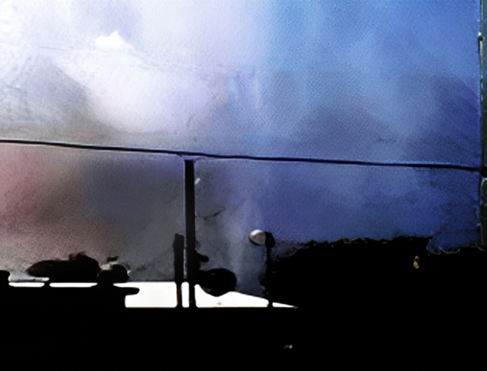
This was the second of two short-lived tornadoes that occurred near Hawk Point, MO around 7:30 p.m. You can see video of this tornado here.
About 20 minutes before the Hawk Point tornado, the same storm produced a brief multiple-vortex tornado about midway between Warrenton and Truxton, MO. I was not sure at the time whether this was a tornado or just funnel clouds, but when Storm Data came out, the National Weather Service confirmed that it was a tornado. You can see video of this tornado here
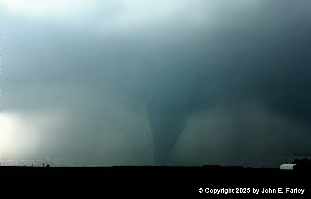
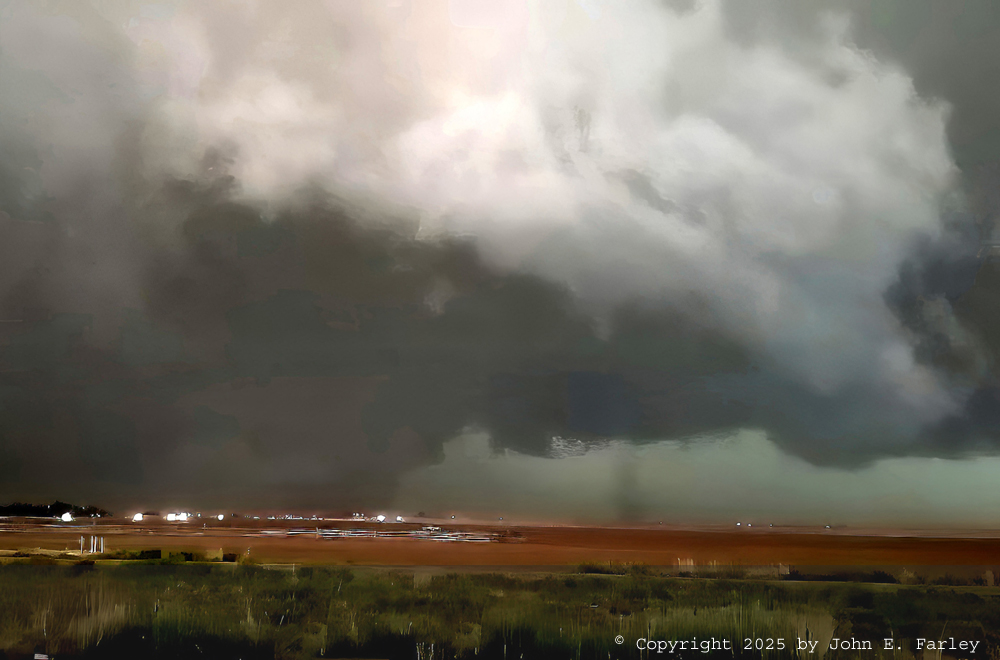
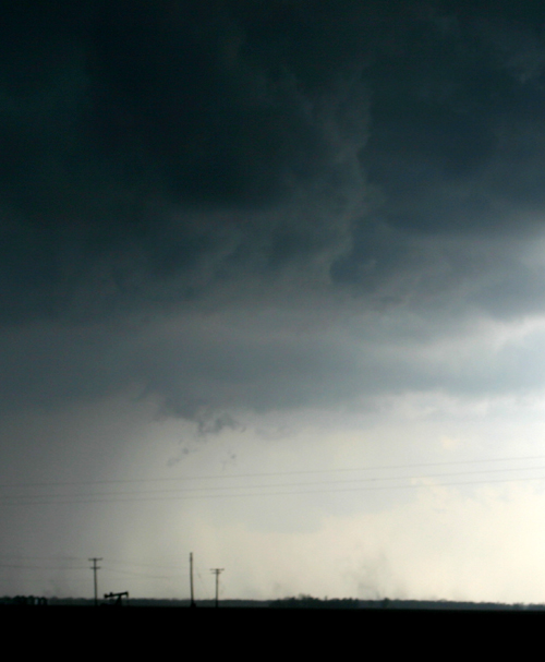
Here, with the benefit of improved photo editing capabilities, is a slightly better and less noisy picture of this tormadn:
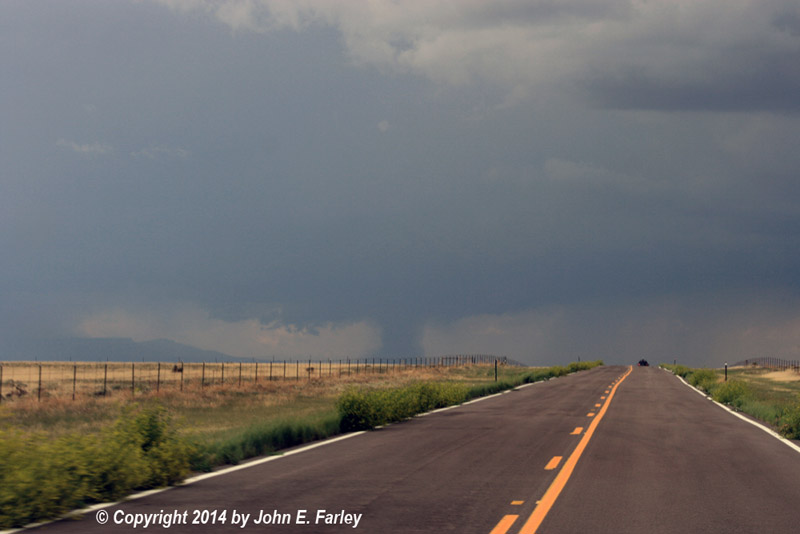
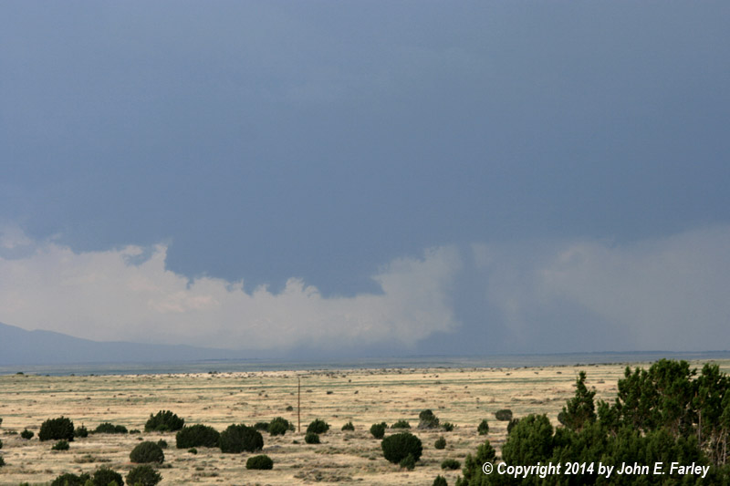
This sunlit but very rain-wrapped tornado formed under the second of two supercells that moved through the Arlington, CO area, and just northeast of La Junta. The tornado was nearly stationary but only lasted a few minutes, remaining in open country south of Arlington.
This nicely backlit tornado began with condensation rising from the ground to meet the funnel above, became a nice elephant trunk, and then a series of funnels with dust swirls underneath. It was on the ground intermittently for 3 minutes or so and stayed in open country. Video available here.
This tornado took the form of a nub funnel with a dust swirl, which for a time was quite intense, underneath the funnel. The dust swirl does not show up well in this picture, but I actually saw it before I saw the funnel above it. The tornado lasted about two minutes. Video available here.
This tornado began as a stout stovepipe and evolved into a multiple vortex structure. It was on the ground for 20 minutes, as it moved slowly, about 20-25 mph, toward the east-northeast. It mostly stayed in open or wooded country, blowing down a lot of trees but causing very little structural damage as it missed most of the farm buildings in the area. The middle picture above contrasts the tornado as it appeared early in its life to how it appeared when a bright flash of lightning briefly front-lit it.
This tornado, somewhat rain-wrapped from some viewpoints, caused damage to farm buildings just west of Larned, but fortunately lifted before reaching the town.
This rather large but weak tornado touched down a little west of Red Bud (video capture). The storm also produced golfball sized hail.
I wasn't sure this was a tornado at first, but other chasers and spotters who were closer confirmed that it was. (The pictures above are video captures.) You can see a truncated lowering above the dust swirl. Later the same day, I saw a much stronger (EF2) and more long-lasting tornado from another storm near Effingham, but was unable to photograph it as the tornado dropped while I was driving through town.
This rather poor video capture was the only picture I got of this tornado near Cordell, OK. The tornado dropped just as I was driving through the town. Do you see a pattern here? The good news is that with better photo-editing capacity now than 2 decades ago, I was able to bring this picture to something much closer to what I saw, albeit briefly:
This picture was taken during the early stages of a F1 tornado that destroyed a bowling alley and damaged several houses and a church in Evansville, IL two days before Christmas. It was my first tornado observed while storm chasing. In one location, the tornado downed several large trees while leaving Christmas decorations on a nearby fence untouched. The tornado occurred with an HP supercell embedded in a squall line.
This brief and weak tornado crossed U.S. 65 just south of Carrolton, MO (video capture). It only lasted for a minute or so. A tornado warning had been issued a few minutes earlier based on radar indication of rotation in this area.
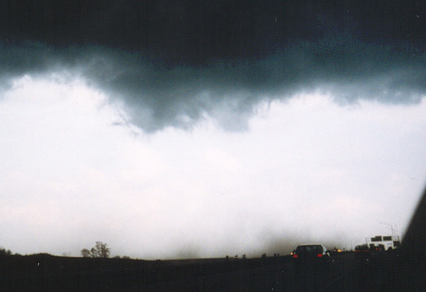
Like the one above near Lincoln, this tornado just southeast of the "Big I" freeway interchange on the southeast side of the Quad Cities had no condensation funnel. But the clouds were rotating strongly above the dust swirl (you can see this by looking at the relative positions of the lowered clouds in the front and back above the dust swirl), so what was going on at ground level was clearly tied to rotation in the clouds above. This seems to have formed as the leading edge of a bow echo interacted with an outflow boundary from another storm to its northeast.
This page last updated August 4, 2025. Seven of the pictures have been updated with better photo-editing apps to look better and more what the tornadoes looked like when I saw them. Photography in the low light of a storm can be tricky, but that is easier to fix in 2025 than it was ten, twenty, or thirty years ago when some of the pictures were taken. Also, pictures were added from the June 5, 2025 tornadofest from Portales, NM to Lubbock, TX
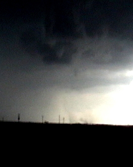
April 23, 2010, near Hawk Point, MO

April 23, 2010, between Warrenton and Truxton, MO
t
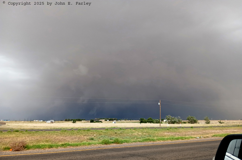
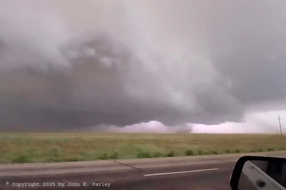
 May 26, 2021 Tornado north of Gruver, Texas
May 16, 2016 SW of Texline, TX
This tornado was rated EF-1 by the National Weather Service in Amarillo, TX.
June 7, 2022, Northeast of La Junta, CO
May 25, 2011, near Greasy Corner, AR


May 25, 2011, southeast of Augusta, AR

June 4, 2008, near Danvers, IL
May 22, 2016, near Howardwick, TX
This is the ropeout of this tornado, which lasted about 10 minutes and was rated EF-1. A poor road decision cost me the chance for a better and longer view of this tornado.
May 11, 2014, near Larned, KS

April 15, 1998, near Red Bud, IL
April 16, 2006, near Assumption, IL
May 5, 2001, near Cordell, OK
December 23, 1996, near Evansville, IL
June 7, 2007, near Carrolton, MO

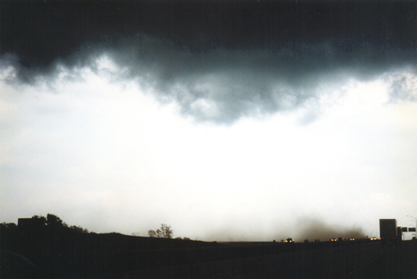
May 28, 2003, near Lincoln, IL
This storm produced tornadoes, gustnadoes, and some vortices that may have fallen somewhere in between. I thought this may have been a gustnado at first, but the facts that 1) it persisted for at least 7 minutes and maybe more like 10 (the two video captures above are about 3-4 minutes apart), and 2) there did appear to be some rotation in the clouds above it led me to classify it as a weak tornadic circulation instead.July 27, 1997, southeast side of Quad Cities area, IL