

This phenomenon occurrs when a combination of freezing fog and snow accumulate on trees, often when low cloud bases result in fog in the mountains before and during snowstorms. In this particular storm, 19 inches fell over a 3-day period, then the storm suddenly ended and the sky cleared.


 Major Ice Storm in Central and Southwest Missouri, January, 2007


Similarly to the "snow ghosts" above (and in the same storm), this rime was the result of freezing fog. But when snowfall is light or does not accompany the freezing fog, you just get the rime, which is a delicate ice or frost that forms when the water droplets in fog freeze onto objects such as trees.


This storm produced 3-4 inches of snow and graupel (snow pellets) in about 3 hours, accompanied by occasional thunder. Note the shelf-cloud feature on the leading edge, similar to summer thunderstorms.


A line of thundersnow storms on the east slope of the Sangre de Cristo mountains. The first picture shows the storm as I approached it from the west. The second shows a bolt of lightning near San Jose as light graupel (snow pellets) and ordinary snow fell. The temperature was around 35 degrees. The third picture shows accumulated snow and graupel along I-25 as I returned to Santa Fe. When I drove through the storm earlier it had quickly accumulated to about an inch on the highway, causing a considerable slowdown in the traffic.
Winter convection, Ski Santa Fe, NM, March 22, 2019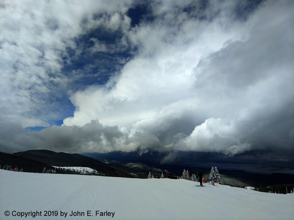
A strong squall approaches the ski area. As it passed over, it produced a heavy burst of graupel (snow pellets), with parts of the ski area getting an inch in 20 minutes. Some of the pellets were 1/3" in diameter.
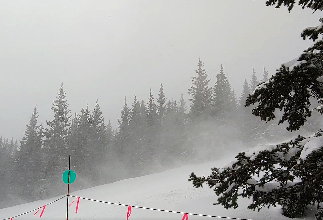
This wind-driven snow squall, which arrived a couple hours later, was accompanied by several runbles of thunder. The same storm produced hail in a number of locations, with 1-inch hail falling near Glorieta (to the southeast of the ski area) at the same time that thundersnow was ocurring at Ski Santa Fe.

Scenes like this played out all over the St. Louis area, as this storm produced 14-22 inches of snow across the area. About 16 inches fell in the Edwardsville area, where this picture was taken. The first several hours of the snowstorm were accompanied by intense thunder and lightning, with snow accumulating at rates of up to 3 inches per hour. Yes, those are cars under there.


As can be seen in these pictures, the cumulonimbus clouds that produce winter snow showers often look a lot like the ones that produce summer thunderstorms. Sometimes, as in the first picture above, there are even mammatus on the underside of the anvil. These snow showers occurred in the early stages of the storm that eventually resulted in the snow ghosts at the top of the page.


Another big snowstorm in the New Mexico mountains.
This page last updated August 12, 2019
Return to Stormy Skies Galleries main page