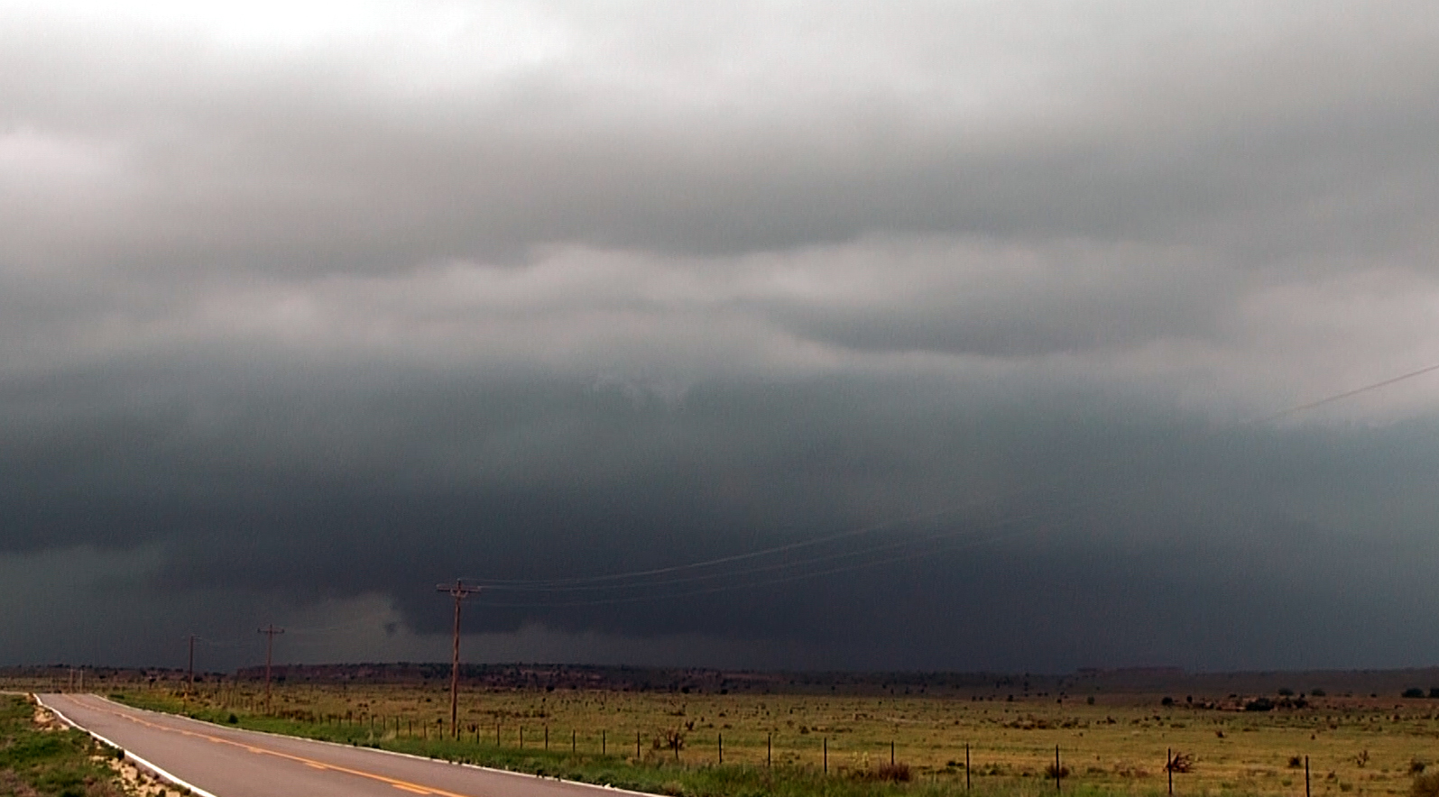
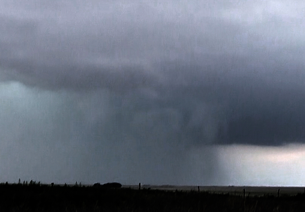
I headed north through Amarillo and continued north past there, figuring that I would need to make some kind of decision on narrowing my target area somewhere around Dumas. Several runs of the HRRR had shown a lone supercell developing in southeast Colorado and tracking southeast into the Panhandles, and that turned out to be spot on. In Dumas I decided to go NW to Dalhart, at which point I could decide to continue north or go northwest. By the time I got there, the predicted supercell had formed, so I decided to proceed northwest on US 87 to Boise City where I could continue north toward Campo, CO or work my way NW toward the NW corner of the OK Panhandle, depending on storm movement. At 3:52 p.m., a TOR warning was issued for a storm in CO north of about where NM, CO, and the OK Panhandle come together. The storm was reported as moving east at 40, but in reality the movement was slower than that. At 4:29 p.m., a SVR warning was issued for the storm now near Kim, CO, valid until 5 p.m. At 4:44 p.m., a SVR warning was reissued for the storm, now 8 miles west of Campo, CO, effective until 5:15. Although movement was reported initially in these warnings as southeast, the storm became pretty much stationary for quite a while and may have even backtracked a bit to the west. By the time I reached Boise City, the storm was on the CO/OK stateline northwest of Boise City, so after a couple miles on a gravel road with a few nasty but passible mud holes that continues north from the intersection of 383 and 412, I stairstepped my way on paved roads to a little north of Black Mesa State Park. At 5:24 the storm got a TOR warning valid until 6:15 from the AMA NWS office, with rotation reported 14 miles NE of Kenton, OK and including Kenton and Black Mesa Park as areas impacted, although both were in fact southwest of the storm's path. The storm had begun as a supercell but for a time became somewhat linear, with an embedded supercell close to but not at its southwest end. Until I was well past Boise City, I could not see much of the storm due to a cumulus cloud field and due to haze. There was general darkness to the northwest, though, and by the time I got to around Black Mesa State Park and a few miles north of there, I began to be able to see the cloud base to a certain extent. By then the storm was TOR-warned, as mnetioned above. But it was murky, dark, and somewhat hidden by rain, so not a great view. As the storm drifted toward the ESE, the view of the storm's base to my northeast got a little better, and radar (while I could get it) showed continuing rotation. Although the view was better, it was still not great. This picture was about as good as the view ever got from the area near/north of Black Mesa State Park:
A mean-looking storm, but nothing that looked anywhere close to a tornado, although there might have been something back in the rain that I could not see. No tornadoes were reported in this area, though. With the storm continuing to move to the ESE, I decided to return to the Boise City area and try to intercept it north of there. A few miles north of Boise City on 287, as the storm crossed the road to my north, it got as photogenic as it was going to get for me. The TOR warning had been replaced with a SVR warning for destructive wind and hail, but it did kind of look to me like a tornado was imminent. Here are two pictures taken from north of Boise City looking NE after the storm crossed U.S. 287:
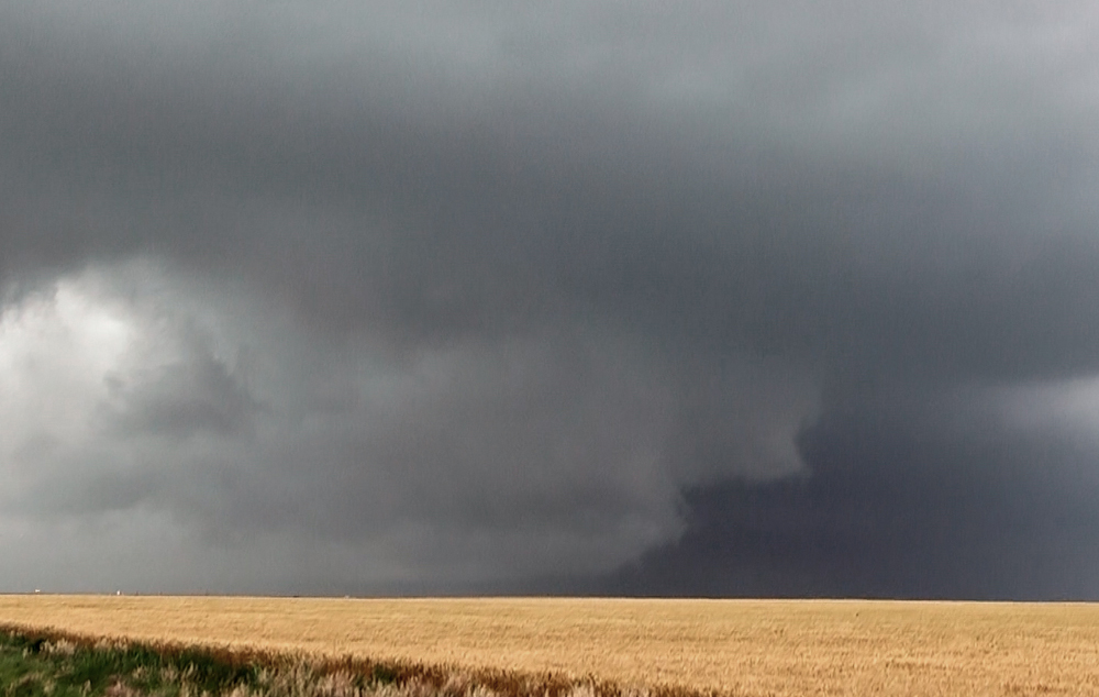
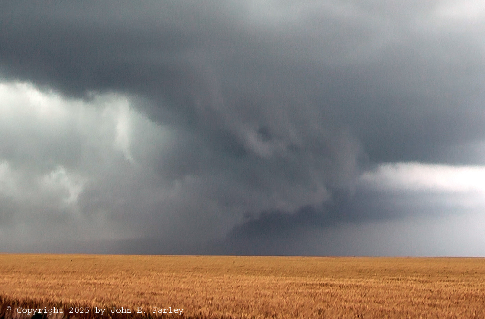
Even by the shape of clouds, the presence of rotation seemed pretty evident to me, but it would still be about a half hour before this storm produced its first tornado farther southeast. There was an east-west road about a half a mile north of me that a lot of chasers were using to head east, but being of a more cautious type I opted to drop back south a couple miles to the edge of Boise City and then head east from there. I thought that if I had taken the road just to my north, I would have quickly been in wind-driven baseball hail, and I had no interest in that. I am wondering if some chasers did encounter that; have not heard anything either way on that. Anyway, as I got a few miles east from Boise City, I got into the RFD with some wind-driven rain but no hail. But the wrapping rain pretty much eliminated any view of the area of interest, so I let it go. Thought of calling it a day, but since I did have a good SE option from just east of Boise City on 287, I took that and found a decent gravel road about 7 or 8 miles down the road that went east, and took that to where it ends at a T intersection. While I was making these maneuvers, a new TOR was issued at 6:46 for for rotation near Keyes and moving southeast toward Griggs. Indeed, a brief tornado did occur 8 minutes later between routes 56 and 412/64 south of Keyes. It was reported by a storm chaser who said it was quickly hidden by wrapping rain. I saw a picture online and it was a dark cone, not fully condensed to the ground, and indeed partly hidden by rain. Apparently it quickly became totally hidden, because a later public information statement from the NWS in AMA gave a start time of 6:54 and and end time of 6:56, but that end time was uncertain because nobody really knew how long it was on the ground after it became invisible in the rain. It did no damage and apparently ended before reaching route 412/64. This tornado probably occured around the time I turned onto the east-west gravel road, hoping to get a view of the storm from the end of that road west of Griggs. The meso, which by the time I got to the end of that road was north or northeast of Griggs but south of 412/64, was evident to me looking northeast, but any structure was hidden by wrapping rain. This is how it looked to me looking northeast, a few minutes after the reported end time of the tornado:
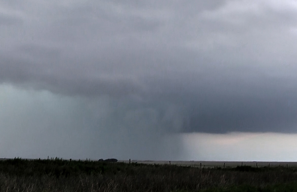
Here is an extreme enhancement of a video capture from about the same time as the picture above. Still really hard to see any kind of structure back in the rain - almost certainly no tornado, but likely still some pretty strong rotation going on at this time:
At this point, with no further east option to continue pursuing the storm and the time well past 7 p.m., I decided to call it a chase and head back to Boise City to find a room for the night. The storm did get more TOR warnings, and I heard from other chasers that the storm became quite a bit more photogenic as it moved farther SE and crossed from the OK Panhandle into the TX Panhandle shortly before sunset. It did also produce three tornadoes in Hansford County, TX just before and after sunset between 8:48 p.m. and 9:22 p.m. But it would have been difficult to catch up from where I was, and attempting to do so would have made my drive home considerably longer the next day. Six hours was long enough. So considering all of that, I am glad I called the chase when I did rather than making another attempt to catch up.
After settling in to my motel room, calling home, and eating some gas-station food (all that seemed to be available that late in that town), I turned my attention to the weather again. I had earlier noticed a new storm to the northwest, which seemed to be following a path to the ESE similar to the first storm. At 9:40 p.m., a TOR warning was issued for this storm until 10:15, with rotation 7 miles NE of Black Mesa State Park - similar to where the earlier storm had passed, but a little more to the SW, closer to the park. The TOR warning also mentioned the possibility of softball-sized hail. At this time, there was a LOT of lightning with this storm, and I knew I had a while to watch it before it would be any threat to Boise City, so I went outside and got some video of the lightning. Here is video of the lightning in the second storm just before 10 p.m. as it moved toward Boise City, taken looking NW from my motel:
The TOR warning was re-issued at 10:09 p.m. until 11 p.m., with the rotation by then located 7 miles of Boise City. A tornado did in fact begin around that time and place, but I am getting ahead of the story. The warning mentioned Boise City and Griggs as locations in the path of the storm. I was closely watching storm-relative velocity on radar and was confident that any tornado would pass northeast of Boise City, but I was concerned about the softball hail that the warning continued to mention. There were indeed strong reflectivity returns on the radar closer to Boise City than the rotation, so I decided it was time to get my car under a canopy. However, others were thinking the same way and both of the ones I had initially scouted were fully taken. So I headed west, figuring that if necessary I could just drive west from Boise City entirely out of the storm's path. However, I found a gas station canopy with nobody under it just a couple blocks down the street so I got under there facing away from the likely wind direction. Despite the tornado warning mentioning Boise City, there were no sirens sounding. Soon a strong blast of wind from the north arrived, along with torrential rain but no hail. Finally 10 or 15 minutes after the TOR warning was issued, the sirens began to blow. By then, the area of rotation was several miles east of Boise City and there was no tornado threat to the town, judging from what I could see on radar. But nonetheless, once the sirens were sounded, they continued to blow constantly for somewhere around 20 minutes, even after the storm had mostly subsided in Boise City. There was a lot of rain and strong (but likely sub-severe) straight-line wind, and with the sirens blowing it made for some good video:
There was in fact a tornado with this storm, but as I expected it passed northeast of Boise City. The tornado began at 10:05 p.m. 7 miles north of Boise City (just as indicated in the re-issue of the warning a few minutes later) and tracked southeast for 5.5 miles. At the start of the tornado, a semi truck was blown off U.S. 287. There was no other damage reported, but a spotter did see the tornado farther southeast. There was also a report of baseball hail 17 miles NNW of Boise City, but I did not see anything closer than that. Although this day was nothing close to the previous one, and although I probably would have seen more if I had chased the storm down into Texas, I would still consider this a pretty decent chase, with two tornadic storms. Not the most photogenic storms except for a short time on the first one, but between that and a couple decent video opportunities after dark, I am satisfied
Chase mileage for the day: Around 320 miles.
Total chase trip mileage: 1498 miles.
Return to 2025 Severe Weather Observation Page
Return to Main Severe Weather Observation Page