This day was kind of a "sneak attack" setup - not much sign of a chase day until fairly late in the evening before, and more so the morning of. A boundary - something of a hybrid of an outflow boundary, backdoor cold front, and dryline would end up setting up in a north-south allignment in New Mexico not too far east of the mountains, with upsloping, moist air east of the boundary and dry air to the west. Surface winds would be southeasterly, with westerly or southwesterly winds up high, so there would also be wind shear. But the setup was not evident 24 hours earlier, as most forecasts and models kept the backdoor cold front to the northeast and dryline farther east. However, the previous day, intense dryline thunderstorms occurred over the Texas Panhandle, especially the southern part of it, and this sent moist outflow to the west and effectively shifted the backdoor cold front farther west and south of where it was expected to be. One result of this was that in the late evening, scattered thunderstorms became widespread over east-central and southeast New Mexico. These were mostly non-severe, but heavy, training storms produced a serious flash flood situation around Fort Sumner, NM. Some places just southeast of there got up to 7 inches of rain, with 4-7 inches in a number of locations in and just east and south of there. US 84 closed for a time because of flooding. This further moistened the air in eastern NM, and forced the outflow boundary/backdoor cold front westward to west of Fort Sumner and Santa Rosa, with moist southeasterly upslope flow over most of the eastern plains. By the early morning SPC outlook, most of NM east of the mountains was in a marginal risk, and the discussion mentioned a possibility of tornadoes. By mid-morning, NWS ABQ issued a flash flood watch for parts of eastern NM, anticipating strong storms with heavy rain. And soon after, SPC upgraded east central and southeast New Mexico to a slight risk, again mentioning the risk of tornadoes.
Due to commitments the day before and the next day, this was really the only day I could chase, and I had pretty much written it off the previous day. But with these developments and things trending in the right direction, by 11 a.m. it was "chase on!" It looked like there would be good instability (CAPE at least 1000-1500, maybe more), enough moisture (dew points rising to around 50 by late morning, maybe more in the afternoon), and good wind shear with southeasterly surface winds (albeit not overly strong) and southwesterly upper winds. Nothing super-great, but overall more than enough to get it done on the high plains of eastern NM. I set an initial target of Santa Rosa, NM, figuring that with good road options in several directions, I would probably be fairly close to where storms would initiate and in a good position to go whatever direction I needed to.
The Chase
11:40 a.m.: Out the door from Santa Fe, with an initial planned target around Santa Rosa, NM. That seemed to be likely near where storms would initiate, and has good road options several directions.
12:30 - Quick pit stop/sandwich grab in Clines Corners. First storm of day has initiated NE of there, a bit earlier and farther west than I had expected, and others were going up near I-40 to the east and NE of Vaughan.
1:45 - I'm in a massive jam on I-40 W of Santa Rosa. A semi overturned in median and lost its load. The storm that initiated east/NE of Vaughan is intensifying around midway between Vaughan and Santa Rosa. It is moving slowly enough (10-15 mph) that I am still confident I can intercept once I am out of the traffic jam.
Supercell 1
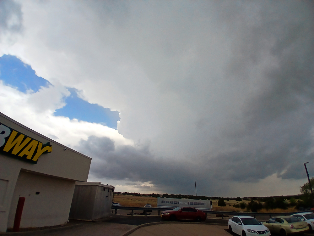
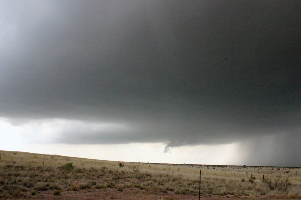
2:10 - Finally in Santa Rosa, I stop for a pit stop at Travel America plaza. The storm is slowly approaching from the SW and looking good on radar. I get some pics from the parking lot and then the back side of travel plaza. After a little while, I drop south, as it looks like the meso, now strong on radar, will pass south of my location. There is increasing inflow wind from the SSE, and brief spritzes of sub-severe hail being flung out of the storm, even though it is well to my SW.
2:25-3:00 - Now around 8 miles down US 84 from Santa Rosa, I'm watching the storm with again occasional spritzes of rain and sub-severe hail. The storm now has great structure, and is now SVR-warned. A tornado watch is issued at 2:50 p.m., valid until 9 p.m. for most of east-central and southeast New Mexico, including my location. Also, the SVR warning for this storm is re-issued at 2:48, valid unitl 3:45. Both this warning and the earlier one mention 1.5 inch hail and 60 mph wind. At times, the storm shows a pretty strong velocity couplet on radar, southwest of Santa Rosa and to my west.
I was still in the path of the now rightward-turning meso, so I dropped a little farther south. The storm produced some small, scuddy lowerings, a couple of which appeared briefly quite interesting - maybe even some brief, small funnels. But not sustained. It also developed a noticeable RFD cut in the base, and at times there was also a nice rainfoot, and other times, quite a bit of dust being kicked up by the RFD wind.
After this, the storm began to weaken. A storm farther north, maybe 20 miles N of Santa Rosa, had now rapidly intensified, and had a very impressive radar signature. There were other storms farther south, around and north and west of Fort Sumner, but they looked messy to me on radar, and it would have required some core punches to go that way. But some of them were SVR warned for a while, although perhaps not by the time I decided to head for the northern storm as my storm weakened. This also required a core punch, but the storm was weakening by now and I did not encounter any hail. I thought I could blast east on I-40 and then go north from Newkirk, which ended up working well. Although in hindsight, I might have been better going after the messy-looking storms to my south, as one of them eventually produced a tornado southeast of Fort Sumner. But also flash flooding that closed roads in that area, so I might have ended up having no easy return route had I done that.
Supercell 2
I blasted east on I-40 toward Newkirk to head north and intercept the storm. By around 3:30, radar was indicating hail as large as 4-inches in diameter with this storm. Other severe weather statements and warnings after that mentioned hail from 2 to 2.5 inches. By the time I was heading north out of Newkirk toward the storm perhaps around 4:45, radar indications of hail were smaller, but still 1.5 to 1.75 inches, and SVR warnings continued to be issued. There were a total of 4, with the last one at 4:41, valid until 5:45. A little before 5, I was getting a good view of the storm.
As I worked my way north, the storm produced intermittent wall clouds and rising scud under its updraft.
At times it looked pretty impressive, with lowerings under the updraft and dust being kicked up by the RFD, close to the rain and hail core.

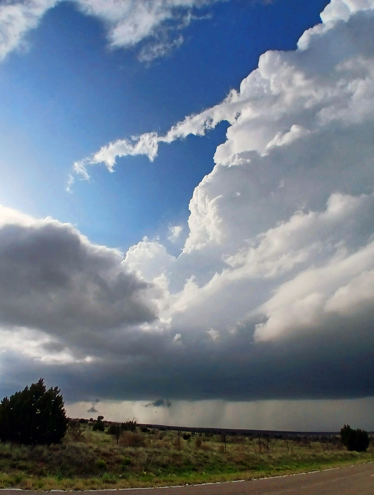
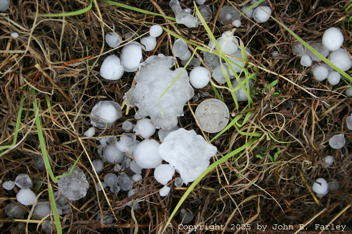
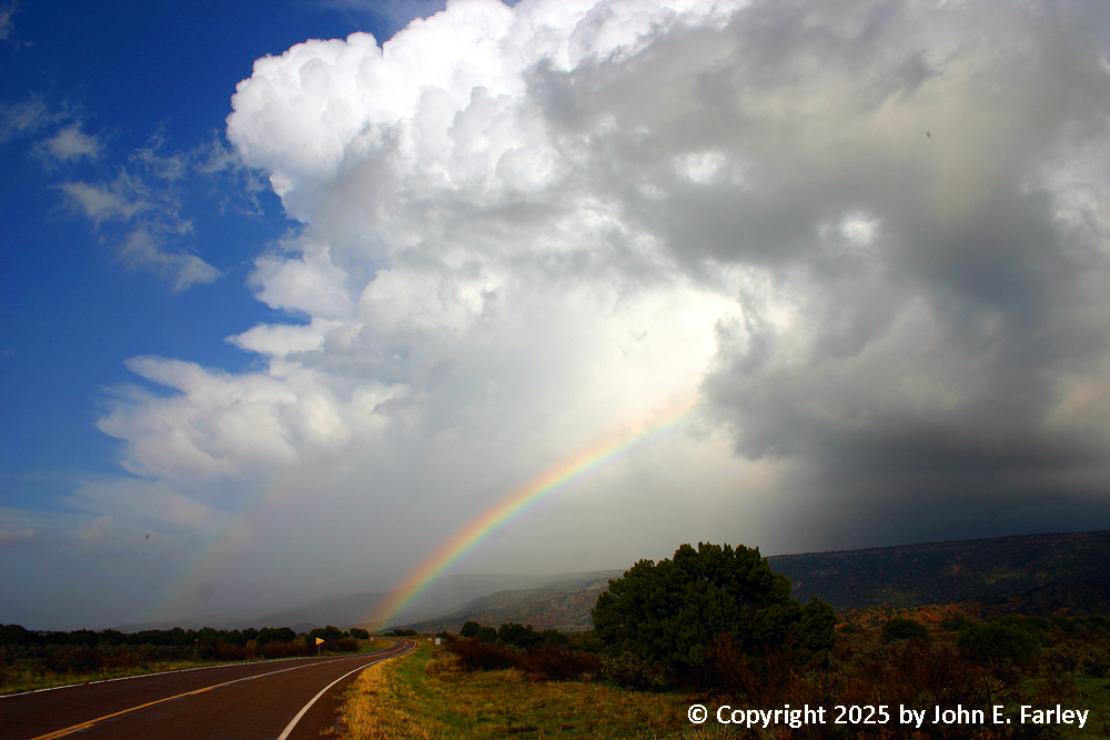
I stopped maybe 10 miles up the road from Newkirk, and let the storm cross in front of me. As it did, it initially seemed to weaken, then to cycle, producing a new meso (and more pronounced on radar than it had been for a while) to my NNE. The meso was moving in such a way that my view of it was about to be blocked by a large mesa, so I moved north to see if I could get to a place to where I could see it around the mesa. That proved to be impossible, but I am glad I did, because the move gave me the opportunity to find some big hailstones and to get some good rainbow and storm structure photo ops. I found several hailstones 2 inches in diameter, and many in the 1 to 1.5-inch range. Here is a picture of one of the 2-inch hailstones, along with several others around quarter size or larger:
The storm was now getting ahead of me and moving into very difficult chase terrain, so I decided not to pursue it any further. It weakened soon after that, anyway. However, before it got away it offered me this view of its backside, along with a double rainbow:
After getting these pictures, I called the 2-inch hail in to NWS ABQ. They seemed very grateful to get the report, and later I saw that was the only LSR they posted on that storm. Likely the hail was even bigger than what I observed earlier and farther west, but the storm was in a thinly populated area so perhaps nobody reported it. Around this time, likely after 5:30, I noticed that a tornado warning had been issued on another storm well to my south, near Fort Sumner. The storm did produce a tornado southeast of there, and since I was returning south anyway, I did briefly consider trying to go after that storm. However, it was soon evident that it was not in a place where I was going to be able to get on it, and in all likelihood would no longer be tornadic even if I could have. However, a new storm was strengthening west and a little north of the tornadic storm, west of Lake Sumner, and I thought I might be able to get to that, so I headed back to Santa Rosa and south again on 84. I was on the wrong side of the storm, but could occasionally see its updraft and backsheared anvil through breaks in the low clouds, so I thought I might be able to see something at least by heading that way.
Supercell 3
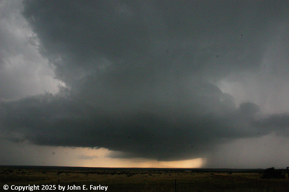
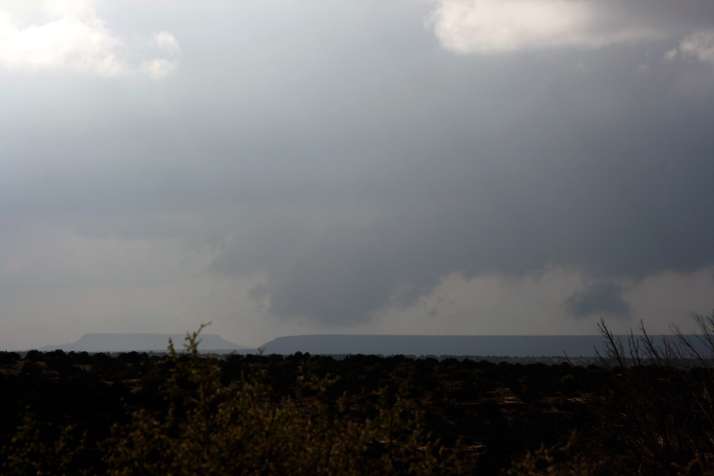
It took a while, but by around 7 p.m. on the road west to Lake Sumner State Park a mile or two west of 84, I began to get a decent view of the updraft and anvil of the storm I was targeting. As I got closer to the turnoff to Lake Sumner, I encountered increasingly heavy rain. This was wrapping around the storm on the north side of the main updraft, driven by strong easterly to southeasterly winds on the north side of the rotating storm. I had to get a mile or 2 west of 84 to get a decent view of the storm structure looking to my southeast, and even then I was still in pretty heavy rain and maybe a little hail, even though by then the edge of the anvil was directly overhead and the main updraft of the eastward-moving storm well to my southeast. Here is a picture I took of this storm around this time:
This picture was taken through quite a bit of rain and I think even through the windshield, as the rain and wind was too intense to get out of the car. But after a while it subsided, and I turned back toward 84. The rain picked up again right as I got near 84, and I stopped to get a few more pictures, even this time getting out of the car briefly into the wind-driven rain. Figuring I was near the back edge of the rain again, I decided to head south to see if I could get a better view of the business end of the storm. But almost immediately, I could see almost nothing, as I drove into what turned out to be dense hail fog almost as soon as I was back on 84. Within a half mile to a mile on 84 south of the turnoff, the road was nearly covered with hail, the hail was a few inches deep on both sides of the road. I tried to take a few pictures, but they were not very good because of the dense fog. I went a few miles farther, hoping to get a better view of the storm, but it was not to be. So I turned around, and heading back north, the views were better as the wind had largely blown the hail fog away. Here is a picture of the hail accumulation on the road and along the sides of it, taken through the windshield driving north:
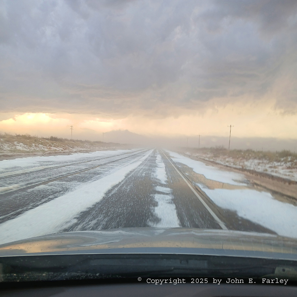
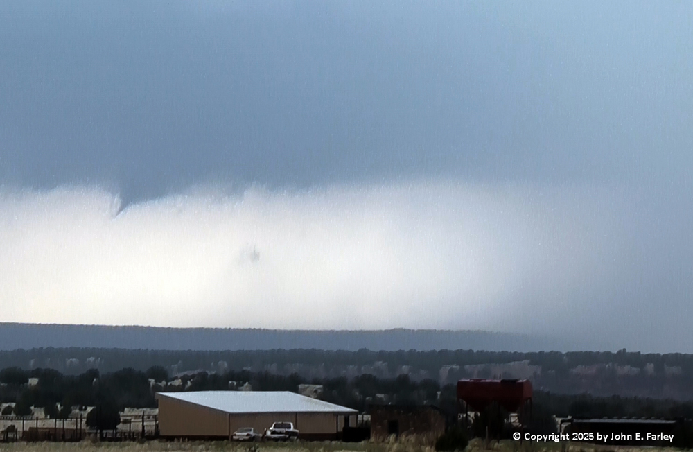
Near the ground looking ahead in this picture, you can see some of the lingering hail fog, which was being blown to the northwest by the southeasterly wind. It did appear to me that although there was a lot of hail, it was all small, well below severe criteria. Also you can see the base of an LP supercell that was northwest of the storm that produced this hail, and sunlit sky visible through the limited precipitation of that storm. That was the next and final one that I chased, although it kind of also chased me.
Supercell 4
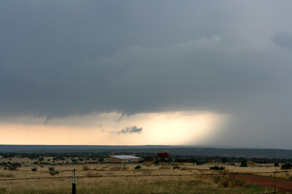
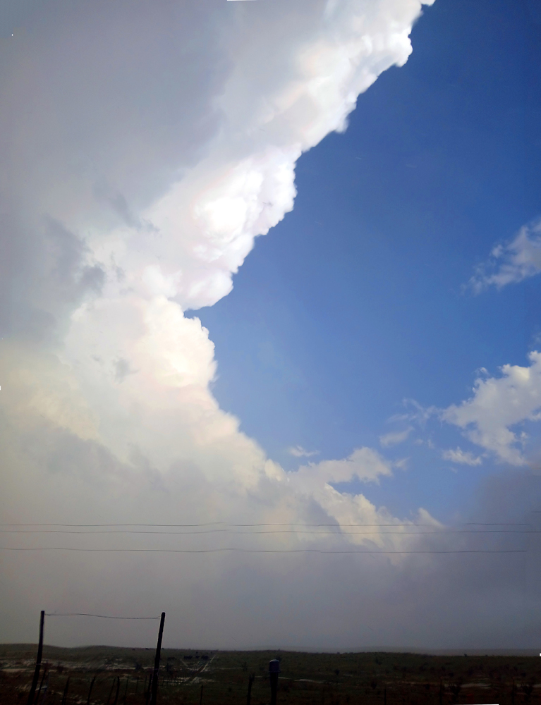
Now actually I had noticed the LP (low-precipitation) supercell farther northwest much earlier on radar, and visually as I drove after Supercell 3. And when I was at my westward-most point going toward Sumner Lake State Park to try to get a view of Supercell 3 to my southeast, the LP supercell to my NW caught my attention, and I did take some pictures of it from there. Backlit by the setting sun, it was pretty impressive, and may have even produced a small shear funnel in its vault area. Here are a wide-angle picture and a more zoomed picture of this LP supercell:
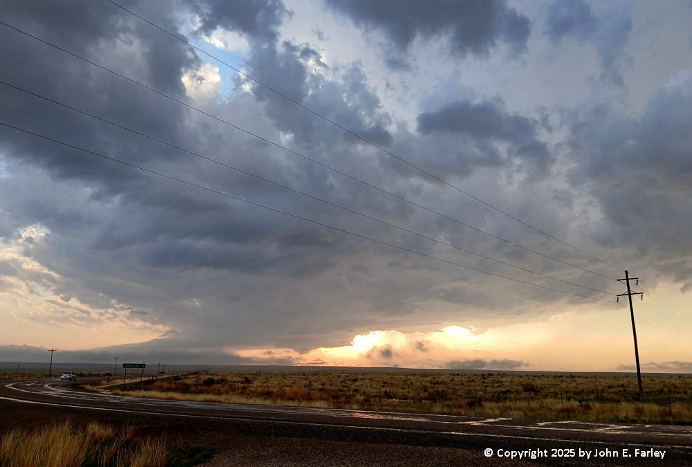
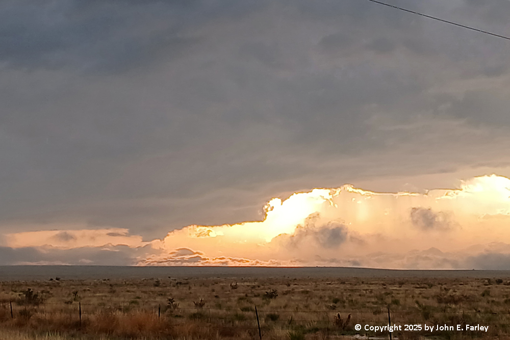
These pictures were taken around 7:08 p.m., looking to the WNW from about 4 or 5 miles east of Sumner Lake State Park. This was just about the time a SVR warning was issued for this storm, for 1,25-inch hail and 60 mph wind. Now in the pictures above, the storm looks more pretty than threatening, but LP supercells can produce big hail even while producing little rain, so the sun shines right through their precipitation cores. It might not look like much is going on there, but sometimes it is. After taking these pictures, I headed south and encountered the hail accumulation on Route 84, as described in my account above of Supercell 3. Returning north, after clearing the hail accumulation, I got some great views of the LP supercell to my northwest (Supercell 4), which was still SVR warned. This was my favorite picture, taken around or a little before 7:30:
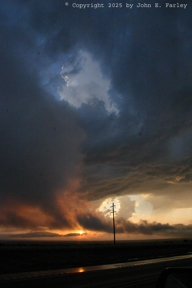
I think this is my new favorite chaser sunset picture, because it has everything in it - the updraft base, an inflow band, the updraft tower visible through a brief opening in the low clouds, the setting sun, and even its reflection on the wet road. And also some barely-visible precipitation under the updraft base. And after this, the chaser kind of changed into the chased. Again, I knew there could be hail, but wanting to get back to Santa Fe before it was dark, I decided to drive under the still SVR-warned storm. I was hoping that I was close enough to being directly under the updraft that any hail would be carried over me by the strong upper winds and fall farther east. No such luck. BANG! I heard the loud sound of a good-sized hailstone striking the car. Then several more, and a couple that broke apart hitting the windshield, too. I was afraid I would lose the windshield, which fortunately I did not, and pretty sure I would have some hail dents in the roof or hood, which upon inspection when I got back to Santa Rosa I did not seem to have, either. But this was large hail, I am sure enough to meet severe criteria, but I never was able to see stones on the ground to see how big they were, and I certainly was not going to get out to look and risk getting bonked on the head. The sound of several of them hitting the car was as loud as I have ever experienced in 30 years of storm-chasing (granted I am usually pretty cautious about hail), so I am sure they were at least an inch in diameter and golfball (1.75") would not surprise me at all. Fortunately, as is often the case with LP supercells, there were not many of them, and in a distance of 2 or 3 miles I was out of the hail. So this kind of capped what I had already decided - this was one hail of a storm-chasing day!
Total chase distance for the day: 393 miles.
Return to 2025 Severe Weather Observation page