
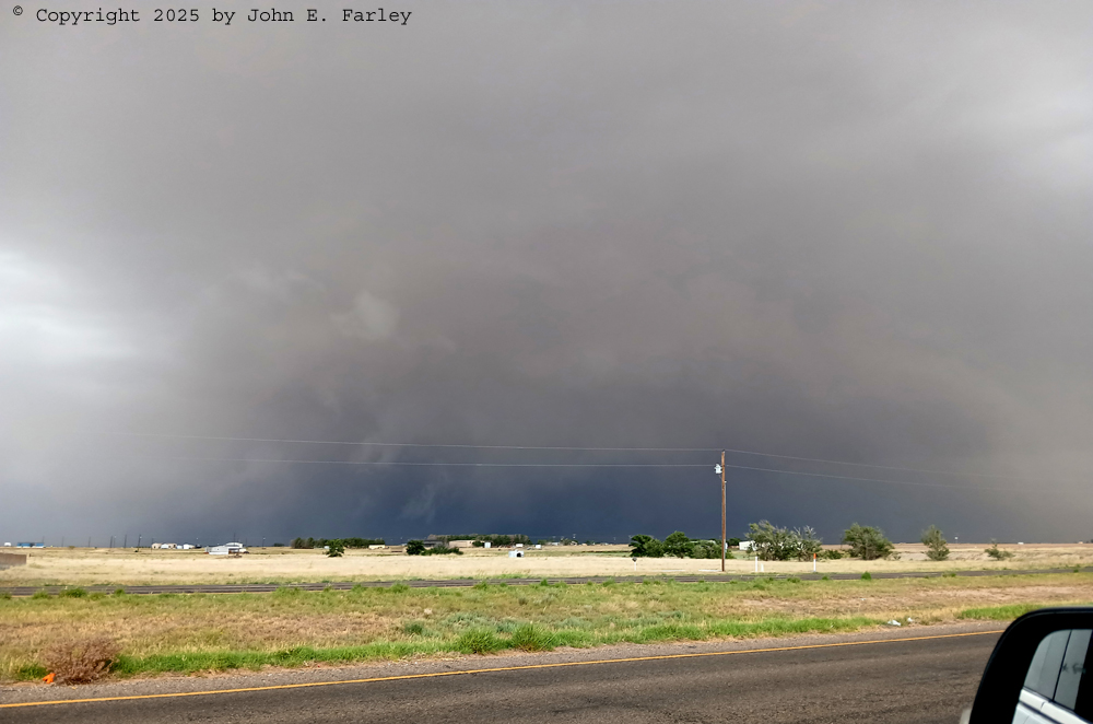
Started south from Tucumcari around 11 or a bit after with an initial target of somewhere in the Clovis-Portales area. Wanted to be close to where storms would initiate and figured I would end up following them into TX. There was some risk in all of eastern NM and the TX Panhandle, but best instability/shear around likely mid-afternoon initiation time was in east-central NM around Clovis and Portales. Even better instability in the Permian Basin area, but I did not want to go that far and did not figure I had to. It was cool and drizzly for the first hour and a half to maybe 2 hours, as I was just on the cool side of the front/outflow boundary. But I was close to it and all indications were it would move back east/NE as a warm front. Did not want to repeat my mistake of May 18 when I waited too long for the warm front to start moving, but I was closer to it now and confident it would move, and by early afternoon it showed signs that it was.
Came through the large wind farm near Grady NM. Eerie look with the low clouds and fog covering the upper parts of the wind turbines, but the lower part more visible. Kept on task at first and thus missed the best images of these, but eventually had to stop and take a few pics.
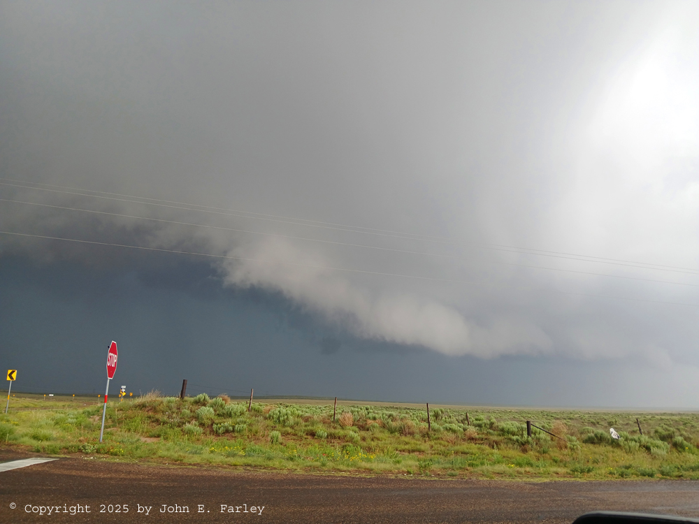
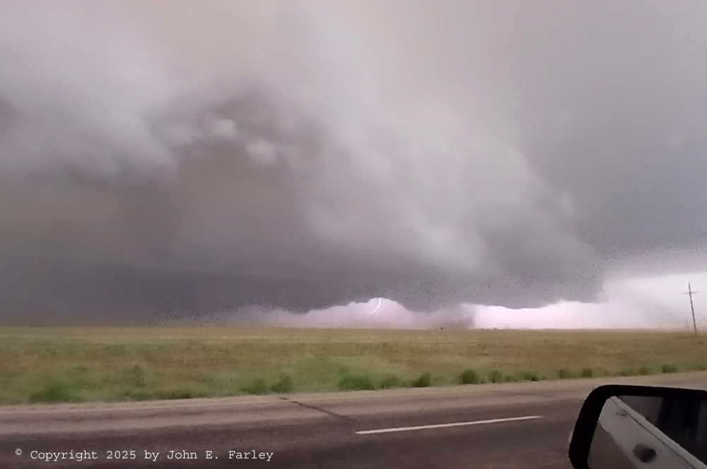
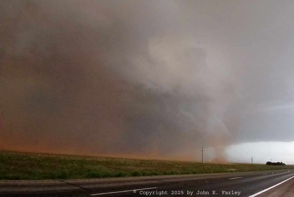
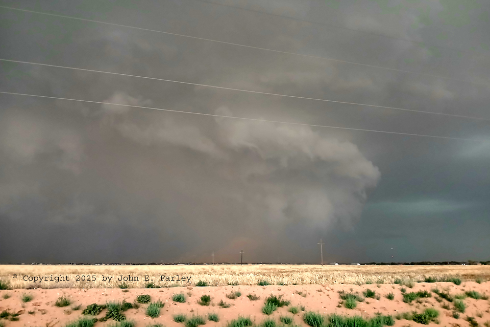
Continued south through Clovis to a little NE of Portales. By now, around 2, storms had initiated well SW of Portales. Initial movement was to the NNE but I expected them to make a right turn, so I cut east a few miles NE of Portales and sat and waited. Eventually one storm strengthened, and movement looked like it would take it NW of Portales, so I decided to move SW for an intercept. Soon there was another storm to its SSE, but the northern one looked better and was closer, so I went for it. Got to it around 2:30 MDT a few miles SW of Portales. It displayed an impressive wall cloud, and went SVR warned at 2:47 MDT for 1.5" hail and 60 mph wind.
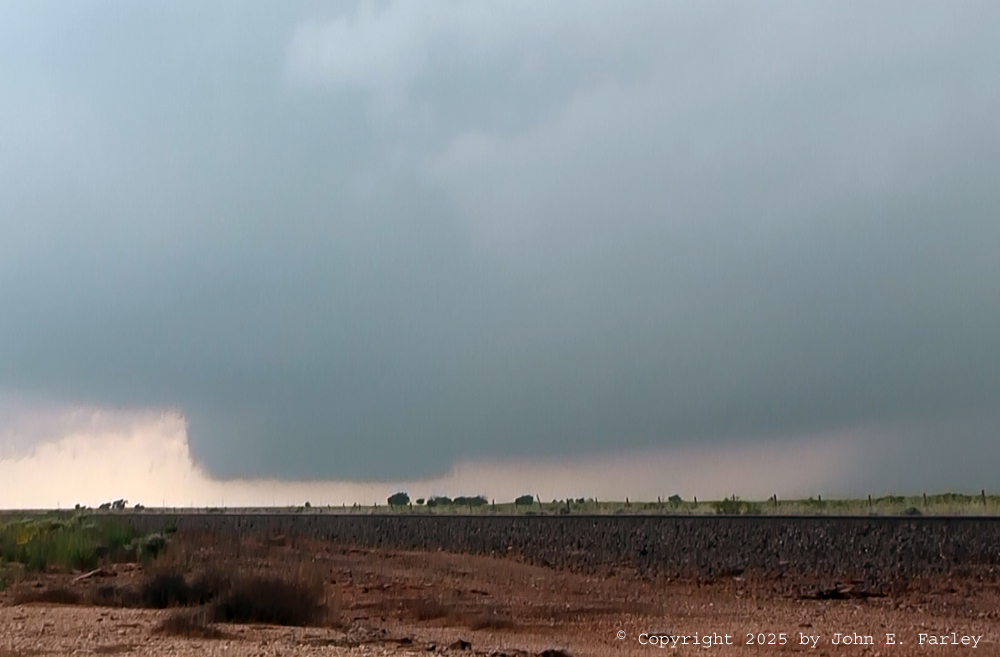
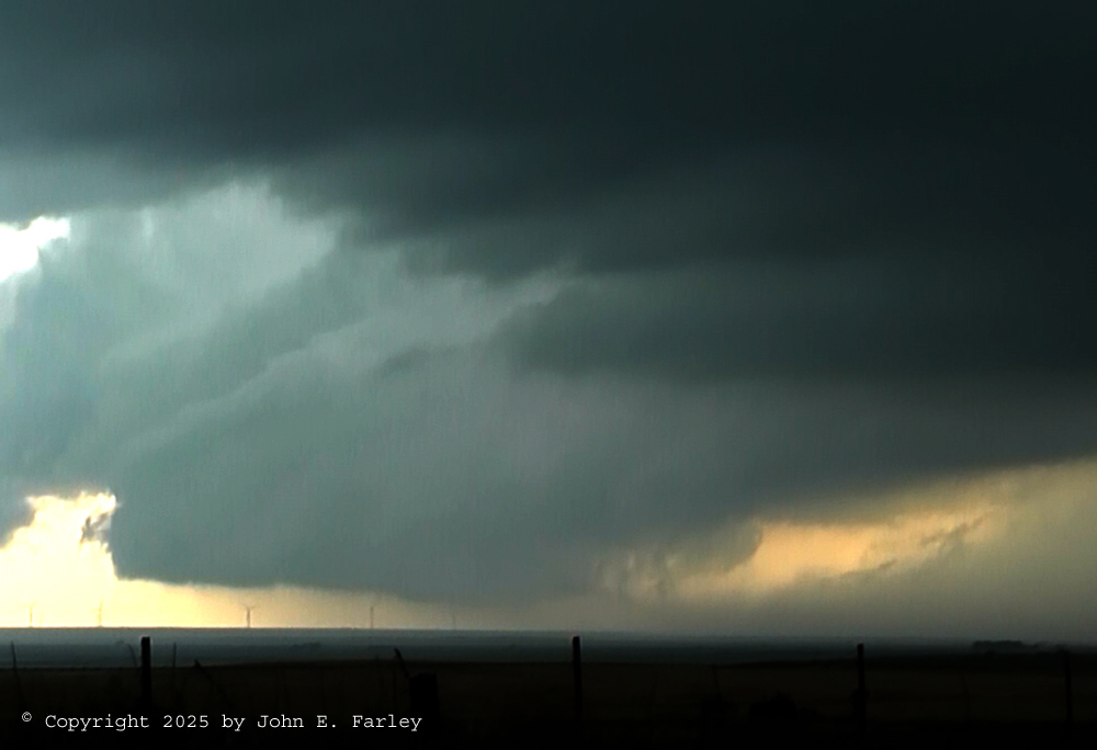
But it soon became evident that it was now making a hard right turn and that I was in the path. So to stay out of the hail, I went to the south edge of Portales and took a paved road that went mostly east with occasional southward stair steps. Thought this would get me far enough S to be S of the storm's path, but the storm kept turning right until it was moving to the ESE, a good 90 degree turn from its initial movement. But honestly I should have paid more attention to my initial thinking in the morning rather than the storm's initial movement, as indications were the storms would move east or SE. Anyway, stopped a couple times, got video, and realized I was still in the path. Eventually stopped at the NE corner of Salt Lake, at the NM-TX state line. I knew I was still in the storm's path, but had a little more breathing room and a good view of the wall cloud. After a few minutes, my phone alarmed for a TOR warning, and it was for my storm, not the next one S of it, which was also SVR warned by now. The TOR warning was issued at 3:36 p.m. for rotation 11 miles SE of Portales, which would place it around that distance to my SW. Actually, turns out the first tornado had already happened by then, a brief weak one near that location which I had my video camera pointed at but did not see. An NWS employee who was closer to it than me and reported it indicated to me that it was a bowl funnel with rotating tendrils, and I do have something that kind of fits that description in my video around that time, specifically some rapidly moving cloud tags that seem to be moving in opposite directions. Can't see the bowl funnel very well but there does appear to be a low-contrast, broad lowering north of the main wall cloud and above the cloud tags, so that could be it. So I will say "maybe" on getting this one. Here is a video capture from around that time. The cloud tags/tendrils, which are just to the right of the wall cloud in the picture, were moving quite noticeably and some in opposite directions, so if I did capture that tornado, I think this is most likely it:
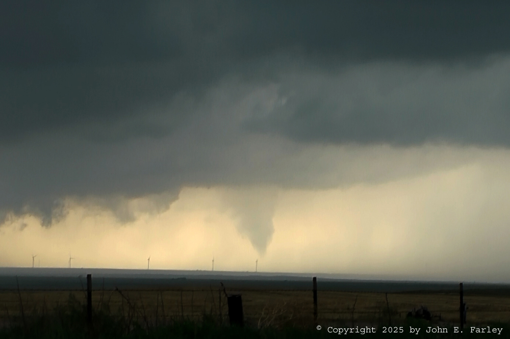
The next one is more clear cut. It formed, again, not under the mail wall cloud but to the right of it from my viewpoint, likely NW or NNW of the wall cloud. It was back in rain a little from my viewpoint but nicely backlit. It formed quickly around 3:40 p.m. MDT, lasted about two minutes, and dissipated equally quickly. Here are a few pictures:

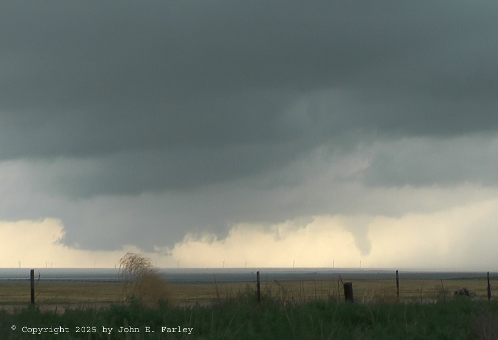
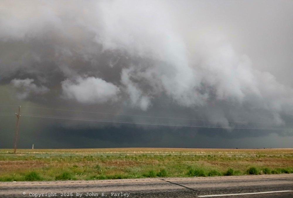
I was still in the path of this storm, and becoming concerned that I would get crunched because this storm was showing signs of merging into the storm to its south-southeast, which was intensifying and was also now tornado-warned. Indeed after that warning it did produce its first of many tornadoes near Lingo, NM. But more on that storm later. I decided to move again to escape the incoming hail, but after that the storm I had been watching came under the influence of the other storm to the south and rapidly weakened. They nearly merged, but then northern storm had a last gasp and surged north a bit, perhaps briefly evolving into a left split. Anyway, it was right on my route to get to the now-dominant southern storm, so I had to back away and let it pass before I could do that. New warnings mentioned the possibility of 4-inch hail, which was probably in the southern storm, but left splits can produce big hail too, and the storms had come so close to merging, I was afraid that if I drove into even the left split they might be indistinguishable and I might drive into giant hail. So I waited a bit and as I did, the storm offered one final bit of eye candy with a nice shelf cloud:
Here is my edited video of the Portales to Rodgers supercell and tornado (possibly two). The first tornado that occurred with this storm began about the time that the part of the video after I moved from my initial location begins. The tornado may have been associated with the rapidly-moving cloud tags just to the right of the wall cloud, which are most visible from around the 1:40 mark in the video to when my phone alarms for the tornado warning. This first tornado ended about the time the warning was issued. The second, more visible tornado, the cone tornado, begins to form around the 3:25 mark in the video, to the right of the wall cloud, and forms quite quickly. It is most fully formed around the 4:45 mark, by which time I have panned so it is in the center of the picture. I said on the video that it could be a funnel cloud, but in fact it was a tornado. Although it was not quite condensed all the way to the ground, a National Weather Service employee confirmed that there was a ground circulation, making it a tornado. Around the 5:30 mark in the video, just after I moved to get a better view of the wall cloud to its left, the tornado dissipated. Here is the video:
Once I knew that the northern storm was dying and the southern one was now the dominant storm and likely to stay that way, my mission was to try to catch up with it without getting caught in giant hail. Normally when you are behind a storm that is not easy, but in this case the movement of the storm was only around 10 to 15 mph to the east-southeast, and I had a pretty good road network including some roads that ran NW-SE, so I thought it might be possible, and it turned out it was. I heard about a large tornado north of Morton, which turned out to be probably the most spectacular tornado of the day, and unfortunately I missed that one. I was not terribly far from it, but being on the back side of the storm there was way too much rain to have any good chance to see it. But I kept trying to catch up, and eventually it worked. In the meantime, as I crossed the storm's path behind it heading southward, I encountered a lot of leaves stripped off trees, and then some big hailstones in Maple, TX. I stopped briefly and photographed a couple 2.5-inch hailstones:
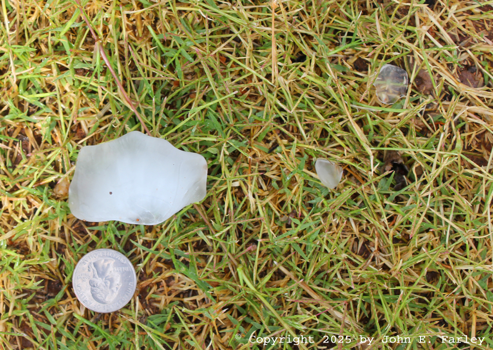
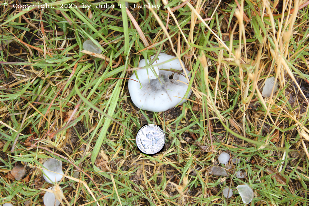
I am quite sure there were bigger stones than these, probably to around 3 inches in diameter. But I was trying to catch up to the storm, so I did not kill any more time to try to find and photograph one. Back on the road, I got what may have been my first glimpse of a tornado with this storm as I approached Morton, looking toward a tornado that occurred south of Pep and east of Morton. Apparently this was a separate tornado from the Morton one, and it was far from a good view from my location. As would be the case a lot with this storm, a lot of the view was cut off by dust and rain. And I was still pretty far away, but catching up, and this gave me hope that I could get to where I would have a better view. This was the view at that point (6:07 p.m. CDT):
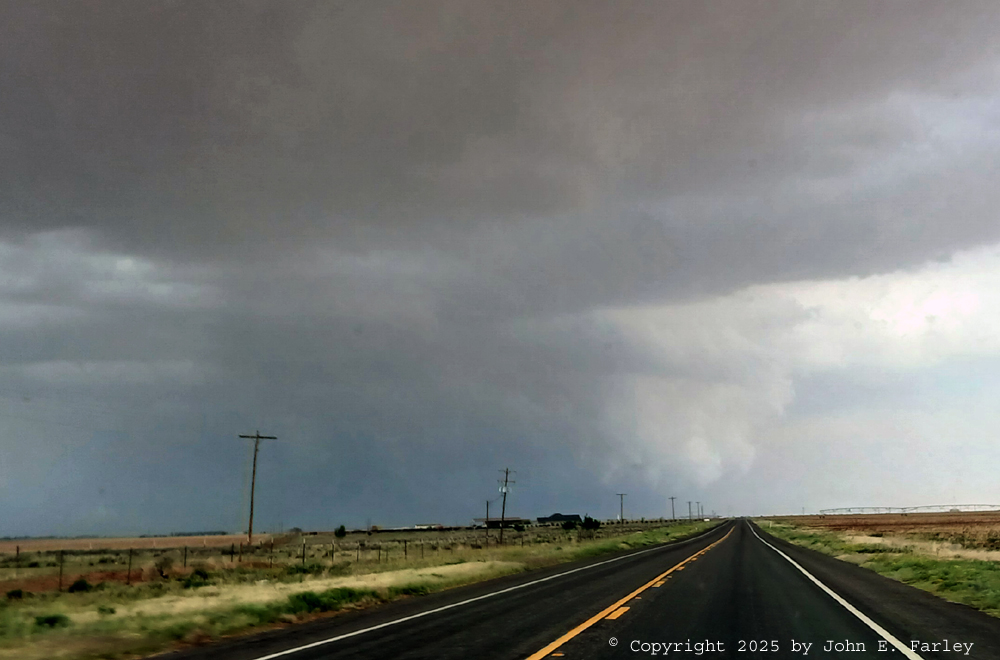
That matches up with the end time of a tornado rated EF-U southwest and south of Pep. The path length was just under 5 miles with an unknown width. The EF rating is unknown because it did not hit anything, but radar velocity data suggests the wind in this tornado could have been as strong as 120 mph, which would be equivalent to a low-end EF-2. The damage survey mentioned the tornado being hard to see due to blowing dust, which was certainly true for me.
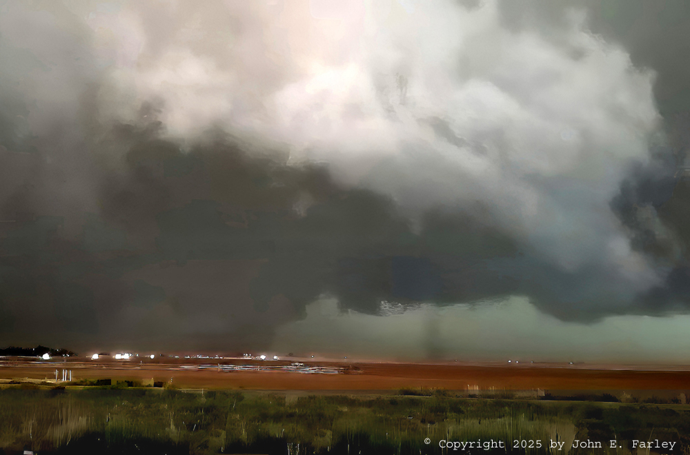
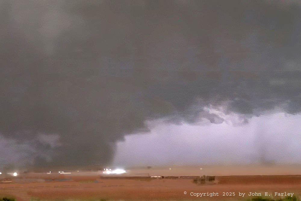
As I went through Levelland, the sirens were blaring. I briefly stopped and got video, but at this time the meso was a big rotating mass of rain and dust, so visibility was not good. One thing worthy of mention is that, on radar in velocity mode, the rotation couplet was intense and the largest I think I have ever seen. Intense rotation over an area miles wide, corresponding to the massive swirl of clouds, rain, and dust. I moved farther east, and around 6:45 got a somewhat better view of the tornado northeast of Levelland. There were a number of reports of tornadoes between Levelland and Whitherall to its NNE, with a semi truck being blown over between those two towns. When I saw this, I was pretty sure I had a tornado, with rotating clouds extending to the ground or very close to it, albeit low contrast:
With what I was thinking confirmed by the multiple tornado reports, I had done it! Caught up with the storm from behind and gotten to where I could see and document tornadoes. This tornado was rated EF-2 and was on the ground from 6:27 to 6:54. It travelled a distance of more than 9 miles and was more than a mile wide at its widest point, 1935 yards, with peak wind estimated at 125 mph.
On a road now crowded with chasers, I worked my way east a little closer to Reese Center and, ultimately, Lubbock. From around 7:15 to 7:50, the mesocyclone pretty much stalled in an area northeast of Smyer (another town I passed through with its sirens blaring) and west of Reece Center. Here are a couple pictures - one a lucky photo and the other a video capture - that I got with lightning flashes illuminating the meso and what was likely either a large multi-vortex tornado or multiple tornadoes:
 Video capture taken at 7:20 p.m. CDT
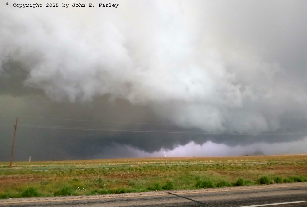 Photo taken at 7:23 p.m. CDT
In both of these pictures, there appear to be vortices to the right of the lightning and possibly to its left back in the rain. And quite possibly others as well. Whether at this point in time it was multiple tornadoes or a very large multi-vortex tornado probably comes down to a matter of judgement. According to the NWS damage survey, the tornado may have been multi-vortex or there may have been at least one satellite tornado, which they suggest per spotter reports may have had a path north of the main tornado. In my pictures above, the feature lofting dust to the right of the lightning could, I suppose, have been an intense burst of straight line wind, but even that, given its motion around the large meso, could arguably been part of a large tornadic circulation. But I think it more likely was a vortex, maybe either a satellite tornado or a subvortex of the main tornado. If you look at its position in the two pictures, which were taken looking northeast, it is farther away in the second picture but relative to the clumps of grass by the road, in the same position or slightly more to the left. This strongly suggests it was rotating around the larger mesocyclone, so possibly either a subvortex or a satellite tornado. Or, comparing to the track in the damage survey, possibly the main tornado. Yet another possibility, given the times in the damage survey of this tornado and the next one, is that the main tornado is the lowering back in the rain and the one to the right of the lightning is the start of the next tornado, the larger one pictured below. Hard to tell, because the details were only visible when there was lightning. That said, the next tornado moved southeast and this feature was likely moving northeast, so I would guess that is the least likely scenario. But any way you cut it, what the NWS damage survey calls the first Smyer tornado is one of the features in these pictures. The damage survey says the tornado began at 7:12 and ended at 7:24. It hit a mobile home community and heavily damaged two of them, causing 2 injuries. The tornado was rated EF-1 with peak wind of 110 mph. It was estimated to have a path width of about a half mile and traveled 3.72 miles.
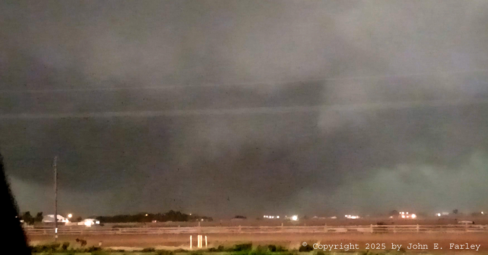
This photo, taken between the times of the two pictures above, shows what the meso looked like when there was not lightning - with the rain and dust, hard to see any vortices under there, but as the pictures above show, there were.
After I got the pictures above, a rear-flank downdraft (RFD) surge, or possibly the outer tornadic circulation, caught up with me around 7:26. Along the leading edge of this surge, at the right of this picture, there was also a gustnado:
With this, I blasted east again to get back ahead of the surge, and found my last viewing spot near Reese Center. Here, I got my most clearly-visible tornado from this storm, with condensation fully to the ground - a "real no-doubter" as I say on the video. What I did not realize at the time but is clearly visible in the pictures and video is that there were two tornadoes - the main one left of the road and a satellite tornado to the right of the road. The video shows that the satellite tornado was rotating around the larger one, and eventually disappears behind it. There may even be another tornado back in the rain, to the left of the main one. These tornadoes occurred between about 7:30 and 7:40 p.m. Here are two video captures of these tornadoes, one with a wider angle and one more zoomed in:
It was very dark when I got the two video captures above. Actually, it could have been the darkest I have ever seen it an hour and a half or more before sunset. As a result, the video captures were grainy, and when I took that out with Topaz, it blurred the pictures a little, especially the first one, but I was able to sharpen it back without reintroducing the grain with some further Topaz edits.
The large tornado in these pictures was rated EF-2 with peak wind of 130 mph and a path width of 968 yards. The path length was about 3 and a third miles, despite it being on the ground for 23 minutes, attesting to its very slow movement. It completely destroyed a manufactured home and caused damage almost to the intersection of the road I was on and the one with the headlights in the pictures. The damage survey does not mention the satellite tornado, but it sure looked like one to me as well as to other chasers and NSSL researchers who reported it as such.
---------------------------------------------------
EDIT #1 ON 6/21/2025:
i have been looking at my pictures and videos further, as well as the NWS damage survey, and have a couple items to add. First, I played around with my video of the latter parts of the larger tornado in the pictures above, and came up with one more capture when the tornado was closer to me, toward the end of the video:
Again, with the low light, quality is not great, but with some enhancement of the contrast I think it makes a pretty dramatic image. The tornado ended less than a mile from where I was taking video, a bit closer than I thought at the time. However, it was probably still a little farther away than that when this was taken.
---------------------------------------------------
This was pretty much the end of the active chase phase of the day, and as had happened earlier around Portales, the chaser now became the chasee. This time, with the company of lots of other chasees. With the storm moving ESE into Lubbock proper, I knew that if I went any further I would be under the meso and solidly in the metro area. So after getting these tornadoes, I blasted south, along with tons of other chasers and frightened locals. This was probably the worst congestion of the day, although there had been plenty of chasers ever since Levelland.
---------------------------------------------------
EDIT #2 ON 6/21/2025:
I had been looking at this picture and trying to figure where it fit into the overall chase sequence. Now, having compared its time stamp (accurate and precise since it was taken with my phone) against the damage surveys, I have figured out what it is. Taken around 7:50 it is the final tornado that this storm produced, near Reece Center, not far from the place where I took the video of the two tornadoes. I do remember that when I cut south toward Wolforth, I did stop once I was clear of the meso's path to take one more look at the storm. By the time stamp, this has to be from then, which means that this is a picture of the final tornado, looking north. A little bit the appearance of the earlier one near Morton that I missed, though not as dramatic as that. I am not sure whether the dust is being lifted by the tornado or by an RFD gust front between me and the tornado. But since I thought I had missed this tornado (at the time I thought that if it was indeed a tornado, it was probably a continuation the larger one of the two I had been viewing, but the damage survey determined it was a separate one), the fact that I did not miss it adds one definitive tornado to my tornado count for the day. Here is my poicture of this tornado:
This tornado was rated EF-1 with a path length of 2.65 miles and a width of 792 yards. It caused tree and roof damage in Reese Center.
--------------------------------------------------
I thought I could cut southwest on US 62 from Wolforth, get southwest of the storm, and come back and find a place to stay after it passed. But it quickly became evident that was not going to work, as low clouds and precipitation were surging leftward (southeastward) toward the road ahead of me. Not going to work when the storm was warned for large, wind-driven hail. So I doubled back to a gas station canopy I had noticed and got under there as the high wind, rain, and hail blasted through between about 8:05 and 8:20 p.m. The canopy did not totally keep my car out of the hail, but it helped. Not sure how big the hail was there but would guess around an inch and a half, and the rain was so heavy that visibility dropped to 100 or 200 feet. After the storm, I encountered lots of leaves stripped from trees, flash flooding everywhere, and power outages with people trying to get through non-working stop lights on flooded roads. A real mess, but I was quickly able to find a hotel near where I was, albeit with many of its north-facing windows busted out by the wind-driven hail. Here are some pictures I took the next morning of the hail-damaged windows:
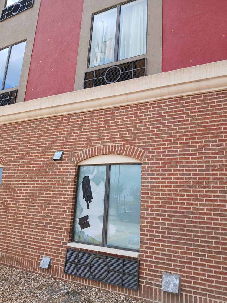
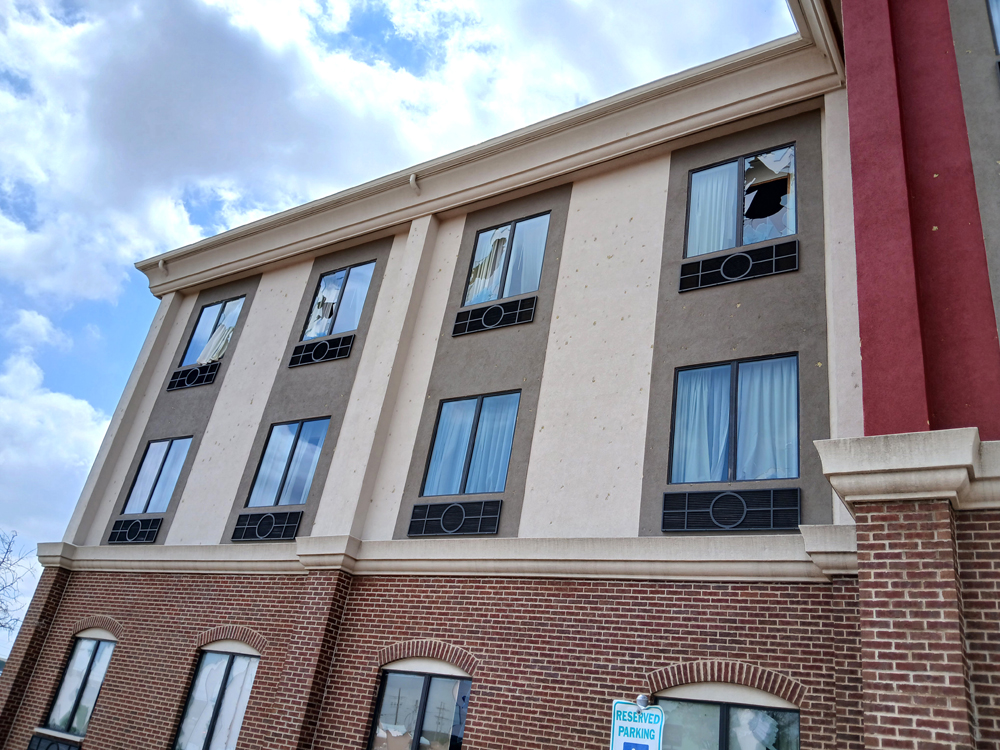
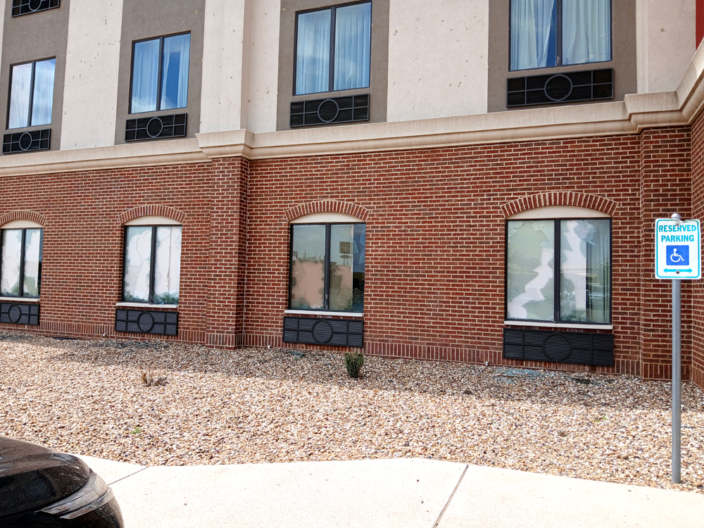
Looks like there is also some damage to the exterior walls of the building, in addition to the broken windows, of which there were at least a dozen.. Don't know how big the hail was there but where I was a couple miles away, as I said, I guestimated 1.5" - and it was wind-driven. Again, not sure how strong the wind was at the hotel, but where I had taken shelter it was strong and there were measured gusts of 58, 66, and 71 mph on the southwest and west sides of Lubbock.
Once I got into my room, I went to get dinner at a Buffalo Wild Wings across the street that was open when many businesses in the area had closed because of the storm. As it turns out, they were NOT going to close for a storm when the Texas and Texas Tech women's softball games were in a national championship series. And the storm did not keep the fans away - the place was about half-full, and LOUD! I love seeing fans get excited and a little rowdy over women's sports!
When I got back to the hotel, I was parked next to a vehicle with a pretty cool chase rig, so I got this picture:
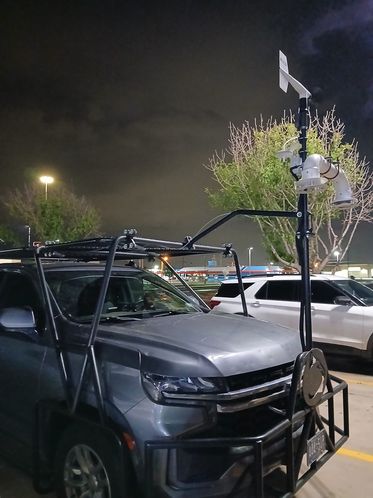
At the upper right of this picture, you can even see a little lightning up in the clouds from the storm we had been chasing, which was now well off to the east. The next morning, as I was loading up to leave, the occupants of that vehicle were doing the same. Turns out they were with the Icechip hail research project, and were from Penn State. I asked them if they got some good hail data yesterday and they said they were kind of distracted by the tornadoes, lol. This was the second consecutive day that I had been on the same storm with the Icechip folks, as I saw a number of LSRs from them on the storm I had chased in New Mexico the previous day.
So what was my tornado count for the day? Minimum of 6, and maybe as many as 9 depending on 1) whether what appears in my video from the first storm with the cloud tags indeed is the first tornado northwest of Rodgers, NM, 2) whether I really have a picture of the Pep tornado - certainly do of the upper part of the circulation, but with the ground part hidden by distance and dust, it is hard to say for sure, and 3) whether the 7:20 and 7:23 pictures show one tornado or two or more. I am counting the satellite tornado northwest of Reese Center because in the pictures and videos that is pretty clearly what it was, even though it does not appear in the damage survey (maybe because it did not hit anything?). Although I missed the most photogenic tornado near Morton, it was still an epic chase day. Not just because I got at least 6 tornadoes - which admittedly were not all what you could call photogenic - but also because of the sheer intensity of this storm. Hail to 5 inches reported. Straight-line wind to 109 mph measured. High wind and large hail at the same time. Many tornadoes. Extensive flash flooding. A sky as dark as I have ever seen an hour and a half or 2 hours before sunset. And one of the widest intense velocity couplets I have ever seen on radar. This storm absolutely had it all, and it was amazing to witness a good bit of it. I would say a top-5 all-time chase, or darn close.
Here is my video of the tornadoes from north of Levelland to near Reese City:
Sorry for the shakiness of the part with the two tornadoes at once. I had started photographing the meso with my phone because it is good at wide angles, and then for some reason I did not switch to my video camera but just kept using the phone for video. Add the darkness, wind, and a little adrenaline, and the video ended up shakier than I would have liked. But still pretty dramatic, I would say.
Here is a map showing my route during the active phase of the chase, along with LSR locations for severe weather I observed (Some of the tornado reports are multiple reports of the same tornado):
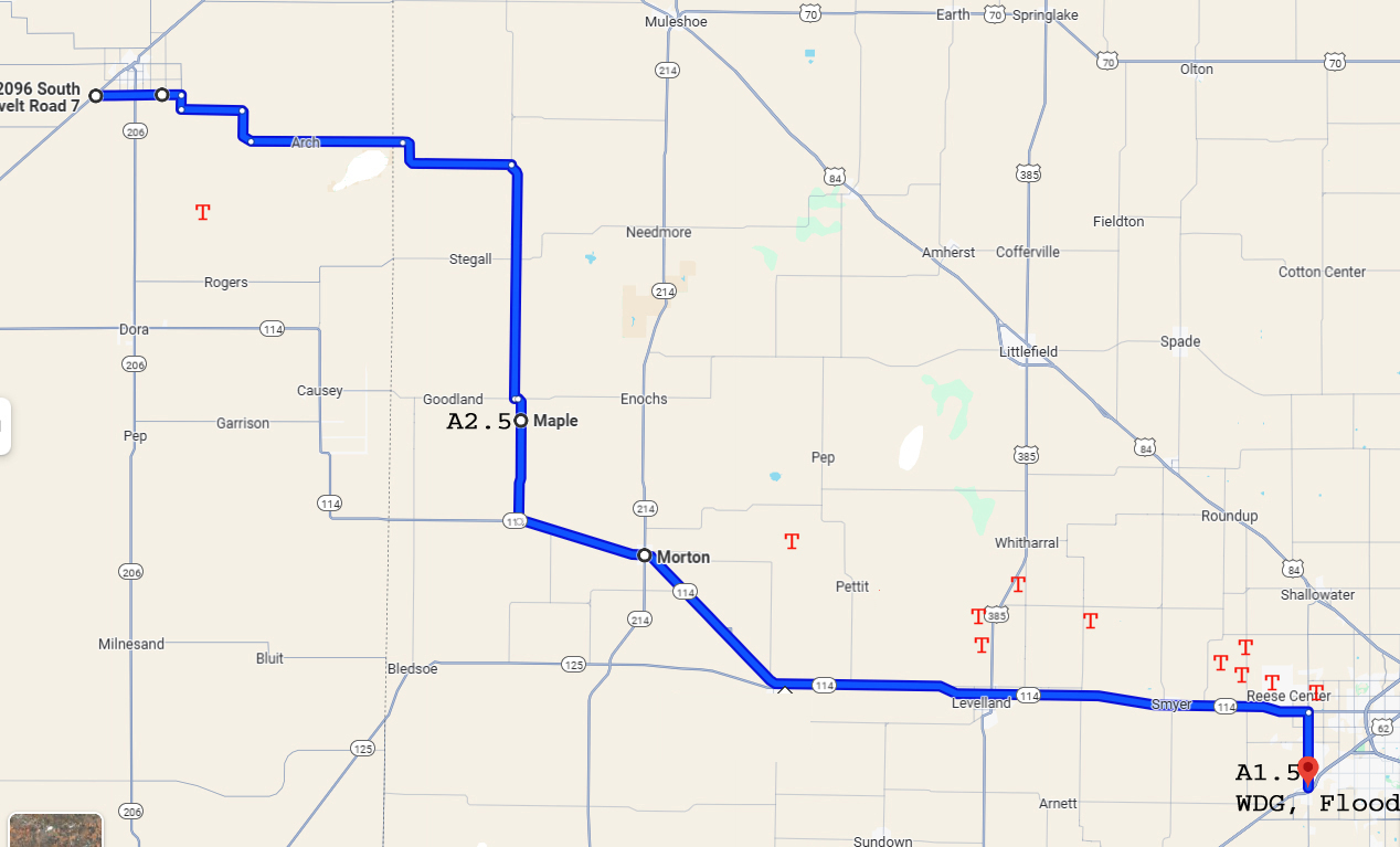
Chase distance for day:280 miles.
Total multi-day chase distance: 1498 miles.