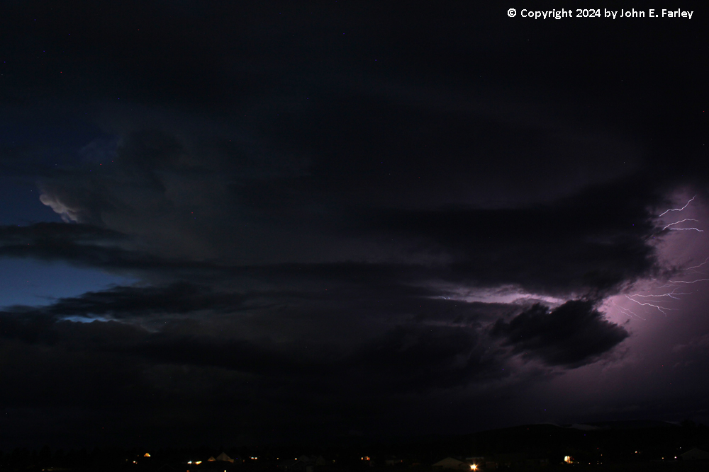
It was not even weather that got me to first notice the storm. After dinner and just after sunset, I decided to go out in the driveway to attempt to photograph the almost-full September super moon. A cloud quickly moved in front of it, but looking back over the house to the west, I noticed that a storm was approaching and that it seemed to have quite a bit of lightning. So, I decided to go to Veterans Memorial Park, which has a fairly unobstructed view of the sky, to see if I could get some lightning pictures. I got there and was set up by around 7:45. There was a nearly-constant low rumble of thunder up in the clouds. As it turns out most of the lightning, though it was very frequent, was hidden within the clouds, but not all of it. With a little light still on the back side of the storm, I got this picture with lightning coming out of the clouds into the air:
A while later, I got this:
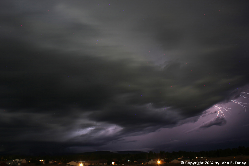
At this point, given the storm structure and the very frequent lightning, I knew I had quite a strong storm and began to wonder if it could be a supercell. It certainly looked like it could be, and it turns out that it was. I had not looked at radar, because once I noticed the storm I could track it visually, and also because my phone has had some issues lately (new phone next week, most likely). As the storm moved closer, along a track that would take it well NNW of me at its closest approach, into north-central Archuleta County between Hatcher Lake and where Piedra Road crosses the Piedra River, it became increasingly evident that it was indeed a supercell:
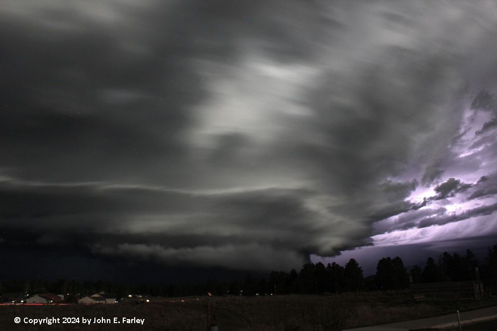
As you can see in the picture, it had a large lowered area that extended fairly close to the ground. Because this was under the main updraft of the storm, I would classify it as a wall cloud, although it did have an attached shelf cloud that extended southwest from it just ahead of the rear-flank downdraft (RFD). Pretty scary-looking at the time I got this picture:
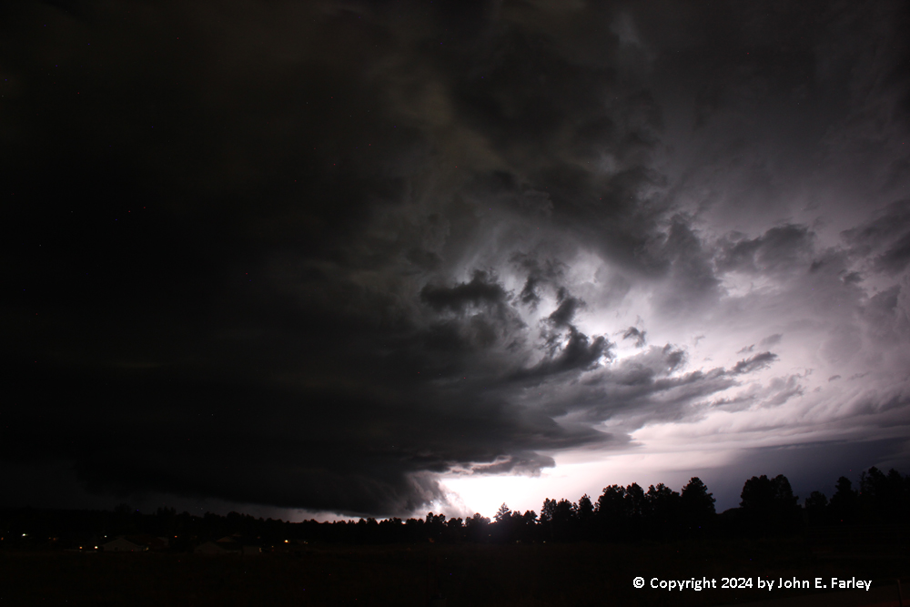
Two things made this storm better for photographing storm structure than most storms at night. First, the lightning in the clouds was very frequent. Thus, it was easy to get storm structure illuminated or backlit by the lightning. Second, the very bright moon front-lit the storm very nicely, especially during the second half of the approximately 50 minutes I was out photographing the storm. That is evident in this picture, taken when the storm was nicely front-lit by the nearly-full moon:
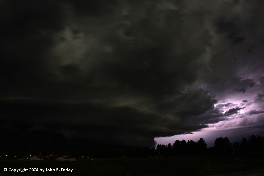
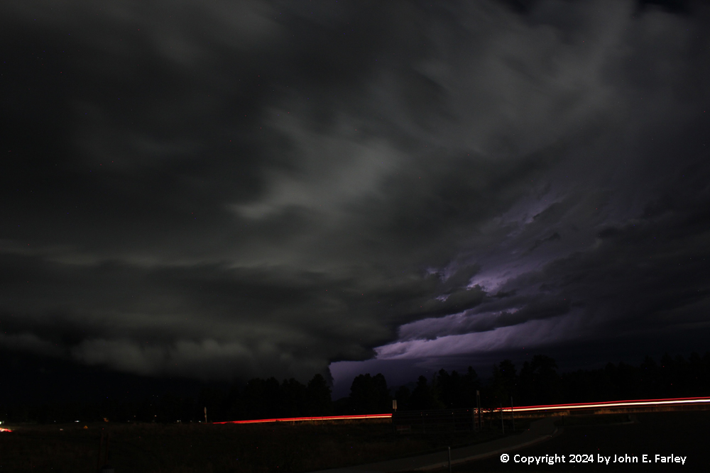
You just don't get night-time storms with structure this easy to photograph very often - especially supercells. Here is another picture, with some car taillights for a little added color:
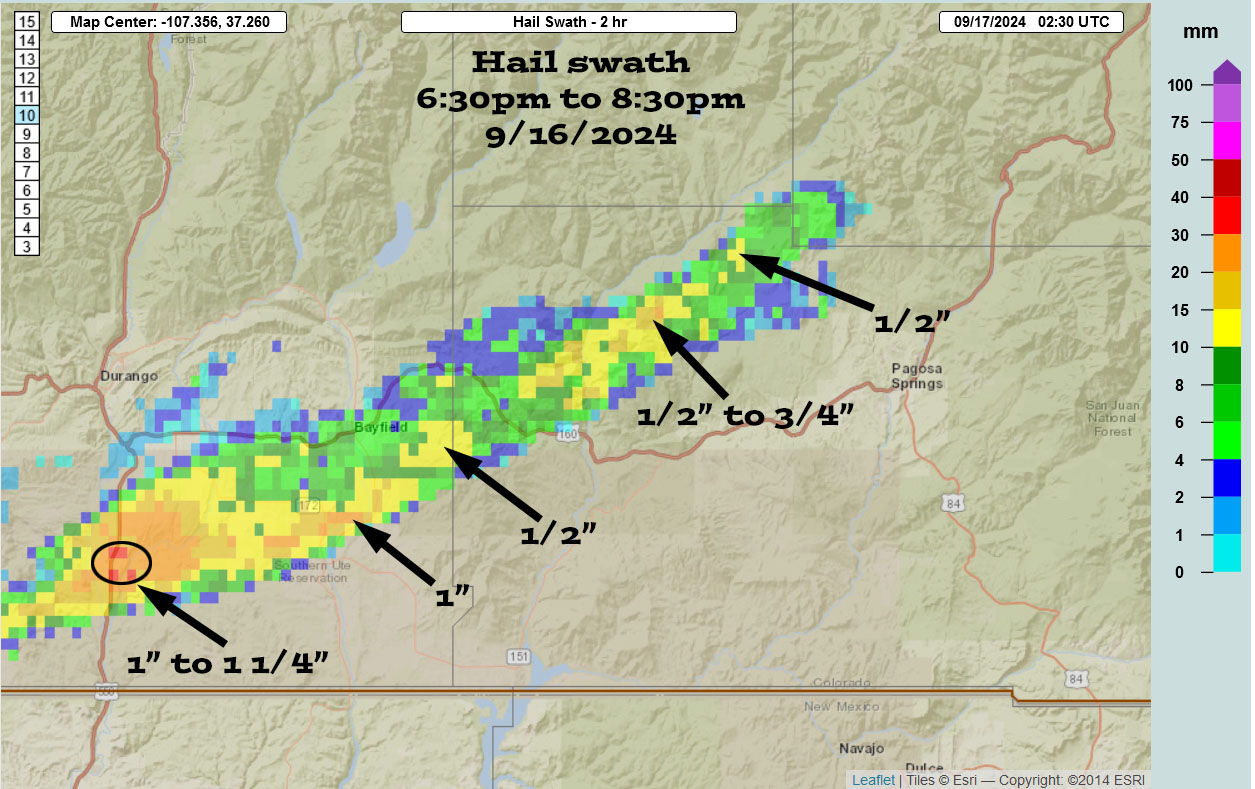
Heck, I have been on supercells in daylight that were harder to photograph than this one. Per radar, this storm produced a swath of hail from southwest of Durango to northwest of Pagosa Springs over the time period from 6:30 to 8:30 MDT. Radar indicated some of the hail up to about half-dollar size. Because the storm, except when it crossed a couple highways, was moving through thinly-populated mountainous and densely-wooded terrain, there is not a lot of ground truth in terms of LSRs, except for a 53 mile gust at the Durango airport, likely from RFD. However, I did see an unofficial report on the Pagosa Weather Facebook page of walnut-sized hail northwest of Pagosa. Not an official hail-size category, but would appear to be somewhere in the ballpark of an inch to an inch and a half in diameter. Here is a map that was posted by Pagosa Weather showing the hail swath, per radar.
By around 8:35, it was evident that the show was over, as the amount of lightning rapidly decreased and my visibility of the storm also worsened due to terrain. Once it hit the colder, more stable air as it neared the Continental Divide mountains, the storm rapidly weakened. It maintained its strength and supercell characteristics longer than I would have guessed, given the relatively low temperatures, loss of any daytime heating, and that it entered an area that had been cloud-covered most of the day. But the surface temperatures were much warmer closer to the Four Corners, and once the storm got going, it was able to sustain itself for quite a while.