I had an enjoyable storm chase today from Center, MO (southwest of Hannibal) to Springfield, IL, on SVR-warned storms all the way. There appear to have been two embedded HP supercell type structures in the squall line, the first of which moved from Mexico, MO to north of Jacksonville, IL, and the second from south of Jacksonville to just northwest or north of Springfield. Keeping ahead of them was a challenge to say the least with reported movement anywhere from 40-75 mph. Both cells produced up to quarter sized hail, and some wind damage and/or measured severe gusts, though there seems to have been more of the latter with the second one.
There was quite a bit of discussion among storm chasers and weather enthusiasts about this day, when a deep low would move from northwest Missouri northeast into SE Minnesota then on into northern Wisconsin, dragging a strong cold front behind it. The following three posts that I made in the forecast thread for the day on Stormtrack summarize the evolution of my thinking on the day's forecast pretty well:
From the afternoon of the previous day:
"I agree on the veering surface winds as a concern - may not be much directional shear by the time the afternoon storms get going. As to overnight convection, I would not write off possible impacts, either bad (stabilization of the airmass, as has happened so many times before this year in IL) or good (laying down outflow boundaries). There is model disagreement on this point - WRF has a lot, GFS much less. In both cases, this is more of an issue northward, but WRF shows overnight and/or morning precip over most of the northern 2/3 of IL. Best case scenario would be good destabilization south of the precip area, and then some OFBs along its southern edge. That might favor a more southern target like Jacksonville, which would be good for me. Right now I'm thinking somewhere around the Jacksonville-Peoria-Lincoln triangle, but lots can (and probably will) still change. I do worry about the limited directional shear, though."
From later that evening:
"The instability doesn't look all that good anywhere in this evening's NAM run. While I agree that the better directional shear in Wisconsin could result in a tornado if strong storms can get going, that is really too far for me to go in such a marginal situation. I'm actually debating between the area just west of STL and farther north between Jacksonville and Galesburg, but actually leaning a bit toward the MO target as the NAM is showing slightly better SRH there. Not sure why, as there is rather limited directional shear anywhere until you get up into WI, although there is a LITTLE directional shear and some speed shear with SSW winds at the surface and strong SW winds at 500 MB and up in both east-central MO and west-central IL. Looks like a situation where a relatively local chase would be OK, but a longer drive would not be warranted - especially given that gas just jumped to 3.79 here in Edwardsville - Yikes! I do think there will be severe storms with the forcing along the CF, and maybe just enough wind shear for a tornado or two in bow/LEWP structures along the squall line somewhere in eastern MO or western IL. Won't be easy to find the needle in the haystack, though."
From the morning of the chase:
"I am still liking the east-central MO/western IL area based on what I am seeing this morning. There is a large relatively clear area in MO behind the band of clouds extending southward from the weakening storms in NE MO/N IL, and as this advects northeast into the target area, it should allow for good heating. The storms in eastern KS are weakening, so I don't think things will get messed up in MO/SW IL by an early squall line. Both the RUC and NAM keep the surface winds pretty much southerly, so there will be some directional shear - SRH predicted up to 400 in some areas. CAPE should be in the vicinity of 1000, maybe 1500 or more if we get good clearing and heating. The models predict plenty of convection this afternoon in eastern MO and western IL. Bottom line: While storm mode is a concern, I am liking this better than anything I have seen in quite a while in this area."
By around noon, a short, narrow line of strong storms had developed from just southwest of St. Louis, near Eureka, MO, southwestward. I thought that, with this activity being ahead of the main front, there might be more potential for discrete storms as opposed to a raging squall line, and it was coming right for me, so I loaded the chase gear in the car and headed out, figuring I could intercept just east of the Mississippi River a few miles from home. After a couple starts due to bone-headed forgetting of stuff, I pulled off I-270 at route 111 to wait for the storms. Since I could get wifi there, I decided to check data, which confirmed what I could already see, which was that the storms in the STL area had quickly weakened. More important, a line of strong storms had now formed ahead of the cold front in central and nothern MO, and SPC had issued a mesoscale discussion noting a rising risk of severe WX ahead of the line and that a watch would likely be needed within an hour. It mentioned the possibility of isolated tornadoes. With the storms now initiated, I decided to proceed to northeast MO, realizing I had just made another boneheaded error - filling my gas tank in IL when gas was 20 cents cheaper in MO. But when I did it, I thought I might be staying in IL if the STL storms had strengthened. Anyway, I figured I would head to somewhere near Bowling Green, MO, where I could intercept the line of storms, then cross the bridge at Lousiana, MO into IL to stay ahead of the storms as they surged east. Soon, my weather radio alarmed to announce the expected watch, but it was for severe thunderstorms, not tornadoes, though it did mention an increasing chance of tornadoes later on in the afternoon.
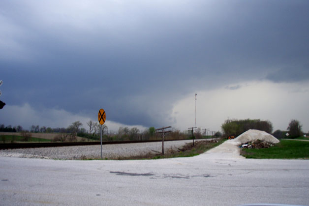
Another data stop in Troy, MO convinced me that the progression of the line was slow enough that I could go on toward Hannibal and reach that area ahead of the storms, and then either cross the river there or backtrack SE to Bowling Green and Lousiana. As I neared Hannibal, I heard the first SVR warning from the STL NWS office just before 3:00 p.m., which included southwestern Rawls County (the county I was in). I had just passed route 19, which goes southwest toward Center and Perry, MO - the latter mentioned in the warning - so I turned around and went down 19. Soon the warning was extended to cover the entire county, mentioning specifically both Center and Hannibal. A mile or so NE of Center, I could see the line of storms to my NW and W, and found a good place to stop, so I parked there and watched the storms for a while. There were lots of ragged, scuddy lowerings and quite a bit of CG, but nothing that looked overly threatening. Soon the sirens begain to blare in Center - I don't know whether they were following the increasingly common practice in MO and IL of blowing the sirens for SVR warnings, or someone mistook the scud for something more threatening - but the sirens blew for 5 minutes or so. By now the storms were getting close, so I decided to retreat back to U.S. 61, where I could backtrack to Bowling Green and cross the Mississippi River at Lousiana. As I did, I could see off to my SW - somewhere south of Center and east of Perry - a feature that looked like it could have been a wall cloud with an inflow tail. This may have been associated with the early stages of the cell I would cross just ahead of near Frankford, MO as it went SVR warned at 3:43 p.m. - with an indicated motion of 65 mph!
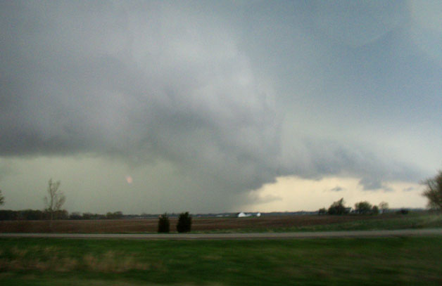
Somehow I managed to keep ahead of this cell as I booked northeast to Lousiana to cross the river - but I could not really see anything until I crossed into IL due the the hilly, wooded terrain in MO near the river. By the time I found a place to stop in the floodplain in Pike Co, IL a few miles northeast of Lousiana, MO, the storm was really getting its act together. (It was here that I realized I had made yet another boneheaded move - failure to erase pictures I had taken on a recent trip from my CF card - which now was full! With no time to figure out what to erase and what to keep, I just switched to the automatic camera I bring as a backup - which undoubtedly resulted in poorer pictures than I would otherwise have gotten.) Just to my west was a greenish core that had developed a distinct shelf cloud:
This intense cell seems to have formed in the outflow area just south of a LEWP (line echo wave pattern, i.e. a kink in the line of storms) where I believe an embedded meso/HP supercell structure had formed while I was blasting through the trees and hills. Here is a view of that feature, looking northwest:
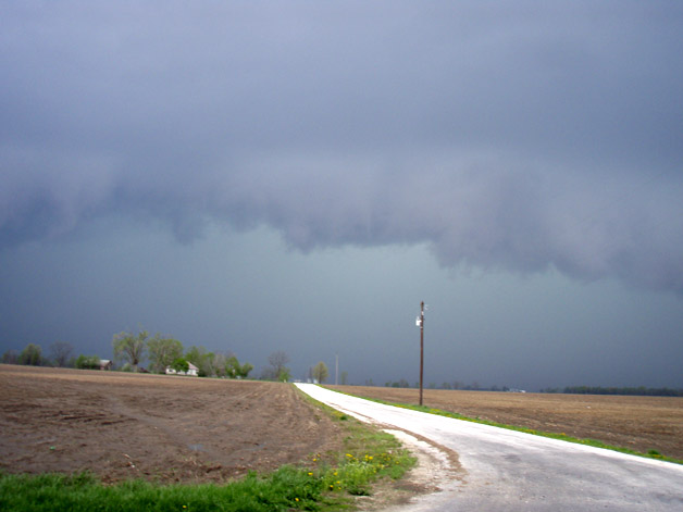
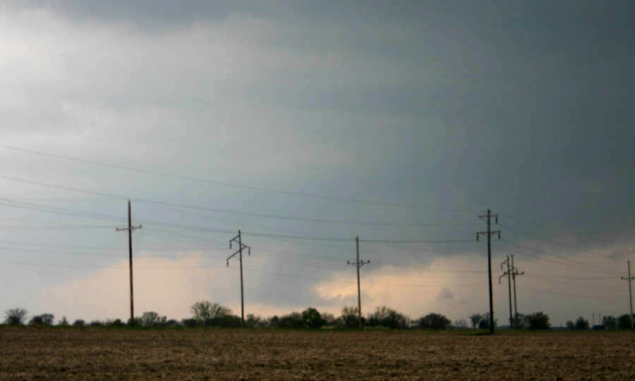
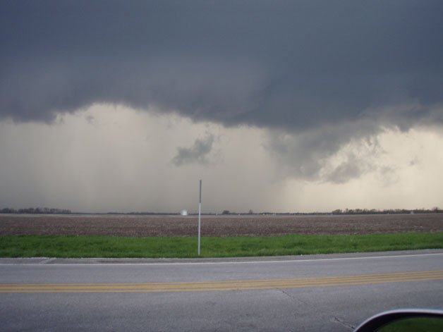
I had to move again, because the core was surging forward and about to overtake me. I thought about cutting southeast along the east side of the flood plain on route 96 to let other cells down the line come to me as I went SE, but decided instead that, with this interesting embedded meso feature, I would try to stay ahead of the storm. The road I was on, U.S. 54, continued northeast for a while but then turned due east and paralleled I-72. If I could get to where the road turned east without being overrun by the storm, I could hopefully stay ahead of it. As I neared where the road turns east, I could see the lowered area at the kink in the line quite well off to my northwest:
Shortly after I took this picture, the storm produced 1-inch hail in Barry, IL, in the general area of this feature. I made it to where the road turns east ahead of the storm, but it was not far behind me, and I got caught behind a couple slow drivers the rest of the way into Pittsfield. I now thought I was about to get overrun by the storm: Going through Pittsfield, I literally could see trees and buildings disappearing in the wall of water 2 blocks behind me, and thought I was about to be swallowed up, but somehow I got out of town and back ahead, continuing east on route 106 rather than going north to I-72 on route 54, where I surely would have been eaten up by the core. As I continued east slowly regaining a little spread between me and the storm, the storm produce additional hail reports to my north, and also a little south of the town of Detroit minutes after I passed through it.
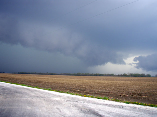
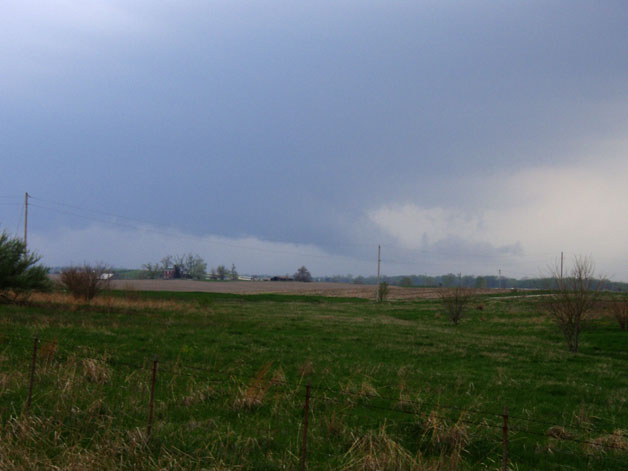
Just before I crossed the Illinois River into Scott Co., I heard that the watch had been upgraded to a tornado watch there and in counties to the east and north. South of there, still a severe thunderstorm watch. The storm, now to my NW, remained severe, blowing the roof off a barn in Exeter, probably around the time I reached I-72 north of Winchester. This picture was taken from the intersection of I-72 and route 106, looking west-northwest in a direction just south of Exeter, about 3 miles away, around the time this occurred.
I blasted east to Jacksonville, stopping briefly just west of town. The storm I had been watching was moving farther to the north, and did not appear as strong. I decided to move farther east on I-72 to stay ahead of the line, and as I did, I noticed a lowering well off to my southwest. It kind of looked like an inflow tail, but also was positioned at the north end of a shelf cloud. I believe it was produced by an intersection of inflow and outflow, as a new kink in the line formed and a strong core developed just to its south. Again, like before, I believe that a meso or HP supercell-type structure formed in the line - and this one, as it turned out, would persist for at least 30 miles to the north side of Springfield.
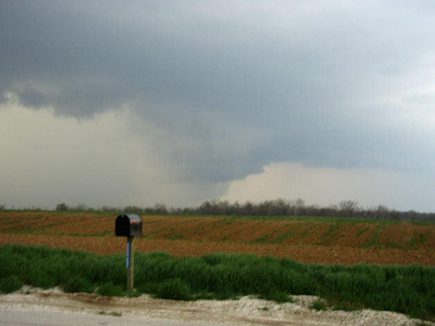
I exited I-72 at route 104 (old U.S. 36) just east of Jacksonville. This road parallels I-72, and I followed it so I could stop where I wanted in order to view the storm. A few miles east of Jacksonville, the lowering I had spotted had evolved into this:
I stayed ahead of the storm on I-72 east into Springfield, as new SVR warnings came out for Sangamon Co., including the city of Springfield. The lowering and the kink in the line crossed I-72 behind me and the core surged along behind me. I got the following picture looking to my NW from perhaps 10 miles west of Springfield:
This would have been somewhere around the time chaser Andrew Pritchard recorded 60 mph wind and dime sized hail south of Farmingdale. Note the similarity of this picture to the above taken quite a bit earlier west of Pittsfield. These are different cells/kinks in the line, but very similar structure.
From this point, I proceeded east to Springfield and decided to head down I-55 toward home. I figured I would still be ahead of the line much of the way and might see something interesting. However, the storms were very linear southward toward STL, albeit with some embedded strong-to-severe cells, and I didn't see a lot interesting except lots and lots of intense CG. I stopped a couple times in the Hamel area to let the heaviest of the storm pass over, but I was between the most intense cells and encountered nothing more than heavy rain, lots of lightning, and 35-40 mph winds.
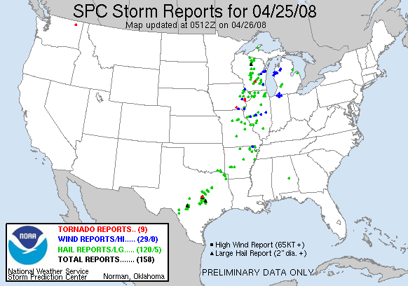
Local Storm Reports from the St. Louis NWS Office
Local Storm Reports from the Lincoln NWS Office
Below is a map showing the approximate route I took (the squiggly blue line, active chase phase only), the approximate paths of the two embedded mesos (the two straight blue lines), and the approximate locations of the severe weather reports (blue pointers):

Return to Weather Observations Page