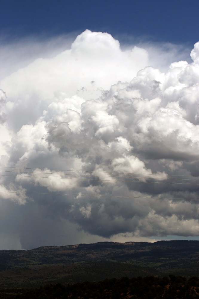
I stopped around 3:30 for gas and to check data at a gas station where US 84 drops SE from I-25. The storms that had developed over the mountains had developed into a messy cluster and were moving on the plains. To some degree, I might be playing catch-up if I went after them, and they looked messy, even though by now they had generated a couple SVR warnings. Also, a new, more isolated storm was just going up to the south of Las Vegas. I figured I could intercept it, then continue south to I-40 and get back on it farther east if it intensified, or go after new storms farther east if they developed. So I dropped southeast on US 84, stopping several miles SE of I-25 to let the storm cross ahead of me as it dropped what turned out to be dime-sized hail along 84. I called this in to NWS ABQ to make sure they knew about this, since the storm was in the area shadowed from their radar by the mountains, and the Cannon AFB radar was down. (This meant that for a good bit of this chase trip, I would be largely reliant on the AMA radar, which actually covers at least far eastern NM fairly well.) After the storm passed, I got this picture a little before 4 p.m. of the updraft base and the hail shafts:
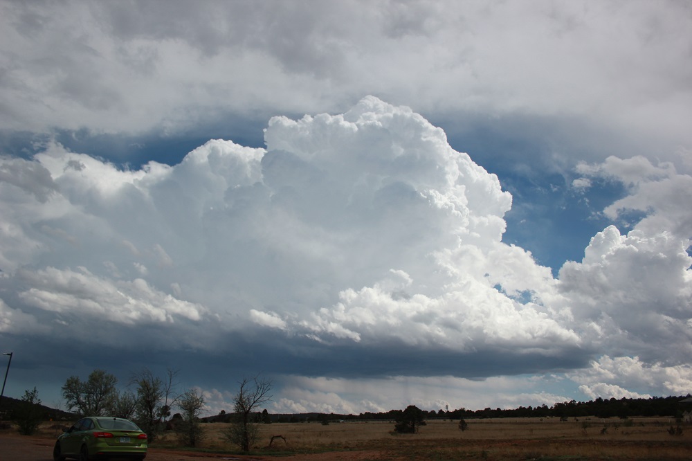
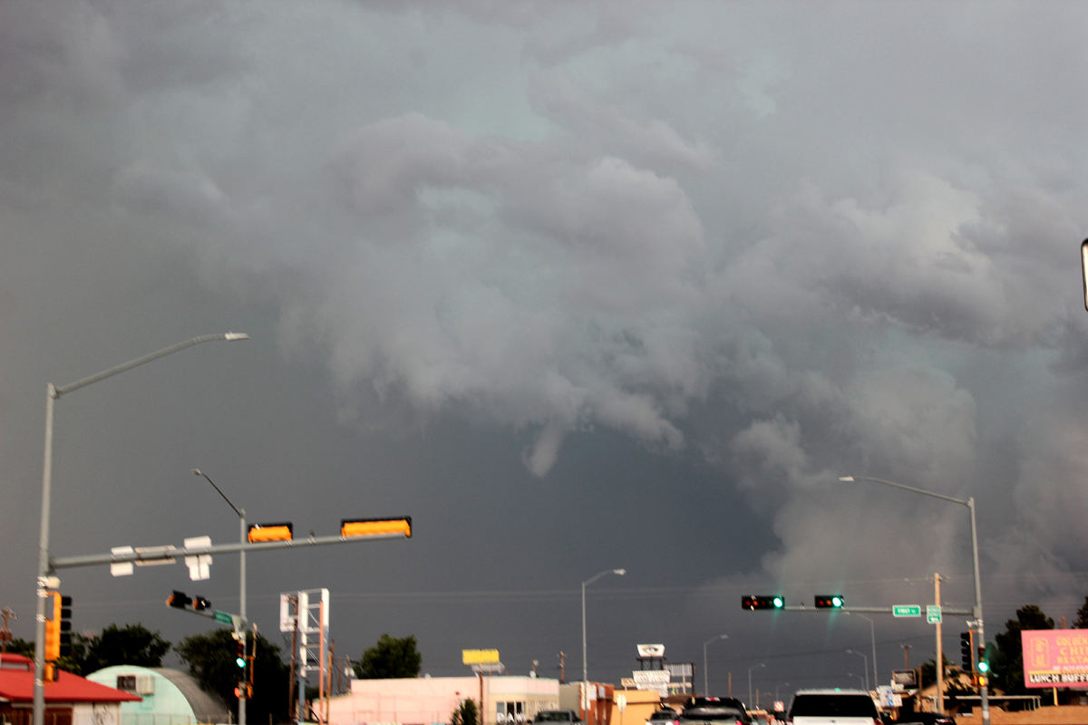
I continued on to the southeast to I-40 and then east on 40, as new storms indeed did go up on the eastern plains northwest of Tucumcari, and as the storm that had developed south of Las Vegas weakened somewhat as it moved onto the plains. So the Tucumcari storm would be my target storm. I got to the first Tucumcari exit around 5:25 as the storm, which had now become a large HP (high-precipitation) supercell and had garnered multiple SVR warnings, was nearing the east edge of Tucumcari, moving southeast. I cautiously approached town on the 40 business loop (old Route 66), seeking to avoid any very strong RFD wind or hail embedded in the RFD. There was pretty strong RFD wind even on the west side of Tucumcari, but no hail. Shortly after getting off 40, I got this picture of the very menacing HP supercell:
As I drove further into town, the storm continued southeast just to the east of Tucumcari, producing a 76-mph gust at the Tucumcari airport, which is 7 miles east of the center of town. This occurred at 5:42 p.m., between the time the picture above and the next one below were taken. This marked the beginnings of a long swath of 75-90+ mph wind that stretched from just east of Tucumcari all the way southeast to Clovis. As I was getting more into town, I also noticed that a small funnel had formed. This did not touch down but may have been a factor in the formation of the swath of intense straight-line wind. Here is a picture of that feature:
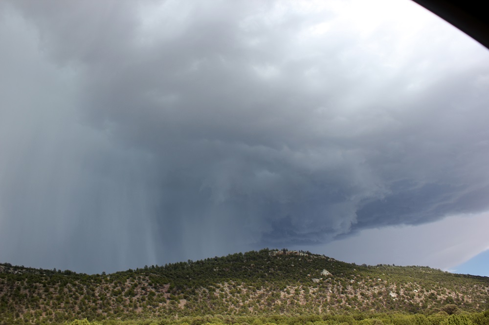
At this point the smart thing to do might have been to have gone south on route 209, but due to poor road awareness and bad experiences with other routes south from I-40 in this area, I did not. Instead, I stopped in town to watch the storm pass just to the east, then probed its path northeast of town to see if there was a hail swath. Turns out there was, but farther east, with multiple reports of 2-inch hail between Tucumcari and San Jon. But where I was there was just a lot of rain (still), strong wind wrapping around the storm from the northeast, and an increasing amount of minor flooding on the road. So I went back to Tucumcari, where the storm still looked impressive even moving away to the southeast. This picture was taken around 6:10, looking southeast from Tucumcari:
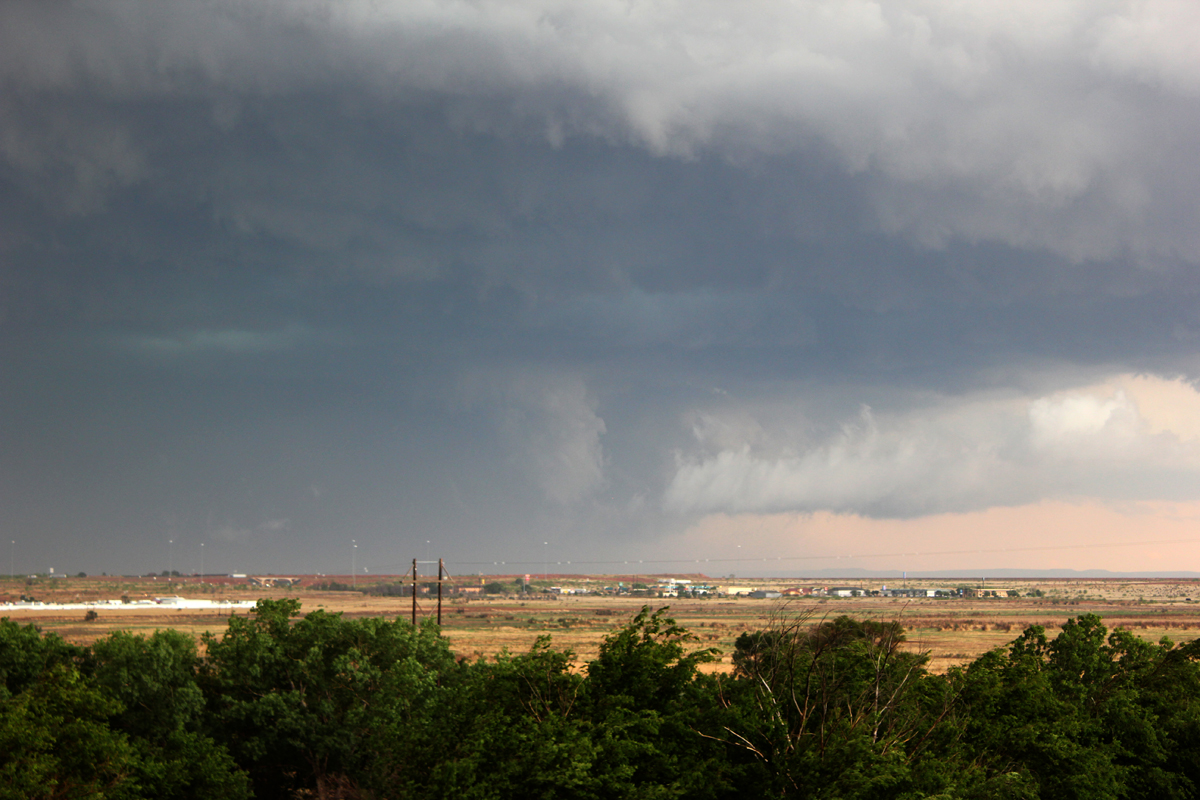
You can see a large lowered area, lighter than the background, near the center of the picture. I would guess this might have been in the ballpark of 10 miles SE of Tucumcari. I could not ascertain any rotation. This was about 40 minutes or so before the tornadoes began near the Quay-Curry county line farther southeast of Tucumcari. Had I gone south after taking this picture, which I did start to do, I might or might not have been able to keep up with the storm enough to see the tornadoes. From what I hear, they were hard to see, even if you were in front of the storm. And by the route I was going to take, south from the Tucumcari Airport exit, I would have eventually run out of paved road, but did not know that at the time. In any case, although I started that way, I ended up getting distracted by this:
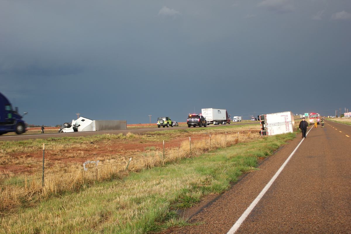
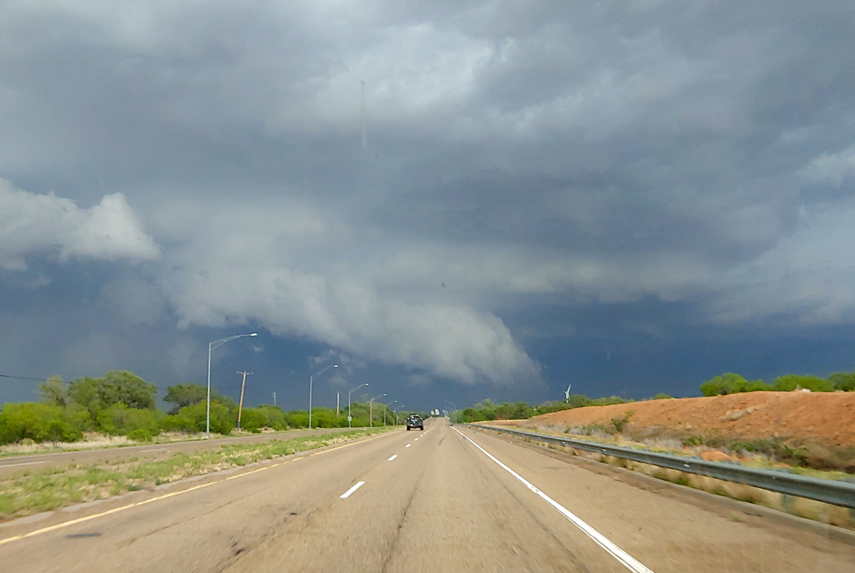
These two semi trucks, travelling opposite directions on I-40, were both blown off the road, to the south, in the same place, about 2 miles west of the airport. A trailer was also off the road right near the airport exit. The fact that the trucks were blown over a couple miles from the airport makes me wonder if the winds there might have been even stronger than what was measured at the airport. In any case, after I spent perhaps 10 minutes going off my planned route to catch up with the storm in order to photograph the trucks from the frontage road, it seemed like the storm was getting away from me, so I decided to head back to Tucumcari to get a room, which I did. However around the time I got to the motel where I ended up staying for the night, I was hearing reports of a "large, destructive tornado" with the storm, near Grady. I knew I was way out of position, but not wanting to pass on even a small opportunity to see what might be a large and persistent tornado, I headed out again and this time did take the road south from the airport exit. Of course, I was on the wrong side of the storm and too far away to see the tornado, but I am glad I went because there was other eye candy. That imcluded this lightning-rainbow combination, from a video capture:
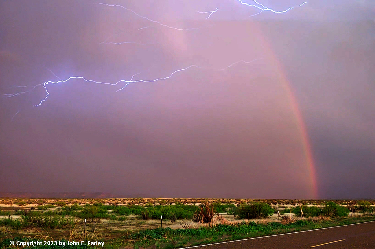
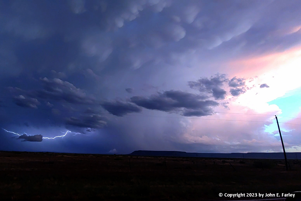
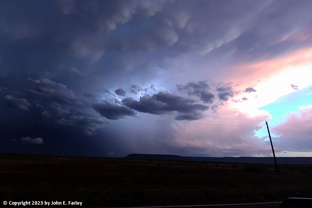
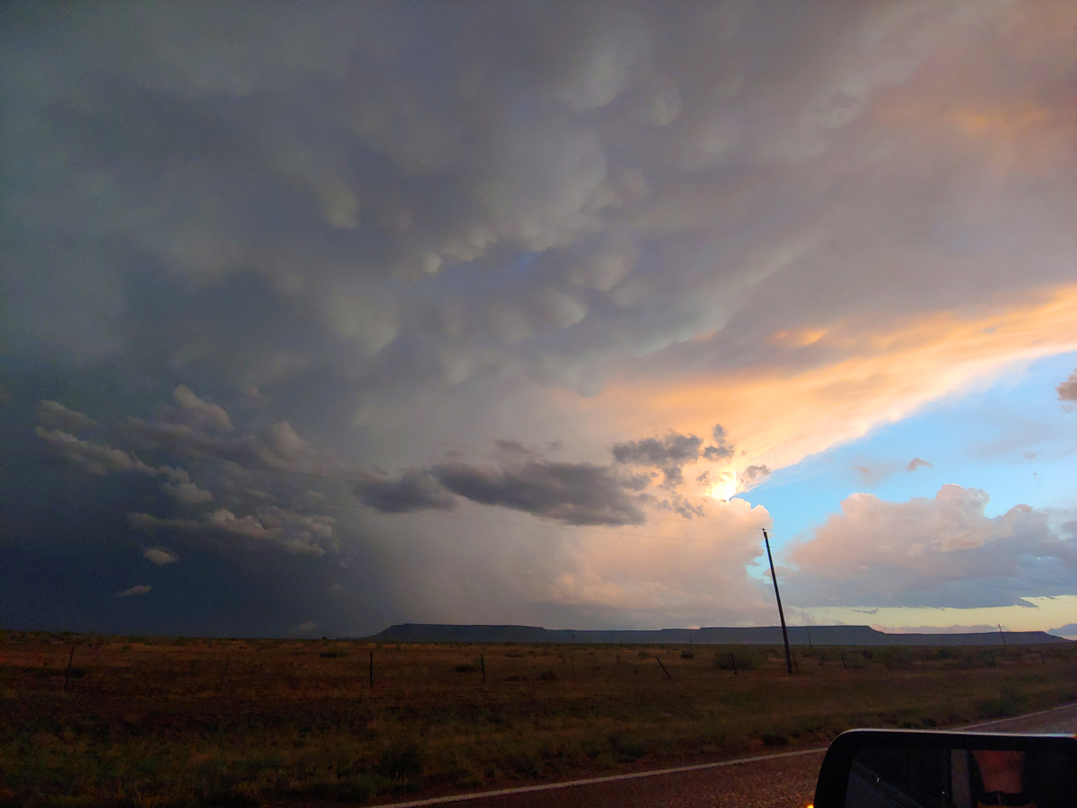
Despite a little rolling shutter effect, I still like this picture because of the colors and the amount of cloud-to-cloud lightning that there was. This picture was taken looking southeast from just before where the pavment ended. No way was I going to risk going further, given the torrential rain that the storm had produced. Also, there was a sign that said the road could be impassible in bad weather. So I started working my way back toward Tucumcari. However, when I got to where the road jogs west for a few miles, I noticed that an impressive sunset view, with mammatus, was developing with the storm and another one that had gone up along its flanking line to the southwest of the main storm. There was a lot of lightning, so I took some video, and was able to pull some nice frame captures of the lightning with the mammatus and sunset lighting of the storm:
After this, I headed back to Tucumcari, stopping for a short time near the airport exit of I-25 to get video of CG lighting that was occurring with a new storm that had formed NE of Tucumcari. Then I headed back into town, and a big suprise. All of Tucumcari had been plunged into darkness after the storm took out the main transmission line from Clovis to Tucumcari. So far as I could see, everything was closed - gas stations, restaurants, fast food joints, pretty much everything. And it was not easy to find my way back to my motel in the total darkness, except for the blinding lights of a number of emergency vehicles at the main intersection (Main St. and Old Route 66), where there may have been a wreck due to the signal lights being out. Somehow I managed to find my way back to my motel, and luckily I had a flashlight in my car. With no place open to eat, all I had was a piece of cake that I had brought with me and thankfully had not yet eaten. So that and some wine I had with me had to pass for dinner. It continued to storm off and on through the night, though non-severe, but Tucumcari, even on the west side of town where my motel was and the big storm had largely missed, ended up getting quite a bit of rain.
As I thought about it, it seemed a little surprising that spending a night in a motel with no power had never happened to me before in my chasing travels over a period of more than 25 years. Considering that we storm storm observers go into areas impacted by storms on a regular basis, you might expect this to happen more. But this was my first time, although I may have sometime or other driven to a different town to avoid it. But in this case I had already booked the motel.
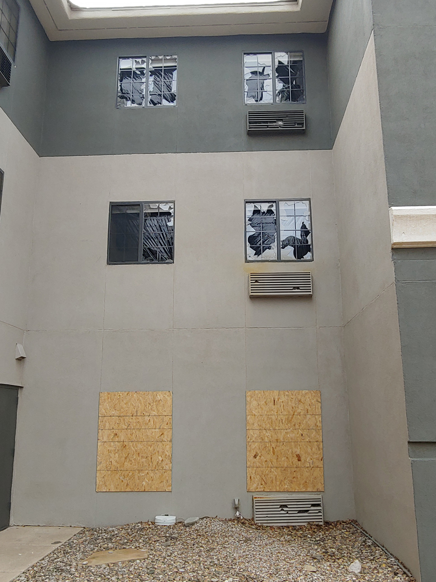
Here is one final photo. It was taken a few days later, on another chase day, but it shows the effects of the storm I chased this day. This was at a motel I stayed at in Clovis. When the storm got there, it was packing winds over 80 mph and still producing 2-inch hail, from around 8:20 to 8:40 p.m. The result was that many north-facing windows were broken out by the wind driven hail all over Clovis, including many like these at the motel where I stayed there a few days after the storm:
Day's chase mileage: approx. 420 miles
Return to 2023 Severe Weather Observation page
Return to Main Severe Weather Observation page