Every time power goes out for an extended time, I am amazed had how dependent we have become on electricity for everything. For example, no food available anywhere in town - all restaurants and fast food joints shut down because of inability to prepare or refrigerate food, or even more so, from what I heard, no way to operate their electronic payment systems. And no internet, even after I managed to recharge my depleted phone in my car the morning of the 25th. You could get a phone signal, but no internet.So my chase day on May 25 began by going 30 or so miles east to Endee,NM to get my first real meal in 24 hours or so. At my first stop in San Jon a bit closer to Tucumcari, they were back open but had no coffee, no creamer if they had had coffee, and no breakfast items. But I found a truck stop (Russell's) with a good restaurant a little farther east in Endee. The huevos rancheros, hash browns, and bacon really hit the spot! Russell's also has an antique car museum worth the stop if you have some down time. After breakfast and gassing up, I headed a little farther on, just far enough into Texas (a half mile at most) to get off at the first exit and go back to the NM Welcome Center, which had wifi where I could look at weather data to get ready for the day's chase. As expected, I would not have to go far. The setup was rather similar to the previous day, with a diffuse dryline setting up just east of the mountans in NM and then shifting east during the day, reasonably good instability, and some directional shear. Wind fields would not be strong, perhaps a little weaker than the previous day, but enough instability and directional shear that supercells would be pretty much a sure thing. And SPC upgraded eastern NM from marginal to slight risk, based on upper winds coming in a bit stronger than had been earlier thought. It looked to me like most of the action would be north of I-40, with CAMS (convection-allowing models) being pretty unanimous in showing a broken line of thunderstorms extending southwestward from the northeast corner of NM and drifting southeast. Again, like the previous day, it appeared that storms would initiate early over or near the mountains, but that more intense storms would develop later, perhaps not until evening, though, farther east, over the eastern plains of NM. So patience, which I do not have a lot of, would be the name of the game.
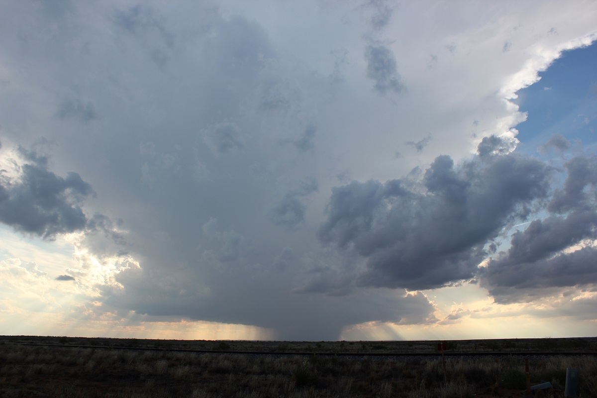
I spent most of my afternoon rather aimlessly wandering around in the broad area north of Tucumcari and east of Mosquero, keeping an eye on the sky for agitated cumulus and in the meantime stopping a couple places to get photos of interesting rock formations. I would see an area where it looked like the cumulus were trying to build up a bit more and head in that directions, only to have them fizzle. There were some real storms over the mountains, but for the most part they stayed there until fairly late in the afternoon, and when they did finally move out onto the plains, it was well north, near the Colorado state line. I thought the storm parameters would be better in the genral area where I was, and that storms would initiate on the plains and become stronger. Which is what eventually happened, but not until after 6 p.m. By around that time, I was on route 402 north of Nara Visa and could see that finally the cumulus were becoming more agitated in a large area to my south. And radar began to show some storm development north of Tucumcari and northwest of Logan. So I headed back that direction, and by the time I got there, two strong, isolated storms were under way, one norttwest of Logan and the other to its southwest, a little north of Tucumcari. I decided to go for the Logan storm, mainly because it would be easier for me to intercept, heading NW on state route 39 as the still intensifying storm drifted slowly SE. Soon the storm went SVR-warned (as did the other one shortly later, IIRC) and clearly was rapidly becoming supercellular.
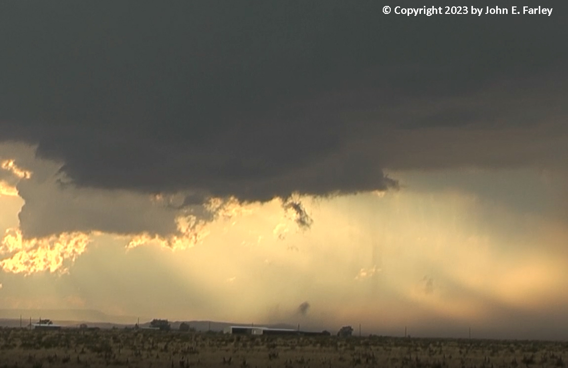
I reached a good viewing point, and once I got on the storm between 5 and 10 miles up route 39 from Logan, I did not need to move more than a few miles over a period of perhaps an hour and a half, as the storm produced multiple reports of golfball hail northwest of Logan. Wall clouds formed intermittently under the meso, and by around 7:30 I was seeing clear rotation in the wall cloud. And then this happened:
I am not entirely sure what to make of this. The wall cloud was definitely rotating at the time, and below it a blob of condensation formed near the ground with a dust cloud underneath. I was too far away to tell whether or not the dust cloud was rotating. It is possible that this could have been a brief tornado, but I really don't know. I sent the video to NWS Albuquerque, and they thought a tornado came close to forming, but probably did not develop a ground circulation. They thought the dust may have been from RFD (the storm's rear-flank downdraft). One experienced storm chaser who looked at the video thought it might have been a tornado because of the way the first condensation forms right near the ground then the feature rose toward the cloud, while another was more skeptical. The lower end of the feature does move away from the core with the outflow, but that can happen with thin ropy tornadoes. So I don't know. You can look at the video and decide for yourself. Here is a video capture of the condensation near the ground and the dust cloud:
Here is another video capture slightly later, as the condensation elongated into a long, thin shape and rose about halfway to the base of the rotating wall cloud:
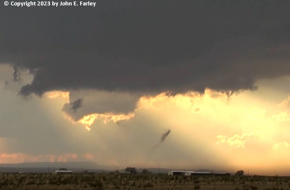
To me, this looked a lot like the ropeout stage of some tornadoes I have seen. Were it not for the fact that it was under a rotating wall cloud and started with a cloud of dust (which as I said, I was too far from to ascertain whether it was spinning or just blown into the air), I would probably discount this as scud, but given the location and appearance, I think it could have been a brief tornadic spinup. There were a lot of chasers on this storm, although by the time the best stuff happened, many had relocated to the other storm closer to Tucumcari, which eventually produced hail up to 3.5 inches in diameter and, for the second straight night, a hurricane-force gust at the Tucumcari airport. Anyway, if anyone else was on my storm and saw the feature above, I would be interested in your take (or anyone's thinking based on my pictures and video).
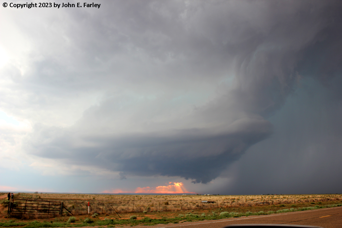
Around the time the above feature appeared, the meso of the storm began to take on the look of a giant top in the sky - beautiful storm structure. Here is a photo taken around 5 minutes after the possible tornado:
When I got around to carefully reviewing more of my video, it also turned out that I had captured video of this feature with lightning. Here is a video capture:

Eventually, as the storm drifted slowly south (I don't think it ever moved more than 5 miles an hour), I needed to move. I was originally planning on getting a place to stay in Logan, but since it now looked like this storm was about to hit Logan, I decided to try to skirt the back edge of the other storm closer to Tucumcari and get a place to stay there. I did get into some hail and needed to wait a bit for the storm to pass, but did make it to Tucumcari and got a place to stay. Then more fun arrived, in the form of a third supercell that popped up west of Tucumcari around 9:30 and drifted into town by a little before 10. Luckily the motel I was staying at had a couple of carports which were empty so I was able to move my car to safety in one of them shortly before the intense barrage of hail arrived. Much of it was dime to quarter-sized, but there were definitely a few golfballs mixed in. Here is some video I got of the hailstorm:
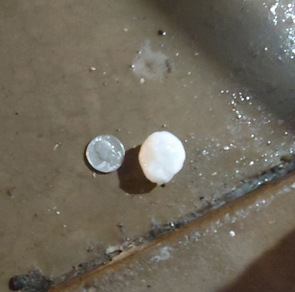
The hail lasted for probably 20-30 minutes and accumulated to a few inches in parts of the parking lot. Here is one stone I used a quarter to measure early in the storm; there were some bigger ones later:
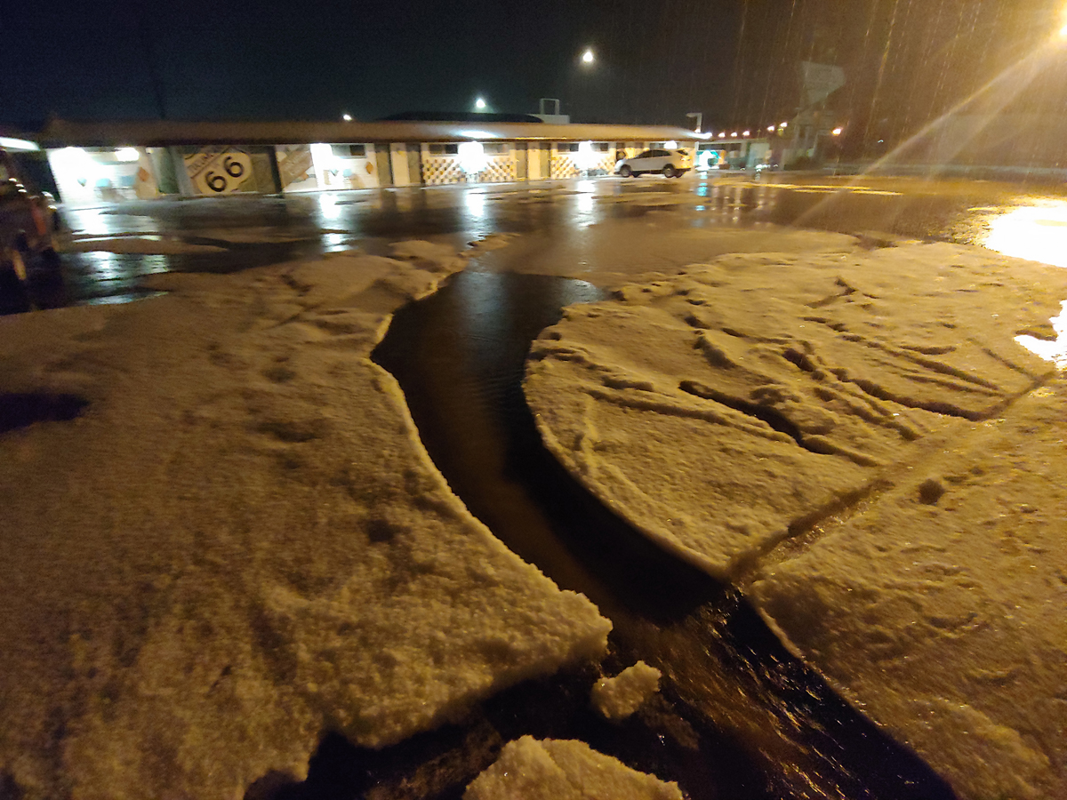
And here is a picture of the hail accumulated in the parking lot:
In nearby areas, there were many road washouts due to flash flooding, including the destruction of a $4 million low-water bridge on old Route 66 that had been scheduled to open soon. You can read the details concerning damage in the Tucumcari area in this Quay County Sun article. As the article mentions the possibility of, Quay County did declare a disaster and apply for state and federal disaster assistance.
Chase distances:
Day's chase mileage approx. 340 miles
Return to 2023 Severe Weather Observation page
Return to Main Severe Weather Observation page