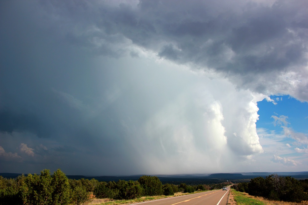
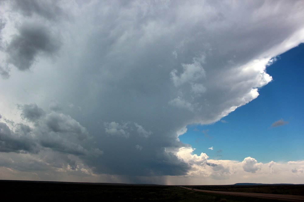
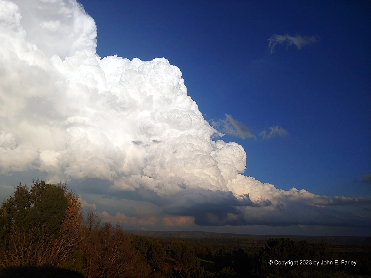
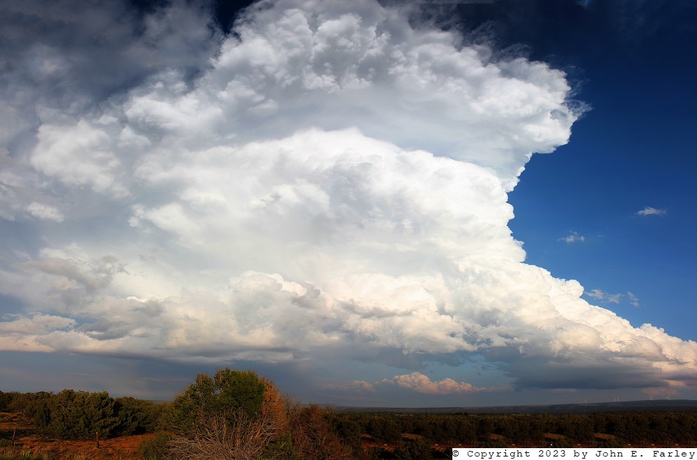
Although storms began to go up early on this day, mostly near and south of Vaughn, they were very slow to become well-organized except for one storm just northeast of Roswell, farther than I wanted to go on the last chase day of my trip, when i was hoping to end up in Santa Fe at the end of the day. There were thunderstorms already as early as 1 p.m., but many of them fizzled out or did not become strong. I drifted west as far as the Vaughn area, only to have the storms I was interested in fizzle out. By around 2, I decided to head up US route 64, which runs NE and SW between Santa Rosa and Vaughn. I thought this way I could keep ahead of some new storms that were around the Vaughn area. There was one very close to Vaughn and another one a little to its southeast between Vaughn and Fort Sumner. Both stayed isolated as they drifted slowly northeast, but failed to strengthen much. A picture of the more northern of these two storms, taken around 2:45 p.m., can be seen here. I hung around the general area of the intersection of US 64 and state route 219, which goes north from 64 from near Pastura eventually leading to I-40 and then eventually to Villanueva State Park. I did consider going up this route for another stronger storm that was to the north, but decided that route would have taken me too far east of that storm. Eventually, after watching the two storms near me seeming to be doing nothing in terms of intensification, I decided to go back to Vaughn and then north from Encino to try to get to that storm. This route involved going through the core of the northern storm, which I did, encountering some hail and big raindrops but nothing too dramatic. By the time I eventually made it up to I-40, the storm I had been after up there had moved farther north and weakened, but in the meantime, a storm to my southeast was becoming increasingly more impressive. I don't know whether this was the storm I had punched through or another that went up in the area. I think the latter, but am not sure, since I had my back turned on that area for quite a while. In any case, when I got to 219 - yes, the same road I had almost driven up but did not - the storm had grown into a decently impressive classic supercell. So I headed down 219 toward Pastura and Route 64, taking the exact opposite path I on that road from what I had nearly done a couple hours earlier. Here is a picture of this storm taken shortly after I turned onto route 219:
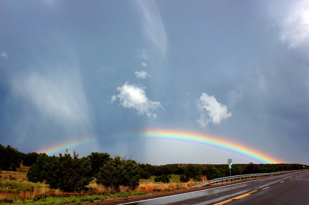
This picture was taken looking south from just south of I-40, around 5 p.m. The thunder coming from the core of the storm was continuous, as it passed over the somewhat lower terrain to my south and southeast. I pushed south on 219, which for a fairly long stretch, jogs somewhat to the southeast. The storm crossed the road in this stretch, and when I got there, there was a swath of hail and a better view of the updraft area of the storm. I took quite a few pictures from there, capturing the storm structure, the hail accumulation, a nice rainbow, and a stream that crossed under the road and was running high and muddy. Here are a couple pictures from there:
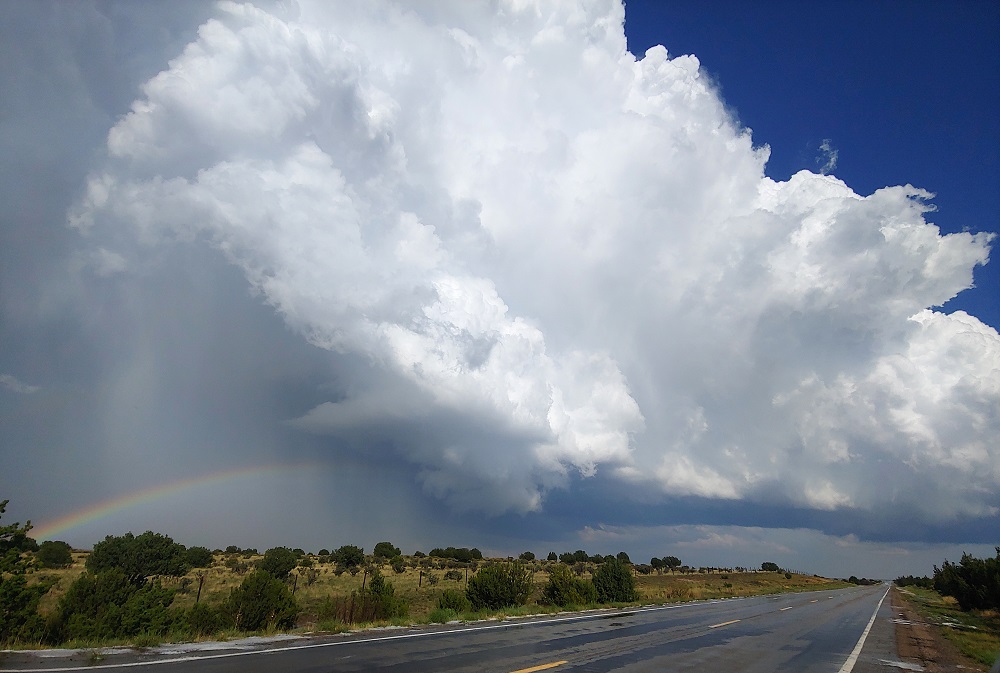
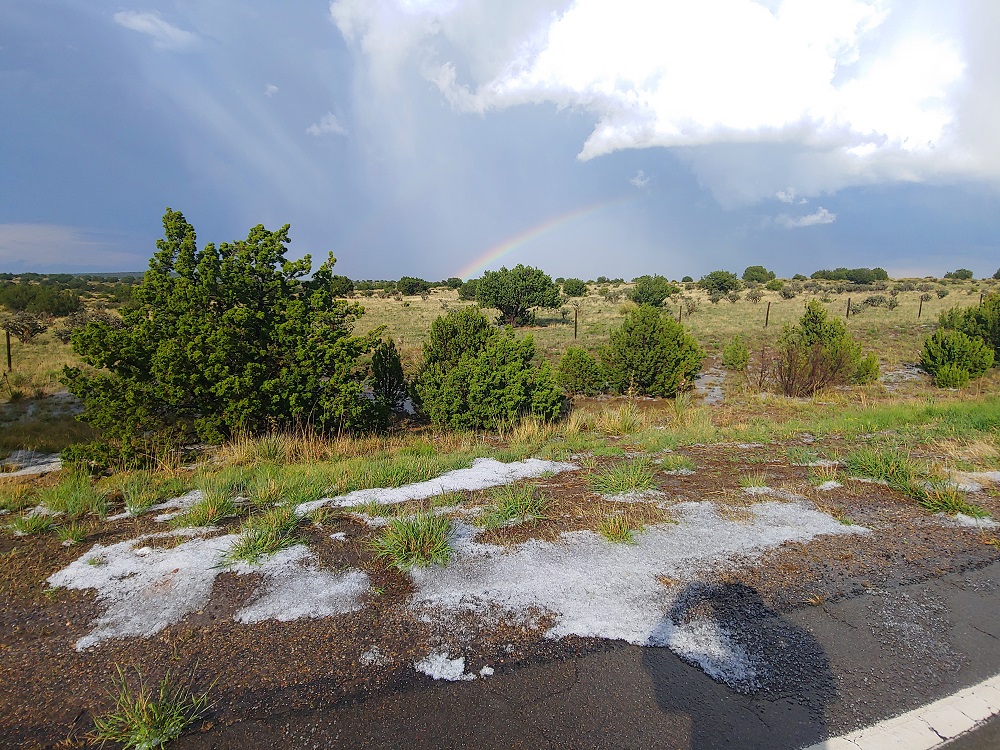
These pictures were taken around 5:15 to 5:20. The hail I found at this location was all sub-severe, but the storm did later get two SVR warnings and eventually probably produced larger hail. As I continued down to 64 and then back northeast toward Santa Rosa, I continued to get nice rainbow and storm structure views:
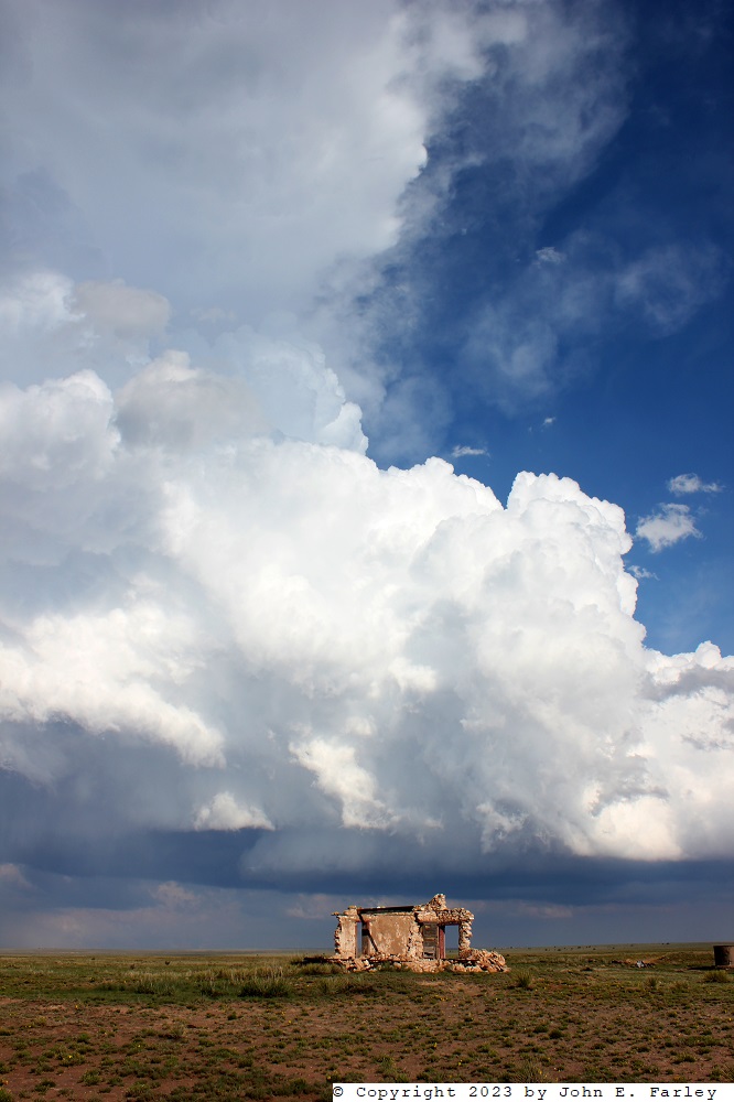
I think the ruins of an old building add some interest to the picture just above. Once I got to Santa Rosa, I went through town and tried to keep after the storm by dropping down 84 toward Fort Sumner. However, the first SVR warning was allowed to expire, the storm had turned more to the right taking it farther from me, and I was not in a good position to see much. It did later get another SVR warning, but by then was well out of my reach. I decided to let it go, head back to Santa Rosa, get some gas and a snack, and call it a chase, heading back toward Santa Fe for the night. However, the storms had another idea, as yet another storm went up almost exactly where the previous one had passed over route 219. Here is a view of that storm a little before 7 p.m., from the intersection of I-40 and state route 219:
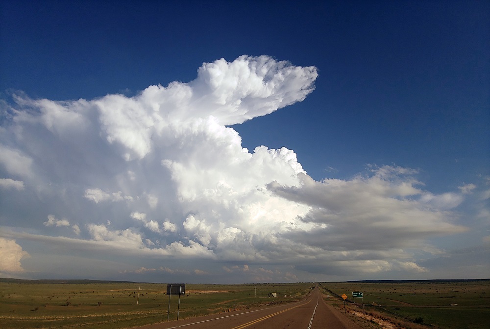
This storm was a gorgeous LP (low-precipitation) supercell, and it called my name. So I headed a ways down 219 again, to get a better view of this storm, ultimately staying with it until about 7:30. Here are a couple pictures, with different degrees of zoom, showing the beautiful LP supercell structure of this storm:
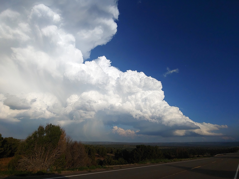
From where I was, the storm filled too much of the sky for me to be able to get all of it in one frame, but I was able to make this panorama photmerge:
This gorgeous LP supercell at the end of the day was a perfect way to end my 4 days of storm observation in New Mexico. Around or shortly after 7:30 I called it a chase for the second (this time really) time, and headed for Santa Fe. The storm moved in a more northeasterly direction than the earlier one had, eventually moving over Santa Rosa and becoming more classic and less LP as it did. I don't think it ever got a SVR warning but I think there were some flood advisories around Santa Rosa, where it produced heavy rain and probably some small hail.
Chase distance for the day: approx. 432 miles
Chase distance for the total trip: 1594 miles