
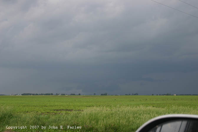
I saw the storms fairly quickly, about halfway to Springfield from Edwardsville, but they proved to be quite a long distance away. By the time I reached Peoria, they looked like they were not too far on the other side, but it was clear by then that I needed to continue farther north, and in fact it was not until I was near I-80 that I got a close look at the storms. I could, about halfway between Peoria and I-80, heading north on IL route 40, see decent looking storms to my NW. This would have been around 3:30 or 3:45. Eventually as I got north of route 17 on some back roads west of route 40, I could see a large lowered area, somewhere between a wall cloud and a big scud mass, with an inflow tail extending from just above it to the NE below the higher updraft base. This was filled in with precipitation behind it and looked progresslively more like an HP imbedded in a line (which, except for the lowered area, looked rather high-based). However, the lowering persisted in some form for a half hour or so as I got closer. I heard about the TOR warning for Whiteside County for the another area of rotation up the line to the northeast from the area I was watching, but knew I could not get to it.
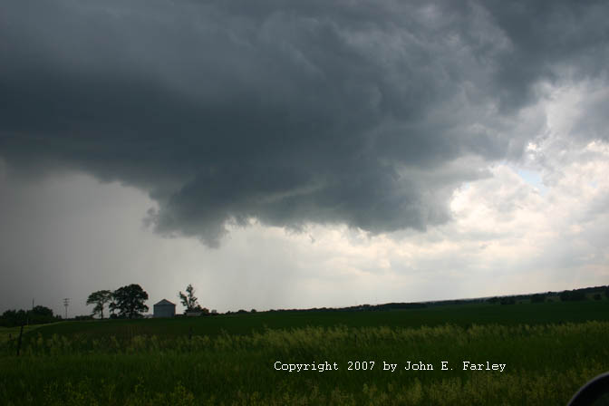
All the while I was watching this storm, I had been looking over my shoulder at another storm developing to my southwest. By around 4:30, this storm was looking good, and I shifted my attention to it. Soon I saw rising scud under the updraft. Shortly later, near the intersection of IL route 40 and I-80 around 4:40 p.m., the rising scud morphed into this nicely-backlit wall cloud:
This photo was taken looking SW from about a mile north of I-80, just before a SVR warning was issued for Bureau County (my location) based on radar indication of a severe storm over Buda, which was in the core, about 5 miles south of my location. The wall cloud had some brief, weak rotation, around the time this picture was taken, but it never came close to producing. This storm was part of a cluster that developed in the area I had been watching off to my SW as I was watching the main line of storms to my north and northwest that prompted the TOR for Whiteside Co. The Buda storm soom merged with the next storm to its south, and the wall cloud dissipated at that time. After this I thought about blasting east on 80 to try to get back ahead of the storms, but that would have required going right through the core and I was not up for that. There were some other chasers on the front side of the storm at this time, and it did produce some additional rotating wall clouds, but I could not see them from my angle.
Figuring I could not regain position on this storm, I decided to work south and hope to eventually find a good spot to poke east and get back ahead of the storms. Options for doing this were limited, due to limited places to cross the Illinois river. But the real problem is that, much south of I-80, the storms quickly became weak and isolated, and were not backbuilding into the juicy air to the south in west central IL to anything like the extent that I had expected. Maybe this area was just too far from the upper dynamics, which were strongest to the northwest, closer to the Dakotas upper low. Later, though, I did manage to get a nice rainbow shot south of Bradford:

As I headed home, I noticed isolated cells just southeast of Peoria and later, to the ESE of Bloomington-Normal. I went southeast on I-74 to check these out, but they just could not really get their acts together, so around 7:00 I broke off the chase at Le Roy and headed home.
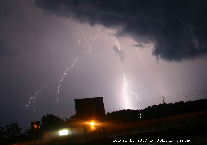
On the way, home, though, I was treated to a nice show of sunlit storms and lightning courtesy of the cluster of storms that moved through the STL area in the early evening.
Near Divernon, IL, looking SE:

From east of Edwardsville, looking NE:

Another lightning pic from the same location can be found here.
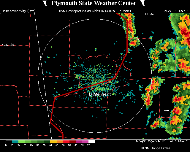
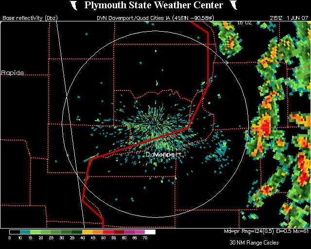
Here are a couple radar images from around the time I saw the wall cloud. The first image is from 4:38 p.m., about the time the wall cloud formed, just before the SVR was issued. The white arrow in the lower right portion of the picture points to the storm. Note that this cell has the highest radar reflectivity (over 60 dbz) of any of the cells in this area. The next image, from 4:51 p.m., shows that the storm I was watching and the next one south had by then merged, producing heavy precipitation over I-80. At this time, the intensity appears to be slightly less, but the area of heavy precip is quite large, now that the two cells have merged into one.
Return to Weather Observation page