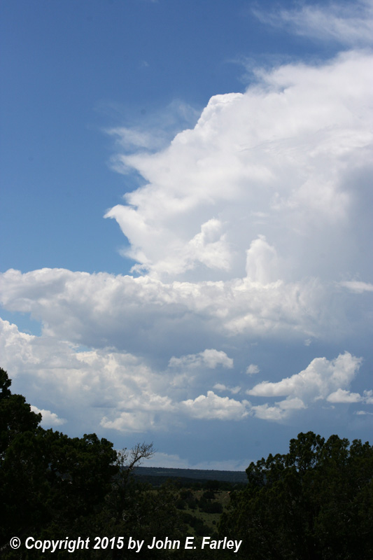
By lunch (around 12:30) in Tucumcari, I was watching distant development near Las Vegas, NM. With only fair-weather cumulus closer to my location, it did not look like anything was going to go up any time soon close to Tucumcari. I could see other towers going up at various places southwest and northeast of the Las Vegas storm, so decided I needed to get west or northwest - and headed west out of Tucumcari on I-40. As I went, I could see another tower going up east or northeast of the Las Vegas storm, and this somewhat closer storm quickly began to look increasingly good. So, I exited N at Newkirk, and worked way irregularly NW to the junction of 104 and 419, just north of Variadero. This was a decision point - head west for the storm near Las Vegas, or north for the more eastern (and somewhat closer) cell, which was located somewhere to my northwest. There was no direct route to it, as a high escarpment stretched from the NE to the SW between me and the storm. But I could likely get to where I could get a decent view of it if I neaded NE on route 419 to where it comes up and out of the canyon west of Mosquero. Once I had gotten a few miles off I-40, I had no data, so could only guess the location and intensity of the storms from what I could see visually. That included the tops of the storms, but not the base because the high escarpment blocked that view, especially for the storm I had decided to target. But just looking at the top ensured me that I was going after the right storm, though it was not clear exactly how well the path I was taking (the only one that existed, really) would work.
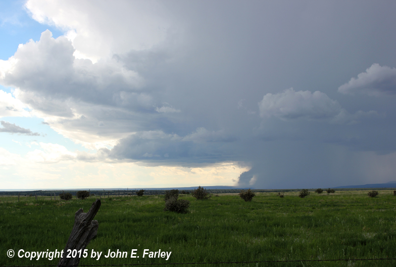
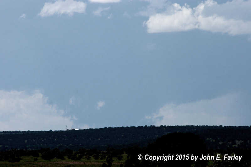
When I finally came out of the canyon W of Mosquero around 2:50 p.m., it was clear that I had made the right choice. Looking to the WNW, I could see from the base of the storm to its overshooting top, and could see that there was a lowering right under the updraft. As I watched the storm for a few minutes from the gravel road that goes north from where 419 comes out of the canyon, it produced large, solid-looking lowerings that appeared to reach the ground:
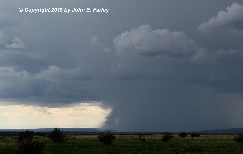
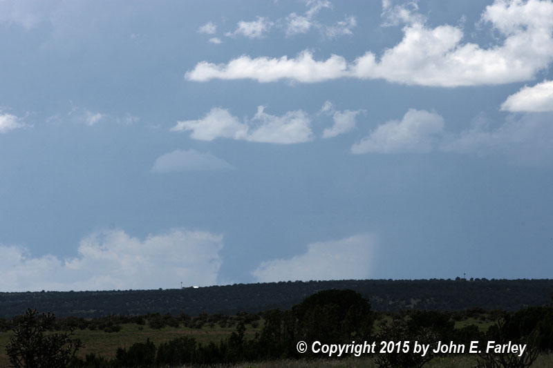
I thought I might be seeing a tornado, although with the storm around 40 miles away, it was at first impossible to tell. I tried my phone to see if I could get data again (I could) and determined that the storm was located near Wagon Mound, NM and was SVR-warned. I zoomed in as much as I could with both my still-camera telephoto (75-300) lens and my video camera. Although in the rather bright light I was in at the time I still could not tell, these zoomed photos and video, when viewed later, suggested a somewhat scuddy, non-rotating lowering, not a tornado. Also, the appearance that it was reaching the ground may have been an illusion, because there was an area of somewhat higher ground between me and the storm. These lowerings were under the updraft, so may have been legitimate (though non-rotating) wall clouds, or they may have been condensation created by microbursts that was subsequently drawn back into the storm's updraft, a process that occurred several times later when I had a better view. So, what I was looking at was an intense but non-tornadic supercell. Intense enough, though, that I now saw a report of a foot of quarter-sized hail a couple miles north of Wagon Mound. This occurred at 2:57 p.m., or while I was watching the storm from this raod.
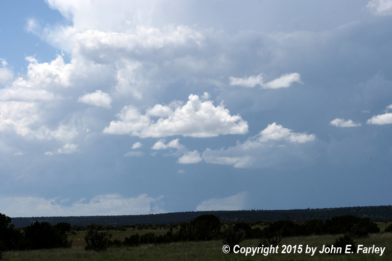
I went north, with occasional stops for video and photography of the storm, on a gravel road that runs from 419 at top of climb out of the canyon to route 39 between Roy and Mosquero - I think it was called Ross Road but am not sure about that. After going northwest a little on 39 (now around 3:20 p.m.), I then turned south, then west, then south again, on other gravel roads SW of 39 and south of Roy. I made two long stops, one perhaps 3 miles south of Roy where the east-west road T-intersects with a north-south one (starting around 3:25), then a couple miles farther south where that road ends (from about 3:40-4:10). I could now see much more clearly what was going on, as the storm was closer (maybe 25 miles away) and I was in a high spot with a totally unobstructed view of the storm and the plains beneath it. Lowerings, often near the ground, appeared to be forming from condensation triggered by wet microbursts/rainfeet. The storm was still SVR warned, and in fact stayed that way from 2:50 p.m. to 6:45 p.m. with multiple warnings. Condensation repeatedly formed near ground just above rainfeet or at the leading edge of the surge of rain and hail, then would be pulled into the updraft:
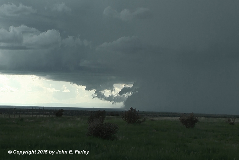
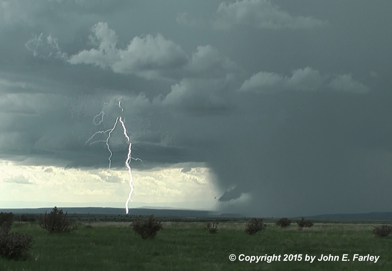
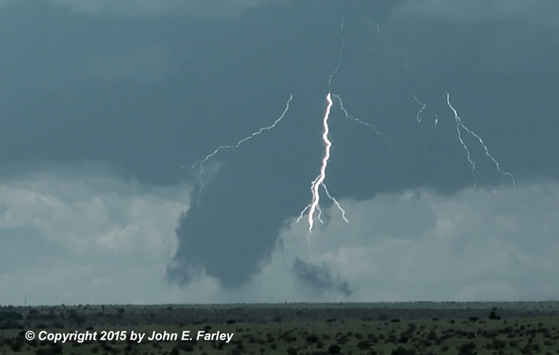
There certainly were times in this process when an untrained eye, or even a well-trained observer looking only at the still images, might think there was a tornado. But there was not - the microbursts were creating condensation near the ground, which was then being drawn back up into the storm's updraft. It is likely that there were some pretty high winds at this time, but the storm was in a very thinly populated area, so there were no reports. The storm at this time was moving slowly to the SE in inaccessible terrain to my west. At times it was quite electrically active:
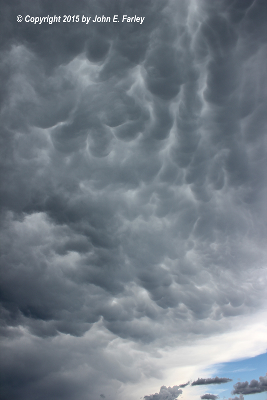
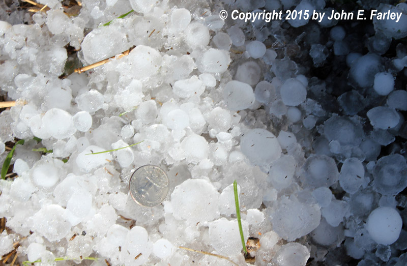
The anvil was being carried by the upper winds directly over my head, with occasional rumbles of thunder and mammatus directly overhead. Eventually the updraft area became obscured by rain, so I circled the north side of the storm to Wagon Mound and on I-25 to Las Vegas. I did make a short side trip north of Wagon Mound on the I-25 frontage road to check out the reported large hail accumulation north of Wagon Mound. There was a narrow swath of deep hail accumulation starting west of I-25 around 3 miles north of town, extending southeast from there across the freeway and on for several miles with lesser amounts along and south of route 120 east of town. The hail north of town was reported by the Highway Department as a foot, but I found 4-5 inches about an hour after storm. Probably there was more than that earlier, but I would guess a foot only where it washed or was drifted. Also, although the hail size was reported as quarter-sized (1" diameter), I found stones larger than a quarter, to around 1.25-1.5" in diameter. And although it was now more than an hour after the storm, the snowplow was still working on the frontage road:

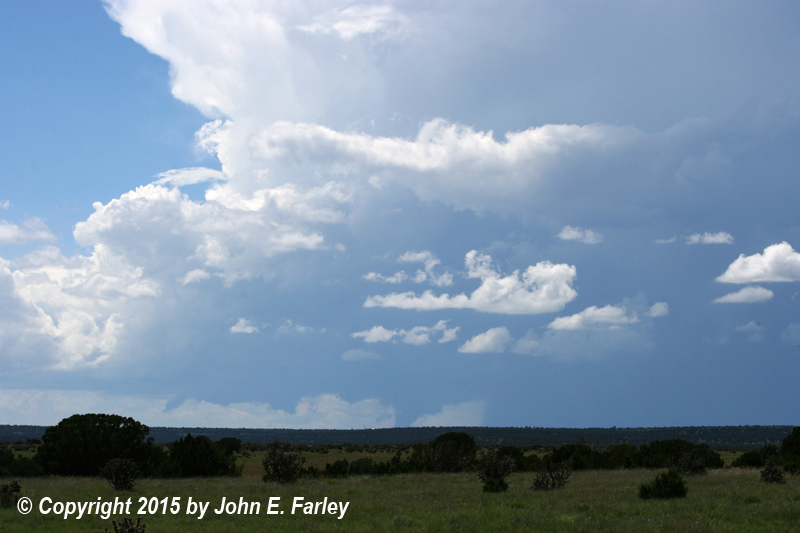
I got one last look at this storm, now from completely the opposite side from where I had first seen it. The storm still looked just as intense, still showing an overshooting top and a lowered area under the updraft, and it was still SVR warned. But it was clear to me that I could not catch up with it again, given its movement now away from me and the very limited road network.
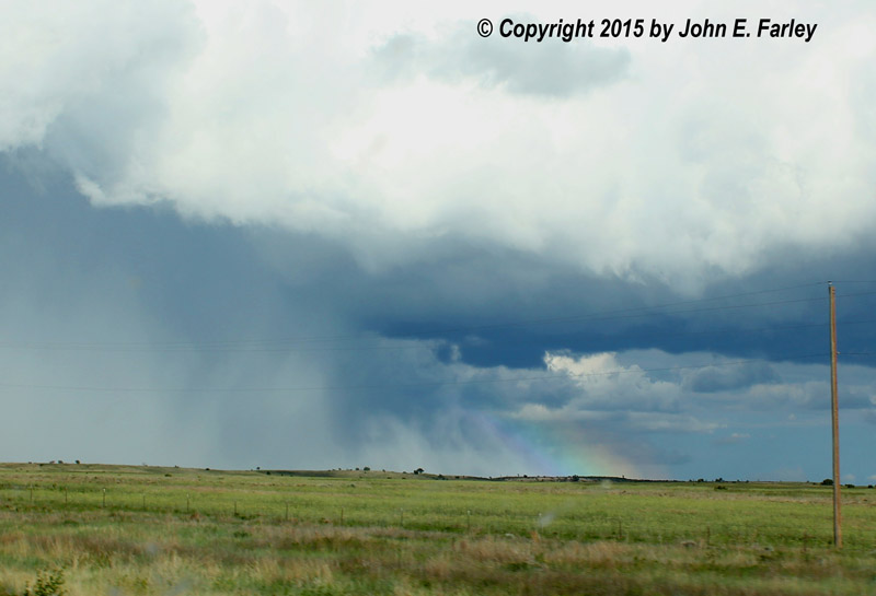
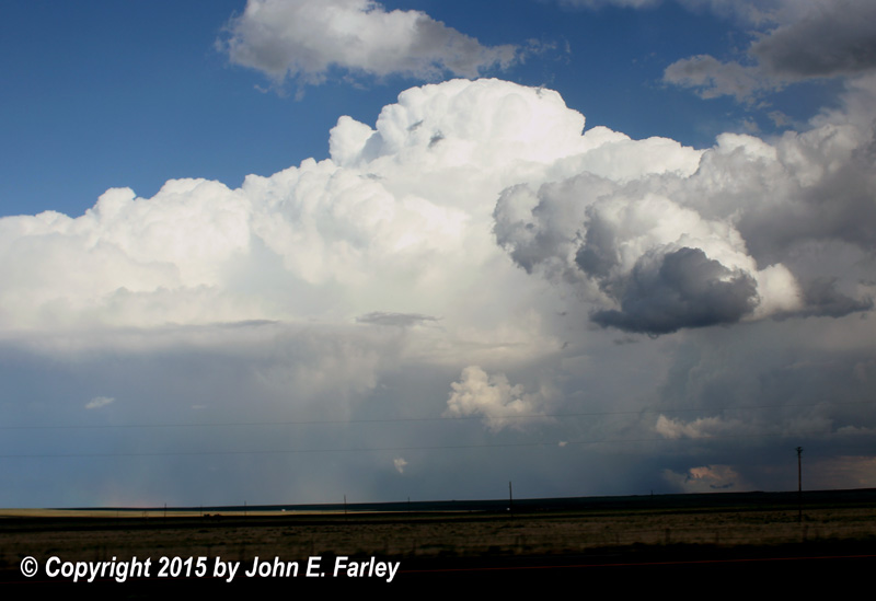
But the chase was not quite over yet. I noticed another intense storm southwest of the one I had been chasing, and closer. I quickly realized that this was original one that I had watched go up near Las Vegas several hours earlier. This storm was a very slow mover. It had lingered near Las Vegas for some time, and even now was just 10 miles or so SE of Las Vegas, but in inaccessible terrain. I proceeded to just east of Las Vegas and stopped to look at it from there, perhaps 10 miles to my southeast. I was treated to a great view of a spectacular sunlit supercell with a rainbow, an occasional rainfoot, and lowerings from time to time under the updraft. This storm was not as intense as the other one - it never went SVR-warned though it did get a special weather statement for penny-sized hail and 50 mph wind. But it was a beautiful storm:
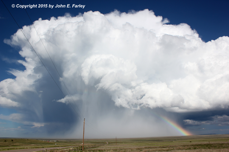
One interesting thing that happened with this storm was that a rainfoot that formed with the precipitation wrapping around meso positioned itself perfectly to get a rainbow that was visible only in the rainfoot, well ahead of the main precipitation shaft:
I tried to chase this storm SE of Las Vegas on U.S. 84 after it moved away from my vantage point east of Las Vegas on 104. However, the storm was to my east, with my view again blocked by a high ridge. By the time I was out of this canyon SE of Las Vegas on 84 and could see storm again, it was weakening so I called it a day and headed for Santa Fe.
Below is a 5x timelapse video of the supercell and a microburst along of its leading edge, set to music. This video shows well the process of condensation forming above the microburst and then being lifted up into the storm's updraft. It also shows the forward surge of the leading edge of the storm during the microbursts. Note, too, that as the microburst surges southeast (right to left), the inflow in the clouds above is coming into the storm from the opposite direction, i.e. from the southeast to the northwest. This video was taken from a few miles south of Roy as the storm was located southwest of Roy, just before it got so far south that the rain obscured my view. Here is the video:
Finally, here is a radar summary of total precipitation from the day's storms. As can be seen on the radar, there were three supercells that tracked from NW to SE in the NE quadrant of NM - the two I observed, and another that tracked southeast from NW of Clayton to near Hereford, TX. This storm also produced copious hail in the 1-1.5" range. You can also see that the supercell that initiated near Las Vegas has the shortest track. This is due mostly to its slow movement, as it was the first of the three to initiate, although it also did dissipate before the other two. The storm I mainly chased tracked from NW of Wagon Mound to SW of Tucumcari, and had a longer track than the Las Vegas storm, mainly due to its somewhat faster movement. The fastest mover of the three was the Clayton one and for this reason it had the longest track, even though it was the last of the three to develop (though probably also the last to dissipate).

Chase distance for the day: 455 miles
Return to 2015 Severe Weather Observation page