Storm 1: Timpas to Toonerville, CO Supercell
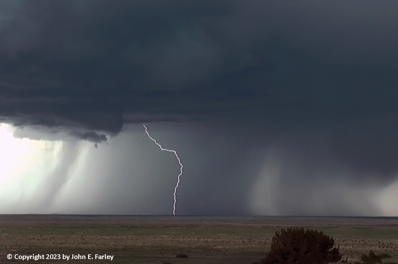
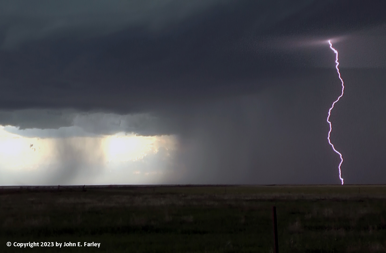
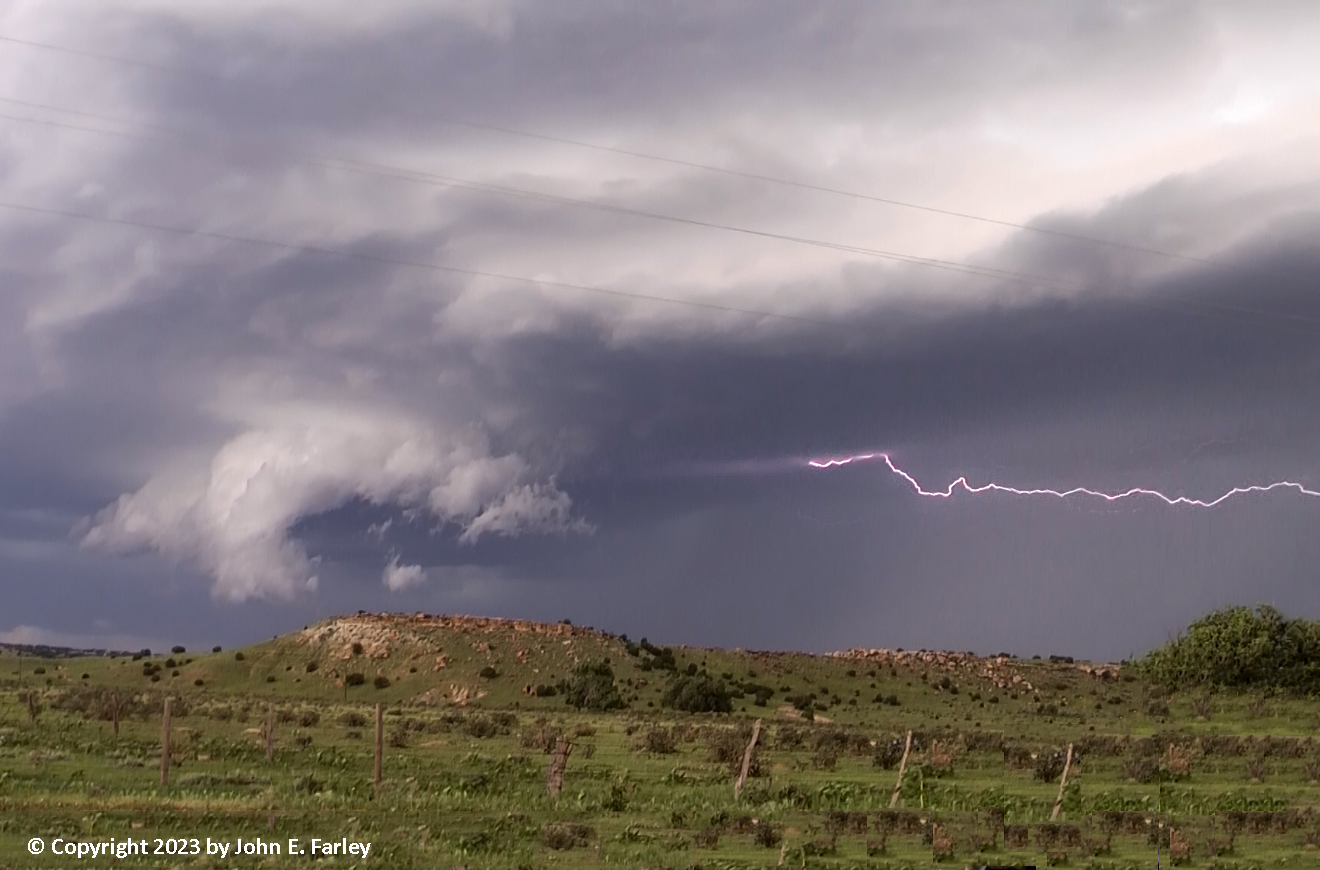
After lunch, by around 2 or so, storms had gone up over the mountains, with one of the stronger ones, but not yet all that impressive, southwest of Walsenburg near the Spanish Peaks. After some indecision, I decided to head down US 350 toward Trinidad, figuring this storm would move over my other possible southwest option, state route 10 from La Junta to Walsenburg. This turned out to be the right choice, as I would have been in the storm or on the wrong side of it had I gone toward Walsenburg. I stopped a few miles southwest of Timpas along 350, and watched the storm from one spot for a long time, as it moved in my general direction. Gradually the storm strengthened, first getting a special weather statement, then a while later a SVR warning, and finally around 4 p.m., its first TOR warning. As the storm strengthened, it produced some impressive lightning:
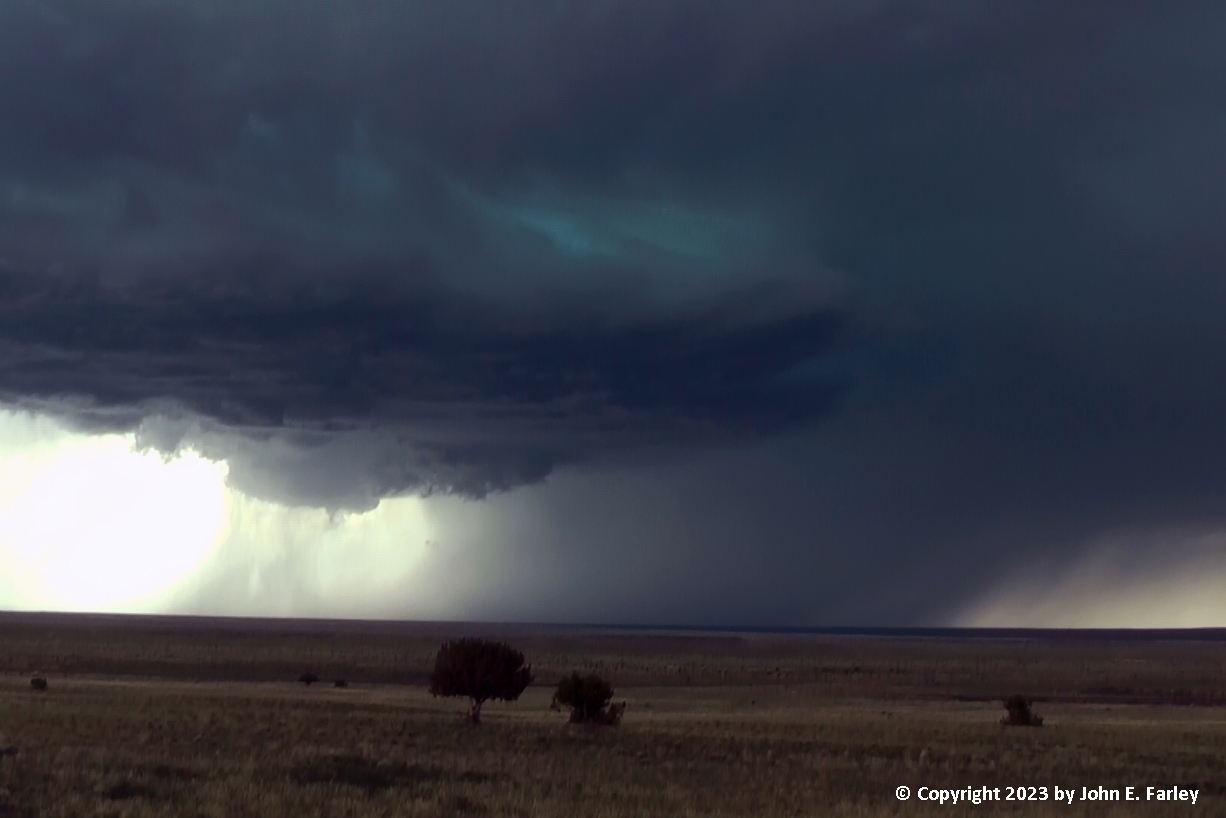
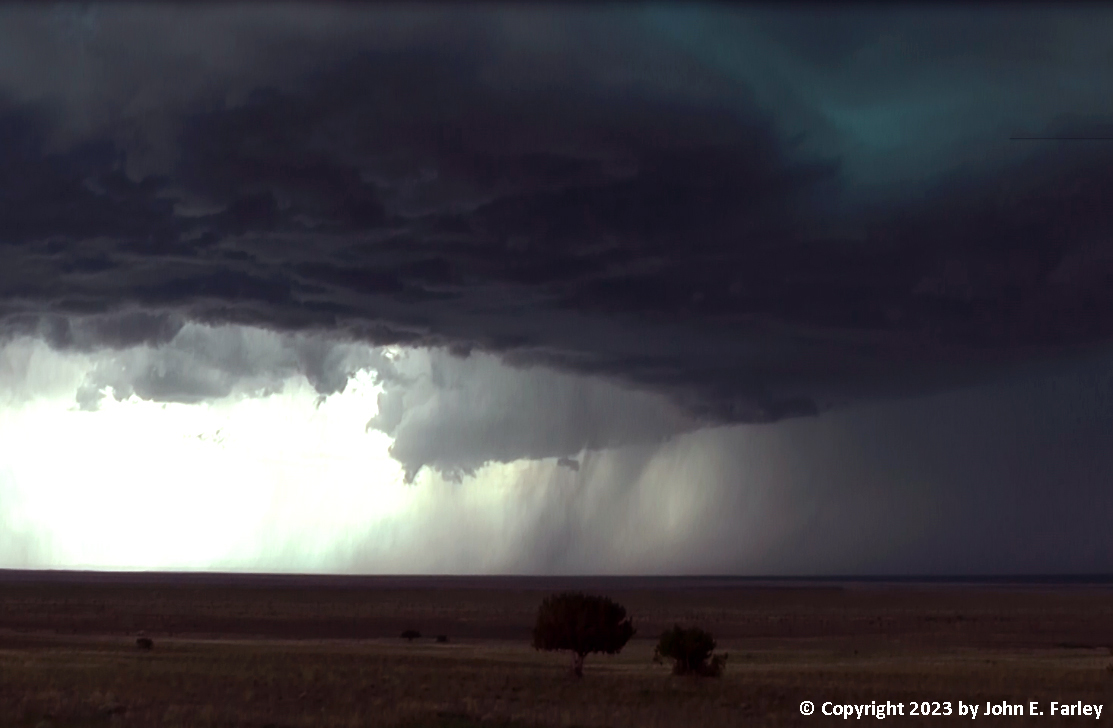
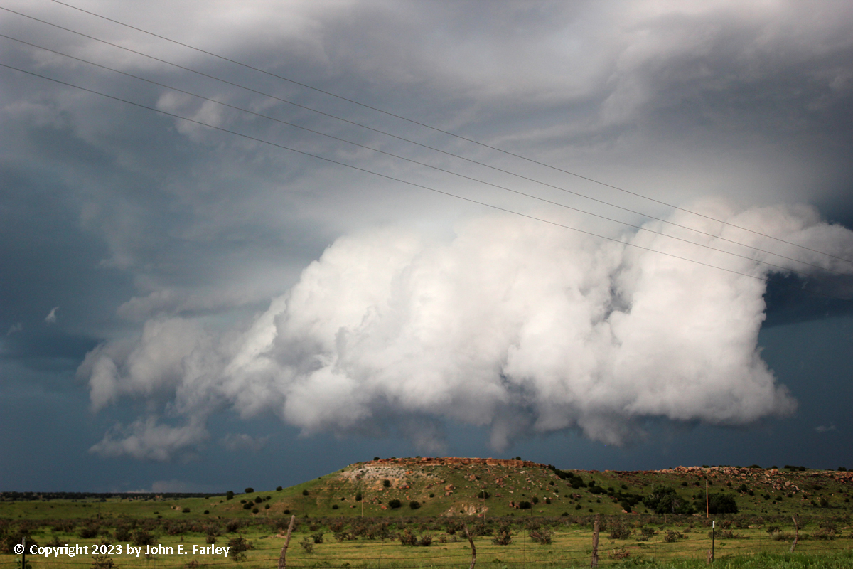
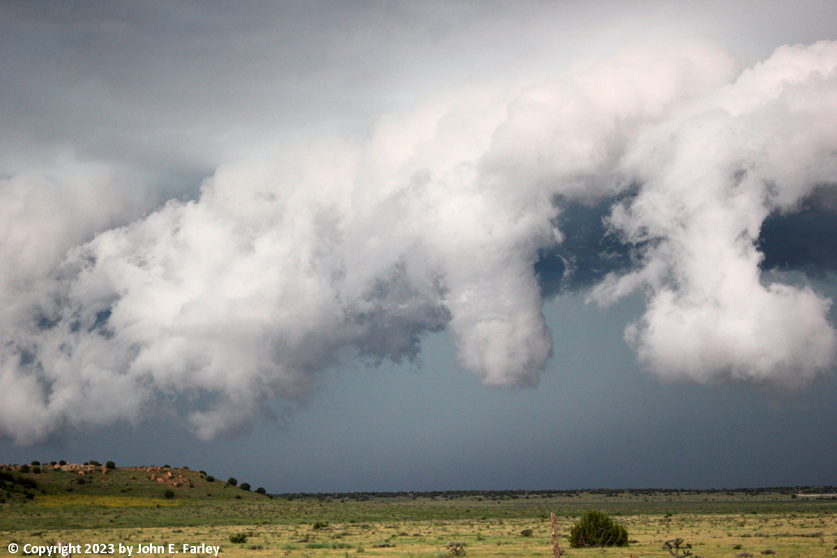
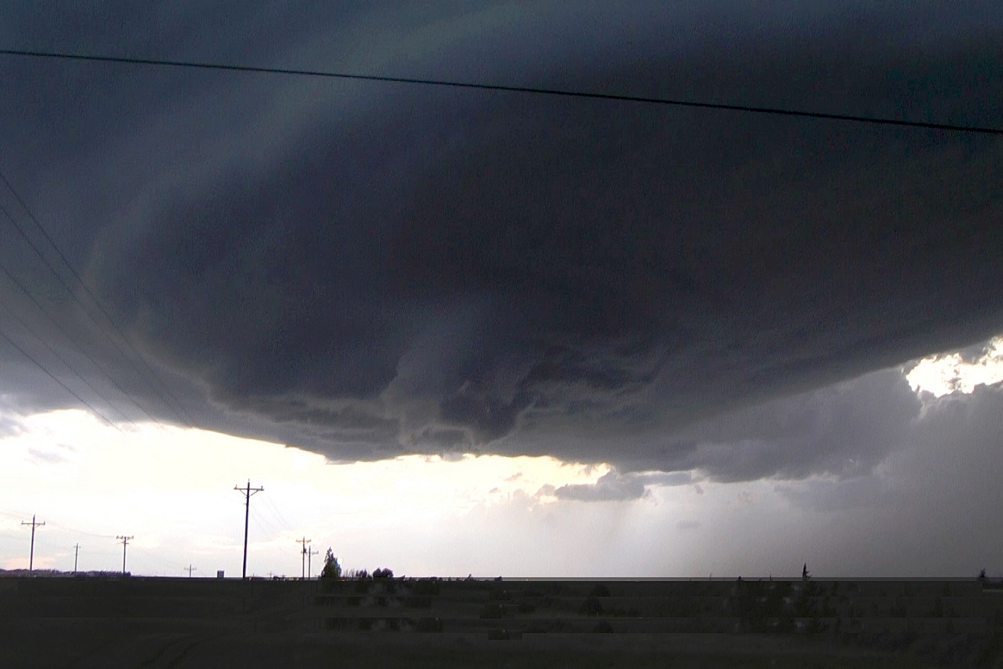
Shortly after the storm became TOR-warned, it produced some remarkable structure, with a very evident rear flank downdraft (RFD) cut. I really thought a tornado was imminent, and there were a couple of short-lived funnels, but nothing came close to touching down. Above and ahead of the meso, the clouds took on the blue-green color characteristic of severe storms and hail. Here are a few pictures from this phase of the storm:
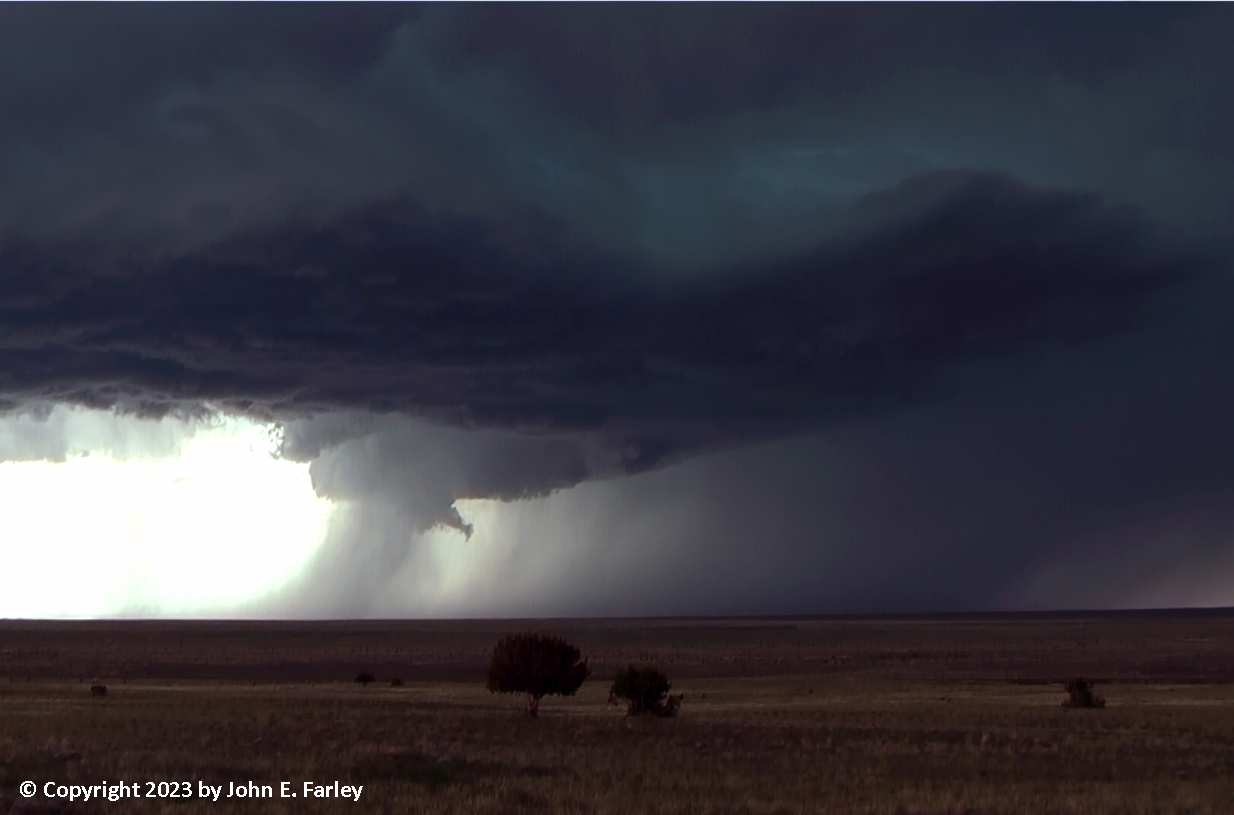
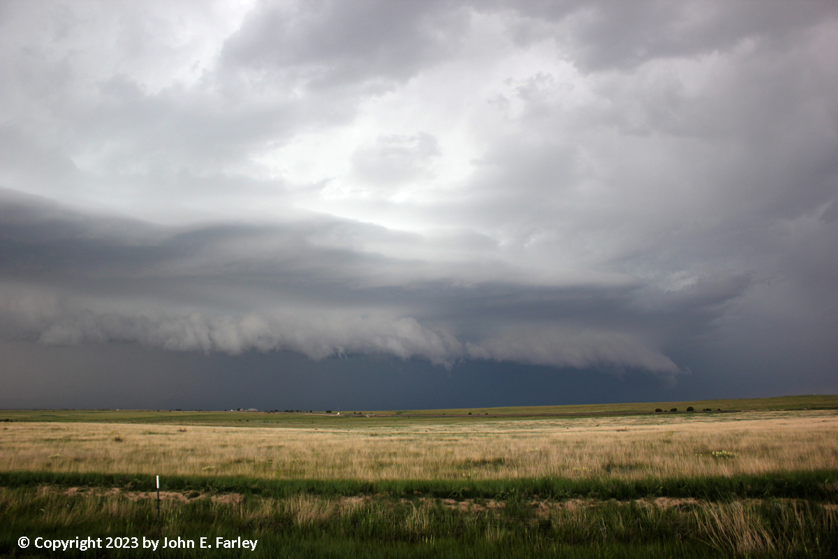
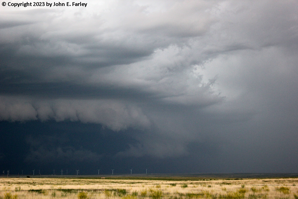
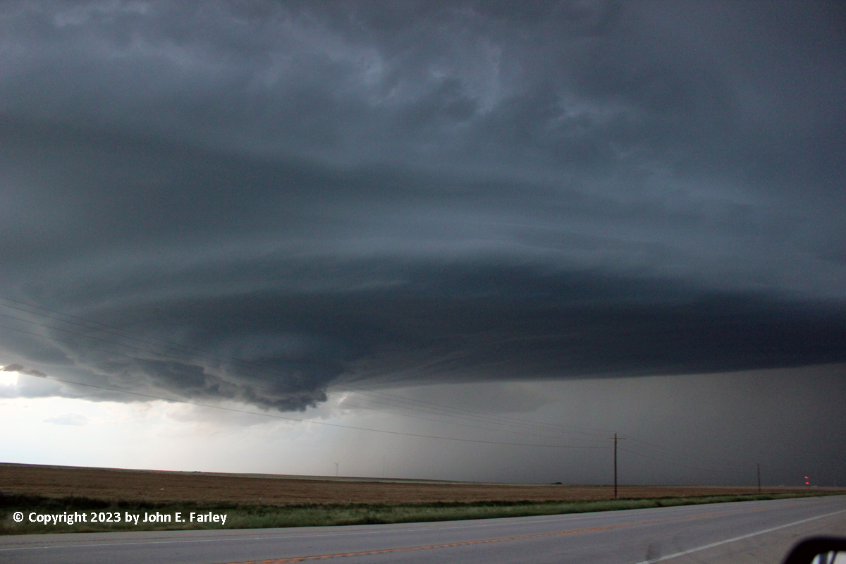
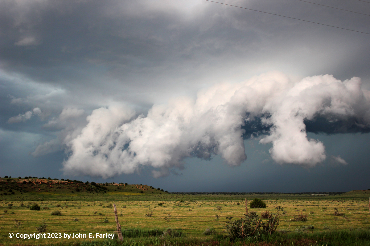
By around 4:15-4:30, it became evident that I would need to move. The storm was going to move directly over my position. Unfortunately, there are no east-west roads in that area, so the only option would be to go back up to La Junta/US 50 and then drop back south to re-intercept the storm, so that is what I undertook. As the storm moved east on a track that would take it to my south as I began to reposition, my view of the mesocyclone quickly became hidden by precipitation. The tornado warning was allowed to expire at 4:30, but another one was issued 8 minutes later, with radar indicating a potentially tornadic circulation right over Timpas. As I was working my way up 350 to La Junta and US 50. I noticed several flashes of lightning from the anvil to the ground, well away from the precipitation. These were probably positive bolts. It took me about an hour to re-position and get back on the storm - that is how limited the road network is in this part of Colorado. There were two south options, state route 109 south from La Junta toward Kim, or state route 101 SSE from Las Animas to Toonerville. I chose the Toonerville route, because it would provide more assurance of still being ahead of the storm once I got repositioned, and perhaps even more important, it offered me an east option to the Springfield area which hopefully would let me stay ahead of the storm and any others that developed near it. It was around 5:15 p.m. when, near Toonerville, I finally got back on the storm again. The structure was still amazing, and although the second TOR warning had been allowerd to expire at 5:15 as scheduled, a new SVR warning was issued for the storm not long after I got on it. Here are a few pictures of the storm from this location:
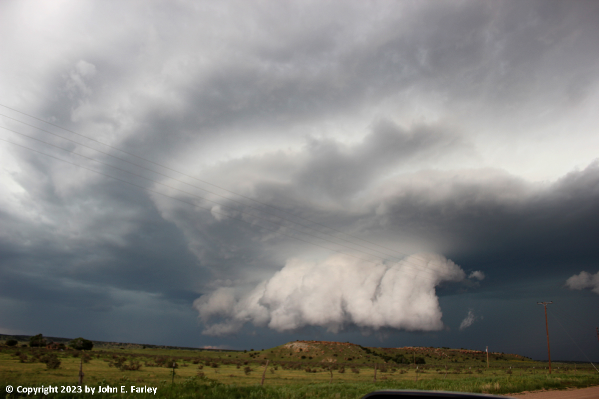
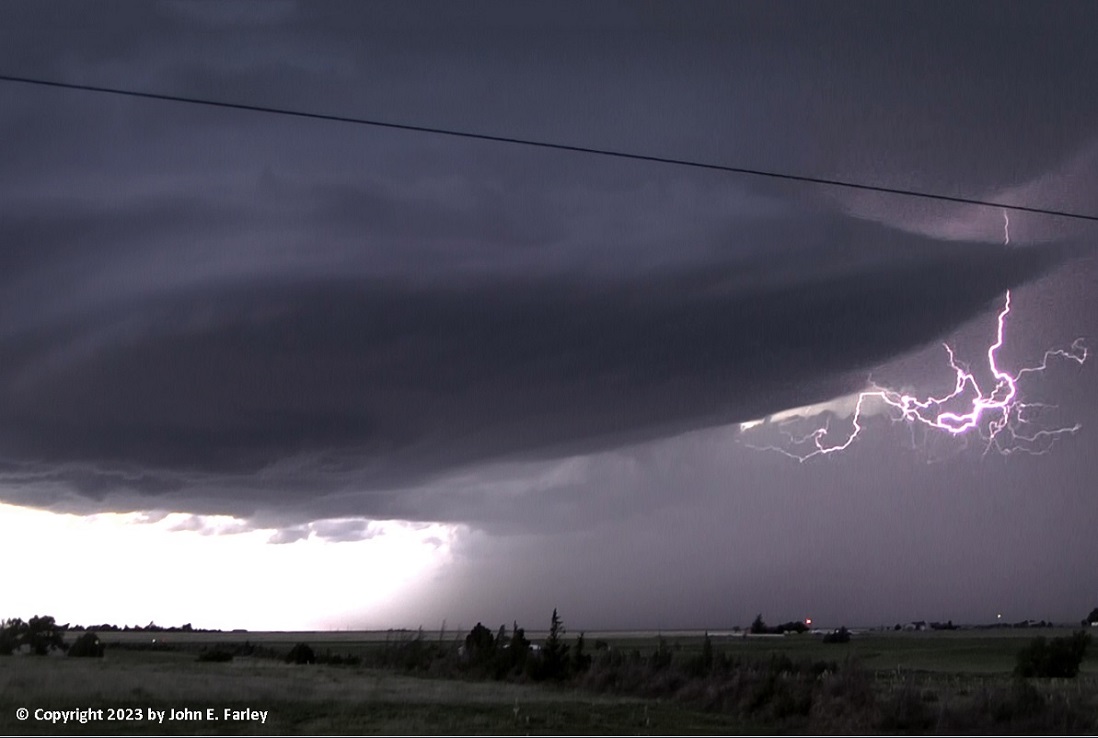
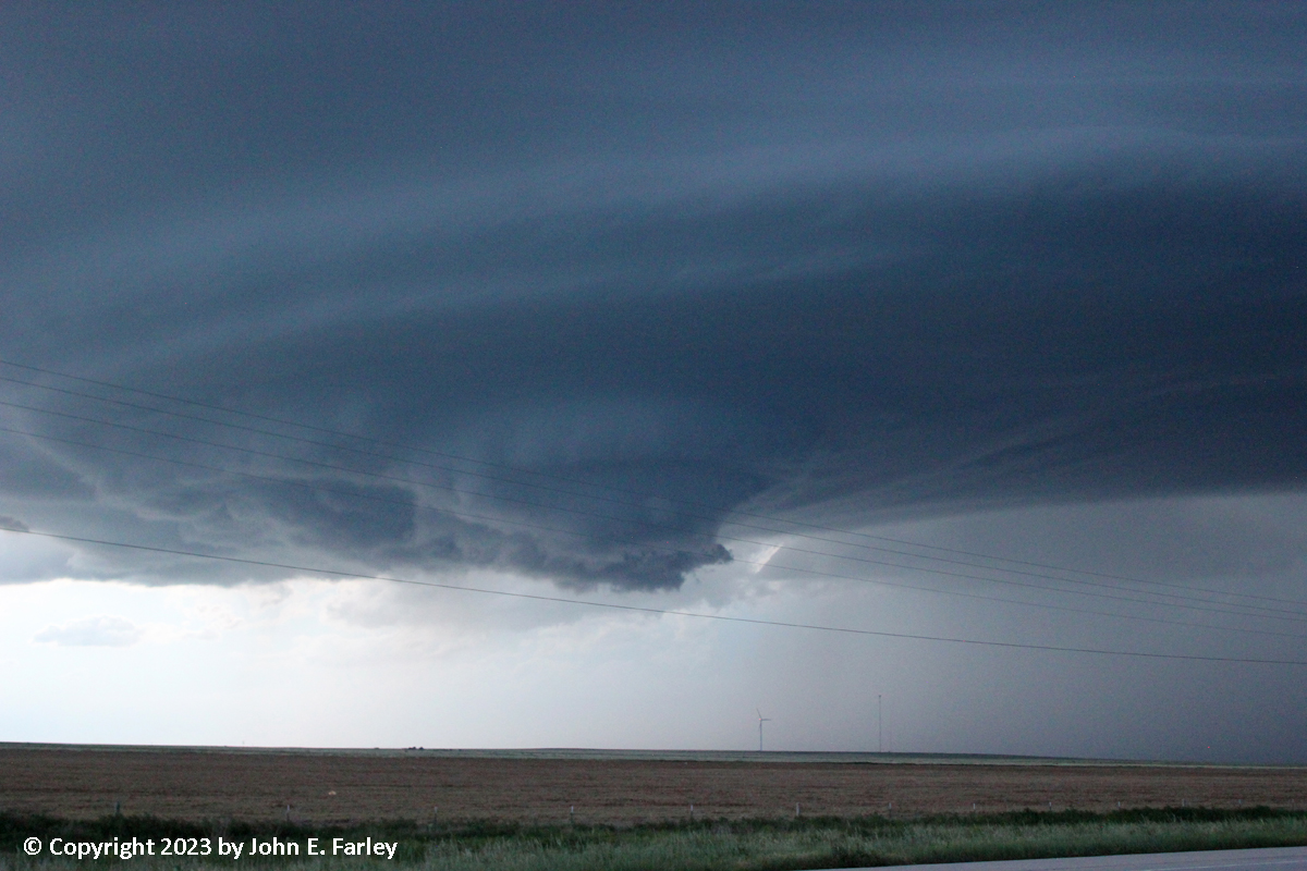
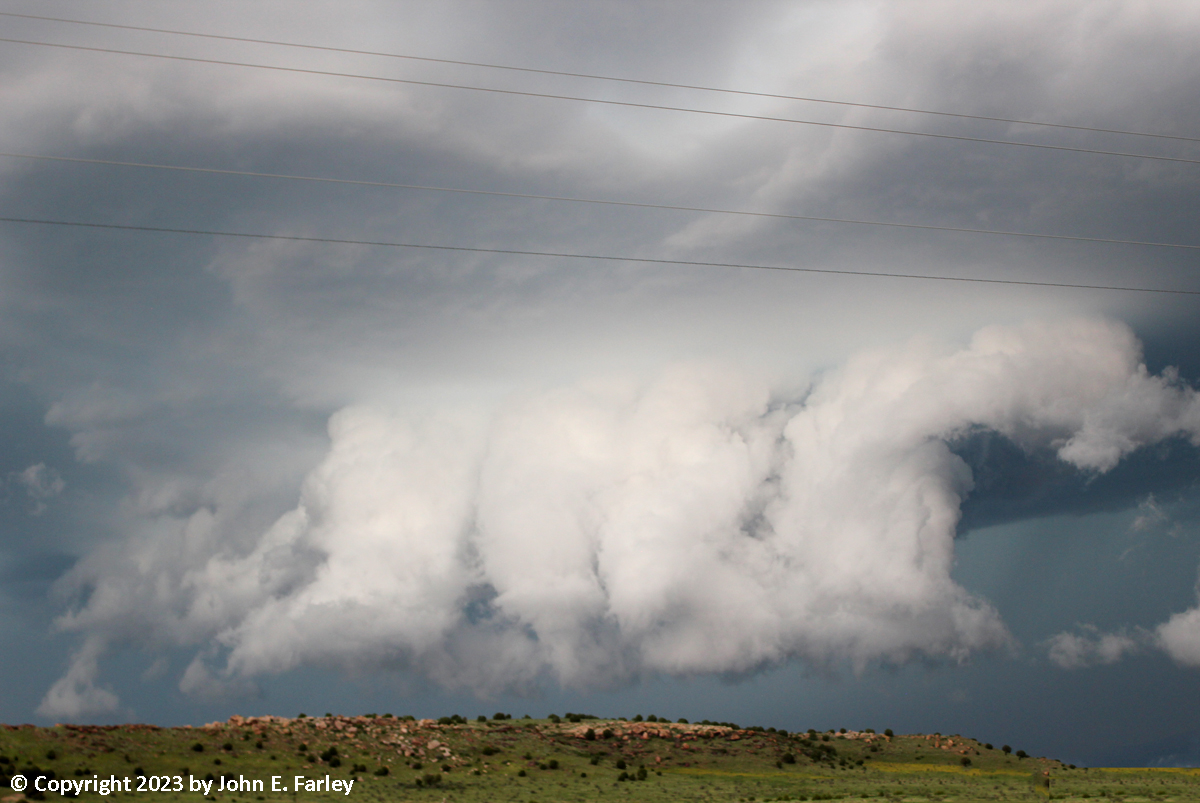
Note that now the wall cloud is front-lit with a dark background. This is because a squall line had now developed to the west of the isolated supoercell I was on, and it was a matter of time before the squall line would catch up and I would have to blast east before that happened. But the front-lighting gave the meso/wall cloud an amazing appearance. There were some lowerings that extended down from the wall cloud which I could not tell whether or not they were funnels. There was, at times, some rotation in the wall cloud, but not a lot. The thunder coming from the clouds, however, was continuouis - non-stop. And at times also some pretty dramatic cloud-to-cloud lightning:
Additional photos from this phase of the storm can be seen here and here. Although when I had first gotten on this storm near Timpas there did not seem to be any other chasers around, by now there were quite a few, including at least two tour groups.
Storm 2: Southeast CO Squall Line
At 6:15, the squall line got its first TOR warning, for rotation detected south of Rocky Ford. This was well to my north and moving to the northeast, so it was not a concern for me. However, by around 6:45, I knew I had to get going. If I did not, I would be overtaken by the squall line, and past Toonerville, the roads are all dirt roads that can become impassible in a heavy storm. So, with some moments of confusion here and there, I headed southeast from Toonerville on those dirt roads past Deora and then east on another dirt road (County Road SS, and then after a one-mile jog to the south, County Road RR) to get to US 287 north of springfield. A new TOR warning was issued at 6:49 for rotation embedded in the squall line, this time farther down the line toward my location, SE of La Junta, but still north of my location. The squall line was getting closer as I headed east toward US 287 and I could not stop for long, but when a third TOR warning was issued for the squall line around 7:20, this time around 26 miles south of Lamar or midway between my position by then and Lamar, I did stop and take a picture of the approaching squall line and then a more zoomed one looking north to the area where the TOR warning was issued:
In the second picture above, you can see what could be the meso embedded in the squall line, which led to the tornado warning. This would be the lowered area below the shelf cloud just to the right center of the picture, although it is certainly possible that the meso was farther back to the north in the murk, blocked from my view by rain. I do not know whether this was a continuation of the meso that led to the earlier TOR warning or a result of the absorption of the supercell I had been chasing. Regardless, despite a couple more warnings later for possible tornadoes embedded in the line, there was no tornado, but the line did produce a severe gust at the Lamar airport, located south of Lamar between the position of the rotation detected on radar and Lamar.
Storm 3: Springfield, CO Supercell
Around 7:30, or about 10 minutes after the third TOR warning was issued for the squall line, another one was issued for what was then the tail-end storm of the squall line, near Pritchett or due west of Springfield. I switched Radarscope from reflectivity to storm-relative velocity, and could see that there were very strong velocity couplets associated with both of the newly-issued tornado warnings. I figured that if I kept going, I could get to 287 and then drop south to or through Springfield ahead of the tail-end storm. Although when the warning was first issued this storm was part of the line and moving at a similar speed, it soon split from the line, slowed down, and became a supercell entirely separate from the squall line. With the slower movement, after driving most of the way on 287 to Springfield, I was able to stop and jog a bit west on a back road for a better view of the approaching supercell. This was around 7:50 to 8:00 p.m., when a second TOR was issued for the storm. Since the storm was clearly tracking on a path that would be to my south, I decided to drop down to Springfield, and found a viewing spot at the SW edge of town just off US 160. From there the storm, moving more or less directly in my direction but slowly, took on amazing "mothership" structure, with a lot of lightning in the storm right next to the meso:

As it moved closer yet, it was evident that a lowering was present. The storm had so darkened the sky by now that it is a bit low-contrast in this picture, but it is there under the wall cloud:
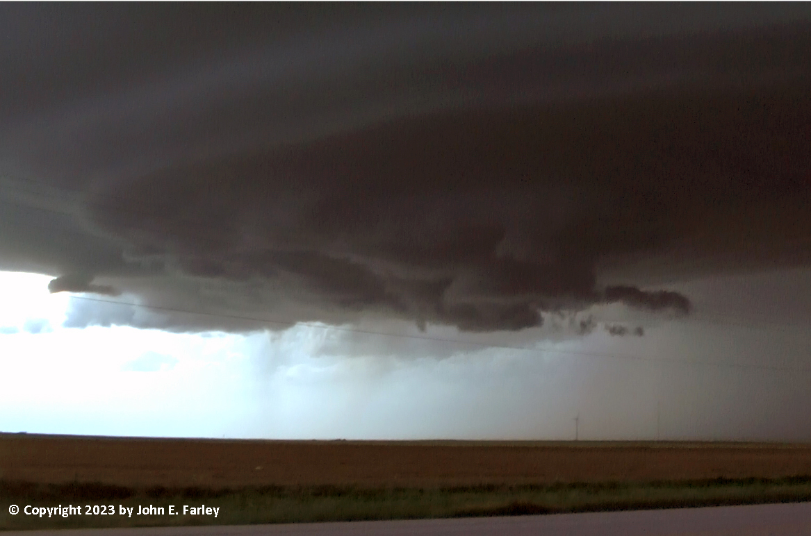
With this coming at me, I knew I had to move again, which I did, to a spot a few miles south of Springfield and safely out of the storm's path. Again at this location I was treated to great storm structure, still with a spaceship-like meso with a pronounced wall cloud underneath, which was exhibitig some rotation:
While I was at this location, it also produced what appeared to be a brief funnel, although that did not last long:
This formed just west of Springfield, so it is a good thing it did not persist or lower, as had there been a tornado it would have hit the town. As it was, parts of Springfield got baseball-sized hail. And there were a few bigger ones. Emergeny management posted a picture of a 3.75-inch spiked hailstone, which I saw on TV later, and eventually there was a report of a 4-inch hailstone. Some vehicles in Springfield, of which I later saw one or two, lost windshields or windows. This storm received a total of three tornado warnings, and was continuously TOR warned from 7:30 to 9:00 p.m., by which time it was past Springfield to the east. Once the storm had passed Springfield it was getting dark and the chase was over. I went back to Springfield and found a place to stay for the night. I also found this in the parking lot:
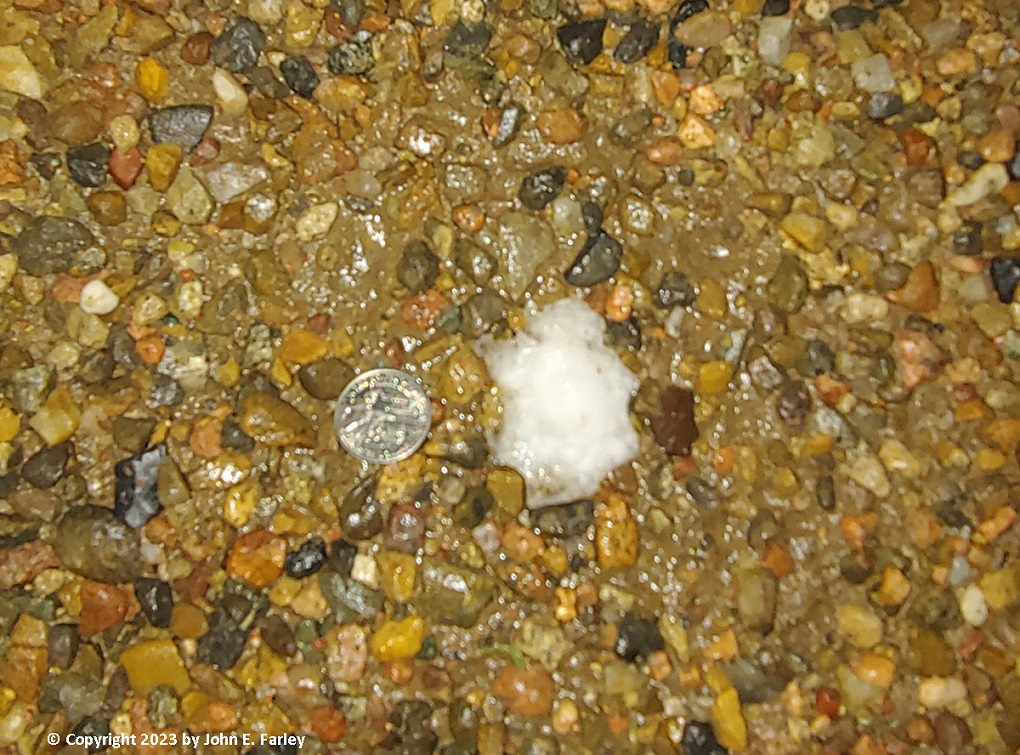
About 2.5" at the widest point, and this was around 20 minutes after the hail fell. I talked to someone the next day who lived nearby and said it was baseball sized there when it fell.
Chase distance for the day: 185 miles.
Return to 2023 Severe Weather Observation Page
Return to main Severe Weather Observation Page