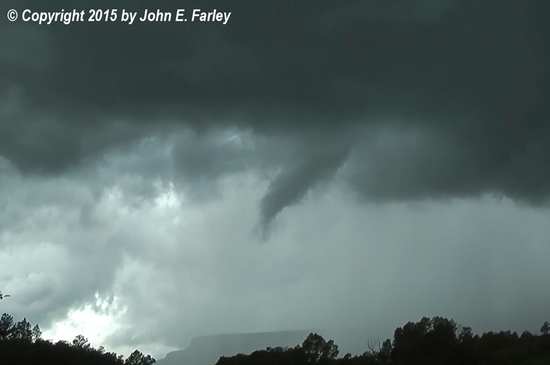
In any case, it turned out that there definitely was some wild weather in Archuleta County, CO during both the afternoon and the evening. First, an intense isolated cell formed in northwest NM near Navajo Lake and tracked ENE on a track that would take it just north of Dulce, NM, crossing the state line into CO and eventually continuing on through the Chromo, CO area. I know from experience that persistent, strong, isolated storms in this area are not to be disregarded, particularly in September and particularly when you have a baroclinic zone of the type mentioned above. It also looked to me like the storm was moving a little to the right (i.e. more eastward and not as much northward) compared to the movement of most of the other shower and thunderstorm activity, suggesting the possibility of a right-moving supercell. By the time I noticed this storm, I was finished enough with my various tasks and activities of the day to turn my attention more to the weather. I could see that the storm's direction and speed of movement was such that I could easily intercept it by heading SE from Pagosa Springs on U.S. 84 and either intercepting it along that route or by making a westward turn toward Dulce. Ultimately, I intercepted this storm around 3:20 p.m. and quickly caught some cloud rotation, including a funnel cloud, about 4 miles west of Chromo, looking to the west or WNW. Only problem was that the funnel cloud and area of rotation were only a half mile or so away, and moving in my direction. So, after getting one minute of video, I knew that for safety reasons I had to retreat back toward Chromo. Here is a video capture of the funnel cloud:
Here is my video of the cloud rotation and funnel cloud:
Once I had retreated a couple miles east and stopped again, the funnel was no longer visible. Either it dissipated, wrapped up in rain, or moved to a point where my view of it was blocked by the mesa just to my northwest. Once I was safely clear of the path and could get a signal in the spotty cell coverage of rural southwest Colorado, I called in the funnel and cloud rotation to NWS Grand Junction. They issued a Special Weather Statement mentioning my report along with a radar indication of the possibility of 50 mph wind, 1/2-inch hail, and heavy rain with the storm. Although I could no longer see any funnel or rotation, low ragged clouds and heavy precipitation were nearly upon me, so I dropped a couple miles SSE of Chromo on 84 and let the storm pass to my north. After the storm passed, I could see what looked like some hail accumulation on the mesa northwest of Chromo, although when I drove up Confar Hill on 84 I could see no hail along the road. I decided to return to where I saw the funnel cloud to see if there was any evidence of damage. I continued west of where I videoed it into the area it passed over, but could see no damage so I do not think it ever touched down.
That was not the end of the day's excitement, however. By 5:30 p.m., another strong and relatively isolated thunderstorm developed southwest of Durango, leading to the issuance of another Special Weather Statement by the Grand Junction NWS, mentioning the possibility of dime size hail and 40 mph wind. By shortly after 7 p.m., this storm was about to cross into Archuleta County and heading for the general direction of Pagosa Springs. So I headed out again, going just a few miles SW of my house to a spot with decent visibility along U.S. 160. I got some video there, then as the storm got closer retreated to Vista Dr. where I got both still photos and video, including a couple nice shots with the lightning trigger. This would have been around 7:30. The storm remained quite intense, and appeared to have at least some degree of HP supercell characteristics, as it approached the Pagosa Springs area. Here are some pictures:
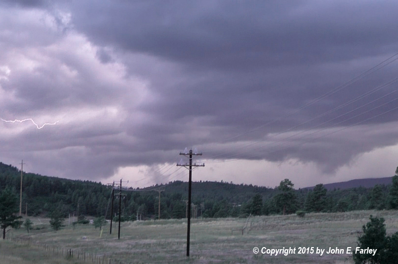
Video capture looking west from U.S. 84 about 6 or 7 miles WSW of Pagosa Springs.
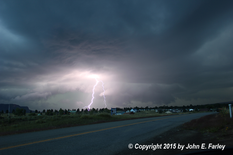
Two images captured with Lightning Trigger on Canon T2i. These were taken around or just after sunset in dusk light from Vista Dr., about 5 miles WSW of Pagosa Springs and about a mile WSW of my house.

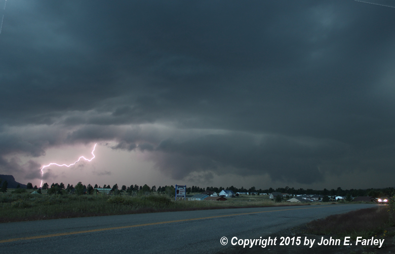
Video capture of lowered area and lightning from Vista Dr. as the storm got close. After this I headed home before the storm could overtake me.
The storm hit with torrential rain, but little or no hail and winds that did not seem greater than about 30 mph. It dumped 1.3 inches of rain in an hour at my house. Combining this with the .50 inch of rain since 4 p.m. the previous day and the .25 inch that fell later in the evening after this storm passed, the 2-day storm total for this weather system came out to 2.05". I suspect that the tropical influence on this system was a contributing factor to both the very heavy rainfall and the relative lack of hail. High atmospheric moisture and upper-air temperatures that are not extremely cold are characteristic of tropical systems, and tend to produce storms with very heavy rainfall but little or no hail.