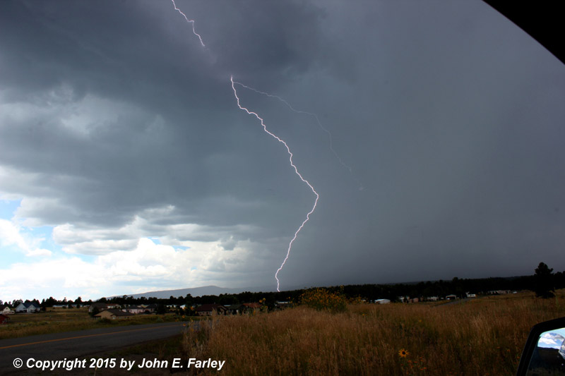
As I was getting ready to leave Pagosa Springs around 2:00 p.m., thunderstorms were erupting in the immediate area around Pagosa Springs, generally just west and north of town. So I went to one of my lightning-viewing spots a mile or so west of home, and was able to capture several flashes. This one was my favorite:
As I headed east to the Pueblo area where I planned to overnight, I encountered additional showers and thunderstorms in the San Juan Mountains, in the San Luis Valley, in the Sangre de Cristo Mountains (where the rain was quite heavy in some areas), and around Pueblo.
After stopping for an unsuccessful attempt at lightning photography on a weakening storm coming out of the San Juans into the San Luis Valley southwest of Monte Vista, I noticed something interesting under the base of one of the higher towers in a line of storms to my northeast:

Notice that what appears to be a large dust swirl seems to be right under the highest tower. At the time I was not sure whether the actual storms were over the San Luis Valley (from which the dust was rising) or the Sangre de Cristo Mountains on the other side of the valley. However, later when I continued east, it became evident that the storms were indeed still over the San Luis Valley, so this dust swirl may have indeed been right under the updraft. Cropping and zooming this photo later revealed this:
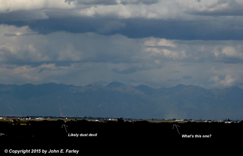
It turns out there are actually two swirlie-thingies in this picture. As I indicate, I think the one on the left is probably a dust devil, though it is possible that it was interacting in some way with the storm. Suppose it could have been a tall gustnado, but dust devils are very common in this area so I think that is more likely. I am less sure of what the larger one on the right may have been. Since it looks like it is right under the tallest updraft, I suppose it could have been a landspout, but there is nothing in the cloud base that suggests that, and none were reported. Or perhaps a large gustnado or other feature associated with outflow? I am not absolutely sure it was spinning, but it does not really look like the kind of plume you get with straight-line outflow. It is only about as wide as it is high. So I don't really know what it was - wish I had been closer. At this point, I was probably a good 20 miles away, maybe more. It persisted for maybe five minutes.
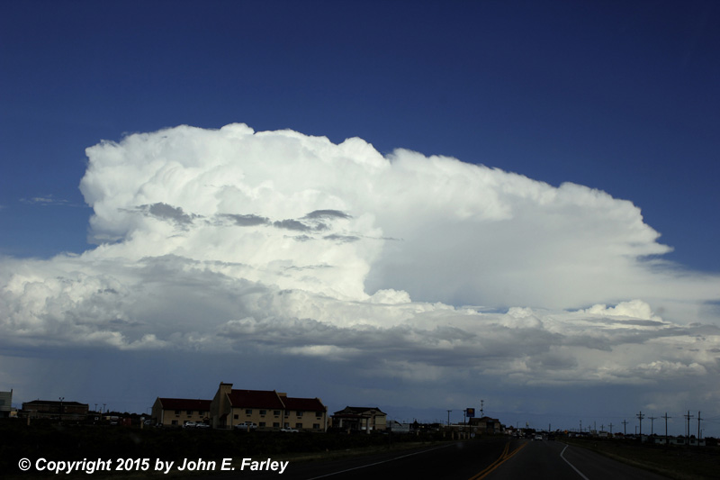
Several of the storms in this line, which was alligned NW-SE and moving generally toward the E or ESE, looked pretty impressive for a while. The upper winds were northwesterly and offered just enough shear to carry the precip a little SE of the updrafts so the storms did not immediately rain themselves out. That can be seen in this picture, taken from the west edge of Alamosa looking more or less to the east:
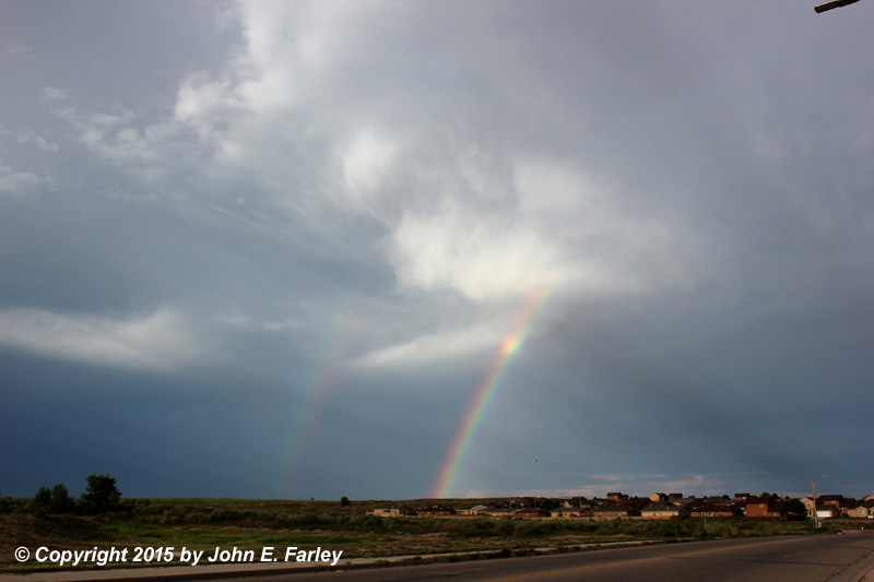
As I crossed the Sangres, I got into the line of showers and storms, encountering widespread mostly light to moderate precipitation and gusty outflow winds. Occasionally a heavier burst, but it looked like most of that was north of me. Not much in the way of lightning or thunder. When I got out onto the plains and eventually headed into Pueblo, more storms were occurring farther out onto the plains, and this one east of Pueblo offered me a nice double rainbow as I headed into town:
Not bad for a mainly travel day.
Return to 2015 Severe Weather Observation page