Supercell Gallery, Page 3
 Supercell east of Trinidad, CO, June 5, 2014
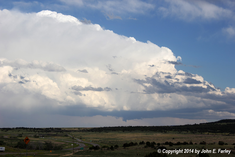
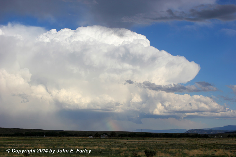
This very photogenic supercell storm dropped golfball hail between Trinidad and Trinchera, CO.
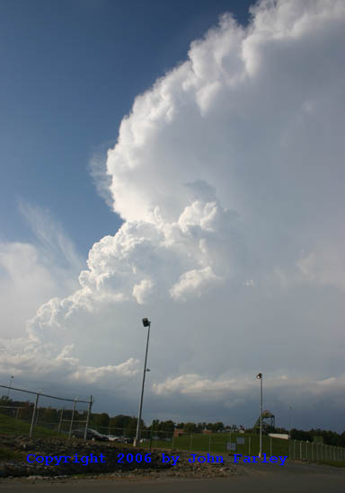
Two Views of Supercell Thunderstorm in far Southern Illinois, September 27, 2006

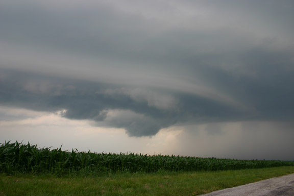
High-Precipitation Supercell West of Carrollton, MO, June 7, 2007
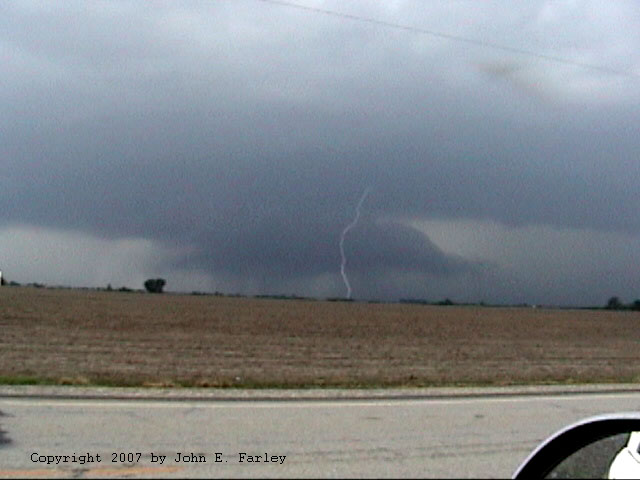
This storm produced 2-inch hail and 80 mph wind gusts.
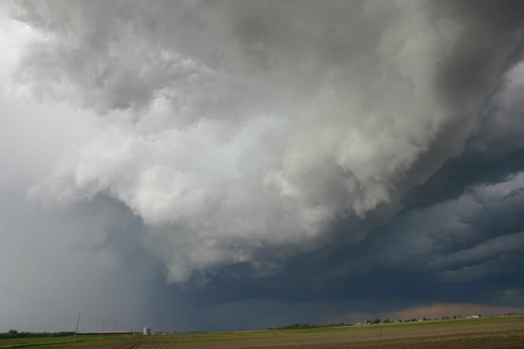
A Few Views of the Supercell that Produced an EF-4 Tornado in St. Louis, MO area, April 22, 2011
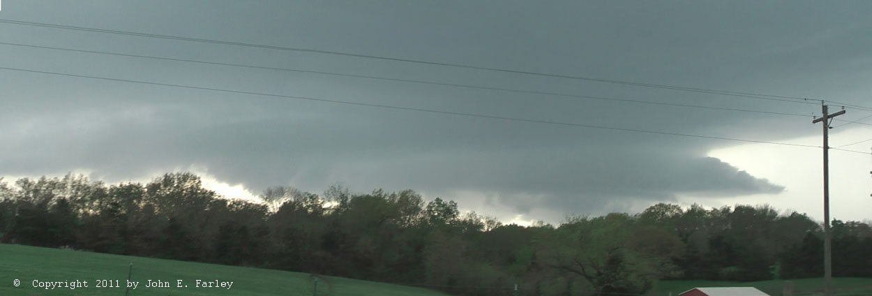
Panorama of the storm's mesocyclone west of Holt's Summit, MO
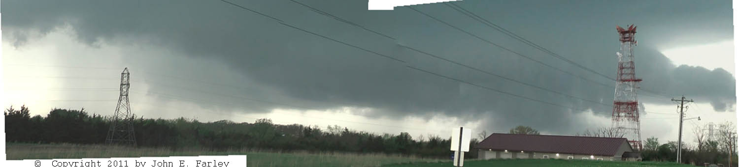 Another panorama showing occluding mesocyclone at left and new one developing at right
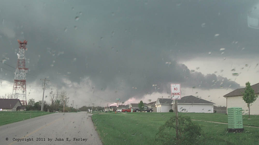
Wall cloud with lightning, north of Holt's Summit
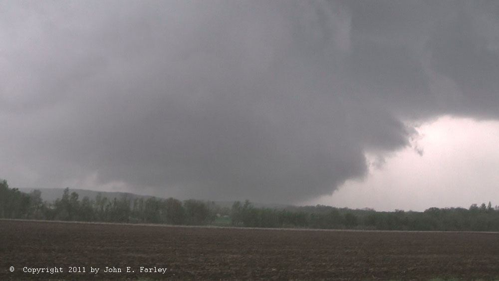
Wall cloud north of Hermann, MO. 4-inch hail was occuring at this time.
Supercell Over Jersey Co., IL, June 13, 2005
Long-Track Tornadic Supercell in IL, April 19, 2011
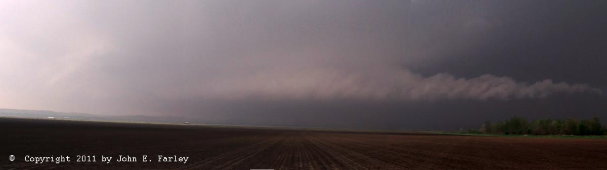
Panorama looking west from Hillview, IL. This storm produced at least two tornadoes and up to 4.5 inch hail.
Elevated supercell in Illinois, May 28, 2011

Produced giant 4.5 inch hail in Macoupin County.
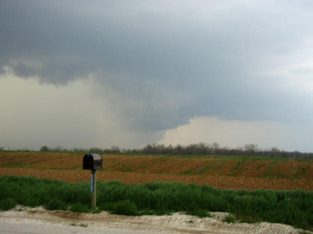
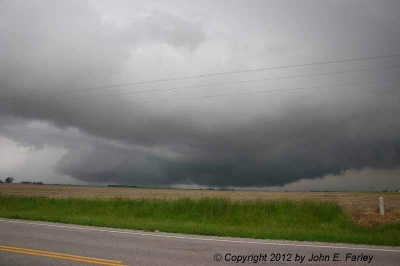
Supercell near Treloar, MO, May 22, 2011


High-Precipitation Supercell with Large Hail and High Wind, Bunker Hill, IL, May 3, 2010
Two Distant Supercells Over Southern Illinois, October 18, 2004
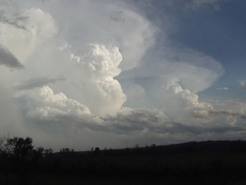
One of these storms produced a long-track tornado near Carbondale.
Late Evening Supercell With Lightning, Across Dunlap Lake in Edwardsville, IL, July 16, 2009

Two High-Precipitation Supercells Embedded in Squall Line, West-Central IL, April 25, 2008.
These two pictures were taken about 60 miles apart in distance and nearly two hours in time; the first near Barry, IL and the second just west of Springfield. The second embedded supercell formed about 30 miles down the line from where the first one was ending at the time. Notice the similarity in the storm structure in the two pictures, despite the fact that they were different cells at different times at different locations along the squall line.
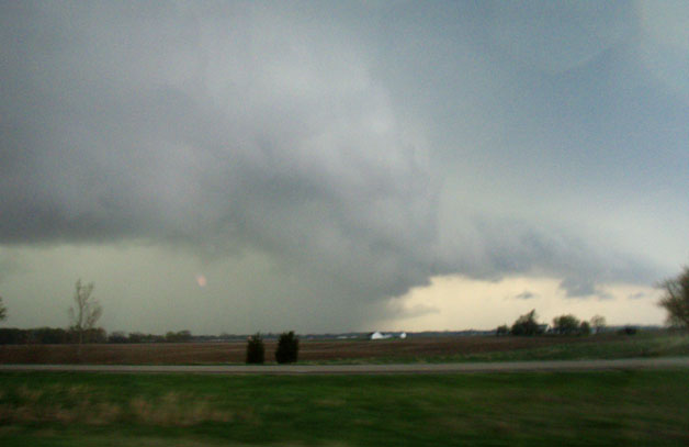
Elongated Tornado-Warned Supercell near Dumas, TX, June 12, 2010

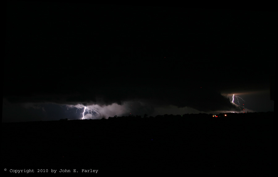
Night-time Supercell Illuminated by Lightning, Stinnett, TX, June 12, 2010
St. Louis/Southwest Illinois Supercell, April 28, 2012
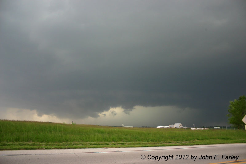
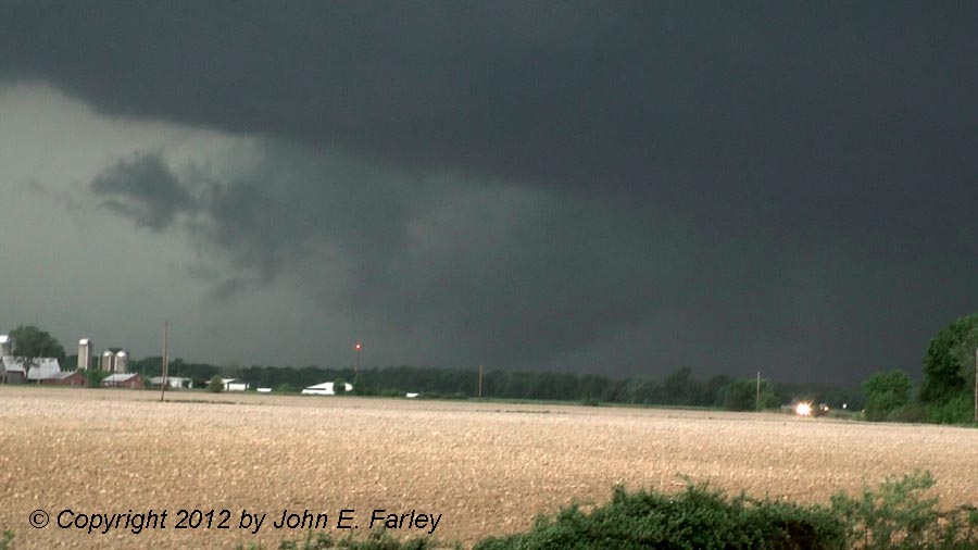
This storm and another one behind it produced more than $1 billion in hail damage in the St. Louis area and southwest Illinois. At the time of the last picture above, 4.5 inch hail was occuring. The storm also produced a fatality when high wind in the rear-flank downdraft (RFD) hit a tent at a bar near Busch Stadium.
This page last updated June 22, 2016.
Return to Supercells gallery entry page
Return to Storm Galleries main page