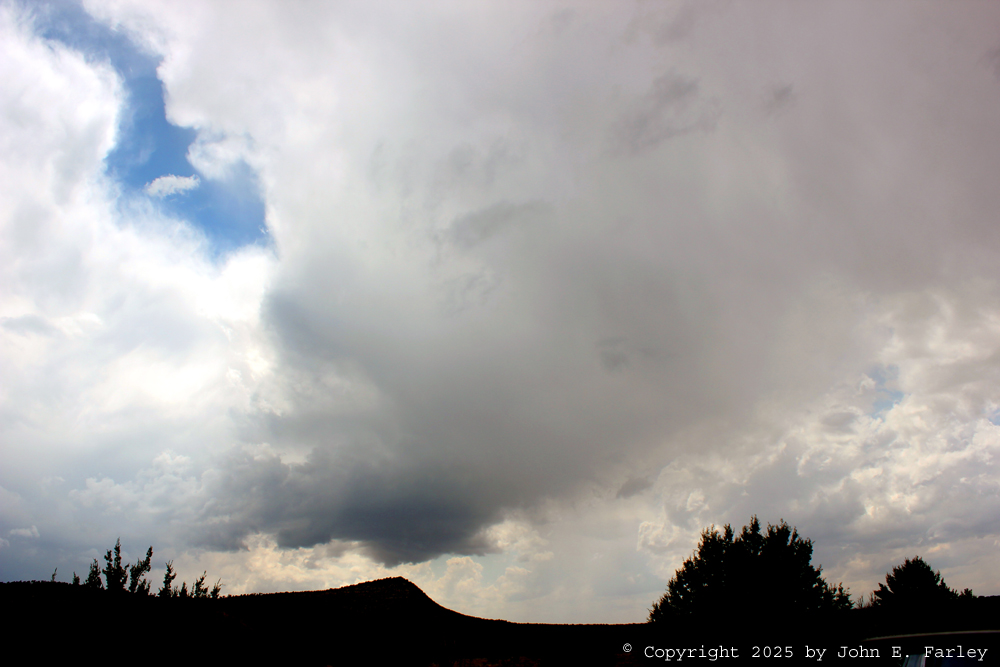
Started out around 9:30 a.m. from Pagosa Springs, CO with an intial target around the Encino-Vaughan area in New Mexico. I expected initiation somewhere around or a little west of there, and the plan would be to follow the storms eastward toward somewhere around Tucumcari or Clovis, possibly even into the TX Panhandle depending on how far east the storms got before dark. After a doing a few brief errands in Santa Fe along the way and a short stop in Clines Corners, I continued down US 285 and was in the target area somewhere around 2:00 p.m. By then, there were quite a few agitated cumulus, and some spotty weak storms had developed to the southwest. This had happend around the time I was in Clines Corners, maybe around 1:15. These storms developed well to the southwest, near and south and west of Corona, but by the time I was in Encino I was not sure I could take the direct route south to Duran to get closer to them without getting overrun and potentially caught in hail, so I took the long way around, going almost to Vaughan to pick up US 54 and head southwest to Duran.
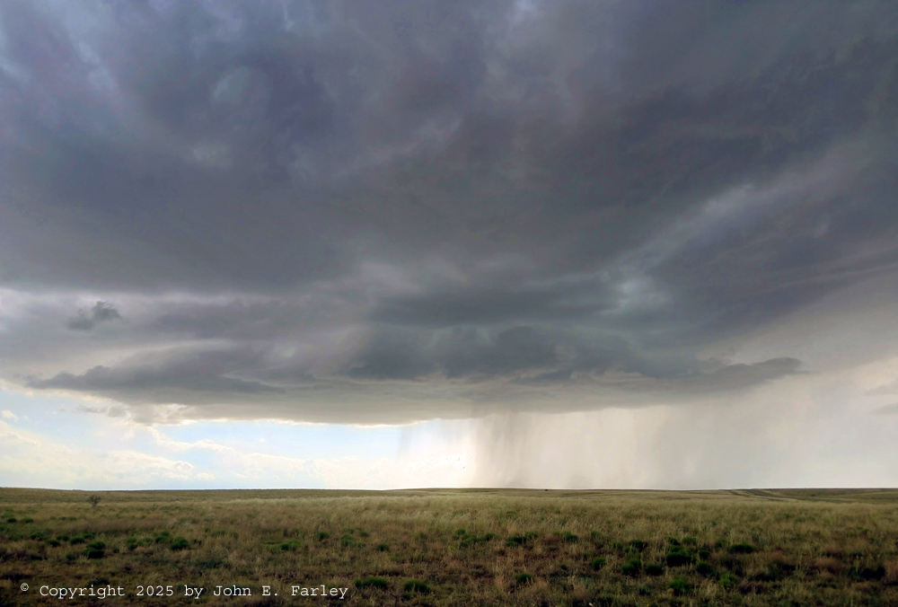
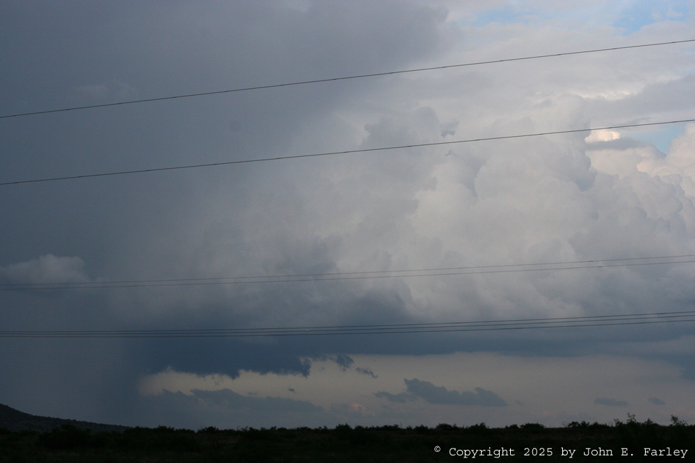
As I said, this storm was quite weak, and after it passed over NM Route 3 to my north, it further weakened and eventually dissipated entirely. But even when I was taking the picture above, I was hearing more thunder from the next storm to the southwest (hereinafter Storm 2), which was in the genral area of Corona. So I went back to US 54 and headed southwest toward Corona. The storm was moving notheast toward me, and looked much stronger, along with having much more lightning and thunder. I retreated back northeast on 54 to stay ahead of the storm as it moved toward me along the highway. When I got back to US 285, I headed southeast past Vaughan and found a place to stop where I had a good view of the storm and would be south of its path Around 4 p.m., it developed a wall cloud for a time:
Although I suspect the storm was producing at least some small hail by this time, it did not get any warnings or special weather statements, and as it crossed the highway between my locaiton and Vaughan, it began to rapidly weaken much like Storm 1 had done, and with a third storm now approaching from the west, I decided to let it go.
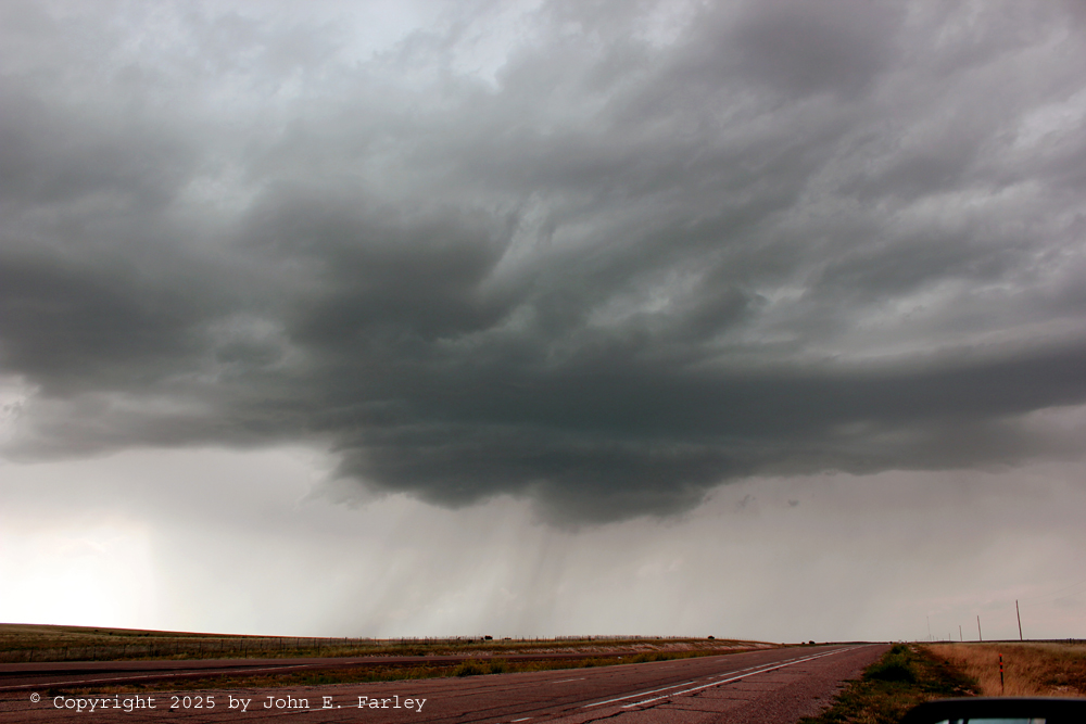
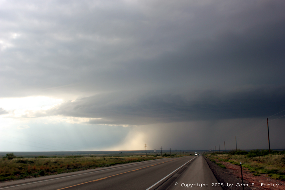
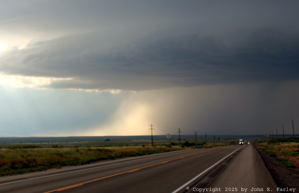
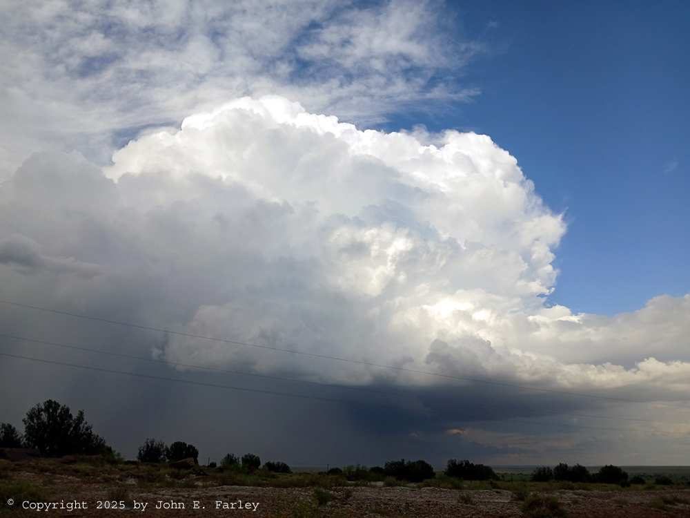
I decided to head east (initially ESE) on US 60 toward Fort Sumner to try to keep ahead of the storm without being directly in its path. After this, the storm weakened somewhat, and I began to wonder if every storm I got on today was going to fizzle out like the earlier ones had. But gradually, a new strengthening phase occurred, and the storm took on some nice LP structure with what I would call a "thin mothership" appearance around 4:45 p.m.
These pictures were taken as the storm approached US 60 southeast of Vaughan, moving to the ENE and passing between my location and Vaughan. There was also some increase in electrical activity at this time. The storm crossed the highway a few miles to my WNW and continued its movement to the ENE, gradually losing the mothership appearance and appearing again to bemporarily weaken, but eventually it began to intensify again. Although there were one or two places I might have been able to turn to the north and get closer to the storm, roads are pretty sparse in this part of NM and not all paved. I decided my best option was to continue on US 60 to Fort Sumner, then head northwest from there to re-intercept the storm between Fort Sumner and Santa Rosa.
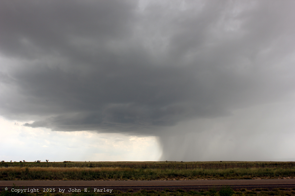
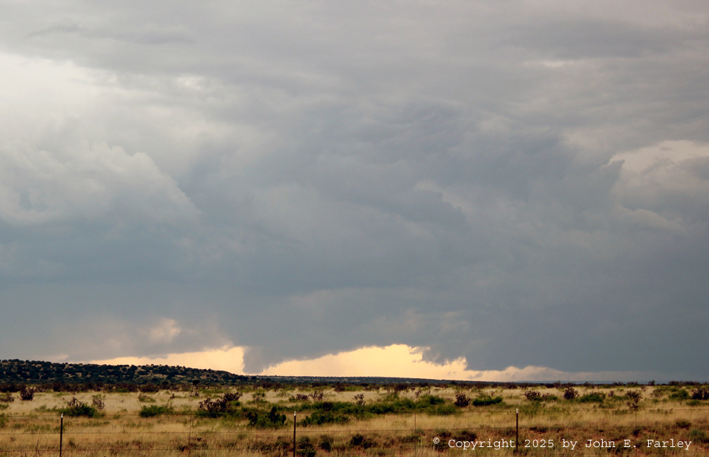
By the time I got to Fort Sumner, the storm was well to my north but on a path that would allow for a re-intercept along US 84 between Fort Sumner and Santa Rosa. And it was strenthening again, this time in a way that would more sustained and more intense. As I got closer to the storm southeast of Santa Rosa, the back side of the rain/hail core was brightly illuminated by the sun, which now was a lower angle as the time was nearing 6 p.m., around 5:50 p.m.:
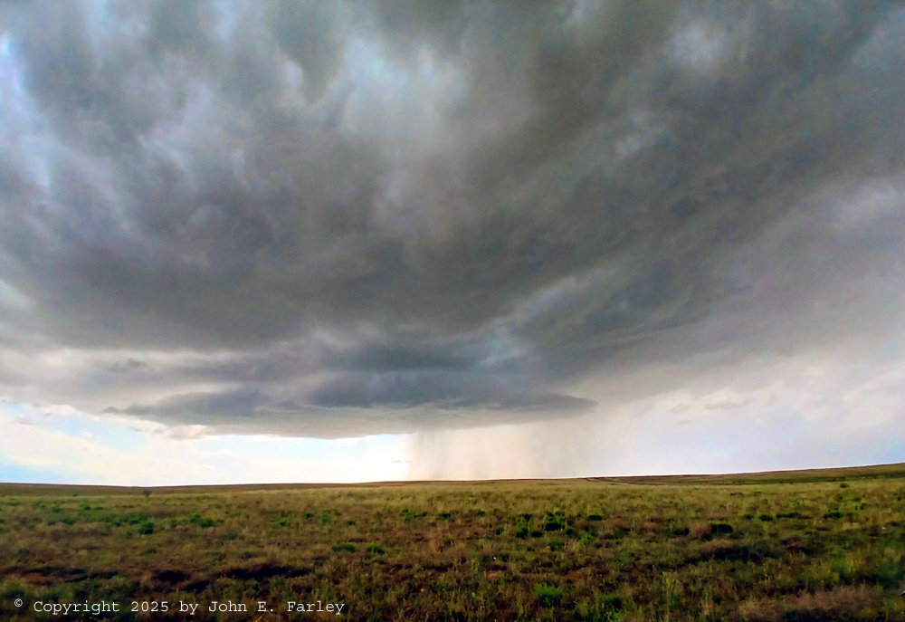
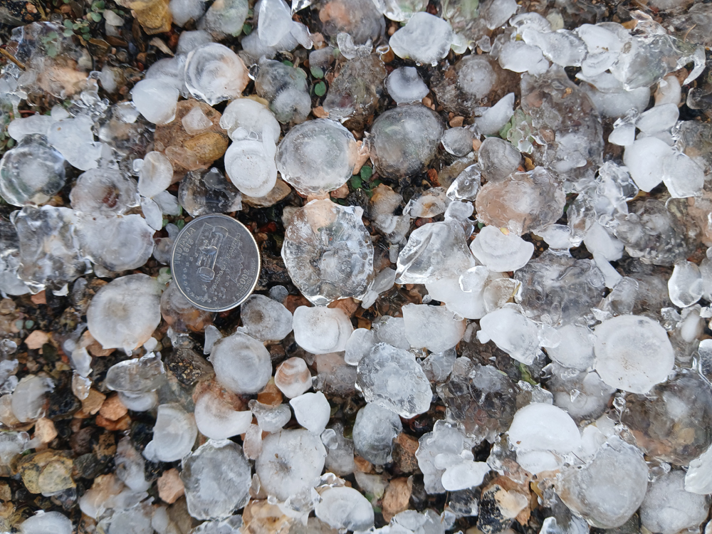
As you can see in these pictures taken as the core was about to cross US 84 ahead of me, there is also a rainfoot indicating the possibility of some pretty strong wind in addition to the hail and heavy rain. On cue, just about the time these pictures were taken, NWS ABQ issued a SVR warning for this torm until 6:30, mentioning 60 mph wind, quarter-sized hail, and that the storm would cross US 84. I edged north after taking these pictures, waiting for it to completely cross the highway so I would not get caught in the hail. When I got to the main hail swath there was a considerable accumulation, with many stones in the nickel to quarter size range, along with other smaller ones. You can see in this picture taht there are multpile stones about the size of the quarter:
I called this in to NWS ABQ, and they also later received a report for around the same time and place from the Icechip hail research project, who were also on this storm. Of course by the time I reached the hail swath, the storm was to my east and continuing its movement to the ENE. It was still looking good around 6:10 p.m., and the sun illuminated it nicely to my east:
Also at 6:10 p.m. a Severe Thunderstorm Watch was issued by SPC for an area 80 miles wide stretching 190 miles east and west, centered on a point 10 miles east of Tucumcari, for the possiblity of hail to 2 inches in diameter, wind to 70 mph, and possibly a tornado or two. There are a few roads where you can go east from 84 between Fort Sumner and Santa Barbara, but they all either dead end or come to T-intersections and are not all paved, so I decided my only hope to catch back up to the storm would be to take I-40 east from Santa Rosa toward Tucumcari. Unfortunately for this chase, I-40 east of Santa Rosa angles to the ENE rather than going due east, which would keep the path of the storm parallel to the interstate but south of it. So I knew that anything I was going to see going that way would likely be through rain, but it was the only option to catch up with the storm. The original SVR warning for this storm (Storm3) was due to expire at 6:30, but a new one was issued for farther east in the storm's path at 6:28, valid until 7:30. More warnings were issued after that, some noting larger hail sizes than the first couple warnings, and I think the storm remained SVR-warned the rest of the time it was in NM and also after that as it moved on into TX.
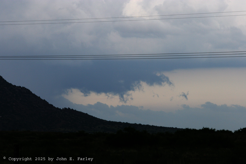
As I started north again toward Santa Rosa, I noticed that storms which were approaching from the west (hereinafter, Storm 4) had some interesting structure that was being nicely bavklit by the lowering sun. These storms were part of a line that had started much earlier in or a bit west of the Rio Grande Valley, prompting a couple SVR warnings in the ABQ area and just south of there in the time frame of aroud 2:50 to 3:40, and even earlier, before 2 p.m., farther west of there. Now, after 6 p.m., the line of storms was no longer SVR warned, although it would be again later. Here is a picture of the line of storms looking to my west just after I took the last two pictures above:
Although the storms look pretty menacing in this picture, this structure is mainly outflow-related, so I rejected any temptation to abandon my efforts to catch back up to Storm 3 and instead turn west toward Storm 4. So after a brief stop in Santa Rosa, I blasted east on I-40 (actually, as noted above, ENE for the first 50 or so miles), hoping I might be able to see some features on the storm through the rain and maybe even catch back up to it somewhere around Tucumcari. Roads were wet and light rain occasionally fell as I carried out that effort, but there was no hail falling or along the road, as the hail swath was well-south of I-40. Somewhere around maybe halfway or a bit more to Tucumcari, I did regain a view of the storm's updraft area, albeit through some rain. I saw a couple of lowered areas that looked like they went pretty close to the ground, but I was on the interstate and by the time I got anywhere I could stop they were gone. Given their brevity, I am guessing they were scud columns, not funnels, but I was too far away to really tell anything about what they were, especially through rain. However, no funnels or tornadoes were reported in that area, although being relatively roadless, there may not have been many folks with any really good view. Eventually, somewhere perhaps 20 miles give or take from Tucumcari, I did find a stretch of frontage road along the south side of I-40. By the time I got to an exit, the storm had moved behind a mesa, but by heading west on the frontage road I was able to regain a view. I wanted to go farther, but came to a stretch where the road was flooded. I could not tell how deep, but since it was at an intersection with a crossing under the interstate, I knew it could be deep, so I stopped, turned around, found the closest place with a view, and got a few pictures like these:
Clearly, this was a pretty intense storm that was continuing to collect SVR warnings, and the Icechip researchers later reported a 1.5" hailstone between Quay and Tucumcari around 7:30. However, I knew I was not going to see much more of the storm unless I got to Tucumcari and went south. And even that would not leave me much daylight. And that turned out to be pretty much the case. I did go south from Tucumcari on NM 209, but it was getting dark and the core was to my east, having crossed the road a few miles ahead of me. I did see some mobile Doppler radar units, perhaps associated with the Icechips project which was on this storm. Before long I decided to call it a chase, and try to get into a motel ahead of the rapidly-spproaching line of storms to my west (Storm 4, as noted above). I did get to a motel, but the owner mentioned the locks on the doors are a little tricky at first, and in my rush to beat the storm and get in, I could not get the west-facing door open. Soon I was blasted by torrential rain and high wind from the west and was quickly drenched, at which point I retreated to the car to get out of the storm and wait it out. Just before it reached Tucumcari, at 7:58 p.m., the line of storms, which as noted earlier had garnered several SVR warnings much earlier and farther west again went SVR warned. There was a LOT of rain and wind at my location - not sure if the wind met severe criteria but it could have - but no hail. And fortunately, the power stayed on. The storms - mostly this one - produced 1.4 to 1.8 inches of rain in the Tucumcari area.
There was a report of a semi blown over on I-40 around 8 p.m. near San Jon, at MM 366, 35 miles east of Tucumcari and just west of Glenrio. This was from Storm 3, probably around or shortly after the time when I got my last look at it from south of Tucumcari, at which time it looked like this:

The light-colored clouds near tha ground on the right-hand side of the picture are likely hail fog, or at least originated as such. Later, around 8:48 NM time (9:48 TX time), a tornado and several funnel clouds were reported north of Simms, TX at a location a little over 20 miles east of the NM state line. I do not know whether this was associated with Storm 3 (the supercell), Storm 4 (the squall line), or perhaps a merger of the two since the squall line was moving considerably faster than the supercell. But by then, I was settled into my motel room in Tucumcari, having gotten the door unlocked easily once I was not under the presssure of beathing the storm
Chase distance for the day: 386 miles.
Total mileage for this chase trip: 1498 miles.
Return to 2025 Severe Weather Observation Page
Return to main Severe Weather Observation Page