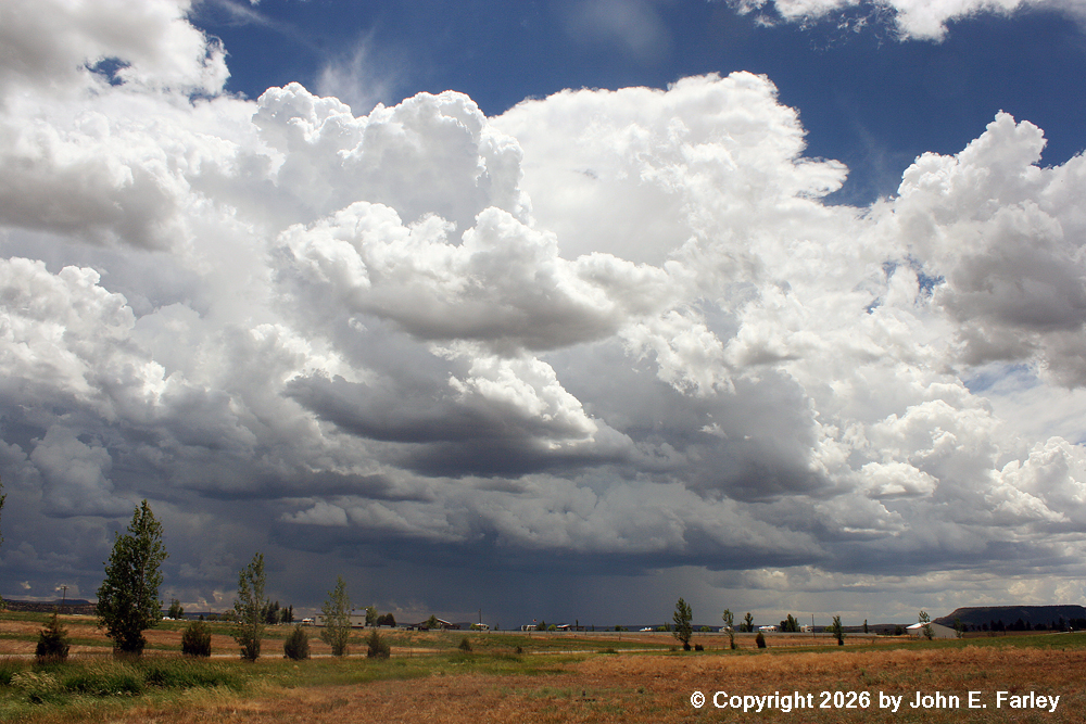
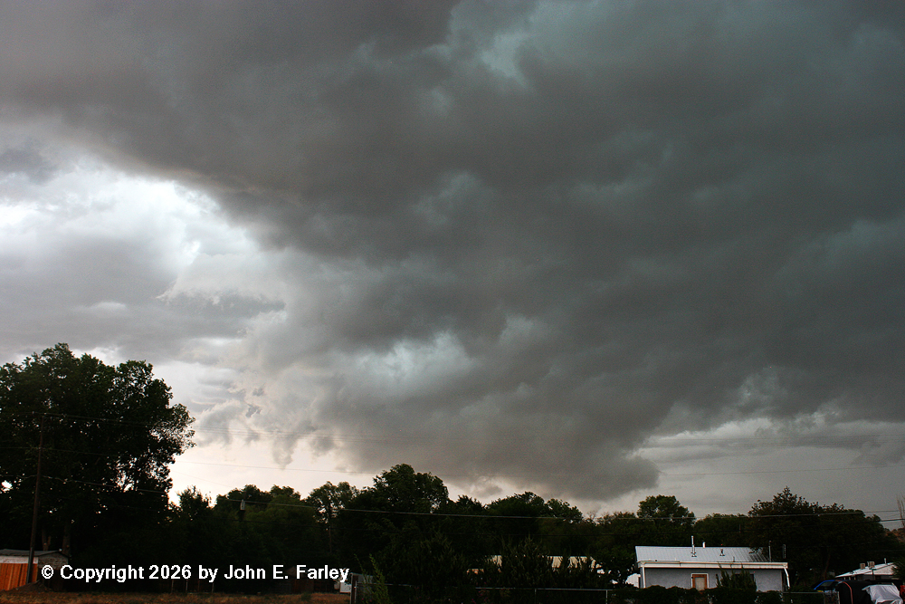
Driving between Pagosa and Durango, I noticed that numerous storms were already popping up over the San Juans and on the south slopes of those mountains. But I kept on going, and could see more distant and stronger storms west and south of Durango. Stopping to check radar just before I entered Durango, I noted strong storms west of Durango near Cortez and south of Durango near Aztec, NM. Since the Aztec storms were in the area of better instability, I decided to head that way, which proved to be a correct and important choice. There were also other storms farther south and west, some of which eventually produced severe wind and hail in the Gallup, NM area. The storms near Aztec were backbuilding to the west. I stoppped near the CO/NM state line and got a few pictures of the storms ahead of me.
I decided to push through these storms since they had no warnings or special weather statements that I was aware of, and there were larger and stronger storms farther south per radar. As I did, I encountered a burst of large raindrops and a few hailstones over a distance of a few miles, a little north of Aztec, NM. One stone that hit the roof of the car was quite loud, so I would guess rather large, maybe quarter sized, but I don't know because there were very few hailstones and I never really saw any except for 2 or 3 that broke when they hit the windshield, so I could not tell how large they were. This was around 2:30 p.m. But visually, it was evident that the precipitation on the storms farther south was much heavier, so I kept going, hoping to intercept the storms south of Bloomfield, NM, which is about 6 miles past Aztec. I continued south to perhaps 10 miles or so south of Bloomfield, arriving there just before 3 p.m. The storms were in a broken line to my west and south, extending from just south of Farmington southeastward near the Bisti Badlands area, where a flash flood warning was eventually issued, on southeastward to west of the Cuba and Jemez Springs areas. In the latter area, multiple landslides eventually blocked NM route 4 and caught at least one car. There were three strong storms in the broken line that I could see, one more or less to my south, a new one that formed to my west, and another in between:
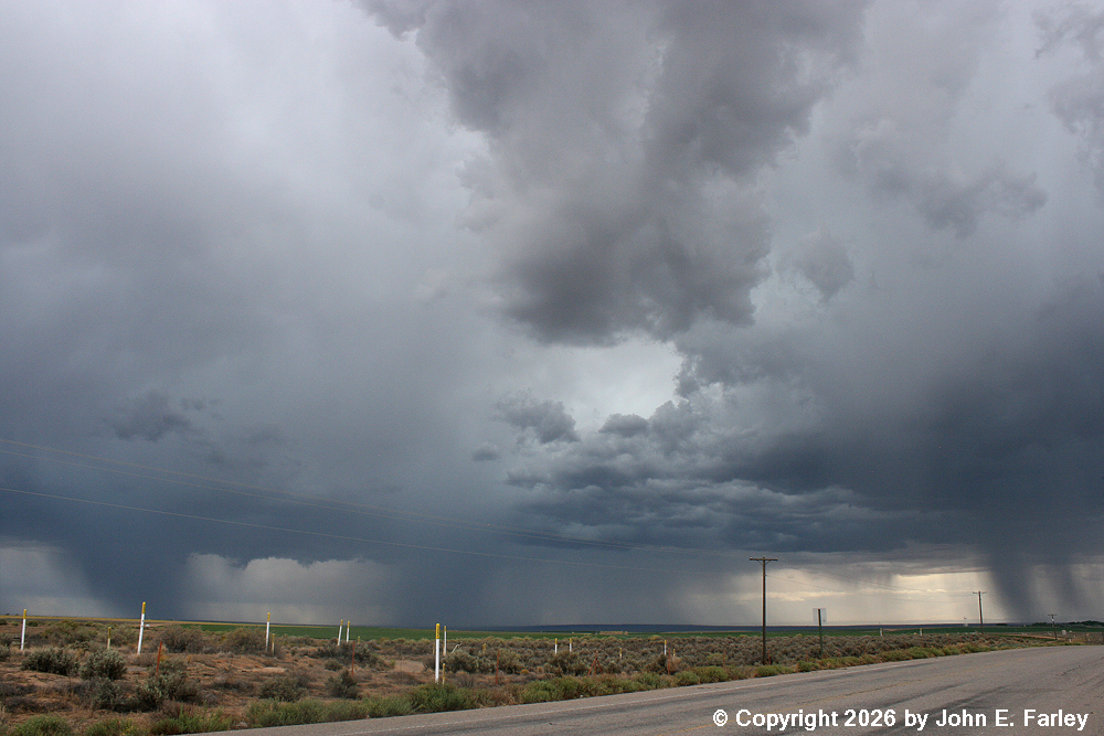
The one to my west, the right-most one in the picture, had just formed and is the one that eventually hit Bloomfield and Aztec with severe wind and hail. Here is a picture of that cell, taken around the same time as the picture just above:
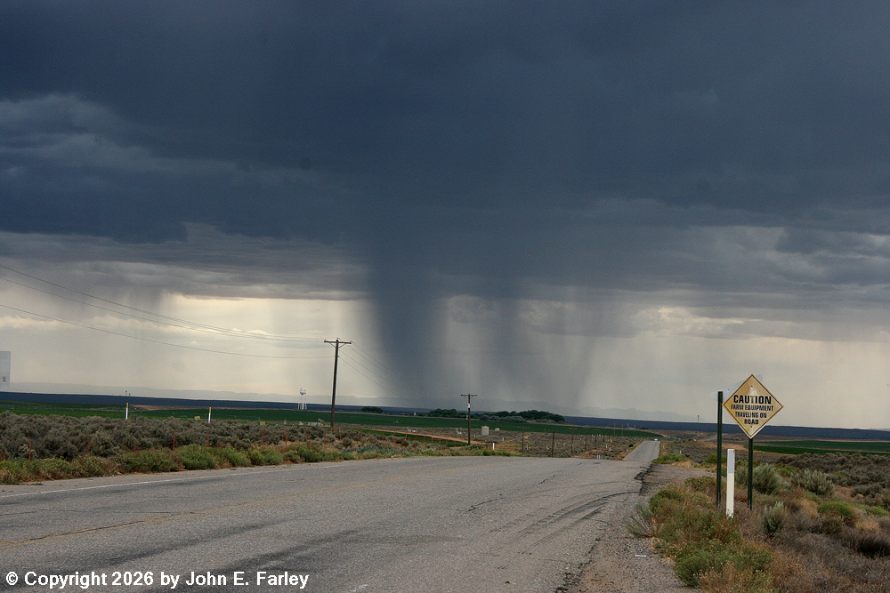
The left-most cell in the picture of the three storms above, which was to my south, likely somewhere between my location and the Bisti Badlands, also looked strong and may have been intensifying at this time:
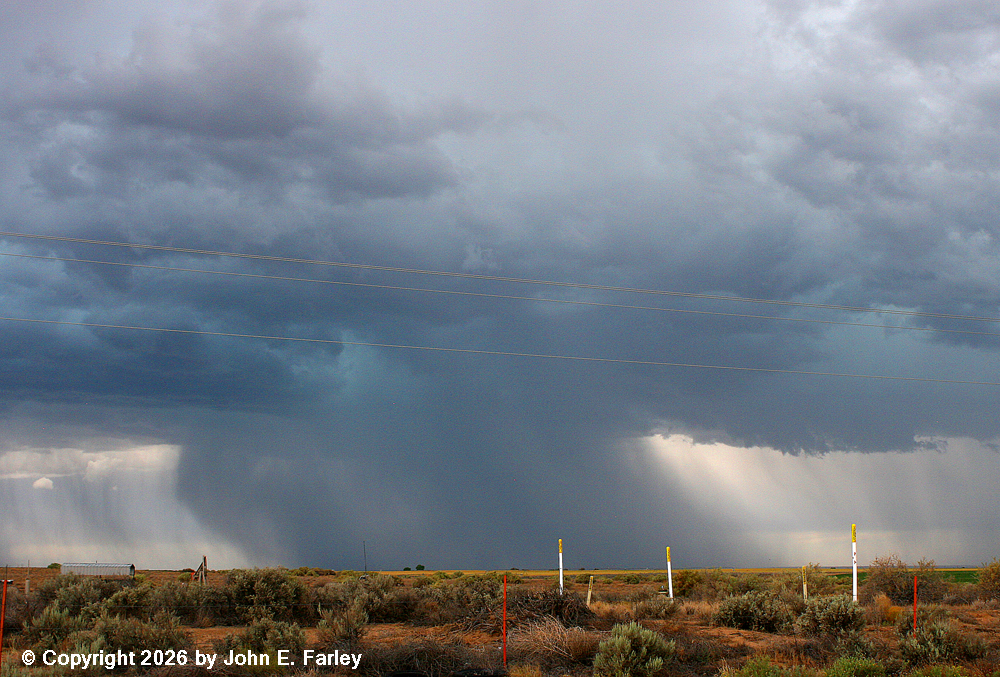
Shortly after I arrived at this location, a special weather statement was issued just after 3 p.m. It mentioned 50-55 mph winds in these storms along with half-inch hail, and indicated that Bloomfield and Farmington were in the path of the storms, along with about 45 miles of highway 550, which I used to get to the storms, as well as a stretch of NM route 4. I stayed in this position as long as I thought I could, but with the line moving toward me and beginning to fill in between cells, I knew I would not be able to stay long. There were some interesting featuers under the updraft just west of the storm to my south:
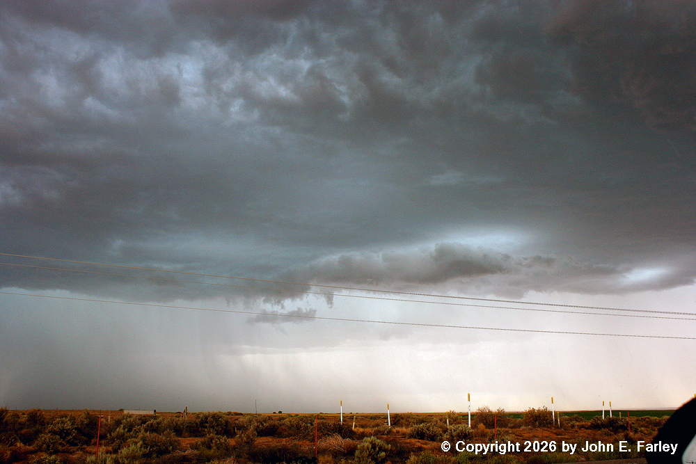
I think the pointy lowering in this picture is a scud finger; in any case, it did not last very long.
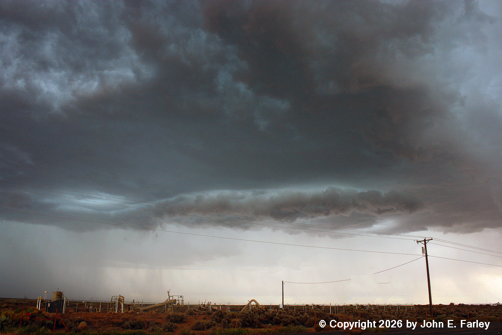
Note the broad, slightly lowered cloud base in this picture, just to the right of the main precipitation area and extending across most of the middle of the picture. I have seen features like this develop into wall clouds, but I think this one was more of a shelf cloud, suggesting to me that the gaps between storms were beginning to fill in and that the precipitation behind the feature was likely to intensify.
With this process under way, and with the heavy core heading for Bloomfield and Aztec (along my route back), I decided I needed to get north to try to stay ahead of the storm and hopefully get through Bloomfield and Aztec before the storm did. As I neared Bloomfield, my phone alerted again, this time for a SVR warning for 60 mph wind and 1-inch hail. The warning was for the entire line of storms, including 60 miles of US 550 and 40 miles of NM route 4. It also specifically mentioned Farmington and Bloomfield as being in the path. I stopped at the south edge of Bloomfield and got this picture, looking west:
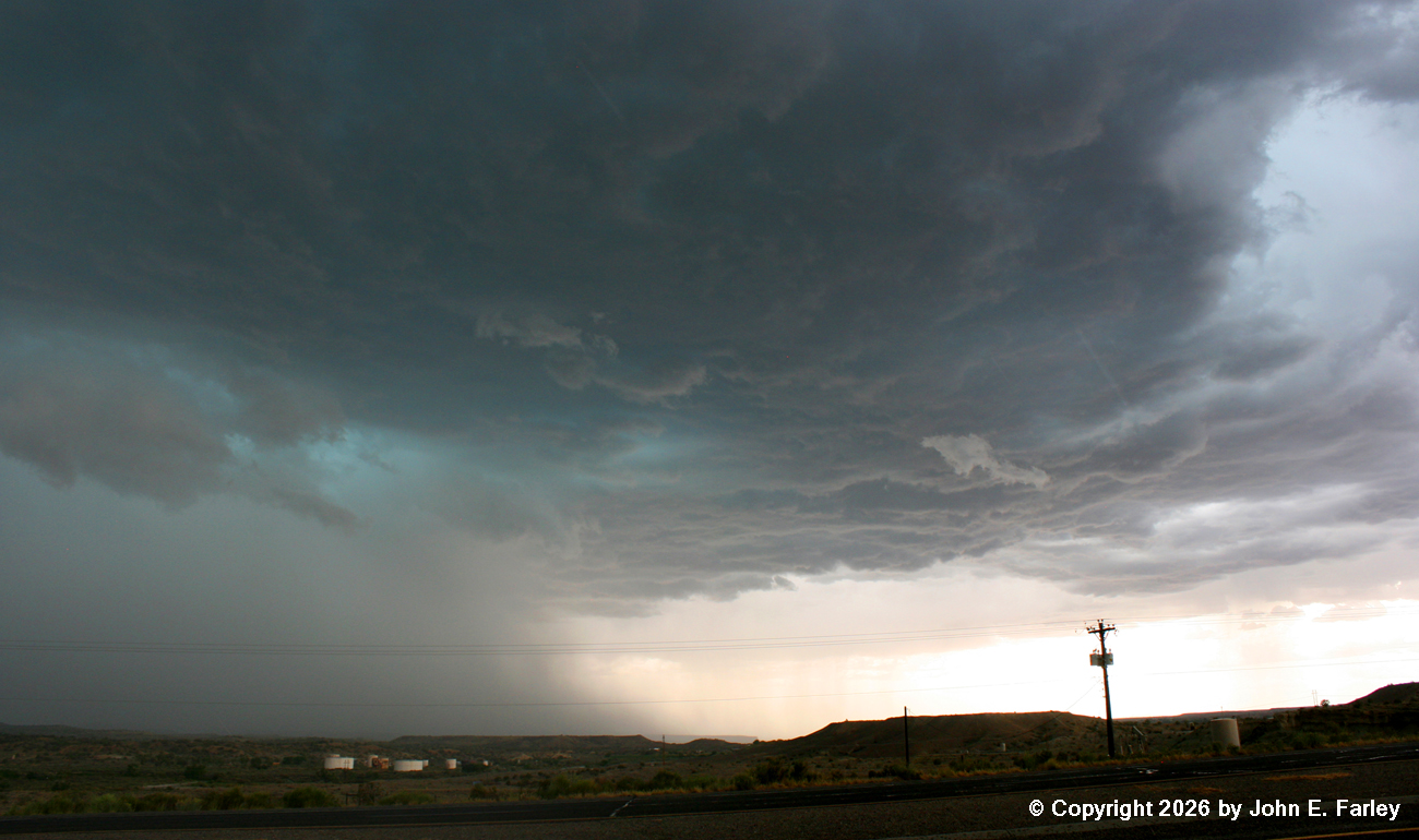
Although the entire line of storms was severe-warned, all of the severe wind and hail reports came from this cell. In the picture above, it certainly had the look - a rainfoot suggesting strong wind and the blue-green color in the clouds suggesting hail. It had both. I did not stay here long, pushing on through Bloomfield to try to stay ahead of the storm. As I passed through town, the outflow wind was increasing, and I switched lanes a couple times to avoid driving under trees that were thrashing around in the wind. I emerged from the other (north) end of town on 550 as intense blowing dust, with some small debris in it, blew across the road. This picture was taken between Bloomfield and Aztec:
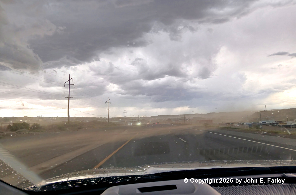
Within a couple minutes of when I took this picture, there were two reports of 60 mph wind in Bloomfield and also a report of 1-inch hail. Severe thunderstorm warning verified! Although there was some small debris blowing around, thankfully the only larger debris that I encountered was tumbleweeds. But it was blowing hard there. Eventually as I neared Aztec, the dust cleared and the wind subsided, as I had managed to get back a little ahead of the storm. When I was most of the way through Aztec, I stopped once more and got this picture:
Although this looks a little like a wall cloud, it was not. Rather, it was an outflow feature along the leading edge of the storm. A 64 mph gust was measured just behind it, within a mile or less of my location. As I was taking this picture looking east, rain and some pea-sized hail began to fall, and I hightailed it out of there to the north to get back ahead of the storm before the hail got any bigger, which I did. A little before the Colorado state line, another strong storm crossed the road ahead of me, but I avoided that core with a brief stop to let it pass. When I got to Durango, I observed some street flooding, and after a brief stop there noted on radar that the storms had grown upscale into an unbroken line, which was ahead of me on my way home to Pagosa Springs, about halfway between Durango and Pagosa Springs. By the time I got home it was a light, steady rain, as the storms had broadened and weakened - another thing the HRRR had predicted would happen by then. We got .10" of rain at our house, the first wetting rain in well over a month. And another .04" from a brief thunderstorm that moved through later that night.
All in all, this was not a bad little chase, and the HRRR really nailed the setup and forecast, with things unfolding almost exactly as it had predicted. And my first chase in my EV worked out fine - did not even have to stop and re-charge in Durango, although there are several places to do so there had I needed to.
Total chase distance: approximately 200 miles.
Return to 2026 Severe Weather Observation page
Return to main Severe Weather Observation page