At long last, my new severe weather observation highlights video, Stormy Skies, Mid Deacade Edition is now available! This video features a dozen tornadoes, including footage from Minneola and Dodge City, KS (May 24. 2016), Trinidad, CO (June 6, 2014). and of a rare high-altitude tornado west of Chama, NM (September 29, 2014), along with lots of other wild weather including thundersnow, supercells, hail, and more. Details and ordering info here! As noted in the linked page, I would be more than happy to trade for other chasers' highlights videos.
Additionally, my previous severe weather observation highlights video, Stormy Skies 2012-13: Wild Weather for All Seasons, featuring the entire lifecycle of the Rozel, KS EF-4 tornado, along with lots of other neat stuff, remains available in limited quantities! Details and ordering info here.
Finally few copies are still available of my 2011 storm observation highlights video Stormy Skies 2011. A short trailer for the video and additional information can be found here.
Follow the links below to see some videos of severe and interesting weather phenomena that I have posted to Youtube (some of my favorite videos are embedded, but there's lots of good stuff in the videos that are just linked, too):
2017
Wolf Creek Pass Thundersnow, May 10, 2017
This clip shows a flash of ligntning followed by thunder, with lots of snow coming down:
A longer (about 8 minutes) video showing highlights of the half hour I observed this storm, with more than a dozen rumbles of thunder while snow comes down, can be seen here
Aspen Springs, CO hailstorm, May 9, 2017 - Up to a half-inch of pea-sized hail falls aloug U.S. 160 in a short time, during a heavy southwest Colorado thunderstorm.
2016
My biggest tornado day ever! A total of six tornadoes near Minneola and Dodge City, KS, May 24, 2016
The formation and early stages of the first of three large tornadoes of which I got good video. This one was rated EF-3
Long-track (15.6 miles) and mile-wide EF 2 tornado that passed just west of Dodge City.
Another EF-3 tornado, this time north of Dodge City.
Thundersnow on the west side of Wolf Creek Pass, CO, May 12, 2015:
Ski Santa Fe thundersnow, March 19 - Includes one very close lightning strike and several rumbles of thunder from a storm that produced 3 inches of graupel and snow in an hour and a half with thunder, then 9 more inches of snow overnight.
2014
0.4 Mile-wide high-end EF-1 tornado west of Chama, NM, September 29, 2017. A Youtube hit with more than 8,600 views:
4 and a half minute highlight video of the third tornado I saw east of Trinidad, CO, June 6, 2014. This large, high-end EF-1 tornado was on the ground for around 14 minutes:
Texas Panhandle Gustnado, April 11, 2012 - This gustnado formed about 20 miles west of Channing as warm inflow and cold outflow collided on the south edge of a strong thunderstorm.
2011
100 MPH Microburst, Hannibal, MO, June 9, 2011 - A long-track supercell produces a destructive microbust on the south side of Hannibal - this video shows the nicely backlit microburst as seen from across the river in Illinois.
Tornado Near Greasy Corner, AR, May 25, 2011 - Photogenic, nicely backlit tornado - this is the only chaser video of this tornado:
Missouri Long-Track tornadic supercell, April 22, 2011 - This is the supercell that produced the destructive EF-4 tornado in the St. Louis area. Video of great mesocyclone structure near Holt's Summit, MO and ground-hugging wall cloud as the storm produces 4-inch hail north of Hermann.
Mesocyclones and Hail, Illinois, April 19, 2011 - I intercept a long-track tornadic supercell near Hillview, IL. Although I miss any good view of the tornadoes it produced, I do get some nice storm structure, and LOTs and LOTS of hail.
Colorado Snow devils, February 20, 2011 - Driving to Buena Vista, CO for some skiing after Chasercon, I observed these snow devils about 8-10 miles southwest of Fairplay, CO.
Thundersnow with Frequent, Close Lightning, Santa Fe, NM, March 19, 2010 - Most intense, close lightning I have seen with snow. High-definition video - a Youtube hit with over 7,400 views:
2009
Tornado near Roodhouse, Illinois, August 19, 2009. This is the start of the long-track tornado that shortly later hit Manchester, IL. (A Youtube hit - over 7,000 views!):
This page last updated June 15, 2017. Check back - I will be adding more video as time permits and as (hopefully) I get some more new severe weather video.
 At long last, my new severe weather observation highlights video, Stormy Skies, Mid Deacade Edition is now available! This video features a dozen tornadoes, including footage from Minneola and Dodge City, KS (May 24. 2016), Trinidad, CO (June 6, 2014). and of a rare high-altitude tornado west of Chama, NM (September 29, 2014), along with lots of other wild weather including thundersnow, supercells, hail, and more. Details and ordering info here! As noted in the linked page, I would be more than happy to trade for other chasers' highlights videos.
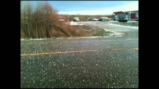